![](/images/other/stat-length.png)
- Randonnées
- A pied
- République Tchèque
République Tchèque, A pied : Les meilleures randonnées, itinéraires, parcours, balades et promenades
République Tchèque : découvrez les 1 424 meilleurs circuits de randonnée pédestre ou à vélo. Notre catalogue préparé à la main par nos randonneurs regorge de superbes paysages qui n'attendent qu'à être explorés. Téléchargez ces itinéraires dans SityTrail, notre application de GPS de randonnée gratuite disponible sur Android et iOS.
Les meilleurs parcours (1424)
![Randonnée A pied Hradiště - Naučná stezka údolím Hradišťského potoka - Photo](https://media.geolcdn.com/t/350/260/cfba48ed-efcf-408d-900f-1d77342522c7.jpeg&format=jpg&maxdim=2)
![A pied A pied](https://static1.geolcdn.com/sitytour/trail-icons/100.png)
Km
A pied
![](/images/other/stat-length.png)
![](https://static1.geolcdn.com/siteimages/upload/files/1508320355ic_sort_den_pos_24dp.png)
![](https://static1.geolcdn.com/siteimages/upload/files/1508320355ic_sort_den_neg_24dp.png)
![](https://static1.geolcdn.com/siteimages/upload/files/16400158638029165_repeat_loop_refresh_sync_direction_icon.png)
• Randonnée créée par local.
![Randonnée A pied Jince - Naučná stezka Z Jinec na Olymp Brd - Photo](https://media.geolcdn.com/t/350/260/7d726ed7-6d09-43b7-9d25-e38ba164c4a0.jpeg&format=jpg&maxdim=2)
![A pied A pied](https://static1.geolcdn.com/sitytour/trail-icons/100.png)
Km
A pied
![](/images/other/stat-length.png)
![](https://static1.geolcdn.com/siteimages/upload/files/1508320355ic_sort_den_pos_24dp.png)
![](https://static1.geolcdn.com/siteimages/upload/files/1508320355ic_sort_den_neg_24dp.png)
![](https://static1.geolcdn.com/siteimages/upload/files/16400158638029165_repeat_loop_refresh_sync_direction_icon.png)
• Randonnée créée par local.
![Randonnée A pied Malá Víska - Naučná stezka Jordán - Photo](https://media.geolcdn.com/t/350/260/561bc882-a328-4ea0-8534-a2cb9c7ea26e.jpeg&format=jpg&maxdim=2)
![A pied A pied](https://static1.geolcdn.com/sitytour/trail-icons/100.png)
Km
A pied
![](/images/other/stat-length.png)
![](https://static1.geolcdn.com/siteimages/upload/files/1508320355ic_sort_den_pos_24dp.png)
![](https://static1.geolcdn.com/siteimages/upload/files/1508320355ic_sort_den_neg_24dp.png)
![](https://static1.geolcdn.com/siteimages/upload/files/16400158638029165_repeat_loop_refresh_sync_direction_icon.png)
• Randonnée créée par VLS ČR.
![Randonnée A pied Strašice - Naučná stezka Okolím Padrťských rybníků - Photo](https://media.geolcdn.com/t/350/260/e147a7f2-eddb-4a26-9a0c-ab5091189530.jpeg&format=jpg&maxdim=2)
![A pied A pied](https://static1.geolcdn.com/sitytour/trail-icons/100.png)
Km
A pied
![](/images/other/stat-length.png)
![](https://static1.geolcdn.com/siteimages/upload/files/1508320355ic_sort_den_pos_24dp.png)
![](https://static1.geolcdn.com/siteimages/upload/files/1508320355ic_sort_den_neg_24dp.png)
![](https://static1.geolcdn.com/siteimages/upload/files/16400158638029165_repeat_loop_refresh_sync_direction_icon.png)
• Randonnée créée par Vojenské lesy a statky ČR.
![Randonnée A pied Dolní Heřmanice - naučná stezka Trasa Nesměřským údolím - Photo](https://media.geolcdn.com/t/350/260/4ea1d114-eef5-4b39-b3d9-b523ef20ef6c.jpeg&format=jpg&maxdim=2)
![A pied A pied](https://static1.geolcdn.com/sitytour/trail-icons/100.png)
Km
A pied
![](/images/other/stat-length.png)
![](https://static1.geolcdn.com/siteimages/upload/files/1508320355ic_sort_den_pos_24dp.png)
![](https://static1.geolcdn.com/siteimages/upload/files/1508320355ic_sort_den_neg_24dp.png)
![](https://static1.geolcdn.com/siteimages/upload/files/16400158638029165_repeat_loop_refresh_sync_direction_icon.png)
• Randonnée créée par cz:KČT. modrá stezka s interaktivními prvky pro děti
![Randonnée A pied Velké Meziříčí - naučná stezka Trasa Balínským údolím - Photo](https://media.geolcdn.com/t/350/260/2bae5076-d03e-439a-9a4d-aa2d607d5342.jpeg&format=jpg&maxdim=2)
![A pied A pied](https://static1.geolcdn.com/sitytour/trail-icons/100.png)
Km
A pied
![](/images/other/stat-length.png)
![](https://static1.geolcdn.com/siteimages/upload/files/1508320355ic_sort_den_pos_24dp.png)
![](https://static1.geolcdn.com/siteimages/upload/files/1508320355ic_sort_den_neg_24dp.png)
![](https://static1.geolcdn.com/siteimages/upload/files/16400158638029165_repeat_loop_refresh_sync_direction_icon.png)
• Randonnée créée par cz:KČT. červená stezka s interaktivními prvky pro děti
![Randonnée A pied Velké Meziříčí - naučné stezky Balínského a Nesměřského údolí - Photo](https://media.geolcdn.com/t/350/260/d1b7eb58-8f49-4422-b5d0-3899b270d9c7.jpeg&format=jpg&maxdim=2)
![A pied A pied](https://static1.geolcdn.com/sitytour/trail-icons/100.png)
Km
A pied
![](/images/other/stat-length.png)
![](https://static1.geolcdn.com/siteimages/upload/files/1508320355ic_sort_den_pos_24dp.png)
![](https://static1.geolcdn.com/siteimages/upload/files/1508320355ic_sort_den_neg_24dp.png)
![](https://static1.geolcdn.com/siteimages/upload/files/16400158638029165_repeat_loop_refresh_sync_direction_icon.png)
• Randonnée créée par cz:KČT.
![Randonnée A pied Baliny - naučná stezka propojení Balinského a Nesměřského údolí - Photo](https://media.geolcdn.com/t/350/260/69a0493d-5501-4b5a-9edd-f04300c22c56.jpeg&format=jpg&maxdim=2)
![A pied A pied](https://static1.geolcdn.com/sitytour/trail-icons/100.png)
Km
A pied
![](/images/other/stat-length.png)
![](https://static1.geolcdn.com/siteimages/upload/files/1508320355ic_sort_den_pos_24dp.png)
![](https://static1.geolcdn.com/siteimages/upload/files/1508320355ic_sort_den_neg_24dp.png)
![](https://static1.geolcdn.com/siteimages/upload/files/16400158638029165_repeat_loop_refresh_sync_direction_icon.png)
• Randonnée créée par cz:KČT. fialová stezka
![Randonnée A pied Dolní Heřmanice - naučná stezka Okruh Nesměřským údolím - Photo](https://media.geolcdn.com/t/350/260/98e3126d-40b6-404b-be0a-30e77ebe62a3.jpeg&format=jpg&maxdim=2)
![A pied A pied](https://static1.geolcdn.com/sitytour/trail-icons/100.png)
Km
A pied
![](/images/other/stat-length.png)
![](https://static1.geolcdn.com/siteimages/upload/files/1508320355ic_sort_den_pos_24dp.png)
![](https://static1.geolcdn.com/siteimages/upload/files/1508320355ic_sort_den_neg_24dp.png)
![](https://static1.geolcdn.com/siteimages/upload/files/16400158638029165_repeat_loop_refresh_sync_direction_icon.png)
• Randonnée créée par cz:KČT. oranžová stezka
![Randonnée A pied Polná na Šumavě - NS Olšina - Photo](https://media.geolcdn.com/t/350/260/d4dd5415-e6fc-4961-98ea-93ee979025e5.jpeg&format=jpg&maxdim=2)
![A pied A pied](https://static1.geolcdn.com/sitytour/trail-icons/100.png)
Km
A pied
![](/images/other/stat-length.png)
![](https://static1.geolcdn.com/siteimages/upload/files/1508320355ic_sort_den_pos_24dp.png)
![](https://static1.geolcdn.com/siteimages/upload/files/1508320355ic_sort_den_neg_24dp.png)
![](https://static1.geolcdn.com/siteimages/upload/files/16400158638029165_repeat_loop_refresh_sync_direction_icon.png)
• VLS ČR, s.p. je státní společnost s více než 80. letou tradicí, s kořeny v první republice. Site web: https://www.vl...
![Randonnée A pied Prachatice - Goldsteig Verbindungsweg Černý Kříž - Prachatice - Photo](https://media.geolcdn.com/t/350/260/c3c91cea-0a90-4fdc-abb9-2afc1597ecb3.jpeg&format=jpg&maxdim=2)
![A pied A pied](https://static1.geolcdn.com/sitytour/trail-icons/100.png)
Km
A pied
![](/images/other/stat-length.png)
![](https://static1.geolcdn.com/siteimages/upload/files/1508320355ic_sort_den_pos_24dp.png)
![](https://static1.geolcdn.com/siteimages/upload/files/1508320355ic_sort_den_neg_24dp.png)
![](https://static1.geolcdn.com/siteimages/upload/files/16400158638029165_repeat_loop_refresh_sync_direction_icon.png)
• Symbole: blauer, stilisierter s-förmiger Weg auf weißem, rechteckigen Grund Site web: https://zlatoustezkou.cz/rout...
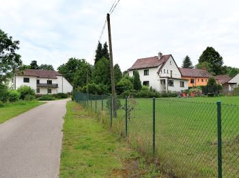
![Randonnée A pied Letiny - [Ž] Bzí - Svárkov - Photo](https://media.geolcdn.com/t/350/260/e4fcdbd7-7501-40ad-9c2a-0022772a1930.jpeg&format=jpg&maxdim=2)
![A pied A pied](https://static1.geolcdn.com/sitytour/trail-icons/100.png)
Km
A pied
![](/images/other/stat-length.png)
![](https://static1.geolcdn.com/siteimages/upload/files/1508320355ic_sort_den_pos_24dp.png)
![](https://static1.geolcdn.com/siteimages/upload/files/1508320355ic_sort_den_neg_24dp.png)
![](https://static1.geolcdn.com/siteimages/upload/files/16400158638029165_repeat_loop_refresh_sync_direction_icon.png)
• Randonnée créée par cz:KČT.
![Randonnée A pied Mažice - Mažická naučná stezka - Photo](https://media.geolcdn.com/t/350/260/16fef0e7-7257-4b99-8729-a923498d289a.jpeg&format=jpg&maxdim=2)
![A pied A pied](https://static1.geolcdn.com/sitytour/trail-icons/100.png)
Km
A pied
![](/images/other/stat-length.png)
![](https://static1.geolcdn.com/siteimages/upload/files/1508320355ic_sort_den_pos_24dp.png)
![](https://static1.geolcdn.com/siteimages/upload/files/1508320355ic_sort_den_neg_24dp.png)
![](https://static1.geolcdn.com/siteimages/upload/files/16400158638029165_repeat_loop_refresh_sync_direction_icon.png)
• Randonnée créée par KČT.
![Randonnée A pied Albrechtice nad Vltavou - Historická stezka Albrechtickem - Photo](https://media.geolcdn.com/t/350/260/4ec0b7ff-0c97-4fba-b42c-637cce5f02aa.jpeg&format=jpg&maxdim=2)
![A pied A pied](https://static1.geolcdn.com/sitytour/trail-icons/100.png)
Km
A pied
![](/images/other/stat-length.png)
![](https://static1.geolcdn.com/siteimages/upload/files/1508320355ic_sort_den_pos_24dp.png)
![](https://static1.geolcdn.com/siteimages/upload/files/1508320355ic_sort_den_neg_24dp.png)
![](https://static1.geolcdn.com/siteimages/upload/files/16400158638029165_repeat_loop_refresh_sync_direction_icon.png)
• Randonnée créée par obec Albrechtice n. Vlt.. chybi zastaveni 8 v Albrechticich
![Randonnée A pied - Stezka svobody 1938-1945 okruh 10,5km - Photo](https://media.geolcdn.com/t/350/260/2b81cacb-e78c-4fe4-b5b9-8bd2fdc1bccc.jpeg&format=jpg&maxdim=2)
![A pied A pied](https://static1.geolcdn.com/sitytour/trail-icons/100.png)
Km
A pied
![](/images/other/stat-length.png)
![](https://static1.geolcdn.com/siteimages/upload/files/1508320355ic_sort_den_pos_24dp.png)
![](https://static1.geolcdn.com/siteimages/upload/files/1508320355ic_sort_den_neg_24dp.png)
![](https://static1.geolcdn.com/siteimages/upload/files/16400158638029165_repeat_loop_refresh_sync_direction_icon.png)
• Randonnée créée par cz:KČT.
![Randonnée A pied Průhonice - Základní okruh - Photo](https://media.geolcdn.com/t/350/260/e2a783db-9b1c-4bb8-a5e8-981f40d414e5.jpeg&format=jpg&maxdim=2)
![A pied A pied](https://static1.geolcdn.com/sitytour/trail-icons/100.png)
Km
A pied
![](/images/other/stat-length.png)
![](https://static1.geolcdn.com/siteimages/upload/files/1508320355ic_sort_den_pos_24dp.png)
![](https://static1.geolcdn.com/siteimages/upload/files/1508320355ic_sort_den_neg_24dp.png)
![](https://static1.geolcdn.com/siteimages/upload/files/16400158638029165_repeat_loop_refresh_sync_direction_icon.png)
• Průhonický park a zámek je Národní kulturní památkou a je zapsán na Seznamu světového dědictví UNESCO. Site web: htt...
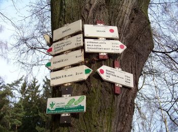
![Randonnée A pied Tisá - [Z] Tisá (bus) – Ostrov - Photo](https://media.geolcdn.com/t/350/260/78f4b062-24a7-4483-95d6-be239bd66196.jpeg&format=jpg&maxdim=2)
![A pied A pied](https://static1.geolcdn.com/sitytour/trail-icons/100.png)
Km
A pied
![](/images/other/stat-length.png)
![](https://static1.geolcdn.com/siteimages/upload/files/1508320355ic_sort_den_pos_24dp.png)
![](https://static1.geolcdn.com/siteimages/upload/files/1508320355ic_sort_den_neg_24dp.png)
![](https://static1.geolcdn.com/siteimages/upload/files/16400158638029165_repeat_loop_refresh_sync_direction_icon.png)
• Randonnée créée par cz:KČT.
![Randonnée A pied Votice - NS Kolem Votic za poznáním - Photo](https://media.geolcdn.com/t/350/260/f108630b-d984-4854-ab21-829e31ac2ddd.jpeg&format=jpg&maxdim=2)
![A pied A pied](https://static1.geolcdn.com/sitytour/trail-icons/100.png)
Km
A pied
![](/images/other/stat-length.png)
![](https://static1.geolcdn.com/siteimages/upload/files/1508320355ic_sort_den_pos_24dp.png)
![](https://static1.geolcdn.com/siteimages/upload/files/1508320355ic_sort_den_neg_24dp.png)
![](https://static1.geolcdn.com/siteimages/upload/files/16400158638029165_repeat_loop_refresh_sync_direction_icon.png)
• Randonnée créée par cz:KČT.
![Randonnée A pied Jankov - NS Po stopách bitvy u Jankova - Photo](https://media.geolcdn.com/t/350/260/fe4031eb-dcc3-4eed-9f5a-ddfe5ac821b0.jpeg&format=jpg&maxdim=2)
![A pied A pied](https://static1.geolcdn.com/sitytour/trail-icons/100.png)
Km
A pied
![](/images/other/stat-length.png)
![](https://static1.geolcdn.com/siteimages/upload/files/1508320355ic_sort_den_pos_24dp.png)
![](https://static1.geolcdn.com/siteimages/upload/files/1508320355ic_sort_den_neg_24dp.png)
![](https://static1.geolcdn.com/siteimages/upload/files/16400158638029165_repeat_loop_refresh_sync_direction_icon.png)
• Randonnée créée par cz:KČT.
![Randonnée A pied Mníšek pod Brdy - NS Mníšek pod Brdy - Photo](https://media.geolcdn.com/t/350/260/2a565180-058b-44a6-b5b6-fdf61dda7657.jpeg&format=jpg&maxdim=2)
![A pied A pied](https://static1.geolcdn.com/sitytour/trail-icons/100.png)
Km
A pied
![](/images/other/stat-length.png)
![](https://static1.geolcdn.com/siteimages/upload/files/1508320355ic_sort_den_pos_24dp.png)
![](https://static1.geolcdn.com/siteimages/upload/files/1508320355ic_sort_den_neg_24dp.png)
![](https://static1.geolcdn.com/siteimages/upload/files/16400158638029165_repeat_loop_refresh_sync_direction_icon.png)
• Randonnée créée par cz:KČT.
20 randonnées affichées sur 1424
Application GPS de randonnée GRATUITE