![](/images/other/stat-length.png)
- Randonnées
- A pied
- Suisse
- Lucerne
- Inconnu
- Emmen
Emmen, Inconnu, A pied : Les meilleures randonnées, itinéraires, parcours, balades et promenades
Emmen : découvrez les meilleures randonnées : 7 a pied et 1 marche. Tous ces circuits, parcours, itinéraires et activités en plein air sont disponibles dans nos applications SityTrail pour smartphones et tablettes.
Les meilleurs parcours (8)
![Randonnée A pied Emmen - Waldibrugg - Hirselen - Photo](https://media.geolcdn.com/t/350/260/fa8a2e0c-7da2-4445-8b60-04ee0c5b05ef.jpeg&format=jpg&maxdim=2)
![A pied A pied](https://static1.geolcdn.com/sitytour/trail-icons/100.png)
Km
A pied
![](/images/other/stat-length.png)
![](https://static1.geolcdn.com/siteimages/upload/files/1508320355ic_sort_den_pos_24dp.png)
![](https://static1.geolcdn.com/siteimages/upload/files/1508320355ic_sort_den_neg_24dp.png)
![](https://static1.geolcdn.com/siteimages/upload/files/16400158638029165_repeat_loop_refresh_sync_direction_icon.png)
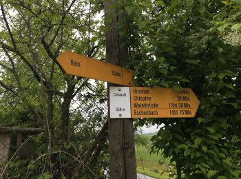
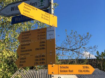
• Randonnée créée par Luzerner Wanderwege. Waldibrugg - Hirselen Symbole: gelber Rhombus
![Randonnée A pied Emmen - Eschenbach - Waldibrugg - Photo](https://media.geolcdn.com/t/350/260/3ee7faf4-aece-4535-9ed3-2d668f57bfe7.jpeg&format=jpg&maxdim=2)
![A pied A pied](https://static1.geolcdn.com/sitytour/trail-icons/100.png)
Km
A pied
![](/images/other/stat-length.png)
![](https://static1.geolcdn.com/siteimages/upload/files/1508320355ic_sort_den_pos_24dp.png)
![](https://static1.geolcdn.com/siteimages/upload/files/1508320355ic_sort_den_neg_24dp.png)
![](https://static1.geolcdn.com/siteimages/upload/files/16400158638029165_repeat_loop_refresh_sync_direction_icon.png)
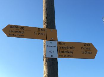
• Eschenbach - Waldibrugg Symbole: gelber Diamant
![Randonnée A pied Emmen - Eschenbach - Höndle - Waldibrugg - Photo](https://media.geolcdn.com/t/350/260/3ee7faf4-aece-4535-9ed3-2d668f57bfe7.jpeg&format=jpg&maxdim=2)
![A pied A pied](https://static1.geolcdn.com/sitytour/trail-icons/100.png)
Km
A pied
![](/images/other/stat-length.png)
![](https://static1.geolcdn.com/siteimages/upload/files/1508320355ic_sort_den_pos_24dp.png)
![](https://static1.geolcdn.com/siteimages/upload/files/1508320355ic_sort_den_neg_24dp.png)
![](https://static1.geolcdn.com/siteimages/upload/files/16400158638029165_repeat_loop_refresh_sync_direction_icon.png)
• Eschenbach - Höndle - Waldibrugg Symbole: gelber Diamant
![Randonnée A pied Emmen - Perlenbrücke - Rathausenbrücke - Photo](https://media.geolcdn.com/t/350/260/c1b2d98f-1a13-4272-ad2b-84a94c2b1f5b.jpeg&format=jpg&maxdim=2)
![A pied A pied](https://static1.geolcdn.com/sitytour/trail-icons/100.png)
Km
A pied
![](/images/other/stat-length.png)
![](https://static1.geolcdn.com/siteimages/upload/files/1508320355ic_sort_den_pos_24dp.png)
![](https://static1.geolcdn.com/siteimages/upload/files/1508320355ic_sort_den_neg_24dp.png)
![](https://static1.geolcdn.com/siteimages/upload/files/16400158638029165_repeat_loop_refresh_sync_direction_icon.png)
• Perlenbrücke - Rathausenbrücke Symbole: gelber Diamant
![Randonnée A pied Emmen - Emmenbrücke-Rotenburg - Photo](https://media.geolcdn.com/t/350/260/a47ec594-ce94-4200-b1b8-d01dcada7297.jpeg&format=jpg&maxdim=2)
![A pied A pied](https://static1.geolcdn.com/sitytour/trail-icons/100.png)
Km
A pied
![](/images/other/stat-length.png)
![](https://static1.geolcdn.com/siteimages/upload/files/1508320355ic_sort_den_pos_24dp.png)
![](https://static1.geolcdn.com/siteimages/upload/files/1508320355ic_sort_den_neg_24dp.png)
![](https://static1.geolcdn.com/siteimages/upload/files/16400158638029165_repeat_loop_refresh_sync_direction_icon.png)
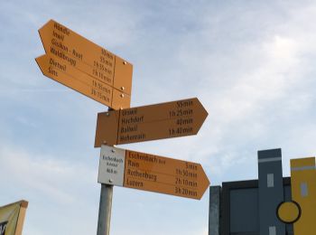
• Randonnée créée par Luzerner Wanderwege. Emmenbrücke-Rotenburg Symbole: gelber Rhombus
![Randonnée A pied Emmen - Moos - Rottertswil - Photo](https://media.geolcdn.com/t/350/260/d288af42-6c44-4f8d-8e3f-b374f7cb84a5.jpeg&format=jpg&maxdim=2)
![A pied A pied](https://static1.geolcdn.com/sitytour/trail-icons/100.png)
Km
A pied
![](/images/other/stat-length.png)
![](https://static1.geolcdn.com/siteimages/upload/files/1508320355ic_sort_den_pos_24dp.png)
![](https://static1.geolcdn.com/siteimages/upload/files/1508320355ic_sort_den_neg_24dp.png)
![](https://static1.geolcdn.com/siteimages/upload/files/16400158638029165_repeat_loop_refresh_sync_direction_icon.png)
• Randonnée créée par Luzerner Wanderwege. Moos - Rottertswil Symbole: gelber Rhombus
![Randonnée A pied Emmen - Cholbe - Waldibrugg - Photo](https://media.geolcdn.com/t/350/260/b64a7078-807f-4c8d-bd06-9d18af054554.jpeg&format=jpg&maxdim=2)
![A pied A pied](https://static1.geolcdn.com/sitytour/trail-icons/100.png)
Km
A pied
![](/images/other/stat-length.png)
![](https://static1.geolcdn.com/siteimages/upload/files/1508320355ic_sort_den_pos_24dp.png)
![](https://static1.geolcdn.com/siteimages/upload/files/1508320355ic_sort_den_neg_24dp.png)
![](https://static1.geolcdn.com/siteimages/upload/files/16400158638029165_repeat_loop_refresh_sync_direction_icon.png)
• Randonnée créée par Luzerner Wanderwege. Cholbe - Waldibrugg Symbole: gelber Rhombus
![Randonnée Marche Emmen - vvvttt0007 - Photo](https://media.geolcdn.com/t/350/260/ext.jpg?maxdim=2&url=https%3A%2F%2Fstatic1.geolcdn.com%2Fsiteimages%2Fupload%2Ffiles%2F1553511878bg_sport_marche.png)
![Marche Marche](https://static1.geolcdn.com/sitytour/trail-icons/101.png)
Km
Marche
![](/images/other/stat-length.png)
![](https://static1.geolcdn.com/siteimages/upload/files/1508320355ic_sort_den_pos_24dp.png)
![](https://static1.geolcdn.com/siteimages/upload/files/1508320355ic_sort_den_neg_24dp.png)
![](https://static1.geolcdn.com/siteimages/upload/files/16400158638029165_repeat_loop_refresh_sync_direction_icon.png)
•
8 randonnées affichées sur 8
Application GPS de randonnée GRATUITE