


3,3 km | 4,7 km-effort
Arrondissement administratif du Haut-Simmental et Gessenay : découvrez les meilleures randonnées : 5 a pied, 22 marche et 1 course à pied. Tous ces circuits, parcours, itinéraires et activités en plein air sont disponibles dans nos applications SityTrail pour smartphones et tablettes.
A pied


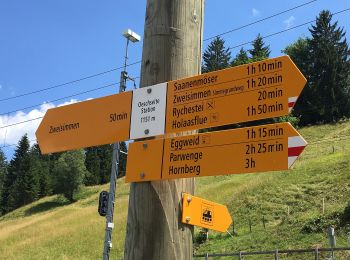
• Symbole: gelber Diamant
A pied
• Symbole: weiss-rot-weiss

A pied
• Randonnée créée par Berner Wanderwege. Gibel - Gütsch Symbole: gelber Rhombus
A pied
• Randonnée créée par Berner Wanderwege. Schwand - Laubbärgli Symbole: Roter Balken auf weissem Rechteck
A pied
• Randonnée créée par Berner Wanderwege. Symbole: weiss-rot-weiss
Marche
•
Marche
•
Marche
•

Marche
•
Marche
•
Marche
•
Marche
•
Marche
•
Marche
•
Marche
•
Marche
•
Marche
•
Marche
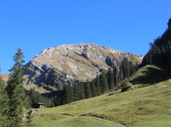
• Oberland Bernois
Marche
Marche
• Parquer au col du Jaun (payant sfr5 la journée). Suivre les indicateurs pour Hundsrügg. A part le début (et la fin)su...
20 randonnées affichées sur 28
Application GPS de randonnée GRATUITE
 SityTrail
IGN / Instituts géographiques
SityTrail World
Le monde est à vous