![](/images/other/stat-length.png)
- Randonnées
- A pied
- Suisse
- Argovie
- Bezirk Brugg
Bezirk Brugg, Argovie, A pied : Les meilleures randonnées, itinéraires, parcours, balades et promenades
Bezirk Brugg : découvrez les meilleures randonnées : 27 a pied et 1 marche. Tous ces circuits, parcours, itinéraires et activités en plein air sont disponibles dans nos applications SityTrail pour smartphones et tablettes.
Les meilleurs parcours (28)
![Randonnée A pied Remigen - Bürersteig - Mandach - Photo](https://media.geolcdn.com/t/350/260/dev_da9ea82e-77bb-44ef-a8bb-511fe399a72b.jpeg&format=jpg&maxdim=2)
![A pied A pied](https://static1.geolcdn.com/sitytour/trail-icons/100.png)
Km
A pied
![](/images/other/stat-length.png)
![](https://static1.geolcdn.com/siteimages/upload/files/1508320355ic_sort_den_pos_24dp.png)
![](https://static1.geolcdn.com/siteimages/upload/files/1508320355ic_sort_den_neg_24dp.png)
![](https://static1.geolcdn.com/siteimages/upload/files/16400158638029165_repeat_loop_refresh_sync_direction_icon.png)
• Symbole: gelbe Raute
![Randonnée A pied Habsburg - Schinznach Bad - Schloss Habsburg - Photo](https://media.geolcdn.com/t/350/260/8709f6e9-bed3-46c5-b839-32473eabf5d1.jpeg&format=jpg&maxdim=2)
![A pied A pied](https://static1.geolcdn.com/sitytour/trail-icons/100.png)
Km
A pied
![](/images/other/stat-length.png)
![](https://static1.geolcdn.com/siteimages/upload/files/1508320355ic_sort_den_pos_24dp.png)
![](https://static1.geolcdn.com/siteimages/upload/files/1508320355ic_sort_den_neg_24dp.png)
![](https://static1.geolcdn.com/siteimages/upload/files/16400158638029165_repeat_loop_refresh_sync_direction_icon.png)
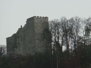
• Schinznach Bad - Schloss Habsburg Symbole: gelbe Raute
![Randonnée A pied Mülligen - Windisch Gemeindehaus - Mülligen - Photo](https://media.geolcdn.com/t/350/260/a0ffacf1-2807-4852-823a-e5886dc42d6d.jpeg&format=jpg&maxdim=2)
![A pied A pied](https://static1.geolcdn.com/sitytour/trail-icons/100.png)
Km
A pied
![](/images/other/stat-length.png)
![](https://static1.geolcdn.com/siteimages/upload/files/1508320355ic_sort_den_pos_24dp.png)
![](https://static1.geolcdn.com/siteimages/upload/files/1508320355ic_sort_den_neg_24dp.png)
![](https://static1.geolcdn.com/siteimages/upload/files/16400158638029165_repeat_loop_refresh_sync_direction_icon.png)
• Randonnée créée par Verein Aargauer Wanderwege. Windisch Gemeindehaus - Mülligen Symbole: gelber Diamant
![Randonnée A pied Windisch - Unterwiindisch - Turgi - Photo](https://media.geolcdn.com/t/350/260/cf058ad3-8aa4-441c-bd2c-9c0f1141337f.jpeg&format=jpg&maxdim=2)
![A pied A pied](https://static1.geolcdn.com/sitytour/trail-icons/100.png)
Km
A pied
![](/images/other/stat-length.png)
![](https://static1.geolcdn.com/siteimages/upload/files/1508320355ic_sort_den_pos_24dp.png)
![](https://static1.geolcdn.com/siteimages/upload/files/1508320355ic_sort_den_neg_24dp.png)
![](https://static1.geolcdn.com/siteimages/upload/files/16400158638029165_repeat_loop_refresh_sync_direction_icon.png)
• Randonnée créée par Verein Aargauer Wanderwege. Symbole: gelbe Raute
![Randonnée A pied Brugg - Scherz - Brugg - Photo](https://media.geolcdn.com/t/350/260/f68a7939-e02d-46f7-b3f3-362e8d2276d7.jpeg&format=jpg&maxdim=2)
![A pied A pied](https://static1.geolcdn.com/sitytour/trail-icons/100.png)
Km
A pied
![](/images/other/stat-length.png)
![](https://static1.geolcdn.com/siteimages/upload/files/1508320355ic_sort_den_pos_24dp.png)
![](https://static1.geolcdn.com/siteimages/upload/files/1508320355ic_sort_den_neg_24dp.png)
![](https://static1.geolcdn.com/siteimages/upload/files/16400158638029165_repeat_loop_refresh_sync_direction_icon.png)
• Randonnée créée par Verein Aargauer Wanderwege. Scherz - Brugg Symbole: gelber Diamant
![Randonnée A pied Habsburg - Schloss Habsburg - Brugg - Photo](https://media.geolcdn.com/t/350/260/8709f6e9-bed3-46c5-b839-32473eabf5d1.jpeg&format=jpg&maxdim=2)
![A pied A pied](https://static1.geolcdn.com/sitytour/trail-icons/100.png)
Km
A pied
![](/images/other/stat-length.png)
![](https://static1.geolcdn.com/siteimages/upload/files/1508320355ic_sort_den_pos_24dp.png)
![](https://static1.geolcdn.com/siteimages/upload/files/1508320355ic_sort_den_neg_24dp.png)
![](https://static1.geolcdn.com/siteimages/upload/files/16400158638029165_repeat_loop_refresh_sync_direction_icon.png)
• Schloss Habsburg - Brugg Symbole: gelber Diamant
![Randonnée A pied Riniken - Riniken - Vorder Rein - Photo](https://media.geolcdn.com/t/350/260/2b0d6164-370d-476b-8077-e486843b561e.jpeg&format=jpg&maxdim=2)
![A pied A pied](https://static1.geolcdn.com/sitytour/trail-icons/100.png)
Km
A pied
![](/images/other/stat-length.png)
![](https://static1.geolcdn.com/siteimages/upload/files/1508320355ic_sort_den_pos_24dp.png)
![](https://static1.geolcdn.com/siteimages/upload/files/1508320355ic_sort_den_neg_24dp.png)
![](https://static1.geolcdn.com/siteimages/upload/files/16400158638029165_repeat_loop_refresh_sync_direction_icon.png)
• Riniken - Vorder Rein Symbole: gelbe Raute
![Randonnée A pied Riniken - Riniken-Brugg - Photo](https://media.geolcdn.com/t/350/260/2b0d6164-370d-476b-8077-e486843b561e.jpeg&format=jpg&maxdim=2)
![A pied A pied](https://static1.geolcdn.com/sitytour/trail-icons/100.png)
Km
A pied
![](/images/other/stat-length.png)
![](https://static1.geolcdn.com/siteimages/upload/files/1508320355ic_sort_den_pos_24dp.png)
![](https://static1.geolcdn.com/siteimages/upload/files/1508320355ic_sort_den_neg_24dp.png)
![](https://static1.geolcdn.com/siteimages/upload/files/16400158638029165_repeat_loop_refresh_sync_direction_icon.png)
• Riniken-Brugg Symbole: gelbe Raute
![Randonnée A pied Mandach - Mandach - Beznau Steg - Photo](https://media.geolcdn.com/t/350/260/dev_da9ea82e-77bb-44ef-a8bb-511fe399a72b.jpeg&format=jpg&maxdim=2)
![A pied A pied](https://static1.geolcdn.com/sitytour/trail-icons/100.png)
Km
A pied
![](/images/other/stat-length.png)
![](https://static1.geolcdn.com/siteimages/upload/files/1508320355ic_sort_den_pos_24dp.png)
![](https://static1.geolcdn.com/siteimages/upload/files/1508320355ic_sort_den_neg_24dp.png)
![](https://static1.geolcdn.com/siteimages/upload/files/16400158638029165_repeat_loop_refresh_sync_direction_icon.png)
• Symbole: gelber Diamant (waagrecht)
![Randonnée A pied Mandach - Mandach - Böttstein - Photo](https://media.geolcdn.com/t/350/260/dev_da9ea82e-77bb-44ef-a8bb-511fe399a72b.jpeg&format=jpg&maxdim=2)
![A pied A pied](https://static1.geolcdn.com/sitytour/trail-icons/100.png)
Km
A pied
![](/images/other/stat-length.png)
![](https://static1.geolcdn.com/siteimages/upload/files/1508320355ic_sort_den_pos_24dp.png)
![](https://static1.geolcdn.com/siteimages/upload/files/1508320355ic_sort_den_neg_24dp.png)
![](https://static1.geolcdn.com/siteimages/upload/files/16400158638029165_repeat_loop_refresh_sync_direction_icon.png)
• Mandach - Böttstein Symbole: gelber Diamant (waagrecht)
![Randonnée A pied Auenstein - Gatter - Brücke Rupperswil - Photo](https://media.geolcdn.com/t/350/260/103b8ffc-a35f-42e3-9577-e54aa0f3a653.jpeg&format=jpg&maxdim=2)
![A pied A pied](https://static1.geolcdn.com/sitytour/trail-icons/100.png)
Km
A pied
![](/images/other/stat-length.png)
![](https://static1.geolcdn.com/siteimages/upload/files/1508320355ic_sort_den_pos_24dp.png)
![](https://static1.geolcdn.com/siteimages/upload/files/1508320355ic_sort_den_neg_24dp.png)
![](https://static1.geolcdn.com/siteimages/upload/files/16400158638029165_repeat_loop_refresh_sync_direction_icon.png)
• Gatter - Brücke Rupperswil Symbole: gelber Diamant (waagrecht)
![Randonnée A pied Bözberg - Linn - Effingen - Photo](https://media.geolcdn.com/t/350/260/e4cdc707-80b9-4075-8496-885577195a50.jpeg&format=jpg&maxdim=2)
![A pied A pied](https://static1.geolcdn.com/sitytour/trail-icons/100.png)
Km
A pied
![](/images/other/stat-length.png)
![](https://static1.geolcdn.com/siteimages/upload/files/1508320355ic_sort_den_pos_24dp.png)
![](https://static1.geolcdn.com/siteimages/upload/files/1508320355ic_sort_den_neg_24dp.png)
![](https://static1.geolcdn.com/siteimages/upload/files/16400158638029165_repeat_loop_refresh_sync_direction_icon.png)
• Linn - Effingen Symbole: gelbe Raute
![Randonnée A pied Remigen - Remigen - Ufem Berg - Photo](https://media.geolcdn.com/t/350/260/dev_e1048505-e268-4013-88ab-c9e5ae5595de.jpeg&format=jpg&maxdim=2)
![A pied A pied](https://static1.geolcdn.com/sitytour/trail-icons/100.png)
Km
A pied
![](/images/other/stat-length.png)
![](https://static1.geolcdn.com/siteimages/upload/files/1508320355ic_sort_den_pos_24dp.png)
![](https://static1.geolcdn.com/siteimages/upload/files/1508320355ic_sort_den_neg_24dp.png)
![](https://static1.geolcdn.com/siteimages/upload/files/16400158638029165_repeat_loop_refresh_sync_direction_icon.png)
• Remigen - Ufem Berg Symbole: gelber Diamant (waagrecht)
![Randonnée A pied Riniken - Riniken-Brugg - Photo](https://media.geolcdn.com/t/350/260/2b0d6164-370d-476b-8077-e486843b561e.jpeg&format=jpg&maxdim=2)
![A pied A pied](https://static1.geolcdn.com/sitytour/trail-icons/100.png)
Km
A pied
![](/images/other/stat-length.png)
![](https://static1.geolcdn.com/siteimages/upload/files/1508320355ic_sort_den_pos_24dp.png)
![](https://static1.geolcdn.com/siteimages/upload/files/1508320355ic_sort_den_neg_24dp.png)
![](https://static1.geolcdn.com/siteimages/upload/files/16400158638029165_repeat_loop_refresh_sync_direction_icon.png)
• Riniken-Brugg Symbole: gelbe Raute
![Randonnée A pied Brugg - Brugg-Hilfswehr NOK - Photo](https://media.geolcdn.com/t/350/260/ff96ce21-2f36-4751-a65e-403f2ea8e7d9.jpeg&format=jpg&maxdim=2)
![A pied A pied](https://static1.geolcdn.com/sitytour/trail-icons/100.png)
Km
A pied
![](/images/other/stat-length.png)
![](https://static1.geolcdn.com/siteimages/upload/files/1508320355ic_sort_den_pos_24dp.png)
![](https://static1.geolcdn.com/siteimages/upload/files/1508320355ic_sort_den_neg_24dp.png)
![](https://static1.geolcdn.com/siteimages/upload/files/16400158638029165_repeat_loop_refresh_sync_direction_icon.png)
• Symbole: gelbe Raute
![Randonnée A pied Remigen - Bürersteig - Remigen - Photo](https://media.geolcdn.com/t/350/260/dev_e1048505-e268-4013-88ab-c9e5ae5595de.jpeg&format=jpg&maxdim=2)
![A pied A pied](https://static1.geolcdn.com/sitytour/trail-icons/100.png)
Km
A pied
![](/images/other/stat-length.png)
![](https://static1.geolcdn.com/siteimages/upload/files/1508320355ic_sort_den_pos_24dp.png)
![](https://static1.geolcdn.com/siteimages/upload/files/1508320355ic_sort_den_neg_24dp.png)
![](https://static1.geolcdn.com/siteimages/upload/files/16400158638029165_repeat_loop_refresh_sync_direction_icon.png)
• Bürersteig - Remigen Symbole: gelber Diamant (waagrecht)
![Randonnée A pied Mandach - Rothbergegg - Geissberg Chameren - Photo](https://media.geolcdn.com/t/350/260/dev_da9ea82e-77bb-44ef-a8bb-511fe399a72b.jpeg&format=jpg&maxdim=2)
![A pied A pied](https://static1.geolcdn.com/sitytour/trail-icons/100.png)
Km
A pied
![](/images/other/stat-length.png)
![](https://static1.geolcdn.com/siteimages/upload/files/1508320355ic_sort_den_pos_24dp.png)
![](https://static1.geolcdn.com/siteimages/upload/files/1508320355ic_sort_den_neg_24dp.png)
![](https://static1.geolcdn.com/siteimages/upload/files/16400158638029165_repeat_loop_refresh_sync_direction_icon.png)
• Rothbergegg - Geissberg Chameren Symbole: gelber Diamant (waagrecht)
![Randonnée A pied Thalheim - Aelmhard - Staffelegg Parkplatz - Photo](https://media.geolcdn.com/t/350/260/91a435ec-8c96-4924-9e0a-0fa3edc393f6.jpeg&format=jpg&maxdim=2)
![A pied A pied](https://static1.geolcdn.com/sitytour/trail-icons/100.png)
Km
A pied
![](/images/other/stat-length.png)
![](https://static1.geolcdn.com/siteimages/upload/files/1508320355ic_sort_den_pos_24dp.png)
![](https://static1.geolcdn.com/siteimages/upload/files/1508320355ic_sort_den_neg_24dp.png)
![](https://static1.geolcdn.com/siteimages/upload/files/16400158638029165_repeat_loop_refresh_sync_direction_icon.png)
• Symbole: gelbe Raute
![Randonnée A pied Schinznach - Schinznach-Dorf - Möseren - Photo](https://media.geolcdn.com/t/350/260/91a435ec-8c96-4924-9e0a-0fa3edc393f6.jpeg&format=jpg&maxdim=2)
![A pied A pied](https://static1.geolcdn.com/sitytour/trail-icons/100.png)
Km
A pied
![](/images/other/stat-length.png)
![](https://static1.geolcdn.com/siteimages/upload/files/1508320355ic_sort_den_pos_24dp.png)
![](https://static1.geolcdn.com/siteimages/upload/files/1508320355ic_sort_den_neg_24dp.png)
![](https://static1.geolcdn.com/siteimages/upload/files/16400158638029165_repeat_loop_refresh_sync_direction_icon.png)
• Schinznach-Dorf - Möseren Symbole: gelbe Raute
![Randonnée A pied Thalheim - Zeiher Homberg - Eichwald - Photo](https://media.geolcdn.com/t/350/260/d1ee7749-5b41-4929-bbef-7ded879177ed.jpeg&format=jpg&maxdim=2)
![A pied A pied](https://static1.geolcdn.com/sitytour/trail-icons/100.png)
Km
A pied
![](/images/other/stat-length.png)
![](https://static1.geolcdn.com/siteimages/upload/files/1508320355ic_sort_den_pos_24dp.png)
![](https://static1.geolcdn.com/siteimages/upload/files/1508320355ic_sort_den_neg_24dp.png)
![](https://static1.geolcdn.com/siteimages/upload/files/16400158638029165_repeat_loop_refresh_sync_direction_icon.png)
• Zeiher Homberg - Eichwald Symbole: gelbe Raute
20 randonnées affichées sur 28
Application GPS de randonnée GRATUITE