


11,9 km | 13,3 km-effort
Fimal : découvrez les meilleures randonnées : 3 a pied et 6 marche. Tous ces circuits, parcours, itinéraires et activités en plein air sont disponibles dans nos applications SityTrail pour smartphones et tablettes.
A pied


• Randonnée créée par Regionaal Landschap Haspengouw & Voeren. Symbole: hexagon
A pied
• Randonnée créée par Regionaal Landschap Haspengouw & Voeren. Symbole: dot
A pied
• Symbole: triangle
Marche
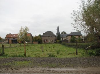
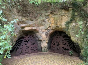
• Promenade dans les campagnes à Vechmaal : paysage riche en histoire, fermes et grottes remplies de chauve-souris. 👣...
Marche
• 🅿️ Départ et Parking: Herberg De Horne Brugstraat 30, 3870 Vechmaal ▶️ Suivre la balise « triangle rouge » D’autres...

Marche
• Départ gare des bus Brugstraat à Vechmaal . possibilité de ravitaillement à Borgloon . plus ou moins 1 km AR.
Marche
• More information on : http://www.wandelroutes.org
Marche
Marche
9 randonnées affichées sur 9
Application GPS de randonnée GRATUITE
 SityTrail
IGN / Instituts géographiques
SityTrail World
Le monde est à vous