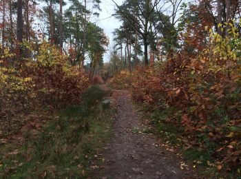
Mechelen-aan-de-Maas, Maasmechelen, A pied : Les meilleures randonnées, itinéraires, parcours, balades et promenades

4 commentaires

Mechelen-aan-de-Maas : découvrez les meilleures randonnées : 11 a pied, 18 marche et 1 marche nordique. Tous ces circuits, parcours, itinéraires et activités en plein air sont disponibles dans nos applications SityTrail pour smartphones et tablettes.


Les meilleurs parcours (30)
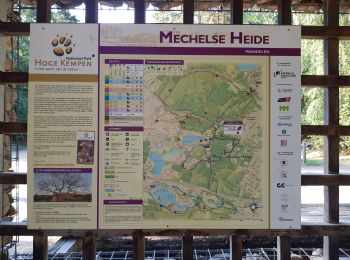
Randonnée Marche Maasmechelen - Mechelse Heide  - Photo
Marche 14.164
Km
GUIDE

Marche

Facile
(2)
Maasmechelen, Flandre, Limbourg, Belgique
14,2 km | 16,2 km-effort
3h 41min
156 m
156 m
Oui
mumu.larandonneuse

• L'itinéraire traverse le Parc National de la Haute Campine (Hoge Kempen). Nous marchons dans le Mechelse Heide et dan...
Randonnée A pied Maasmechelen - Station As Groene rechthoek - Photo
A pied 3.315
Km
GUIDE+

A pied

Facile
Maasmechelen, Flandre, Limbourg, Belgique
3,3 km | 3,8 km-effort
51min
37 m
37 m
Oui
SityTrail - itinéraires balisés pédestres

• Randonnée créée par Regionaal Landschap Kempen en Maasland. Symbole: rectangle

Randonnée A pied Maasmechelen - Station As Blauwe ruit - Photo
A pied 6.525
Km
GUIDE+

A pied

Facile
Maasmechelen, Flandre, Limbourg, Belgique
6,5 km | 7,1 km-effort
1h 36min
42 m
42 m
Oui
SityTrail - itinéraires balisés pédestres

• Randonnée créée par Regionaal Landschap Kempen en Maasland. Symbole: diamond
Randonnée A pied Maasmechelen - Station As Rode driehoek - Photo
A pied 12.034
Km
GUIDE+

A pied

Facile
Maasmechelen, Flandre, Limbourg, Belgique
12 km | 13,4 km-effort
3h 3min
106 m
106 m
Oui
SityTrail - itinéraires balisés pédestres

• Randonnée créée par Regionaal Landschap Kempen en Maasland. Symbole: triangle
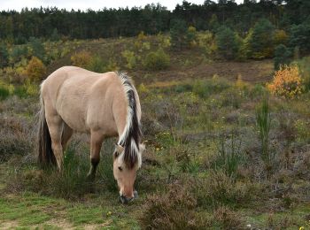
Randonnée A pied Maasmechelen - Kikbeekbron Blauwe ruit - Photo
A pied 4.562
Km
GUIDE+

A pied

Facile
Maasmechelen, Flandre, Limbourg, Belgique
4,6 km | 5,2 km-effort
1h 11min
51 m
50 m
Oui
SityTrail - itinéraires balisés pédestres

• Randonnée créée par Regionaal Landschap Kempen en Maasland. Symbole: diamond
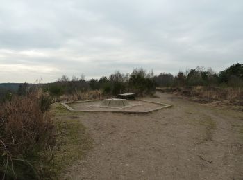
Randonnée A pied Maasmechelen - Mechels Bos Oranje bol - Photo
A pied 5.571
Km
GUIDE+

A pied

Facile
Maasmechelen, Flandre, Limbourg, Belgique
5,6 km | 6,6 km-effort
1h 30min
78 m
79 m
Oui
SityTrail - itinéraires balisés pédestres

• Randonnée créée par Regionaal Landschap Kempen en Maasland. Symbole: disk
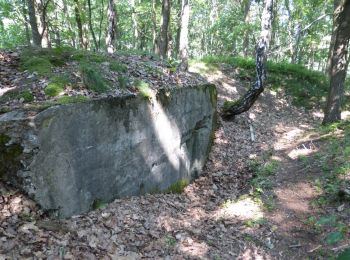
Randonnée A pied Maasmechelen - Mechels Bos Paarse trapezium - Photo
A pied 8.546
Km
GUIDE+

A pied

Facile
Maasmechelen, Flandre, Limbourg, Belgique
8,5 km | 9,6 km-effort
2h 10min
79 m
78 m
Oui
SityTrail - itinéraires balisés pédestres

• Randonnée créée par Regionaal Landschap Kempen en Maasland. Symbole: trapezium

Randonnée A pied Maasmechelen - Mechelse Heide Gele zeshoek - Photo
A pied 5.497
Km
GUIDE+

A pied

Facile
Maasmechelen, Flandre, Limbourg, Belgique
5,5 km | 6,5 km-effort
1h 27min
72 m
71 m
Oui
SityTrail - itinéraires balisés pédestres

• Randonnée créée par Regionaal Landschap Kempen en Maasland. Symbole: hexagon

Randonnée A pied Maasmechelen - Mechelse Heide Groene rechthoek - Photo
A pied 3.748
Km
GUIDE+

A pied

Facile
Maasmechelen, Flandre, Limbourg, Belgique
3,7 km | 4,4 km-effort
1h 0min
52 m
52 m
Oui
SityTrail - itinéraires balisés pédestres

• Randonnée créée par Regionaal Landschap Kempen en Maasland. Symbole: rectangle

Randonnée A pied Maasmechelen - Mechelse Heide Blauwe ruit - Photo
A pied 5.461
Km
GUIDE+

A pied

Facile
Maasmechelen, Flandre, Limbourg, Belgique
5,5 km | 6,3 km-effort
1h 25min
61 m
61 m
Oui
SityTrail - itinéraires balisés pédestres

• Randonnée créée par Regionaal Landschap Kempen en Maasland. Symbole: diamond

Randonnée A pied Maasmechelen - Mechelse Heide Rode driehoek - Photo
A pied 7.295
Km
GUIDE+

A pied

Facile
Maasmechelen, Flandre, Limbourg, Belgique
7,3 km | 8,5 km-effort
1h 56min
92 m
92 m
Oui
SityTrail - itinéraires balisés pédestres

• Randonnée créée par Regionaal Landschap Kempen en Maasland. Symbole: triangle
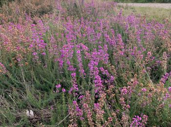
Randonnée Marche Maasmechelen - Mechelse Heide à Maasmechelen - Les bruyères - Photo
Marche 5.488
Km
GUIDE

Marche

Moyen
Maasmechelen, Flandre, Limbourg, Belgique
5,5 km | 6,4 km-effort
1h 27min
69 m
69 m
Oui
Benjamin27

• Champs infinis de bruyères dans un paysage désertique et typique de la Haute Campine. 👣 Distance : 5,6km - balisage...

Randonnée Marche Maasmechelen - Mechelse Heide - Photo
Marche 18.686
Km

Marche

Facile
Maasmechelen, Flandre, Limbourg, Belgique
18,7 km | 22 km-effort
2h 40min
227 m
200 m
Non
mavbelgium

• mooie tocht van 10 km door Mechelse Heide.. matig pittig door de steile (korte) hellingen/trappen. Mooi zicht van de ...

Randonnée A pied Maasmechelen - Mechels bos Groene rechthoek - Photo
A pied 3.735
Km
GUIDE+

A pied

Facile
Maasmechelen, Flandre, Limbourg, Belgique
3,7 km | 4,1 km-effort
55min
27 m
27 m
Oui
SityTrail - itinéraires balisés pédestres

• Randonnée créée par Regionaal Landschap Kempen en Maasland. Symbole: rectangle

Randonnée Marche Maasmechelen - maas - Photo
Marche 11.615
Km

Marche

Très facile
Maasmechelen, Flandre, Limbourg, Belgique
11,6 km | 14,4 km-effort
3h 44min
210 m
209 m
Oui
patrick357

Randonnée Marche Maasmechelen - Mechelse Heide - Photo
Marche 9.149
Km

Marche

Facile
Maasmechelen, Flandre, Limbourg, Belgique
9,1 km | 10,2 km-effort
2h 0min
82 m
83 m
Oui
kris.peirelinck@skynet.be

Randonnée Marche Maasmechelen - mechelse heide - Photo
Marche 10.311
Km

Marche

Facile
Maasmechelen, Flandre, Limbourg, Belgique
10,3 km | 12 km-effort
3h 33min
126 m
121 m
Oui
moniquebvin

• Super balade nature combinant les tracés jaune et rouge. Départ au parking (200 premiers metres non enregistrés-part...

Randonnée Marche Maasmechelen - As: Mechelse Heide (PVDB) - Photo
Marche 10.21
Km
GUIDE

Marche

Facile
Maasmechelen, Flandre, Limbourg, Belgique
10,2 km | 11,9 km-effort
Inconnu
128 m
126 m
Oui
Peter.vdbergh

Randonnée Marche Maasmechelen - w-belgie-heide-en-boswandeling - Photo
Marche 10.935
Km

Marche

Très facile
Maasmechelen, Flandre, Limbourg, Belgique
10,9 km | 12,4 km-effort
Inconnu
111 m
107 m
Oui
gpstracks

• More information on GPStracks.nl : http://www.gpstracks.nl

Randonnée Marche Maasmechelen - Maasmechelen Panorama wandeling - 10 km RT - Photo
Marche 10.826
Km

Marche

Très facile
Maasmechelen, Flandre, Limbourg, Belgique
10,8 km | 12,6 km-effort
Inconnu
133 m
133 m
Oui
wandelroutes

• More information on : http://www.wandelroutes.org

20 randonnées affichées sur 30

Application GPS de randonnée GRATUITE

Logo SityTrail SityTrail

IGN / Instituts géographiques

Télécharger SityTrail sur l'App Store Télécharger SityTrail sur Google Play

Logo SityTrail SityTrail World

Le monde est à vous

Télécharger SityTrail sur l'App Store Télécharger SityTrail sur Google Play Télécharger SityTrail sur Huawei AppGallery

Activités

Fermer
Mes abonnements