![](/images/other/stat-length.png)
- Randonnées
- A pied
- Belgique
- Flandre
- Limbourg
- Saint-Trond
- Saint-Trond
Saint-Trond, Saint-Trond, A pied : Les meilleures randonnées, itinéraires, parcours, balades et promenades
Saint-Trond : découvrez les meilleures randonnées : 8 a pied, 27 marche et 1 marche nordique. Tous ces circuits, parcours, itinéraires et activités en plein air sont disponibles dans nos applications SityTrail pour smartphones et tablettes.
Les meilleurs parcours (36)
![Randonnée Marche Saint-Trond - Promenade dans le domaine provincial](https://media.geolcdn.com/t/350/260/b90730e6-26e4-40d2-a400-559a79179cf5.jpg&format=jpg&maxdim=2)
![Marche Marche](https://static1.geolcdn.com/sitytour/trail-icons/101.png)
Km
Marche
![](/images/other/stat-length.png)
![](https://static1.geolcdn.com/siteimages/upload/files/1508320355ic_sort_den_pos_24dp.png)
![](https://static1.geolcdn.com/siteimages/upload/files/1508320355ic_sort_den_neg_24dp.png)
![](https://static1.geolcdn.com/siteimages/upload/files/16400158638029165_repeat_loop_refresh_sync_direction_icon.png)
• 🅿️ Départ et Parking: Nieuwenhoven 1, 3800 Sint-Truiden (Saint-Trond) Prévoir de bonnes chaussures de marche (cela ...
![Randonnée A pied Saint-Trond - Bernissem wandeling - Photo](https://media.geolcdn.com/t/350/260/da47f886-95ef-4a45-a44c-87cd8463dff7.jpeg&format=jpg&maxdim=2)
![A pied A pied](https://static1.geolcdn.com/sitytour/trail-icons/100.png)
Km
A pied
![](/images/other/stat-length.png)
![](https://static1.geolcdn.com/siteimages/upload/files/1508320355ic_sort_den_pos_24dp.png)
![](https://static1.geolcdn.com/siteimages/upload/files/1508320355ic_sort_den_neg_24dp.png)
![](https://static1.geolcdn.com/siteimages/upload/files/16400158638029165_repeat_loop_refresh_sync_direction_icon.png)
• Randonnée créée par Watering van Sint-Truiden.
![Randonnée A pied Saint-Trond - Cicindria Straeten oranje bol - Photo](https://media.geolcdn.com/t/350/260/6d7e87b3-3f7e-4b4a-bf60-733308598a38.jpeg&format=jpg&maxdim=2)
![A pied A pied](https://static1.geolcdn.com/sitytour/trail-icons/100.png)
Km
A pied
![](/images/other/stat-length.png)
![](https://static1.geolcdn.com/siteimages/upload/files/1508320355ic_sort_den_pos_24dp.png)
![](https://static1.geolcdn.com/siteimages/upload/files/1508320355ic_sort_den_neg_24dp.png)
![](https://static1.geolcdn.com/siteimages/upload/files/16400158638029165_repeat_loop_refresh_sync_direction_icon.png)
• Randonnée créée par Sint-Truiden. Symbole: rectangle
![Randonnée A pied Saint-Trond - Cicindria Straeten groene rechthoek - Photo](https://media.geolcdn.com/t/350/260/6d7e87b3-3f7e-4b4a-bf60-733308598a38.jpeg&format=jpg&maxdim=2)
![A pied A pied](https://static1.geolcdn.com/sitytour/trail-icons/100.png)
Km
A pied
![](/images/other/stat-length.png)
![](https://static1.geolcdn.com/siteimages/upload/files/1508320355ic_sort_den_pos_24dp.png)
![](https://static1.geolcdn.com/siteimages/upload/files/1508320355ic_sort_den_neg_24dp.png)
![](https://static1.geolcdn.com/siteimages/upload/files/16400158638029165_repeat_loop_refresh_sync_direction_icon.png)
• Randonnée créée par Sint-Truiden. Symbole: rectangle
![Randonnée A pied Saint-Trond - Staaien rode driehoek - Photo](https://media.geolcdn.com/t/350/260/cd3d1f60-3cd2-4539-a2b4-06ec7df817c9.jpeg&format=jpg&maxdim=2)
![A pied A pied](https://static1.geolcdn.com/sitytour/trail-icons/100.png)
Km
A pied
![](/images/other/stat-length.png)
![](https://static1.geolcdn.com/siteimages/upload/files/1508320355ic_sort_den_pos_24dp.png)
![](https://static1.geolcdn.com/siteimages/upload/files/1508320355ic_sort_den_neg_24dp.png)
![](https://static1.geolcdn.com/siteimages/upload/files/16400158638029165_repeat_loop_refresh_sync_direction_icon.png)
• Randonnée créée par Stad Sint-Truiden. Symbole: triangle
![Randonnée A pied Saint-Trond - Staaien oranje bol - Photo](https://media.geolcdn.com/t/350/260/7b137b54-411c-4e68-8c6c-aeb3fad0dd86.jpeg&format=jpg&maxdim=2)
![A pied A pied](https://static1.geolcdn.com/sitytour/trail-icons/100.png)
Km
A pied
![](/images/other/stat-length.png)
![](https://static1.geolcdn.com/siteimages/upload/files/1508320355ic_sort_den_pos_24dp.png)
![](https://static1.geolcdn.com/siteimages/upload/files/1508320355ic_sort_den_neg_24dp.png)
![](https://static1.geolcdn.com/siteimages/upload/files/16400158638029165_repeat_loop_refresh_sync_direction_icon.png)
• Randonnée créée par Stad Sint-Truiden. Symbole: dot
![Randonnée A pied Saint-Trond - Nieuwenhoven Oranje bol - Photo](https://media.geolcdn.com/t/350/260/b2e64be1-e82e-4959-ae54-cebd0419e976.jpeg&format=jpg&maxdim=2)
![A pied A pied](https://static1.geolcdn.com/sitytour/trail-icons/100.png)
Km
A pied
![](/images/other/stat-length.png)
![](https://static1.geolcdn.com/siteimages/upload/files/1508320355ic_sort_den_pos_24dp.png)
![](https://static1.geolcdn.com/siteimages/upload/files/1508320355ic_sort_den_neg_24dp.png)
![](https://static1.geolcdn.com/siteimages/upload/files/16400158638029165_repeat_loop_refresh_sync_direction_icon.png)
• Randonnée créée par Regionaal Landschap Haspengouw. Symbole: dot
![Randonnée A pied Saint-Trond - Nieuwenhoven Blauwe ruit - Photo](https://media.geolcdn.com/t/350/260/b2e64be1-e82e-4959-ae54-cebd0419e976.jpeg&format=jpg&maxdim=2)
![A pied A pied](https://static1.geolcdn.com/sitytour/trail-icons/100.png)
Km
A pied
![](/images/other/stat-length.png)
![](https://static1.geolcdn.com/siteimages/upload/files/1508320355ic_sort_den_pos_24dp.png)
![](https://static1.geolcdn.com/siteimages/upload/files/1508320355ic_sort_den_neg_24dp.png)
![](https://static1.geolcdn.com/siteimages/upload/files/16400158638029165_repeat_loop_refresh_sync_direction_icon.png)
• Randonnée créée par Regionaal Landschap Haspengouw. Symbole: diamond
![Randonnée A pied Saint-Trond - Nieuwenhoven rode driehoek - Photo](https://media.geolcdn.com/t/350/260/ba036578-e487-412c-9b56-087ce0b67338.jpeg&format=jpg&maxdim=2)
![A pied A pied](https://static1.geolcdn.com/sitytour/trail-icons/100.png)
Km
A pied
![](/images/other/stat-length.png)
![](https://static1.geolcdn.com/siteimages/upload/files/1508320355ic_sort_den_pos_24dp.png)
![](https://static1.geolcdn.com/siteimages/upload/files/1508320355ic_sort_den_neg_24dp.png)
![](https://static1.geolcdn.com/siteimages/upload/files/16400158638029165_repeat_loop_refresh_sync_direction_icon.png)
• Randonnée créée par Regionaal Landschap Haspengouw. Symbole: triangle
![Randonnée Marche Saint-Trond - Kortenbos - Photo](https://media.geolcdn.com/t/350/260/929a4a7a-384c-4130-9a44-9e6ece6636cb.jpg&format=jpg&maxdim=2)
![Marche Marche](https://static1.geolcdn.com/sitytour/trail-icons/101.png)
Km
Marche
![](/images/other/stat-length.png)
![](https://static1.geolcdn.com/siteimages/upload/files/1508320355ic_sort_den_pos_24dp.png)
![](https://static1.geolcdn.com/siteimages/upload/files/1508320355ic_sort_den_neg_24dp.png)
![](https://static1.geolcdn.com/siteimages/upload/files/16400158638029165_repeat_loop_refresh_sync_direction_icon.png)
• Beau parcours en 2 boucles 10 km et 11,4 km. 📌 Parochiezaal Nobertusheem, Begaardenbosstraat à Kortenbos
![Randonnée Marche Saint-Trond - La petite église de Guvelingen à Saint-Trond - Photo](https://media.geolcdn.com/t/350/260/2dfbb9e1-f6fd-446e-ac63-6ef5fef7f407.jpeg&format=jpg&maxdim=2)
![Marche Marche](https://static1.geolcdn.com/sitytour/trail-icons/101.png)
Km
Marche
![](/images/other/stat-length.png)
![](https://static1.geolcdn.com/siteimages/upload/files/1508320355ic_sort_den_pos_24dp.png)
![](https://static1.geolcdn.com/siteimages/upload/files/1508320355ic_sort_den_neg_24dp.png)
![](https://static1.geolcdn.com/siteimages/upload/files/16400158638029165_repeat_loop_refresh_sync_direction_icon.png)
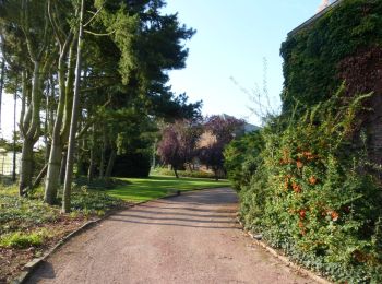
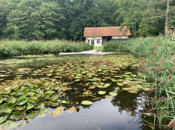
• Pour rejoindre cette petite église bien cachée, il suffit de traverser le magnifique domaine Speelhof. Entre eau et a...
![Randonnée Marche Saint-Trond - La vallée du ruisseau Cicindria à Saint-Trond (petite) - Photo](https://media.geolcdn.com/t/350/260/fb59e6e8-e19f-409b-83a1-d662f2e9ddcb.jpg&format=jpg&maxdim=2)
![Marche Marche](https://static1.geolcdn.com/sitytour/trail-icons/101.png)
Km
Marche
![](/images/other/stat-length.png)
![](https://static1.geolcdn.com/siteimages/upload/files/1508320355ic_sort_den_pos_24dp.png)
![](https://static1.geolcdn.com/siteimages/upload/files/1508320355ic_sort_den_neg_24dp.png)
![](https://static1.geolcdn.com/siteimages/upload/files/16400158638029165_repeat_loop_refresh_sync_direction_icon.png)
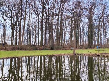
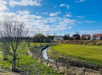
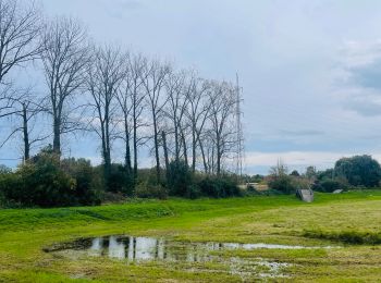
• Dans cette vallée, vous aurez un panorama complet des paysages typiques de la Hesbaye. Longez ce magnifique ruisseau ...
![Randonnée Marche Saint-Trond - La vallée fruitière à Saint-Trond - Photo](https://media.geolcdn.com/t/350/260/1eb5917c-9ec1-4729-bf31-3ca14ced1caa.jpg&format=jpg&maxdim=2)
![Marche Marche](https://static1.geolcdn.com/sitytour/trail-icons/101.png)
Km
Marche
![](/images/other/stat-length.png)
![](https://static1.geolcdn.com/siteimages/upload/files/1508320355ic_sort_den_pos_24dp.png)
![](https://static1.geolcdn.com/siteimages/upload/files/1508320355ic_sort_den_neg_24dp.png)
![](https://static1.geolcdn.com/siteimages/upload/files/16400158638029165_repeat_loop_refresh_sync_direction_icon.png)
• Petite promenade simple, accessible pour prendre l’air et déconnecter. Les paysages de Hesbaye sont très jolis, avec ...
![Randonnée Marche Saint-Trond - Evenement](https://media.geolcdn.com/t/350/260/af01bbc1-1427-44e0-8703-722b0cf9517e.jpeg&format=jpg&maxdim=2)
![Marche Marche](https://static1.geolcdn.com/sitytour/trail-icons/101.png)
Km
Marche
![](/images/other/stat-length.png)
![](https://static1.geolcdn.com/siteimages/upload/files/1508320355ic_sort_den_pos_24dp.png)
![](https://static1.geolcdn.com/siteimages/upload/files/1508320355ic_sort_den_neg_24dp.png)
![](https://static1.geolcdn.com/siteimages/upload/files/16400158638029165_repeat_loop_refresh_sync_direction_icon.png)
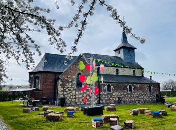
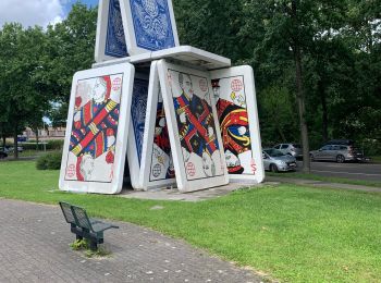
• Manière originale de découvrir la ville et ses lieux emblématiques, cette promenade vous fera contempler le patrimoin...
![Randonnée Marche Saint-Trond - Le domaine Nieuwenhoven à Saint-Trond - Photo](https://media.geolcdn.com/t/350/260/5a82fde7-8ae2-47da-8f50-fb496e254c9e.jpeg&format=jpg&maxdim=2)
![Marche Marche](https://static1.geolcdn.com/sitytour/trail-icons/101.png)
Km
Marche
![](/images/other/stat-length.png)
![](https://static1.geolcdn.com/siteimages/upload/files/1508320355ic_sort_den_pos_24dp.png)
![](https://static1.geolcdn.com/siteimages/upload/files/1508320355ic_sort_den_neg_24dp.png)
![](https://static1.geolcdn.com/siteimages/upload/files/16400158638029165_repeat_loop_refresh_sync_direction_icon.png)
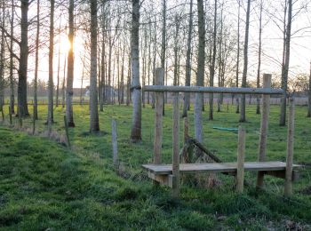
• Magnifique promenade dans les bois et découverte de plantations, chapelles, paysages divers et époustouflants! 👣 D...
![Randonnée Marche Saint-Trond - Saint-Trond - Photo](https://media.geolcdn.com/t/350/260/b3819886-1eb8-4e79-8c09-da156be48d79.jpg&format=jpg&maxdim=2)
![Marche Marche](https://static1.geolcdn.com/sitytour/trail-icons/101.png)
Km
Marche
![](/images/other/stat-length.png)
![](https://static1.geolcdn.com/siteimages/upload/files/1508320355ic_sort_den_pos_24dp.png)
![](https://static1.geolcdn.com/siteimages/upload/files/1508320355ic_sort_den_neg_24dp.png)
![](https://static1.geolcdn.com/siteimages/upload/files/16400158638029165_repeat_loop_refresh_sync_direction_icon.png)
• tour de ville
![Randonnée Marche Saint-Trond - Fruitvalleiwandeling - bloesem - Photo](https://media.geolcdn.com/t/350/260/ext.jpg?maxdim=2&url=https%3A%2F%2Fstatic1.geolcdn.com%2Fsiteimages%2Fupload%2Ffiles%2F1553511878bg_sport_marche.png)
![Marche Marche](https://static1.geolcdn.com/sitytour/trail-icons/101.png)
Km
Marche
![](/images/other/stat-length.png)
![](https://static1.geolcdn.com/siteimages/upload/files/1508320355ic_sort_den_pos_24dp.png)
![](https://static1.geolcdn.com/siteimages/upload/files/1508320355ic_sort_den_neg_24dp.png)
![](https://static1.geolcdn.com/siteimages/upload/files/16400158638029165_repeat_loop_refresh_sync_direction_icon.png)
![Randonnée Marche Saint-Trond - Les zones inondables de Bernissem à Saint-Trond - Photo](https://media.geolcdn.com/t/350/260/5f457ad3-b593-4066-af33-77d77159e797.jpeg&format=jpg&maxdim=2)
![Marche Marche](https://static1.geolcdn.com/sitytour/trail-icons/101.png)
Km
Marche
![](/images/other/stat-length.png)
![](https://static1.geolcdn.com/siteimages/upload/files/1508320355ic_sort_den_pos_24dp.png)
![](https://static1.geolcdn.com/siteimages/upload/files/1508320355ic_sort_den_neg_24dp.png)
![](https://static1.geolcdn.com/siteimages/upload/files/16400158638029165_repeat_loop_refresh_sync_direction_icon.png)
![Randonnée Marche Saint-Trond - Le domaine 't Speelhof à Saint-Trond - Photo](https://media.geolcdn.com/t/350/260/46e37628-5e32-4494-85b7-b69cb5ce1e50.jpeg&format=jpg&maxdim=2)
![Marche Marche](https://static1.geolcdn.com/sitytour/trail-icons/101.png)
Km
Marche
![](/images/other/stat-length.png)
![](https://static1.geolcdn.com/siteimages/upload/files/1508320355ic_sort_den_pos_24dp.png)
![](https://static1.geolcdn.com/siteimages/upload/files/1508320355ic_sort_den_neg_24dp.png)
![](https://static1.geolcdn.com/siteimages/upload/files/16400158638029165_repeat_loop_refresh_sync_direction_icon.png)
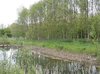
• Très joli. Si vous voulez voir des animaux, un magnifique cours d’eau, des paysages de la Hesbaye et vous ressourcer ...
![Randonnée Marche Saint-Trond - Saint Trond Les Fruitiers 25 04 2017 - Photo](https://media.geolcdn.com/t/350/260/ext.jpg?maxdim=2&url=https%3A%2F%2Fservices.sitytrail.com%2FGeolivesWS%2FDownloadMedia.ashx%3FTrailID%3D739558%26Media%3Dfix__20170425154506.jpg)
![Marche Marche](https://static1.geolcdn.com/sitytour/trail-icons/101.png)
Km
Marche
![](/images/other/stat-length.png)
![](https://static1.geolcdn.com/siteimages/upload/files/1508320355ic_sort_den_pos_24dp.png)
![](https://static1.geolcdn.com/siteimages/upload/files/1508320355ic_sort_den_neg_24dp.png)
![](https://static1.geolcdn.com/siteimages/upload/files/16400158638029165_repeat_loop_refresh_sync_direction_icon.png)
20 randonnées affichées sur 36
Application GPS de randonnée GRATUITE