Forchtenstein, Bezirk Mattersburg, A pied : Les meilleures randonnées, itinéraires, parcours, balades et promenades

Forchtenstein : découvrez les meilleures randonnées : 8 a pied. Tous ces circuits, parcours, itinéraires et activités en plein air sont disponibles dans nos applications SityTrail pour smartphones et tablettes.


Les meilleurs parcours (8)
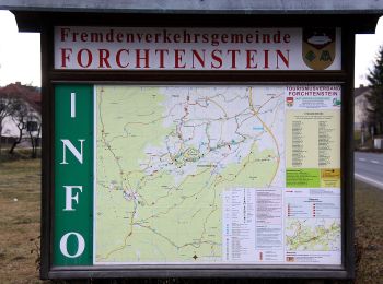
Randonnée A pied Forchtenstein - Kalkbrennofenweg Forchtenstein ( Sportplatz - Burg Forchtenstein - Steinbruch und retour) - Photo
A pied 7.435
Km
PRO

A pied

Facile
Forchtenstein, Burgenland, Bezirk Mattersburg, Autriche
7,4 km | 11,2 km-effort
2h 32min
290 m
251 m
Non
SityTrail - itinéraires balisés pédestres

• Randonnée créée par Österreichischer Touristenklub, Sektion Rosalia. Symbole: blau und weiß waagerecht + D
Randonnée A pied Forchtenstein - Kastanienstrecke (Start: Forchtenstein GH Schreiner) - Photo
A pied 7.19
Km
PRO

A pied

Facile
Forchtenstein, Burgenland, Bezirk Mattersburg, Autriche
7,2 km | 10,9 km-effort
2h 29min
282 m
281 m
Oui
SityTrail - itinéraires balisés pédestres

• Randonnée créée par Tourismusverband Region Rosalia. Symbole: grünes Schild mit Pfeil
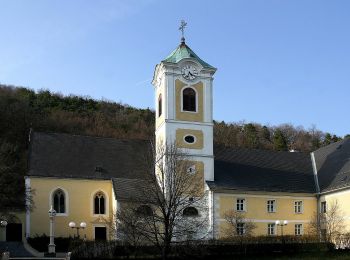
Randonnée A pied Forchtenstein - Forchtenstein - Kirchensteig - Rosalia - Photo
A pied 3.404
Km
PRO

A pied

Facile
Forchtenstein, Burgenland, Bezirk Mattersburg, Autriche
3,4 km | 7,1 km-effort
1h 36min
366 m
1 m
Non
SityTrail - itinéraires balisés pédestres

• Randonnée créée par Österreichischer Touristenklub, Sektion Rosalia. Symbole: grüner, waagrechter Balken

Randonnée A pied Forchtenstein - NW Furtstrecke - Photo
A pied 4.036
Km
PRO

A pied

Facile
Forchtenstein, Burgenland, Bezirk Mattersburg, Autriche
4 km | 4,8 km-effort
1h 5min
55 m
70 m
Non
SityTrail - itinéraires balisés pédestres

• Randonnée créée par Tourismusverband Region Rosalia. Symbole: grünes Schild mit Pfeil

Randonnée A pied Forchtenstein - Reitsteigweg Forchtenstein ( Sportplatz - Burg Forchtenstein - Rosalia) - Photo
A pied 7.32
Km
PRO

A pied

Facile
Forchtenstein, Burgenland, Bezirk Mattersburg, Autriche
7,3 km | 12,4 km-effort
2h 48min
482 m
65 m
Non
SityTrail - itinéraires balisés pédestres

• Randonnée créée par Österreichischer Touristenklub, Sektion Rosalia. Symbole: blau und weiß waagerecht + C

Randonnée A pied Forchtenstein - Hotterweg Forchtenstein ( Sportplatz - Wiesenerhöhe - Rosalia) - Photo
A pied 11.297
Km
PRO

A pied

Facile
Forchtenstein, Burgenland, Bezirk Mattersburg, Autriche
11,3 km | 16,9 km-effort
3h 50min
526 m
102 m
Non
SityTrail - itinéraires balisés pédestres

• Randonnée créée par Österreichischer Touristenklub, Sektion Rosalia. Symbole: blau und weiß waagerecht + A

Randonnée A pied Forchtenstein - NW Eisteichstrecke - Photo
A pied 9.166
Km
PRO

A pied

Facile
Forchtenstein, Burgenland, Bezirk Mattersburg, Autriche
9,2 km | 11,5 km-effort
2h 36min
174 m
172 m
Oui
SityTrail - itinéraires balisés pédestres

• Randonnée créée par Tourismusverband Region Rosalia. Symbole: grünes Schild mit Pfeil

Randonnée A pied Forchtenstein - Hotterweg Forchtenstein ( Sportplatz - Badestausee - Rosalia) - Photo
A pied 6.239
Km
PRO

A pied

Facile
Forchtenstein, Burgenland, Bezirk Mattersburg, Autriche
6,2 km | 10,8 km-effort
2h 26min
444 m
28 m
Non
SityTrail - itinéraires balisés pédestres

• Randonnée créée par Österreichischer Touristenklub, Sektion Rosalia. Symbole: blau und weiß waagerecht + B

8 randonnées affichées sur 8

Application GPS de randonnée GRATUITE

Logo SityTrail SityTrail

IGN / Instituts géographiques

Télécharger SityTrail sur l'App Store Télécharger SityTrail sur Google Play

Logo SityTrail SityTrail World

Le monde est à vous

Télécharger SityTrail sur l'App Store Télécharger SityTrail sur Google Play Télécharger SityTrail sur Huawei AppGallery

Activités

Fermer
Mes abonnements