![](/images/other/stat-length.png)
- Randonnées
- A pied
- Autriche
- Haute-Autriche
- Bezirk Freistadt
- Kefermarkt
Kefermarkt, Bezirk Freistadt, A pied : Les meilleures randonnées, itinéraires, parcours, balades et promenades
Kefermarkt : découvrez les meilleures randonnées : 3 a pied. Tous ces circuits, parcours, itinéraires et activités en plein air sont disponibles dans nos applications SityTrail pour smartphones et tablettes.
Les meilleurs parcours (3)
![Randonnée A pied Kefermarkt - Buchbergweg - Photo](https://media.geolcdn.com/t/350/260/ext.jpg?maxdim=2&url=https%3A%2F%2Fmedia.geolcdn.com%2Ff%2F78387aa7-1c3a-469e-88f6-c21fd54182d9.jpeg)
![A pied A pied](https://static1.geolcdn.com/sitytour/trail-icons/100.png)
Km
A pied
![](/images/other/stat-length.png)
![](https://static1.geolcdn.com/siteimages/upload/files/1508320355ic_sort_den_pos_24dp.png)
![](https://static1.geolcdn.com/siteimages/upload/files/1508320355ic_sort_den_neg_24dp.png)
![](https://static1.geolcdn.com/siteimages/upload/files/16400158638029165_repeat_loop_refresh_sync_direction_icon.png)
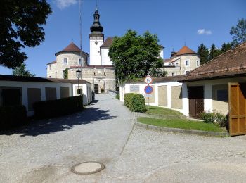
• Randonnée créée par Gemeinde Kefermarkt. Symbole: gelber Hinweispfeil mit schwarzem Text "K31 Buchbergweg"
![Randonnée A pied Kefermarkt - Burgen- und Schlösserweg - Photo](https://media.geolcdn.com/t/350/260/ext.jpg?maxdim=2&url=https%3A%2F%2Fmedia.geolcdn.com%2Ff%2F68b05141-0c23-4fe5-b237-d42b62a9e6fe.jpeg)
![A pied A pied](https://static1.geolcdn.com/sitytour/trail-icons/100.png)
Km
A pied
![](/images/other/stat-length.png)
![](https://static1.geolcdn.com/siteimages/upload/files/1508320355ic_sort_den_pos_24dp.png)
![](https://static1.geolcdn.com/siteimages/upload/files/1508320355ic_sort_den_neg_24dp.png)
![](https://static1.geolcdn.com/siteimages/upload/files/16400158638029165_repeat_loop_refresh_sync_direction_icon.png)
• Randonnée créée par Gemeinde Gutau. http://wiki.openstreetmap.org/wiki/WikiProject_Austria/Wanderwege Symbole: Schi...
![Randonnée A pied Kefermarkt - Grüblweg - Photo](https://media.geolcdn.com/t/350/260/ext.jpg?maxdim=2&url=https%3A%2F%2Fstatic1.geolcdn.com%2Fsiteimages%2Fupload%2Ffiles%2F1545311037marcheuse_200dpi.jpg)
![A pied A pied](https://static1.geolcdn.com/sitytour/trail-icons/100.png)
Km
A pied
![](/images/other/stat-length.png)
![](https://static1.geolcdn.com/siteimages/upload/files/1508320355ic_sort_den_pos_24dp.png)
![](https://static1.geolcdn.com/siteimages/upload/files/1508320355ic_sort_den_neg_24dp.png)
![](https://static1.geolcdn.com/siteimages/upload/files/16400158638029165_repeat_loop_refresh_sync_direction_icon.png)
• Randonnée créée par Gemeinde Kefermarkt. Symbole: Weißer Text K39 auf violetem Grund (manchmal auch schwarz auf gelb)
3 randonnées affichées sur 3
Application GPS de randonnée GRATUITE