![](/images/other/stat-length.png)
- Randonnées
- A pied
- Autriche
- Styrie
- Bezirk Deutschlandsberg
- Sankt Stefan ob Stainz
Sankt Stefan ob Stainz, Bezirk Deutschlandsberg, A pied : Les meilleures randonnées, itinéraires, parcours, balades et promenades
Sankt Stefan ob Stainz : découvrez les meilleures randonnées : 18 a pied. Tous ces circuits, parcours, itinéraires et activités en plein air sont disponibles dans nos applications SityTrail pour smartphones et tablettes.
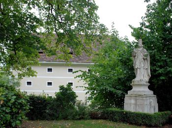
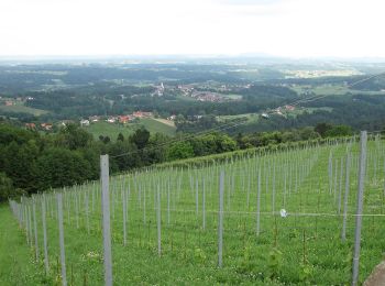
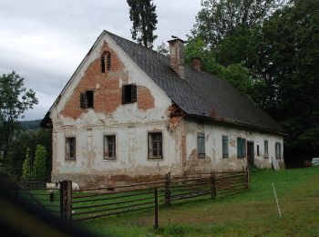
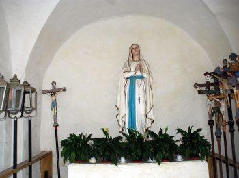
Les meilleurs parcours (18)
![Randonnée A pied Sankt Stefan ob Stainz - Rundwanderweg 8 - Photo](https://media.geolcdn.com/t/350/260/e3acf875-4102-41bd-8531-eb1ebb336bdf.jpeg&format=jpg&maxdim=2)
![A pied A pied](https://static1.geolcdn.com/sitytour/trail-icons/100.png)
Km
A pied
![](/images/other/stat-length.png)
![](https://static1.geolcdn.com/siteimages/upload/files/1508320355ic_sort_den_pos_24dp.png)
![](https://static1.geolcdn.com/siteimages/upload/files/1508320355ic_sort_den_neg_24dp.png)
![](https://static1.geolcdn.com/siteimages/upload/files/16400158638029165_repeat_loop_refresh_sync_direction_icon.png)
• http://wiki.openstreetmap.org/index.php?title=WikiProject_Austria/Wanderwege Symbole: rot - weiss - rot
![Randonnée A pied Sankt Stefan ob Stainz - GenussSchilchern dort - Photo](https://media.geolcdn.com/t/350/260/f937fa2a-2af9-42ff-94da-c79a35ec08e8.jpeg&format=jpg&maxdim=2)
![A pied A pied](https://static1.geolcdn.com/sitytour/trail-icons/100.png)
Km
A pied
![](/images/other/stat-length.png)
![](https://static1.geolcdn.com/siteimages/upload/files/1508320355ic_sort_den_pos_24dp.png)
![](https://static1.geolcdn.com/siteimages/upload/files/1508320355ic_sort_den_neg_24dp.png)
![](https://static1.geolcdn.com/siteimages/upload/files/16400158638029165_repeat_loop_refresh_sync_direction_icon.png)
• Randonnée créée par Region Reinischkogel. http://wiki.openstreetmap.org/wiki/WikiProject_Austria/Wanderwege Symbole...
![Randonnée A pied Sankt Stefan ob Stainz - GenussSchilchern da Westliche Runde - Photo](https://media.geolcdn.com/t/350/260/cd824936-cc33-47d1-9f08-83c91ad0be15.jpeg&format=jpg&maxdim=2)
![A pied A pied](https://static1.geolcdn.com/sitytour/trail-icons/100.png)
Km
A pied
![](/images/other/stat-length.png)
![](https://static1.geolcdn.com/siteimages/upload/files/1508320355ic_sort_den_pos_24dp.png)
![](https://static1.geolcdn.com/siteimages/upload/files/1508320355ic_sort_den_neg_24dp.png)
![](https://static1.geolcdn.com/siteimages/upload/files/16400158638029165_repeat_loop_refresh_sync_direction_icon.png)
• Randonnée créée par Region Reinischkogel. http://wiki.openstreetmap.org/wiki/WikiProject_Austria/Wanderwege Symbole...
![Randonnée A pied Sankt Stefan ob Stainz - GenussSchilchern da Mittlere Runde - Photo](https://media.geolcdn.com/t/350/260/026dae34-bc22-4cf5-b0e0-068919ac0ab9.jpeg&format=jpg&maxdim=2)
![A pied A pied](https://static1.geolcdn.com/sitytour/trail-icons/100.png)
Km
A pied
![](/images/other/stat-length.png)
![](https://static1.geolcdn.com/siteimages/upload/files/1508320355ic_sort_den_pos_24dp.png)
![](https://static1.geolcdn.com/siteimages/upload/files/1508320355ic_sort_den_neg_24dp.png)
![](https://static1.geolcdn.com/siteimages/upload/files/16400158638029165_repeat_loop_refresh_sync_direction_icon.png)
• Randonnée créée par Region Reinischkogel. http://wiki.openstreetmap.org/wiki/WikiProject_Austria/Wanderwege Symbole...
![Randonnée A pied Sankt Stefan ob Stainz - GenussSchilchern da Östliche Runde - Photo](https://media.geolcdn.com/t/350/260/6e2a7ca2-ed89-41b8-862d-f43f536e8e88.jpeg&format=jpg&maxdim=2)
![A pied A pied](https://static1.geolcdn.com/sitytour/trail-icons/100.png)
Km
A pied
![](/images/other/stat-length.png)
![](https://static1.geolcdn.com/siteimages/upload/files/1508320355ic_sort_den_pos_24dp.png)
![](https://static1.geolcdn.com/siteimages/upload/files/1508320355ic_sort_den_neg_24dp.png)
![](https://static1.geolcdn.com/siteimages/upload/files/16400158638029165_repeat_loop_refresh_sync_direction_icon.png)
• Randonnée créée par Region Reinischkogel. http://wiki.openstreetmap.org/wiki/WikiProject_Austria/Wanderwege Symbole...
![Randonnée A pied Sankt Stefan ob Stainz - Wanderweg S1 - Photo](https://media.geolcdn.com/t/350/260/cd824936-cc33-47d1-9f08-83c91ad0be15.jpeg&format=jpg&maxdim=2)
![A pied A pied](https://static1.geolcdn.com/sitytour/trail-icons/100.png)
Km
A pied
![](/images/other/stat-length.png)
![](https://static1.geolcdn.com/siteimages/upload/files/1508320355ic_sort_den_pos_24dp.png)
![](https://static1.geolcdn.com/siteimages/upload/files/1508320355ic_sort_den_neg_24dp.png)
![](https://static1.geolcdn.com/siteimages/upload/files/16400158638029165_repeat_loop_refresh_sync_direction_icon.png)
• Randonnée créée par TVB Schilcherland. http://wiki.openstreetmap.org/wiki/WikiProject_Austria/Wanderwege Symbole: r...
![Randonnée A pied Sankt Stefan ob Stainz - Wanderweg S3 - Photo](https://media.geolcdn.com/t/350/260/cd824936-cc33-47d1-9f08-83c91ad0be15.jpeg&format=jpg&maxdim=2)
![A pied A pied](https://static1.geolcdn.com/sitytour/trail-icons/100.png)
Km
A pied
![](/images/other/stat-length.png)
![](https://static1.geolcdn.com/siteimages/upload/files/1508320355ic_sort_den_pos_24dp.png)
![](https://static1.geolcdn.com/siteimages/upload/files/1508320355ic_sort_den_neg_24dp.png)
![](https://static1.geolcdn.com/siteimages/upload/files/16400158638029165_repeat_loop_refresh_sync_direction_icon.png)
• Randonnée créée par TVB Schilcherland. http://wiki.openstreetmap.org/wiki/WikiProject_Austria/Wanderwege Symbole: r...
![Randonnée A pied Sankt Stefan ob Stainz - Wanderweg S4 - Photo](https://media.geolcdn.com/t/350/260/53aa7c90-6cd6-440a-9cd9-5e1901f5db91.jpeg&format=jpg&maxdim=2)
![A pied A pied](https://static1.geolcdn.com/sitytour/trail-icons/100.png)
Km
A pied
![](/images/other/stat-length.png)
![](https://static1.geolcdn.com/siteimages/upload/files/1508320355ic_sort_den_pos_24dp.png)
![](https://static1.geolcdn.com/siteimages/upload/files/1508320355ic_sort_den_neg_24dp.png)
![](https://static1.geolcdn.com/siteimages/upload/files/16400158638029165_repeat_loop_refresh_sync_direction_icon.png)
• Randonnée créée par TVB Schilcherland. http://wiki.openstreetmap.org/wiki/WikiProject_Austria/Wanderwege Symbole: r...
![Randonnée A pied Sankt Stefan ob Stainz - Wanderweg S13 - Photo](https://media.geolcdn.com/t/350/260/f937fa2a-2af9-42ff-94da-c79a35ec08e8.jpeg&format=jpg&maxdim=2)
![A pied A pied](https://static1.geolcdn.com/sitytour/trail-icons/100.png)
Km
A pied
![](/images/other/stat-length.png)
![](https://static1.geolcdn.com/siteimages/upload/files/1508320355ic_sort_den_pos_24dp.png)
![](https://static1.geolcdn.com/siteimages/upload/files/1508320355ic_sort_den_neg_24dp.png)
![](https://static1.geolcdn.com/siteimages/upload/files/16400158638029165_repeat_loop_refresh_sync_direction_icon.png)
• Randonnée créée par TVB Schilcherland. http://wiki.openstreetmap.org/wiki/WikiProject_Austria/Wanderwege Symbole: r...
![Randonnée A pied Sankt Stefan ob Stainz - Wanderweg 11g - Photo](https://media.geolcdn.com/t/350/260/8ed70273-0255-41a6-94e3-ad96039e721d.jpeg&format=jpg&maxdim=2)
![A pied A pied](https://static1.geolcdn.com/sitytour/trail-icons/100.png)
Km
A pied
![](/images/other/stat-length.png)
![](https://static1.geolcdn.com/siteimages/upload/files/1508320355ic_sort_den_pos_24dp.png)
![](https://static1.geolcdn.com/siteimages/upload/files/1508320355ic_sort_den_neg_24dp.png)
![](https://static1.geolcdn.com/siteimages/upload/files/16400158638029165_repeat_loop_refresh_sync_direction_icon.png)
• Randonnée créée par TVB Schilcherland. http://wiki.openstreetmap.org/wiki/WikiProject_Austria/Wanderwege
![Randonnée A pied Sankt Stefan ob Stainz - St. Stefan Rundweg - Photo](https://media.geolcdn.com/t/350/260/f937fa2a-2af9-42ff-94da-c79a35ec08e8.jpeg&format=jpg&maxdim=2)
![A pied A pied](https://static1.geolcdn.com/sitytour/trail-icons/100.png)
Km
A pied
![](/images/other/stat-length.png)
![](https://static1.geolcdn.com/siteimages/upload/files/1508320355ic_sort_den_pos_24dp.png)
![](https://static1.geolcdn.com/siteimages/upload/files/1508320355ic_sort_den_neg_24dp.png)
![](https://static1.geolcdn.com/siteimages/upload/files/16400158638029165_repeat_loop_refresh_sync_direction_icon.png)
• Randonnée créée par F.V.V. St. Stefan. Symbole: rot-weiss-rot 10
![Randonnée A pied Sankt Stefan ob Stainz - Kastanienweg - Photo](https://media.geolcdn.com/t/350/260/f937fa2a-2af9-42ff-94da-c79a35ec08e8.jpeg&format=jpg&maxdim=2)
![A pied A pied](https://static1.geolcdn.com/sitytour/trail-icons/100.png)
Km
A pied
![](/images/other/stat-length.png)
![](https://static1.geolcdn.com/siteimages/upload/files/1508320355ic_sort_den_pos_24dp.png)
![](https://static1.geolcdn.com/siteimages/upload/files/1508320355ic_sort_den_neg_24dp.png)
![](https://static1.geolcdn.com/siteimages/upload/files/16400158638029165_repeat_loop_refresh_sync_direction_icon.png)
![Randonnée A pied Sankt Stefan ob Stainz - Wanderweg 24 - Photo](https://media.geolcdn.com/t/350/260/ext.jpg?maxdim=2&url=https%3A%2F%2Fstatic1.geolcdn.com%2Fsiteimages%2Fupload%2Ffiles%2F1545311037marcheuse_200dpi.jpg)
![A pied A pied](https://static1.geolcdn.com/sitytour/trail-icons/100.png)
Km
A pied
![](/images/other/stat-length.png)
![](https://static1.geolcdn.com/siteimages/upload/files/1508320355ic_sort_den_pos_24dp.png)
![](https://static1.geolcdn.com/siteimages/upload/files/1508320355ic_sort_den_neg_24dp.png)
![](https://static1.geolcdn.com/siteimages/upload/files/16400158638029165_repeat_loop_refresh_sync_direction_icon.png)
• http://wiki.openstreetmap.org/wiki/WikiProject_Austria/Wanderwege Symbole: rot-weiss-rot 24
![Randonnée A pied Sankt Stefan ob Stainz - Gundersdorfer Rundwanderweg - Photo](https://media.geolcdn.com/t/350/260/ext.jpg?maxdim=2&url=https%3A%2F%2Fstatic1.geolcdn.com%2Fsiteimages%2Fupload%2Ffiles%2F1545311037marcheuse_200dpi.jpg)
![A pied A pied](https://static1.geolcdn.com/sitytour/trail-icons/100.png)
Km
A pied
![](/images/other/stat-length.png)
![](https://static1.geolcdn.com/siteimages/upload/files/1508320355ic_sort_den_pos_24dp.png)
![](https://static1.geolcdn.com/siteimages/upload/files/1508320355ic_sort_den_neg_24dp.png)
![](https://static1.geolcdn.com/siteimages/upload/files/16400158638029165_repeat_loop_refresh_sync_direction_icon.png)
• Randonnée créée par ???. http://wiki.openstreetmap.org/wiki/WikiProject_Austria/Wanderwege Symbole: rot-weiss-rot
![Randonnée A pied Sankt Stefan ob Stainz - Wanderweg S2 - Photo](https://media.geolcdn.com/t/350/260/ext.jpg?maxdim=2&url=https%3A%2F%2Fstatic1.geolcdn.com%2Fsiteimages%2Fupload%2Ffiles%2F1545311037marcheuse_200dpi.jpg)
![A pied A pied](https://static1.geolcdn.com/sitytour/trail-icons/100.png)
Km
A pied
![](/images/other/stat-length.png)
![](https://static1.geolcdn.com/siteimages/upload/files/1508320355ic_sort_den_pos_24dp.png)
![](https://static1.geolcdn.com/siteimages/upload/files/1508320355ic_sort_den_neg_24dp.png)
![](https://static1.geolcdn.com/siteimages/upload/files/16400158638029165_repeat_loop_refresh_sync_direction_icon.png)
• Randonnée créée par TVB Schilcherland. http://wiki.openstreetmap.org/wiki/WikiProject_Austria/Wanderwege Symbole: r...
![Randonnée A pied Sankt Stefan ob Stainz - Wanderweg S6 - Photo](https://media.geolcdn.com/t/350/260/ext.jpg?maxdim=2&url=https%3A%2F%2Fstatic1.geolcdn.com%2Fsiteimages%2Fupload%2Ffiles%2F1545311037marcheuse_200dpi.jpg)
![A pied A pied](https://static1.geolcdn.com/sitytour/trail-icons/100.png)
Km
A pied
![](/images/other/stat-length.png)
![](https://static1.geolcdn.com/siteimages/upload/files/1508320355ic_sort_den_pos_24dp.png)
![](https://static1.geolcdn.com/siteimages/upload/files/1508320355ic_sort_den_neg_24dp.png)
![](https://static1.geolcdn.com/siteimages/upload/files/16400158638029165_repeat_loop_refresh_sync_direction_icon.png)
• Randonnée créée par TVB Schilcherland. http://wiki.openstreetmap.org/wiki/WikiProject_Austria/Wanderwege Symbole: r...
![Randonnée A pied Sankt Stefan ob Stainz - Wanderweg S12 - Photo](https://media.geolcdn.com/t/350/260/ext.jpg?maxdim=2&url=https%3A%2F%2Fstatic1.geolcdn.com%2Fsiteimages%2Fupload%2Ffiles%2F1545311037marcheuse_200dpi.jpg)
![A pied A pied](https://static1.geolcdn.com/sitytour/trail-icons/100.png)
Km
A pied
![](/images/other/stat-length.png)
![](https://static1.geolcdn.com/siteimages/upload/files/1508320355ic_sort_den_pos_24dp.png)
![](https://static1.geolcdn.com/siteimages/upload/files/1508320355ic_sort_den_neg_24dp.png)
![](https://static1.geolcdn.com/siteimages/upload/files/16400158638029165_repeat_loop_refresh_sync_direction_icon.png)
• Randonnée créée par TVB Schilcherland. http://wiki.openstreetmap.org/wiki/WikiProject_Austria/Wanderwege Symbole: r...
![Randonnée A pied Sankt Stefan ob Stainz - Sommereben Rundwanderweg 60 - Photo](https://media.geolcdn.com/t/350/260/ext.jpg?maxdim=2&url=https%3A%2F%2Fstatic1.geolcdn.com%2Fsiteimages%2Fupload%2Ffiles%2F1545311037marcheuse_200dpi.jpg)
![A pied A pied](https://static1.geolcdn.com/sitytour/trail-icons/100.png)
Km
A pied
![](/images/other/stat-length.png)
![](https://static1.geolcdn.com/siteimages/upload/files/1508320355ic_sort_den_pos_24dp.png)
![](https://static1.geolcdn.com/siteimages/upload/files/1508320355ic_sort_den_neg_24dp.png)
![](https://static1.geolcdn.com/siteimages/upload/files/16400158638029165_repeat_loop_refresh_sync_direction_icon.png)
• http://wiki.openstreetmap.org/wiki/WikiProject_Austria/Wanderwege Symbole: rot-weiss-rot 60
18 randonnées affichées sur 18
Application GPS de randonnée GRATUITE