![](/images/other/stat-length.png)
Stainz, Bezirk Deutschlandsberg, A pied : Les meilleures randonnées, itinéraires, parcours, balades et promenades
Stainz : découvrez les meilleures randonnées : 21 a pied. Tous ces circuits, parcours, itinéraires et activités en plein air sont disponibles dans nos applications SityTrail pour smartphones et tablettes.
Les meilleurs parcours (21)
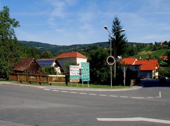
![Randonnée A pied Stainz - Kapellenweg Rundwanderweg - Photo](https://media.geolcdn.com/t/350/260/11e1c200-075c-4350-b1db-5b5ce680fc35.jpeg&format=jpg&maxdim=2)
![A pied A pied](https://static1.geolcdn.com/sitytour/trail-icons/100.png)
Km
A pied
![](/images/other/stat-length.png)
![](https://static1.geolcdn.com/siteimages/upload/files/1508320355ic_sort_den_pos_24dp.png)
![](https://static1.geolcdn.com/siteimages/upload/files/1508320355ic_sort_den_neg_24dp.png)
![](https://static1.geolcdn.com/siteimages/upload/files/16400158638029165_repeat_loop_refresh_sync_direction_icon.png)
• Randonnée créée par TVB Schilcherland. Symbole: rot-weiss-rot 3
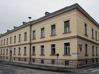
![Randonnée A pied Stainz - Rundwanderweg 6 - Photo](https://media.geolcdn.com/t/350/260/5ed6c64b-b34e-434a-ae5f-765a72f24c19.jpeg&format=jpg&maxdim=2)
![A pied A pied](https://static1.geolcdn.com/sitytour/trail-icons/100.png)
Km
A pied
![](/images/other/stat-length.png)
![](https://static1.geolcdn.com/siteimages/upload/files/1508320355ic_sort_den_pos_24dp.png)
![](https://static1.geolcdn.com/siteimages/upload/files/1508320355ic_sort_den_neg_24dp.png)
![](https://static1.geolcdn.com/siteimages/upload/files/16400158638029165_repeat_loop_refresh_sync_direction_icon.png)
• Randonnée créée par TVB Schilcherland. http://wiki.openstreetmap.org/index.php?title=WikiProject_Austria/Wanderwege ...
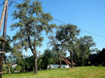
![Randonnée A pied Stainz - Rundwanderweg 5 - Photo](https://media.geolcdn.com/t/350/260/7d61edee-df08-498a-a846-bec59c615131.jpeg&format=jpg&maxdim=2)
![A pied A pied](https://static1.geolcdn.com/sitytour/trail-icons/100.png)
Km
A pied
![](/images/other/stat-length.png)
![](https://static1.geolcdn.com/siteimages/upload/files/1508320355ic_sort_den_pos_24dp.png)
![](https://static1.geolcdn.com/siteimages/upload/files/1508320355ic_sort_den_neg_24dp.png)
![](https://static1.geolcdn.com/siteimages/upload/files/16400158638029165_repeat_loop_refresh_sync_direction_icon.png)
• Randonnée créée par TVB Schilcherland. http://wiki.openstreetmap.org/index.php?title=WikiProject_Austria/Wanderwege ...
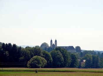
![Randonnée A pied Stainz - Wanderweg 2 - Photo](https://media.geolcdn.com/t/350/260/77c70ad5-e976-4701-84b7-f907939537df.jpeg&format=jpg&maxdim=2)
![A pied A pied](https://static1.geolcdn.com/sitytour/trail-icons/100.png)
Km
A pied
![](/images/other/stat-length.png)
![](https://static1.geolcdn.com/siteimages/upload/files/1508320355ic_sort_den_pos_24dp.png)
![](https://static1.geolcdn.com/siteimages/upload/files/1508320355ic_sort_den_neg_24dp.png)
![](https://static1.geolcdn.com/siteimages/upload/files/16400158638029165_repeat_loop_refresh_sync_direction_icon.png)
• Randonnée créée par TVB Schilcherland.
![Randonnée A pied Stainz - Wanderweg 13 - Photo](https://media.geolcdn.com/t/350/260/77c70ad5-e976-4701-84b7-f907939537df.jpeg&format=jpg&maxdim=2)
![A pied A pied](https://static1.geolcdn.com/sitytour/trail-icons/100.png)
Km
A pied
![](/images/other/stat-length.png)
![](https://static1.geolcdn.com/siteimages/upload/files/1508320355ic_sort_den_pos_24dp.png)
![](https://static1.geolcdn.com/siteimages/upload/files/1508320355ic_sort_den_neg_24dp.png)
![](https://static1.geolcdn.com/siteimages/upload/files/16400158638029165_repeat_loop_refresh_sync_direction_icon.png)
• Randonnée créée par TVB Schilcherland. Symbole: rot-weiss-rot 13
![Randonnée A pied Stainz - Wanderweg 4 - Photo](https://media.geolcdn.com/t/350/260/225c0f97-b2ee-4304-af09-7910bb88995c.jpeg&format=jpg&maxdim=2)
![A pied A pied](https://static1.geolcdn.com/sitytour/trail-icons/100.png)
Km
A pied
![](/images/other/stat-length.png)
![](https://static1.geolcdn.com/siteimages/upload/files/1508320355ic_sort_den_pos_24dp.png)
![](https://static1.geolcdn.com/siteimages/upload/files/1508320355ic_sort_den_neg_24dp.png)
![](https://static1.geolcdn.com/siteimages/upload/files/16400158638029165_repeat_loop_refresh_sync_direction_icon.png)
• Symbole: rot-weiss-rot 4
![Randonnée A pied Stainz - Rundwanderweg 7 - Photo](https://media.geolcdn.com/t/350/260/b89d10da-9ce9-4833-af7e-b571f3db5dbd.jpeg&format=jpg&maxdim=2)
![A pied A pied](https://static1.geolcdn.com/sitytour/trail-icons/100.png)
Km
A pied
![](/images/other/stat-length.png)
![](https://static1.geolcdn.com/siteimages/upload/files/1508320355ic_sort_den_pos_24dp.png)
![](https://static1.geolcdn.com/siteimages/upload/files/1508320355ic_sort_den_neg_24dp.png)
![](https://static1.geolcdn.com/siteimages/upload/files/16400158638029165_repeat_loop_refresh_sync_direction_icon.png)
• Randonnée créée par TVB Schilcherland. http://wiki.openstreetmap.org/index.php?title=WikiProject_Austria/Wanderwege ...

![Randonnée A pied Stainz - Wanderweg 16 - Photo](https://media.geolcdn.com/t/350/260/8e192a5d-1fbd-4034-9802-46abdeafd427.jpeg&format=jpg&maxdim=2)
![A pied A pied](https://static1.geolcdn.com/sitytour/trail-icons/100.png)
Km
A pied
![](/images/other/stat-length.png)
![](https://static1.geolcdn.com/siteimages/upload/files/1508320355ic_sort_den_pos_24dp.png)
![](https://static1.geolcdn.com/siteimages/upload/files/1508320355ic_sort_den_neg_24dp.png)
![](https://static1.geolcdn.com/siteimages/upload/files/16400158638029165_repeat_loop_refresh_sync_direction_icon.png)
• Randonnée créée par TVB Schilcherland. http://wiki.openstreetmap.org/wiki/WikiProject_Austria/Wanderwege Symbole: r...
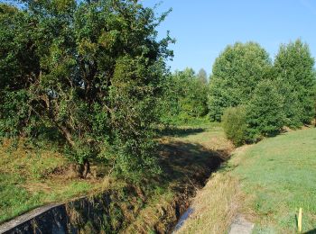
![Randonnée A pied Stainz - Georgsberg Rundweg - Photo](https://media.geolcdn.com/t/350/260/08973876-c1c7-45a8-8cc4-39030cd7e8ef.jpeg&format=jpg&maxdim=2)
![A pied A pied](https://static1.geolcdn.com/sitytour/trail-icons/100.png)
Km
A pied
![](/images/other/stat-length.png)
![](https://static1.geolcdn.com/siteimages/upload/files/1508320355ic_sort_den_pos_24dp.png)
![](https://static1.geolcdn.com/siteimages/upload/files/1508320355ic_sort_den_neg_24dp.png)
![](https://static1.geolcdn.com/siteimages/upload/files/16400158638029165_repeat_loop_refresh_sync_direction_icon.png)
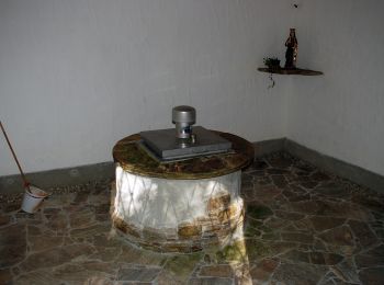
• http://wiki.openstreetmap.org/wiki/WikiProject_Austria/Wanderwege Symbole: rot-weiss-rot 15 Site web: http://www.w...
![Randonnée A pied Stainz - Wanderweg 10g - Photo](https://media.geolcdn.com/t/350/260/8ed70273-0255-41a6-94e3-ad96039e721d.jpeg&format=jpg&maxdim=2)
![A pied A pied](https://static1.geolcdn.com/sitytour/trail-icons/100.png)
Km
A pied
![](/images/other/stat-length.png)
![](https://static1.geolcdn.com/siteimages/upload/files/1508320355ic_sort_den_pos_24dp.png)
![](https://static1.geolcdn.com/siteimages/upload/files/1508320355ic_sort_den_neg_24dp.png)
![](https://static1.geolcdn.com/siteimages/upload/files/16400158638029165_repeat_loop_refresh_sync_direction_icon.png)
• Randonnée créée par TVB Schilcherland. http://wiki.openstreetmap.org/wiki/WikiProject_Austria/Wanderwege Symbole: r...
![Randonnée A pied Stainz - Wanderweg 9 - Photo](https://media.geolcdn.com/t/350/260/8ed70273-0255-41a6-94e3-ad96039e721d.jpeg&format=jpg&maxdim=2)
![A pied A pied](https://static1.geolcdn.com/sitytour/trail-icons/100.png)
Km
A pied
![](/images/other/stat-length.png)
![](https://static1.geolcdn.com/siteimages/upload/files/1508320355ic_sort_den_pos_24dp.png)
![](https://static1.geolcdn.com/siteimages/upload/files/1508320355ic_sort_den_neg_24dp.png)
![](https://static1.geolcdn.com/siteimages/upload/files/16400158638029165_repeat_loop_refresh_sync_direction_icon.png)
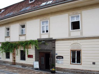
• Randonnée créée par TVB Schilcherland. http://wiki.openstreetmap.org/wiki/WikiProject_Austria/Wanderwege Symbole: r...
![Randonnée A pied Stainz - Wanderweg 12 - Photo](https://media.geolcdn.com/t/350/260/69b97e88-ae31-49a7-aefe-171d47b61e82.jpeg&format=jpg&maxdim=2)
![A pied A pied](https://static1.geolcdn.com/sitytour/trail-icons/100.png)
Km
A pied
![](/images/other/stat-length.png)
![](https://static1.geolcdn.com/siteimages/upload/files/1508320355ic_sort_den_pos_24dp.png)
![](https://static1.geolcdn.com/siteimages/upload/files/1508320355ic_sort_den_neg_24dp.png)
![](https://static1.geolcdn.com/siteimages/upload/files/16400158638029165_repeat_loop_refresh_sync_direction_icon.png)
• Symbole: rot-weiss-rot 12
![Randonnée A pied Stainz - Stainzer Panoramaweg 1 - Photo](https://media.geolcdn.com/t/350/260/77c70ad5-e976-4701-84b7-f907939537df.jpeg&format=jpg&maxdim=2)
![A pied A pied](https://static1.geolcdn.com/sitytour/trail-icons/100.png)
Km
A pied
![](/images/other/stat-length.png)
![](https://static1.geolcdn.com/siteimages/upload/files/1508320355ic_sort_den_pos_24dp.png)
![](https://static1.geolcdn.com/siteimages/upload/files/1508320355ic_sort_den_neg_24dp.png)
![](https://static1.geolcdn.com/siteimages/upload/files/16400158638029165_repeat_loop_refresh_sync_direction_icon.png)
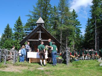
• Randonnée créée par TVB Schilcherland. Symbole: rot-weiss-rot 1
![Randonnée A pied Stainz - Rundwanderweg A2 - Photo](https://media.geolcdn.com/t/350/260/f2f3465d-2e11-4615-a71e-fcddcc8c8a0e.jpeg&format=jpg&maxdim=2)
![A pied A pied](https://static1.geolcdn.com/sitytour/trail-icons/100.png)
Km
A pied
![](/images/other/stat-length.png)
![](https://static1.geolcdn.com/siteimages/upload/files/1508320355ic_sort_den_pos_24dp.png)
![](https://static1.geolcdn.com/siteimages/upload/files/1508320355ic_sort_den_neg_24dp.png)
![](https://static1.geolcdn.com/siteimages/upload/files/16400158638029165_repeat_loop_refresh_sync_direction_icon.png)
• Symbole: rot-weiss-rot A2
![Randonnée A pied Stainz - Wanderweg 14 - Photo](https://media.geolcdn.com/t/350/260/f2f3465d-2e11-4615-a71e-fcddcc8c8a0e.jpeg&format=jpg&maxdim=2)
![A pied A pied](https://static1.geolcdn.com/sitytour/trail-icons/100.png)
Km
A pied
![](/images/other/stat-length.png)
![](https://static1.geolcdn.com/siteimages/upload/files/1508320355ic_sort_den_pos_24dp.png)
![](https://static1.geolcdn.com/siteimages/upload/files/1508320355ic_sort_den_neg_24dp.png)
![](https://static1.geolcdn.com/siteimages/upload/files/16400158638029165_repeat_loop_refresh_sync_direction_icon.png)
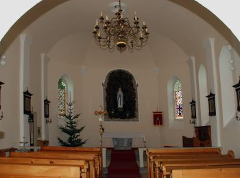
• http://wiki.openstreetmap.org/wiki/WikiProject_Austria/Wanderwege Symbole: rot-weiss-rot 14
![Randonnée A pied Stainz - Wanderweg 8 - Photo](https://media.geolcdn.com/t/350/260/880c7a9d-9f7b-496c-9375-350fa2b7f1c7.jpeg&format=jpg&maxdim=2)
![A pied A pied](https://static1.geolcdn.com/sitytour/trail-icons/100.png)
Km
A pied
![](/images/other/stat-length.png)
![](https://static1.geolcdn.com/siteimages/upload/files/1508320355ic_sort_den_pos_24dp.png)
![](https://static1.geolcdn.com/siteimages/upload/files/1508320355ic_sort_den_neg_24dp.png)
![](https://static1.geolcdn.com/siteimages/upload/files/16400158638029165_repeat_loop_refresh_sync_direction_icon.png)
• Randonnée créée par TVB Schilcherland. http://wiki.openstreetmap.org/wiki/WikiProject_Austria/Wanderwege Symbole: r...
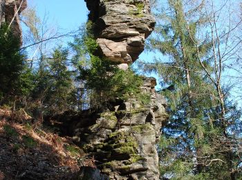
![Randonnée A pied Stainz - Sommereben Rundwanderweg 58 - Photo](https://media.geolcdn.com/t/350/260/e4357cb1-9916-4a57-ab78-8b281639b032.jpeg&format=jpg&maxdim=2)
![A pied A pied](https://static1.geolcdn.com/sitytour/trail-icons/100.png)
Km
A pied
![](/images/other/stat-length.png)
![](https://static1.geolcdn.com/siteimages/upload/files/1508320355ic_sort_den_pos_24dp.png)
![](https://static1.geolcdn.com/siteimages/upload/files/1508320355ic_sort_den_neg_24dp.png)
![](https://static1.geolcdn.com/siteimages/upload/files/16400158638029165_repeat_loop_refresh_sync_direction_icon.png)
• http://wiki.openstreetmap.org/wiki/WikiProject_Austria/Wanderwege Symbole: rot-weiss-rot 58
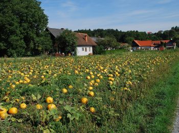
![Randonnée A pied Stainz - Marhofer Genußwanderweg - Photo](https://media.geolcdn.com/t/350/260/19314cf9-68e1-4b6b-aad5-0cdc8746a9d5.jpeg&format=jpg&maxdim=2)
![A pied A pied](https://static1.geolcdn.com/sitytour/trail-icons/100.png)
Km
A pied
![](/images/other/stat-length.png)
![](https://static1.geolcdn.com/siteimages/upload/files/1508320355ic_sort_den_pos_24dp.png)
![](https://static1.geolcdn.com/siteimages/upload/files/1508320355ic_sort_den_neg_24dp.png)
![](https://static1.geolcdn.com/siteimages/upload/files/16400158638029165_repeat_loop_refresh_sync_direction_icon.png)
![Randonnée A pied Stainz - Höllerhanslweg - Photo](https://media.geolcdn.com/t/350/260/11e1c200-075c-4350-b1db-5b5ce680fc35.jpeg&format=jpg&maxdim=2)
![A pied A pied](https://static1.geolcdn.com/sitytour/trail-icons/100.png)
Km
A pied
![](/images/other/stat-length.png)
![](https://static1.geolcdn.com/siteimages/upload/files/1508320355ic_sort_den_pos_24dp.png)
![](https://static1.geolcdn.com/siteimages/upload/files/1508320355ic_sort_den_neg_24dp.png)
![](https://static1.geolcdn.com/siteimages/upload/files/16400158638029165_repeat_loop_refresh_sync_direction_icon.png)
![Randonnée A pied Stainz - Rundwanderweg A3 - Photo](https://media.geolcdn.com/t/350/260/ce1e57e5-d38c-4989-9305-078d9a35247c.jpeg&format=jpg&maxdim=2)
![A pied A pied](https://static1.geolcdn.com/sitytour/trail-icons/100.png)
Km
A pied
![](/images/other/stat-length.png)
![](https://static1.geolcdn.com/siteimages/upload/files/1508320355ic_sort_den_pos_24dp.png)
![](https://static1.geolcdn.com/siteimages/upload/files/1508320355ic_sort_den_neg_24dp.png)
![](https://static1.geolcdn.com/siteimages/upload/files/16400158638029165_repeat_loop_refresh_sync_direction_icon.png)
• http://wiki.openstreetmap.org/wiki/WikiProject_Austria/Wanderwege Symbole: rot-weiss-rot A3
20 randonnées affichées sur 21
Application GPS de randonnée GRATUITE