![](/images/other/stat-length.png)
- Randonnées
- A pied
- Autriche
- Basse-Autriche
- Bezirk Wiener Neustadt
- Gemeinde Wiesmath
Gemeinde Wiesmath, Bezirk Wiener Neustadt, A pied : Les meilleures randonnées, itinéraires, parcours, balades et promenades
Gemeinde Wiesmath : découvrez les meilleures randonnées : 10 a pied. Tous ces circuits, parcours, itinéraires et activités en plein air sont disponibles dans nos applications SityTrail pour smartphones et tablettes.
Les meilleurs parcours (10)
![Randonnée A pied Gemeinde Wiesmath - Wiesmath - Nußleiten - Süßhof - Wiesmath - Photo](https://media.geolcdn.com/t/350/260/5436646f-8068-471a-a18f-baf9b9018f6f.jpeg&format=jpg&maxdim=2)
![A pied A pied](https://static1.geolcdn.com/sitytour/trail-icons/100.png)
Km
A pied
![](/images/other/stat-length.png)
![](https://static1.geolcdn.com/siteimages/upload/files/1508320355ic_sort_den_pos_24dp.png)
![](https://static1.geolcdn.com/siteimages/upload/files/1508320355ic_sort_den_neg_24dp.png)
![](https://static1.geolcdn.com/siteimages/upload/files/16400158638029165_repeat_loop_refresh_sync_direction_icon.png)
• Symbole: grün-weiß Schild mit B7
![Randonnée A pied Gemeinde Wiesmath - Wiesmath - Hölle Braunstorfer - Annaberg - Wiesmath - Photo](https://media.geolcdn.com/t/350/260/ff72d190-f7ae-46c5-b3e3-05addc677791.jpeg&format=jpg&maxdim=2)
![A pied A pied](https://static1.geolcdn.com/sitytour/trail-icons/100.png)
Km
A pied
![](/images/other/stat-length.png)
![](https://static1.geolcdn.com/siteimages/upload/files/1508320355ic_sort_den_pos_24dp.png)
![](https://static1.geolcdn.com/siteimages/upload/files/1508320355ic_sort_den_neg_24dp.png)
![](https://static1.geolcdn.com/siteimages/upload/files/16400158638029165_repeat_loop_refresh_sync_direction_icon.png)
• Symbole: grün-weiß Schild mit B2
![Randonnée A pied Gemeinde Wiesmath - Wiesmath - Annaberg - Putzenbauer - Wiesmath - Photo](https://media.geolcdn.com/t/350/260/ff72d190-f7ae-46c5-b3e3-05addc677791.jpeg&format=jpg&maxdim=2)
![A pied A pied](https://static1.geolcdn.com/sitytour/trail-icons/100.png)
Km
A pied
![](/images/other/stat-length.png)
![](https://static1.geolcdn.com/siteimages/upload/files/1508320355ic_sort_den_pos_24dp.png)
![](https://static1.geolcdn.com/siteimages/upload/files/1508320355ic_sort_den_neg_24dp.png)
![](https://static1.geolcdn.com/siteimages/upload/files/16400158638029165_repeat_loop_refresh_sync_direction_icon.png)
• Symbole: grün-weiß Schild mit B1
![Randonnée A pied Gemeinde Wiesmath - Wiesmath - Lehen - Sommerhäuser - Schwarzenberg - Stadtweg - Wiesmath - Photo](https://media.geolcdn.com/t/350/260/c60b52b2-3976-4ebb-9186-82e71b0c0e6c.jpeg&format=jpg&maxdim=2)
![A pied A pied](https://static1.geolcdn.com/sitytour/trail-icons/100.png)
Km
A pied
![](/images/other/stat-length.png)
![](https://static1.geolcdn.com/siteimages/upload/files/1508320355ic_sort_den_pos_24dp.png)
![](https://static1.geolcdn.com/siteimages/upload/files/1508320355ic_sort_den_neg_24dp.png)
![](https://static1.geolcdn.com/siteimages/upload/files/16400158638029165_repeat_loop_refresh_sync_direction_icon.png)
• Symbole: grün-weiß Schild mit B10
![Randonnée A pied Gemeinde Wiesmath - Wiesmath - Lehen - Naturdenkmal Teufelstein - Sperkerriegel - Wiesmath - Photo](https://media.geolcdn.com/t/350/260/35664496-b1b5-44fa-be0e-2025d3c91e66.jpeg&format=jpg&maxdim=2)
![A pied A pied](https://static1.geolcdn.com/sitytour/trail-icons/100.png)
Km
A pied
![](/images/other/stat-length.png)
![](https://static1.geolcdn.com/siteimages/upload/files/1508320355ic_sort_den_pos_24dp.png)
![](https://static1.geolcdn.com/siteimages/upload/files/1508320355ic_sort_den_neg_24dp.png)
![](https://static1.geolcdn.com/siteimages/upload/files/16400158638029165_repeat_loop_refresh_sync_direction_icon.png)
• Symbole: grün-weiß Schild mit B6
![Randonnée A pied Gemeinde Wiesmath - Wiesmath - Beilstein - Wiesmath - Photo](https://media.geolcdn.com/t/350/260/270dff2d-3f18-4064-9634-4a4eeaf8dac4.jpeg&format=jpg&maxdim=2)
![A pied A pied](https://static1.geolcdn.com/sitytour/trail-icons/100.png)
Km
A pied
![](/images/other/stat-length.png)
![](https://static1.geolcdn.com/siteimages/upload/files/1508320355ic_sort_den_pos_24dp.png)
![](https://static1.geolcdn.com/siteimages/upload/files/1508320355ic_sort_den_neg_24dp.png)
![](https://static1.geolcdn.com/siteimages/upload/files/16400158638029165_repeat_loop_refresh_sync_direction_icon.png)
• Symbole: grün-weiß Schild mit B9
![Randonnée A pied Gemeinde Wiesmath - Wiesmath - Badstuberkapelle - Judenbauer - Geretschlag - Wiesmath - Photo](https://media.geolcdn.com/t/350/260/1b82d493-7364-466a-ab57-5a47cda6beee.jpeg&format=jpg&maxdim=2)
![A pied A pied](https://static1.geolcdn.com/sitytour/trail-icons/100.png)
Km
A pied
![](/images/other/stat-length.png)
![](https://static1.geolcdn.com/siteimages/upload/files/1508320355ic_sort_den_pos_24dp.png)
![](https://static1.geolcdn.com/siteimages/upload/files/1508320355ic_sort_den_neg_24dp.png)
![](https://static1.geolcdn.com/siteimages/upload/files/16400158638029165_repeat_loop_refresh_sync_direction_icon.png)
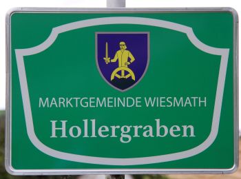
• 2016: wurde aufgelassen; zwischen Hollergraben und Geretschlag nicht mehr gepflegt Symbole: grün-weiß Schild mit B8
![Randonnée A pied Gemeinde Wiesmath - Wiesmath - Sperkerriegel - Kreuzeiche - Kindelmühle - Wiesmath - Photo](https://media.geolcdn.com/t/350/260/302141d2-db2d-4dc2-a1db-5affeedc57cb.jpeg&format=jpg&maxdim=2)
![A pied A pied](https://static1.geolcdn.com/sitytour/trail-icons/100.png)
Km
A pied
![](/images/other/stat-length.png)
![](https://static1.geolcdn.com/siteimages/upload/files/1508320355ic_sort_den_pos_24dp.png)
![](https://static1.geolcdn.com/siteimages/upload/files/1508320355ic_sort_den_neg_24dp.png)
![](https://static1.geolcdn.com/siteimages/upload/files/16400158638029165_repeat_loop_refresh_sync_direction_icon.png)
• Symbole: grün-weiß Schild mit B5
![Randonnée A pied Gemeinde Wiesmath - Wiesmath -Sperkerriegel - Kindelmühle - Wiesmath - Photo](https://media.geolcdn.com/t/350/260/04c87b15-0364-4793-b415-1671fb4d1166.jpeg&format=jpg&maxdim=2)
![A pied A pied](https://static1.geolcdn.com/sitytour/trail-icons/100.png)
Km
A pied
![](/images/other/stat-length.png)
![](https://static1.geolcdn.com/siteimages/upload/files/1508320355ic_sort_den_pos_24dp.png)
![](https://static1.geolcdn.com/siteimages/upload/files/1508320355ic_sort_den_neg_24dp.png)
![](https://static1.geolcdn.com/siteimages/upload/files/16400158638029165_repeat_loop_refresh_sync_direction_icon.png)
• Symbole: grün-weiß Schild mit B4
![Randonnée A pied Gemeinde Wiesmath - Neuris - Schönwald - Kindlmühle - Photo](https://media.geolcdn.com/t/350/260/04c87b15-0364-4793-b415-1671fb4d1166.jpeg&format=jpg&maxdim=2)
![A pied A pied](https://static1.geolcdn.com/sitytour/trail-icons/100.png)
Km
A pied
![](/images/other/stat-length.png)
![](https://static1.geolcdn.com/siteimages/upload/files/1508320355ic_sort_den_pos_24dp.png)
![](https://static1.geolcdn.com/siteimages/upload/files/1508320355ic_sort_den_neg_24dp.png)
![](https://static1.geolcdn.com/siteimages/upload/files/16400158638029165_repeat_loop_refresh_sync_direction_icon.png)
• Symbole: grün-weiß Schild mit B3
10 randonnées affichées sur 10
Application GPS de randonnée GRATUITE