![](/images/other/stat-length.png)
- Randonnées
- A pied
- Autriche
- Basse-Autriche
- Bezirk Neunkirchen
- Gemeinde Kirchberg am Wechsel
Gemeinde Kirchberg am Wechsel, Bezirk Neunkirchen, A pied : Les meilleures randonnées, itinéraires, parcours, balades et promenades
Gemeinde Kirchberg am Wechsel : découvrez les meilleures randonnées : 15 a pied. Tous ces circuits, parcours, itinéraires et activités en plein air sont disponibles dans nos applications SityTrail pour smartphones et tablettes.
Les meilleurs parcours (15)
![Randonnée A pied Gemeinde Kirchberg am Wechsel - Spazierweg 10 - Photo](https://media.geolcdn.com/t/350/260/017188e0-9641-45a4-9e12-df3945b34ac1.jpeg&format=jpg&maxdim=2)
![A pied A pied](https://static1.geolcdn.com/sitytour/trail-icons/100.png)
Km
A pied
![](/images/other/stat-length.png)
![](https://static1.geolcdn.com/siteimages/upload/files/1508320355ic_sort_den_pos_24dp.png)
![](https://static1.geolcdn.com/siteimages/upload/files/1508320355ic_sort_den_neg_24dp.png)
![](https://static1.geolcdn.com/siteimages/upload/files/16400158638029165_repeat_loop_refresh_sync_direction_icon.png)
• Randonnée créée par Tourismusverein Kirchberg am Wechsel. Symbole: grünes Schild mit weißem Punkt und Zahl 10
![Randonnée A pied Gemeinde Kirchberg am Wechsel - Kirchberg a.W. - Karlhöhe - Photo](https://media.geolcdn.com/t/350/260/bcc93319-5a06-429c-bea6-905900362b4d.jpeg&format=jpg&maxdim=2)
![A pied A pied](https://static1.geolcdn.com/sitytour/trail-icons/100.png)
Km
A pied
![](/images/other/stat-length.png)
![](https://static1.geolcdn.com/siteimages/upload/files/1508320355ic_sort_den_pos_24dp.png)
![](https://static1.geolcdn.com/siteimages/upload/files/1508320355ic_sort_den_neg_24dp.png)
![](https://static1.geolcdn.com/siteimages/upload/files/16400158638029165_repeat_loop_refresh_sync_direction_icon.png)
• Symbole: roter, waagrechter Balken
![Randonnée A pied Gemeinde Kirchberg am Wechsel - Hochwechsel Wanderweg (Kirchberg a.W. - Steyersberger Schwaig - Photo](https://media.geolcdn.com/t/350/260/fac3801f-c0f9-4dcb-9a51-47da7b6c942b.jpeg&format=jpg&maxdim=2)
![A pied A pied](https://static1.geolcdn.com/sitytour/trail-icons/100.png)
Km
A pied
![](/images/other/stat-length.png)
![](https://static1.geolcdn.com/siteimages/upload/files/1508320355ic_sort_den_pos_24dp.png)
![](https://static1.geolcdn.com/siteimages/upload/files/1508320355ic_sort_den_neg_24dp.png)
![](https://static1.geolcdn.com/siteimages/upload/files/16400158638029165_repeat_loop_refresh_sync_direction_icon.png)
• Randonnée créée par DEV Kirchau. Symbole: roter Punkt auf weißem Grund
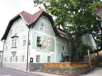
![Randonnée A pied Gemeinde Kirchberg am Wechsel - Wanderweg Saurücken - Photo](https://media.geolcdn.com/t/350/260/f0edc9b7-1e30-4e43-8587-9859de84b486.jpeg&format=jpg&maxdim=2)
![A pied A pied](https://static1.geolcdn.com/sitytour/trail-icons/100.png)
Km
A pied
![](/images/other/stat-length.png)
![](https://static1.geolcdn.com/siteimages/upload/files/1508320355ic_sort_den_pos_24dp.png)
![](https://static1.geolcdn.com/siteimages/upload/files/1508320355ic_sort_den_neg_24dp.png)
![](https://static1.geolcdn.com/siteimages/upload/files/16400158638029165_repeat_loop_refresh_sync_direction_icon.png)
• Randonnée créée par Tourismusverein Kirchberg am Wechsel. Symbole: oranger Punkt auf weißem Grund
![Randonnée A pied Gemeinde Kirchberg am Wechsel - Kirchberg - Steyersberger Schwaig - Hochwechsel - Photo](https://media.geolcdn.com/t/350/260/f0edc9b7-1e30-4e43-8587-9859de84b486.jpeg&format=jpg&maxdim=2)
![A pied A pied](https://static1.geolcdn.com/sitytour/trail-icons/100.png)
Km
A pied
![](/images/other/stat-length.png)
![](https://static1.geolcdn.com/siteimages/upload/files/1508320355ic_sort_den_pos_24dp.png)
![](https://static1.geolcdn.com/siteimages/upload/files/1508320355ic_sort_den_neg_24dp.png)
![](https://static1.geolcdn.com/siteimages/upload/files/16400158638029165_repeat_loop_refresh_sync_direction_icon.png)
• Randonnée créée par Österreichischer Touristenklub. Symbole: roter, waagrechter Balken
![Randonnée A pied Gemeinde Kirchberg am Wechsel - Spazierweg 5 - Photo](https://media.geolcdn.com/t/350/260/fac3801f-c0f9-4dcb-9a51-47da7b6c942b.jpeg&format=jpg&maxdim=2)
![A pied A pied](https://static1.geolcdn.com/sitytour/trail-icons/100.png)
Km
A pied
![](/images/other/stat-length.png)
![](https://static1.geolcdn.com/siteimages/upload/files/1508320355ic_sort_den_pos_24dp.png)
![](https://static1.geolcdn.com/siteimages/upload/files/1508320355ic_sort_den_neg_24dp.png)
![](https://static1.geolcdn.com/siteimages/upload/files/16400158638029165_repeat_loop_refresh_sync_direction_icon.png)
• Randonnée créée par Tourismusverein Kirchberg am Wechsel. Symbole: grünes Schild mit weißem Punkt und Zahl 5
![Randonnée A pied Gemeinde Kirchberg am Wechsel - Wanderweg Passkapelle - Photo](https://media.geolcdn.com/t/350/260/fac3801f-c0f9-4dcb-9a51-47da7b6c942b.jpeg&format=jpg&maxdim=2)
![A pied A pied](https://static1.geolcdn.com/sitytour/trail-icons/100.png)
Km
A pied
![](/images/other/stat-length.png)
![](https://static1.geolcdn.com/siteimages/upload/files/1508320355ic_sort_den_pos_24dp.png)
![](https://static1.geolcdn.com/siteimages/upload/files/1508320355ic_sort_den_neg_24dp.png)
![](https://static1.geolcdn.com/siteimages/upload/files/16400158638029165_repeat_loop_refresh_sync_direction_icon.png)
• Randonnée créée par Tourismusverein Kirchberg am Wechsel. Symbole: brauner Punkt auf weißem Grund
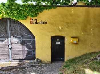
![Randonnée A pied Gemeinde Kirchberg am Wechsel - Kranichberg Schloß - Egg - Raach - Photo](https://media.geolcdn.com/t/350/260/8cb61248-f720-4028-a202-b65a40f0f104.jpeg&format=jpg&maxdim=2)
![A pied A pied](https://static1.geolcdn.com/sitytour/trail-icons/100.png)
Km
A pied
![](/images/other/stat-length.png)
![](https://static1.geolcdn.com/siteimages/upload/files/1508320355ic_sort_den_pos_24dp.png)
![](https://static1.geolcdn.com/siteimages/upload/files/1508320355ic_sort_den_neg_24dp.png)
![](https://static1.geolcdn.com/siteimages/upload/files/16400158638029165_repeat_loop_refresh_sync_direction_icon.png)
• Randonnée créée par Österreichischer Touristenklub, Sektion Raxgmoa. Symbole: grüner, waagrechter Balken
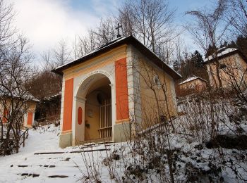
![Randonnée A pied Gemeinde Kirchberg am Wechsel - Rams Wanderweg - Photo](https://media.geolcdn.com/t/350/260/d1e5f4c6-6850-4eeb-8b99-bba11196beb0.jpeg&format=jpg&maxdim=2)
![A pied A pied](https://static1.geolcdn.com/sitytour/trail-icons/100.png)
Km
A pied
![](/images/other/stat-length.png)
![](https://static1.geolcdn.com/siteimages/upload/files/1508320355ic_sort_den_pos_24dp.png)
![](https://static1.geolcdn.com/siteimages/upload/files/1508320355ic_sort_den_neg_24dp.png)
![](https://static1.geolcdn.com/siteimages/upload/files/16400158638029165_repeat_loop_refresh_sync_direction_icon.png)
• Randonnée créée par Tourismusverein Kirchberg. Symbole: grüner Punkt
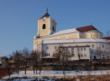
![Randonnée A pied Gemeinde Kirchberg am Wechsel - Panorama Wanderweg (Kirchberg a.W.) - Photo](https://media.geolcdn.com/t/350/260/e5cc6cd7-48a1-4fee-850f-547cb5db42c3.jpeg&format=jpg&maxdim=2)
![A pied A pied](https://static1.geolcdn.com/sitytour/trail-icons/100.png)
Km
A pied
![](/images/other/stat-length.png)
![](https://static1.geolcdn.com/siteimages/upload/files/1508320355ic_sort_den_pos_24dp.png)
![](https://static1.geolcdn.com/siteimages/upload/files/1508320355ic_sort_den_neg_24dp.png)
![](https://static1.geolcdn.com/siteimages/upload/files/16400158638029165_repeat_loop_refresh_sync_direction_icon.png)
• Symbole: gelber Punkt
![Randonnée A pied Gemeinde Kirchberg am Wechsel - Kirchberg - Kirchgraben - Hasleiten - Ödenkirchen - Photo](https://media.geolcdn.com/t/350/260/ec7297a6-03eb-40b6-bbb9-696f4b7a5547.jpeg&format=jpg&maxdim=2)
![A pied A pied](https://static1.geolcdn.com/sitytour/trail-icons/100.png)
Km
A pied
![](/images/other/stat-length.png)
![](https://static1.geolcdn.com/siteimages/upload/files/1508320355ic_sort_den_pos_24dp.png)
![](https://static1.geolcdn.com/siteimages/upload/files/1508320355ic_sort_den_neg_24dp.png)
![](https://static1.geolcdn.com/siteimages/upload/files/16400158638029165_repeat_loop_refresh_sync_direction_icon.png)
• Symbole: blauer, waagrechter Balken
![Randonnée A pied Gemeinde Kirchberg am Wechsel - Kirchberg - Paßkapelle - Photo](https://media.geolcdn.com/t/350/260/fac3801f-c0f9-4dcb-9a51-47da7b6c942b.jpeg&format=jpg&maxdim=2)
![A pied A pied](https://static1.geolcdn.com/sitytour/trail-icons/100.png)
Km
A pied
![](/images/other/stat-length.png)
![](https://static1.geolcdn.com/siteimages/upload/files/1508320355ic_sort_den_pos_24dp.png)
![](https://static1.geolcdn.com/siteimages/upload/files/1508320355ic_sort_den_neg_24dp.png)
![](https://static1.geolcdn.com/siteimages/upload/files/16400158638029165_repeat_loop_refresh_sync_direction_icon.png)
• Randonnée créée par Österreichischer Touristenklub. Symbole: gelber, waagerechter Balken
![Randonnée A pied Gemeinde Kirchberg am Wechsel - Filzkunstwanderweg - Photo](https://media.geolcdn.com/t/350/260/e5cc6cd7-48a1-4fee-850f-547cb5db42c3.jpeg&format=jpg&maxdim=2)
![A pied A pied](https://static1.geolcdn.com/sitytour/trail-icons/100.png)
Km
A pied
![](/images/other/stat-length.png)
![](https://static1.geolcdn.com/siteimages/upload/files/1508320355ic_sort_den_pos_24dp.png)
![](https://static1.geolcdn.com/siteimages/upload/files/1508320355ic_sort_den_neg_24dp.png)
![](https://static1.geolcdn.com/siteimages/upload/files/16400158638029165_repeat_loop_refresh_sync_direction_icon.png)
![Randonnée A pied Gemeinde Kirchberg am Wechsel - Kampsteiner Schwaig - Herrgottschnitzerhütte - Gasthof Hansl am Oad - Photo](https://media.geolcdn.com/t/350/260/ext.jpg?maxdim=2&url=https%3A%2F%2Fstatic1.geolcdn.com%2Fsiteimages%2Fupload%2Ffiles%2F1545311037marcheuse_200dpi.jpg)
![A pied A pied](https://static1.geolcdn.com/sitytour/trail-icons/100.png)
Km
A pied
![](/images/other/stat-length.png)
![](https://static1.geolcdn.com/siteimages/upload/files/1508320355ic_sort_den_pos_24dp.png)
![](https://static1.geolcdn.com/siteimages/upload/files/1508320355ic_sort_den_neg_24dp.png)
![](https://static1.geolcdn.com/siteimages/upload/files/16400158638029165_repeat_loop_refresh_sync_direction_icon.png)
• Randonnée créée par Österreichischer Touristenklub. Symbole: blauer,waagrechter Balken
![Randonnée A pied Gemeinde Kirchberg am Wechsel - Rundwanderweg entlang Rundloipe Steyersberger Schwaig - Photo](https://media.geolcdn.com/t/350/260/ext.jpg?maxdim=2&url=https%3A%2F%2Fstatic1.geolcdn.com%2Fsiteimages%2Fupload%2Ffiles%2F1545311037marcheuse_200dpi.jpg)
![A pied A pied](https://static1.geolcdn.com/sitytour/trail-icons/100.png)
Km
A pied
![](/images/other/stat-length.png)
![](https://static1.geolcdn.com/siteimages/upload/files/1508320355ic_sort_den_pos_24dp.png)
![](https://static1.geolcdn.com/siteimages/upload/files/1508320355ic_sort_den_neg_24dp.png)
![](https://static1.geolcdn.com/siteimages/upload/files/16400158638029165_repeat_loop_refresh_sync_direction_icon.png)
• Symbole: kleiner roter Punkt
15 randonnées affichées sur 15
Application GPS de randonnée GRATUITE