![](/images/other/stat-length.png)
![Excursión Senderismo Bessines - Bessines - La tranché - Photo](https://media.geolcdn.com/t/1900/400/ext.pjpeg?maxdim=2&url=https%3A%2F%2Fstatic1.geolcdn.com%2Fsiteimages%2Fupload%2Ffiles%2F1553511878bg_sport_marche.png)
Bessines - La tranché
olaze
Usuario
![Longitud](/images/other/stat-length.png)
Longitud
11,2 km
![Altitud máxima](https://static1.geolcdn.com/siteimages/upload/files/1508320355ic_sort_altitude_max_24dp.png)
Altitud máxima
31 m
![Desnivel positivo](https://static1.geolcdn.com/siteimages/upload/files/1508320355ic_sort_den_pos_24dp.png)
Desnivel positivo
90 m
![Km-Effort](/images/other/stat-length.png)
Km-Effort
12,4 km
![Altitud mínima](https://static1.geolcdn.com/siteimages/upload/files/1508320355ic_sort_altitude_min_24dp.png)
Altitud mínima
1 m
![Desnivel negativo](https://static1.geolcdn.com/siteimages/upload/files/1508320355ic_sort_den_neg_24dp.png)
Desnivel negativo
92 m
![Boucle](https://static1.geolcdn.com/siteimages/upload/files/16400158638029165_repeat_loop_refresh_sync_direction_icon.png)
Boucle
No
Fecha de creación :
2014-12-10 00:00:00.0
Última modificación :
2014-12-10 00:00:00.0
![Senderismo](https://static1.geolcdn.com/sitytour/trail-icons/101.png)
2h44
Dificultad : Fácil
![Escanee este código QR para abrir la excursión en la aplicación SityTrail](https://capi.geolives.com/qq0zvz2zws4bq2lad0pu/sitytour/trails/98178/qr.png?size=200)
Aplicación GPS de excursión GRATIS
A propósito
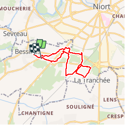
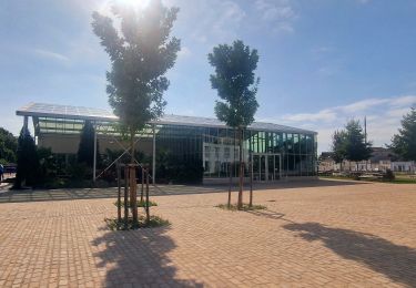
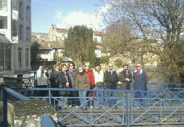
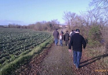
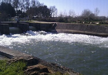
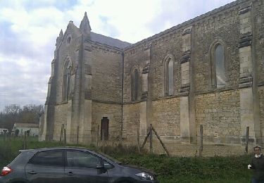
Ruta Senderismo de 11,2 km a descubrir en Nueva Aquitania, Deux-Sèvres, Bessines. Esta ruta ha sido propuesta por olaze.
Descripción
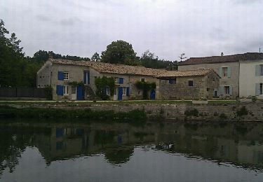
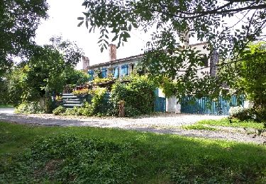
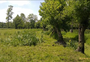
Promenade départ et retour Bessines. Dans campagne vers lieu dit La tranchée.11,5 Km jusqu'au parking de La Grange.
Club rando Bessines
Localización
País:
France
Región :
Nueva Aquitania
Departamento/provincia :
Deux-Sèvres
Municipio :
Bessines
Localidad:
Unknown
Salida:(Dec)
Salida:(UTM)
691593 ; 5130426 (30T) N.
Comentarios
Excursiones cerca
![Excursión Senderismo Magné - Magné circuit 2 - Photo](https://media.geolcdn.com/t/375/260/ext.jpg?maxdim=2&url=https%3A%2F%2Fservices.sitytrail.com%2FGeolivesWS%2FDownloadMedia.ashx%3FTrailID%3D134543%26Media%3D20120619153700.jpeg)
![Senderismo Senderismo](https://static1.geolcdn.com/sitytour/trail-icons/101.png)
Magné circuit 2
Senderismo
Muy fácil
(1)
Magné,
Nueva Aquitania,
Deux-Sèvres,
France
![](/images/other/stat-length.png)
6,5 km | 7 km-effort
1h 54min
![](https://static1.geolcdn.com/siteimages/upload/files/16400158638029165_repeat_loop_refresh_sync_direction_icon.png)
Sí
![Excursión Senderismo Magné - Magné Marais Poitevin - Photo](https://media.geolcdn.com/t/375/260/ext.jpg?maxdim=2&url=https%3A%2F%2Fservices.sitytrail.com%2FGeolivesWS%2FDownloadMedia.ashx%3FTrailID%3D810922%26Media%3Dfix__20170815164855.jpg)
![Senderismo Senderismo](https://static1.geolcdn.com/sitytour/trail-icons/101.png)
Magné Marais Poitevin
Senderismo
Fácil
(1)
Magné,
Nueva Aquitania,
Deux-Sèvres,
France
![](/images/other/stat-length.png)
12,2 km | 13,4 km-effort
2h 40min
![](https://static1.geolcdn.com/siteimages/upload/files/16400158638029165_repeat_loop_refresh_sync_direction_icon.png)
Sí
![Excursión Senderismo Niort - Golf_Romagné.6,7 km - Photo](https://media.geolcdn.com/t/375/260/ext.jpg?maxdim=2&url=https%3A%2F%2Fservices.sitytrail.com%2FGeolivesWS%2FDownloadMedia.ashx%3FTrailID%3D215779%26Media%3D37e406ac-d365-4508-b68c-b6579f0f7264.jpg)
![Senderismo Senderismo](https://static1.geolcdn.com/sitytour/trail-icons/101.png)
Golf_Romagné.6,7 km
Senderismo
Fácil
(1)
Niort,
Nueva Aquitania,
Deux-Sèvres,
France
![](/images/other/stat-length.png)
6,7 km | 7,3 km-effort
1h 37min
![](https://static1.geolcdn.com/siteimages/upload/files/16400158638029165_repeat_loop_refresh_sync_direction_icon.png)
Sí
![Excursión Senderismo Niort - Balade découverte Niort - Photo](https://media.geolcdn.com/t/375/260/d622b737-8be2-44b3-ad35-fb0a7ff78151.jpg&format=jpg&maxdim=2)
![Senderismo Senderismo](https://static1.geolcdn.com/sitytour/trail-icons/101.png)
Balade découverte Niort
Senderismo
Muy fácil
Niort,
Nueva Aquitania,
Deux-Sèvres,
France
![](/images/other/stat-length.png)
5,9 km | 6,7 km-effort
1h 26min
![](https://static1.geolcdn.com/siteimages/upload/files/16400158638029165_repeat_loop_refresh_sync_direction_icon.png)
Sí
![Excursión Senderismo Niort - Niort_pré Leroy - Photo](https://media.geolcdn.com/t/375/260/ext.jpg?maxdim=2&url=https%3A%2F%2Fservices.sitytrail.com%2FGeolivesWS%2FDownloadMedia.ashx%3FTrailID%3D252885%26Media%3Dfix__20140227151540.jpg)
![Senderismo Senderismo](https://static1.geolcdn.com/sitytour/trail-icons/101.png)
Niort_pré Leroy
Senderismo
Fácil
Niort,
Nueva Aquitania,
Deux-Sèvres,
France
![](/images/other/stat-length.png)
6,8 km | 7,7 km-effort
1h 42min
![](https://static1.geolcdn.com/siteimages/upload/files/16400158638029165_repeat_loop_refresh_sync_direction_icon.png)
Sí
![Excursión Senderismo Niort - St Liguaire (Buffevent)-6,7km - Photo](https://media.geolcdn.com/t/375/260/ext.jpg?maxdim=2&url=https%3A%2F%2Fservices.sitytrail.com%2FGeolivesWS%2FDownloadMedia.ashx%3FTrailID%3D238042%26Media%3Dfix__20131219153913.jpg)
![Senderismo Senderismo](https://static1.geolcdn.com/sitytour/trail-icons/101.png)
St Liguaire (Buffevent)-6,7km
Senderismo
Muy fácil
Niort,
Nueva Aquitania,
Deux-Sèvres,
France
![](/images/other/stat-length.png)
6,7 km | 7,7 km-effort
1h 41min
![](https://static1.geolcdn.com/siteimages/upload/files/16400158638029165_repeat_loop_refresh_sync_direction_icon.png)
Sí
![Excursión Senderismo Magné - Magné - 7,8km - marais Pin - Photo](https://media.geolcdn.com/t/375/260/ext.jpg?maxdim=2&url=https%3A%2F%2Fservices.sitytrail.com%2FGeolivesWS%2FDownloadMedia.ashx%3FTrailID%3D194902%26Media%3D20130530110434.jpeg)
![Senderismo Senderismo](https://static1.geolcdn.com/sitytour/trail-icons/101.png)
Magné - 7,8km - marais Pin
Senderismo
Fácil
Magné,
Nueva Aquitania,
Deux-Sèvres,
France
![](/images/other/stat-length.png)
7,8 km | 8,4 km-effort
1h 52min
![](https://static1.geolcdn.com/siteimages/upload/files/16400158638029165_repeat_loop_refresh_sync_direction_icon.png)
Sí
![Excursión Senderismo Magné - Magné-Marais Pin - Photo](https://media.geolcdn.com/t/375/260/ext.jpg?maxdim=2&url=https%3A%2F%2Fservices.sitytrail.com%2FGeolivesWS%2FDownloadMedia.ashx%3FTrailID%3D176028%26Media%3D20130219144152.jpeg)
![Senderismo Senderismo](https://static1.geolcdn.com/sitytour/trail-icons/101.png)
Magné-Marais Pin
Senderismo
Fácil
Magné,
Nueva Aquitania,
Deux-Sèvres,
France
![](/images/other/stat-length.png)
7,5 km | 8 km-effort
1h 47min
![](https://static1.geolcdn.com/siteimages/upload/files/16400158638029165_repeat_loop_refresh_sync_direction_icon.png)
Sí
![Excursión Senderismo Magné - Chapelle St-Macrine - Photo](https://media.geolcdn.com/t/375/260/ext.jpg?maxdim=2&url=https%3A%2F%2Fservices.sitytrail.com%2FGeolivesWS%2FDownloadMedia.ashx%3FTrailID%3D164624%26Media%3D20121129153946.jpeg)
![Senderismo Senderismo](https://static1.geolcdn.com/sitytour/trail-icons/101.png)
Chapelle St-Macrine
Senderismo
Fácil
Magné,
Nueva Aquitania,
Deux-Sèvres,
France
![](/images/other/stat-length.png)
6,5 km | 7,2 km-effort
1h 35min
![](https://static1.geolcdn.com/siteimages/upload/files/16400158638029165_repeat_loop_refresh_sync_direction_icon.png)
Sí