


21 km | 35 km-effort


Usuario


Aplicación GPS de excursión GRATIS
 SityTrail
IGN / Institutos geográficos
SityTrail World
El mundo es suyo
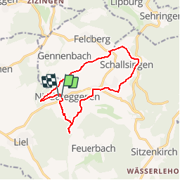
Ruta Senderismo de 11,9 km a descubrir en Baden-Wurtemberg, Landkreis Lörrach, Schliengen. Esta ruta ha sido propuesta por E.BURCK.
Au Stelli : au parc des expositions sur l'une des magnifiques routes de randonnée et de terre battue.
Comme d'habitude, les clients seront à nouveau gâtés avec de délicieux steaks, des saucisses grillées, du pain fermier, de la salade, de la bière pression, des vins Markgräfler et une riche sélection de gâteaux.
Senderismo
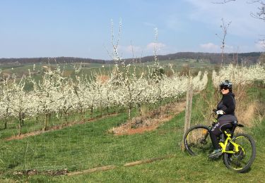
Bici de montaña

Senderismo
Senderismo
Senderismo
Senderismo
Senderismo
Senderismo
Senderismo