


14,5 km | 19,1 km-effort


Usuario


Aplicación GPS de excursión GRATIS
 SityTrail
IGN / Institutos geográficos
SityTrail World
El mundo es suyo
Ruta Senderismo de 10,7 km a descubrir en Occitania, Pirineos Orientales, Banyuls-sur-Mer. Esta ruta ha sido propuesta por MarieFrancoise.
Départ du port de Banyuls .contourner l.université P et M Curie. marcher un peu sur la route pour trouver le chemin côtier au niveau du panneau sortie de Banyuls.
longer la côte .ce chemin aboutit à un petit parking et tout de suite reprendre le chemin côtier en direction de Cerbère
Magnifiques points de vue
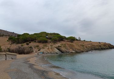
 à la plage de Peyrefite ( vers Cerbère ) - Photo 1")
 à la plage de Peyrefite ( vers Cerbère ) - Photo 2")
 à la plage de Peyrefite ( vers Cerbère ) - Photo 3")
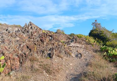
 à la plage de Peyrefite ( vers Cerbère ) - Photo 4")
 à la plage de Peyrefite ( vers Cerbère ) - Photo 5")
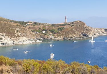
 à la plage de Peyrefite ( vers Cerbère ) - Photo 6")
 à la plage de Peyrefite ( vers Cerbère ) - Photo 7")
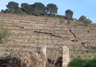
 à la plage de Peyrefite ( vers Cerbère ) - Photo 8")
 à la plage de Peyrefite ( vers Cerbère ) - Photo 9")
 à la plage de Peyrefite ( vers Cerbère ) - Photo 10")
 à la plage de Peyrefite ( vers Cerbère ) - Photo 11")
 à la plage de Peyrefite ( vers Cerbère ) - Photo 12")
 à la plage de Peyrefite ( vers Cerbère ) - Photo 13")
 à la plage de Peyrefite ( vers Cerbère ) - Photo 14")
 à la plage de Peyrefite ( vers Cerbère ) - Photo 15")
 à la plage de Peyrefite ( vers Cerbère ) - Photo 16")
 à la plage de Peyrefite ( vers Cerbère ) - Photo 17")

Senderismo

Senderismo

Senderismo

Senderismo

Senderismo
Senderismo
Senderismo
Senderismo
Senderismo