![](/images/other/stat-length.png)
![Excursión Senderismo Saint-Pierre-de-Chartreuse - La Dent du Crolles - Photo](https://media.geolcdn.com/t/1900/400/ext.pjpeg?maxdim=2&url=https%3A%2F%2Fstatic1.geolcdn.com%2Fsiteimages%2Fupload%2Ffiles%2F1553511878bg_sport_marche.png)
La Dent du Crolles
Phil36
Usuario
![Longitud](/images/other/stat-length.png)
Longitud
7,3 km
![Altitud máxima](https://static1.geolcdn.com/siteimages/upload/files/1508320355ic_sort_altitude_max_24dp.png)
Altitud máxima
2036 m
![Desnivel positivo](https://static1.geolcdn.com/siteimages/upload/files/1508320355ic_sort_den_pos_24dp.png)
Desnivel positivo
662 m
![Km-Effort](/images/other/stat-length.png)
Km-Effort
16,1 km
![Altitud mínima](https://static1.geolcdn.com/siteimages/upload/files/1508320355ic_sort_altitude_min_24dp.png)
Altitud mínima
1443 m
![Desnivel negativo](https://static1.geolcdn.com/siteimages/upload/files/1508320355ic_sort_den_neg_24dp.png)
Desnivel negativo
661 m
![Boucle](https://static1.geolcdn.com/siteimages/upload/files/16400158638029165_repeat_loop_refresh_sync_direction_icon.png)
Boucle
Sí
Fecha de creación :
2018-04-17 22:44:40.741
Última modificación :
2018-04-17 22:44:40.741
![Senderismo](https://static1.geolcdn.com/sitytour/trail-icons/101.png)
4h30
Dificultad : Difícil
![Escanee este código QR para abrir la excursión en la aplicación SityTrail](https://capi.geolives.com/qq0zvz2zws4bq2lad0pu/sitytour/trails/929001/qr.png?size=200)
Aplicación GPS de excursión GRATIS
A propósito
Ruta Senderismo de 7,3 km a descubrir en Auvergne-Rhône-Alpes, Isère, Saint-Pierre-de-Chartreuse. Esta ruta ha sido propuesta por Phil36.
Descripción
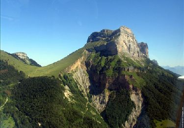
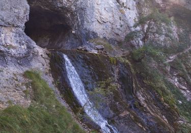
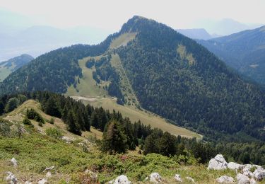
la dent du crolles est un nom célèbre pour les spéléologues du monde entier, mais c'est aussi un sommet emblématique du massif et parte d'entrée de la Réserve naturelle des Hauts de chartreuse.
Localización
País:
France
Región :
Auvergne-Rhône-Alpes
Departamento/provincia :
Isère
Municipio :
Saint-Pierre-de-Chartreuse
Localidad:
Unknown
Salida:(Dec)
Salida:(UTM)
722395 ; 5020465 (31T) N.
Comentarios
Excursiones cerca
![Excursión Senderismo Saint-Nazaire-les-Eymes - Chateau-Nardent par le C9 - Photo](https://media.geolcdn.com/t/375/260/536a5eba-5214-4ffc-98c0-901c667d171a.jpg&format=jpg&maxdim=2)
![Senderismo Senderismo](https://static1.geolcdn.com/sitytour/trail-icons/101.png)
Chateau-Nardent par le C9
Senderismo
Difícil
(2)
Saint-Nazaire-les-Eymes,
Auvergne-Rhône-Alpes,
Isère,
France
![](/images/other/stat-length.png)
8,2 km | 17,7 km-effort
6h 23min
![](https://static1.geolcdn.com/siteimages/upload/files/16400158638029165_repeat_loop_refresh_sync_direction_icon.png)
Sí
![Excursión Senderismo Plateau-des-Petites-Roches - Dent de Crolles - Photo](https://media.geolcdn.com/t/375/260/ext.jpg?maxdim=2&url=https%3A%2F%2Fservices.sitytrail.com%2FGeolivesWS%2FDownloadMedia.ashx%3FTrailID%3D130814%26Media%3D767bc21a-4ce2-4030-b461-37133051040c.jpg)
![Senderismo Senderismo](https://static1.geolcdn.com/sitytour/trail-icons/101.png)
Dent de Crolles
Senderismo
Medio
(2)
Plateau-des-Petites-Roches,
Auvergne-Rhône-Alpes,
Isère,
France
![](/images/other/stat-length.png)
5,7 km | 14,7 km-effort
4h 0min
![](https://static1.geolcdn.com/siteimages/upload/files/16400158638029165_repeat_loop_refresh_sync_direction_icon.png)
Sí
![Excursión Senderismo Saint-Pierre-de-Chartreuse - Le Charmant Som 1867m, par les dalles - Photo](https://media.geolcdn.com/t/375/260/ext.jpg?maxdim=2&url=https%3A%2F%2Fservices.sitytrail.com%2FGeolivesWS%2FDownloadMedia.ashx%3FTrailID%3D101690%26Media%3D1926_1.jpg)
![Senderismo Senderismo](https://static1.geolcdn.com/sitytour/trail-icons/101.png)
Le Charmant Som 1867m, par les dalles
Senderismo
Medio
(1)
Saint-Pierre-de-Chartreuse,
Auvergne-Rhône-Alpes,
Isère,
France
![](/images/other/stat-length.png)
9,7 km | 21 km-effort
5h 0min
![](https://static1.geolcdn.com/siteimages/upload/files/16400158638029165_repeat_loop_refresh_sync_direction_icon.png)
Sí
![Excursión Senderismo Plateau-des-Petites-Roches - Piton et Dôme de Bellefont - Photo](https://media.geolcdn.com/t/375/260/ext.jpg?maxdim=2&url=https%3A%2F%2Fservices.sitytrail.com%2FGeolivesWS%2FDownloadMedia.ashx%3FTrailID%3D101446%26Media%3D1519_1.jpg)
![Senderismo Senderismo](https://static1.geolcdn.com/sitytour/trail-icons/101.png)
Piton et Dôme de Bellefont
Senderismo
Difícil
(1)
Plateau-des-Petites-Roches,
Auvergne-Rhône-Alpes,
Isère,
France
![](/images/other/stat-length.png)
10,1 km | 24 km-effort
6h 45min
![](https://static1.geolcdn.com/siteimages/upload/files/16400158638029165_repeat_loop_refresh_sync_direction_icon.png)
Sí
![Excursión Senderismo Saint-Pierre-de-Chartreuse - pas de rochebrune et de rocheplane - Photo](https://media.geolcdn.com/t/375/260/643b9872-5358-4c95-b9d7-43cb72f88471.jpg&format=jpg&maxdim=2)
![Senderismo Senderismo](https://static1.geolcdn.com/sitytour/trail-icons/101.png)
pas de rochebrune et de rocheplane
Senderismo
Difícil
Saint-Pierre-de-Chartreuse,
Auvergne-Rhône-Alpes,
Isère,
France
![](/images/other/stat-length.png)
13,2 km | 26 km-effort
5h 32min
![](https://static1.geolcdn.com/siteimages/upload/files/16400158638029165_repeat_loop_refresh_sync_direction_icon.png)
Sí
![Excursión Senderismo Saint-Pierre-de-Chartreuse - tour de la Dent de crolles par des sangles - Photo](https://media.geolcdn.com/t/375/260/9e1abd5a-85a3-461c-ab6a-25f1470ccefa.jpg&format=jpg&maxdim=2)
![Senderismo Senderismo](https://static1.geolcdn.com/sitytour/trail-icons/101.png)
tour de la Dent de crolles par des sangles
Senderismo
Muy difícil
Saint-Pierre-de-Chartreuse,
Auvergne-Rhône-Alpes,
Isère,
France
![](/images/other/stat-length.png)
18,3 km | 38 km-effort
7h 35min
![](https://static1.geolcdn.com/siteimages/upload/files/16400158638029165_repeat_loop_refresh_sync_direction_icon.png)
Sí
![Excursión A pie Plateau-des-Petites-Roches - Tour de Pravouta - Photo](https://media.geolcdn.com/t/375/260/432c9697-22d9-4837-a6d3-2165ebce375b.jpeg&format=jpg&maxdim=2)
![A pie A pie](https://static1.geolcdn.com/sitytour/trail-icons/100.png)
Tour de Pravouta
A pie
Fácil
Plateau-des-Petites-Roches,
Auvergne-Rhône-Alpes,
Isère,
France
![](/images/other/stat-length.png)
3,9 km | 7,5 km-effort
1h 42min
![](https://static1.geolcdn.com/siteimages/upload/files/16400158638029165_repeat_loop_refresh_sync_direction_icon.png)
Sí
![Excursión Esquí de fondo Plateau-des-Petites-Roches - Pravouta et bec de Charvet - Photo](https://media.geolcdn.com/t/375/260/b74dc963-a672-4a8f-9168-b0500b4135b1.jpg&format=jpg&maxdim=2)
![Esquí de fondo Esquí de fondo](https://static1.geolcdn.com/sitytour/trail-icons/503.png)
Pravouta et bec de Charvet
Esquí de fondo
Fácil
Plateau-des-Petites-Roches,
Auvergne-Rhône-Alpes,
Isère,
France
![](/images/other/stat-length.png)
13,1 km | 30 km-effort
5h 49min
![](https://static1.geolcdn.com/siteimages/upload/files/16400158638029165_repeat_loop_refresh_sync_direction_icon.png)
No
![Excursión Senderismo Plateau-des-Petites-Roches - Dent de Crolles tour - Photo](https://media.geolcdn.com/t/375/260/ext.jpg?maxdim=2&url=https%3A%2F%2Fstatic1.geolcdn.com%2Fsiteimages%2Fupload%2Ffiles%2F1553511878bg_sport_marche.png)
![Senderismo Senderismo](https://static1.geolcdn.com/sitytour/trail-icons/101.png)
Dent de Crolles tour
Senderismo
Muy fácil
(1)
Plateau-des-Petites-Roches,
Auvergne-Rhône-Alpes,
Isère,
France
![](/images/other/stat-length.png)
14,2 km | 32 km-effort
8h 33min
![](https://static1.geolcdn.com/siteimages/upload/files/16400158638029165_repeat_loop_refresh_sync_direction_icon.png)
Sí