![](/images/other/stat-length.png)
en forêt de Compiègne_11_la landeblin_les Petits Monts
en forêt de Compiègne
mes randos en forêt
![Longitud](/images/other/stat-length.png)
![Altitud máxima](https://static1.geolcdn.com/siteimages/upload/files/1508320355ic_sort_altitude_max_24dp.png)
![Desnivel positivo](https://static1.geolcdn.com/siteimages/upload/files/1508320355ic_sort_den_pos_24dp.png)
![Km-Effort](/images/other/stat-length.png)
![Altitud mínima](https://static1.geolcdn.com/siteimages/upload/files/1508320355ic_sort_altitude_min_24dp.png)
![Desnivel negativo](https://static1.geolcdn.com/siteimages/upload/files/1508320355ic_sort_den_neg_24dp.png)
![Boucle](https://static1.geolcdn.com/siteimages/upload/files/16400158638029165_repeat_loop_refresh_sync_direction_icon.png)
![Senderismo](https://static1.geolcdn.com/sitytour/trail-icons/101.png)
3h31
Dificultad : Difícil
![Escanee este código QR para abrir la excursión en la aplicación SityTrail](https://capi.geolives.com/qq0zvz2zws4bq2lad0pu/sitytour/trails/924054/qr.png?size=200)
Aplicación GPS de excursión GRATIS
A propósito
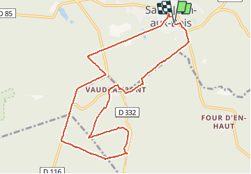
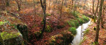
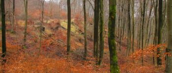
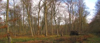
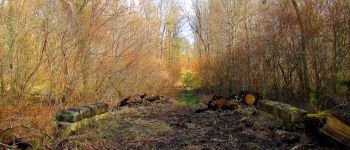
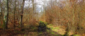
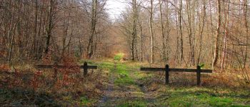
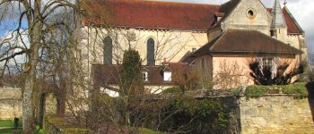
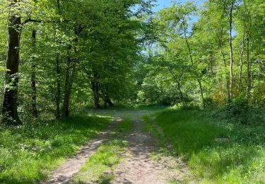
Ruta Senderismo de 10,4 km a descubrir en Alta Francia, Oise, Saint-Jean-aux-Bois. Esta ruta ha sido propuesta por en forêt de Compiègne.
Descripción
03/ 2018
voir aussi
http://foret-de-retz.over-blog.com/
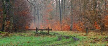
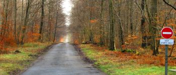
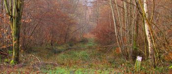
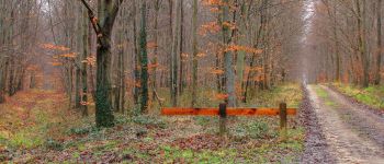
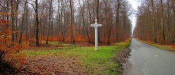
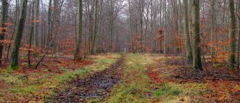
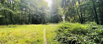
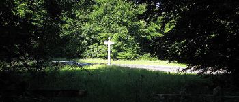
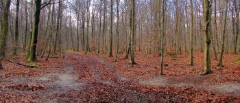
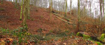
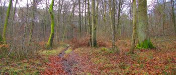
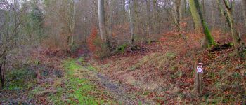
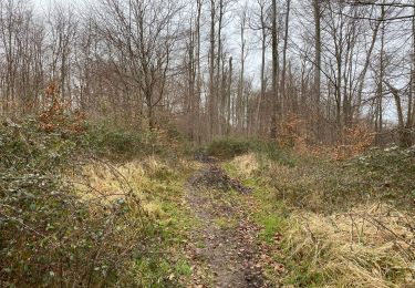
rando classée difficile à cause de la boue dans certains chemins (débardage, arbres tombés ...).
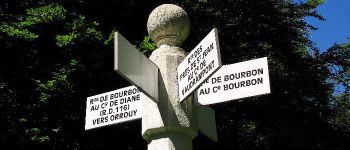
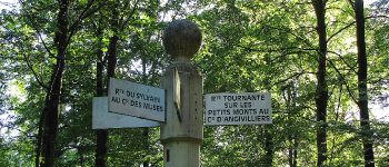
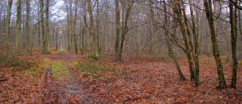
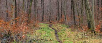
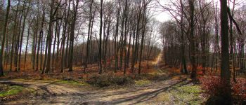
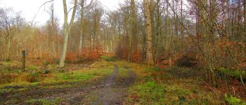
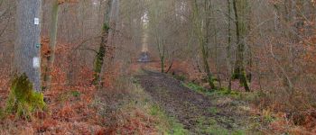
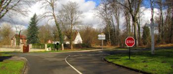
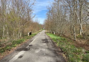
A partir du parking, rejoindre la route du Parquet. La suivre jusqu'au carrefour de Bourbon. Prendre à gauche la route de Morienval et continuer jusqu'au carrefour de Vaudrampont. Prendre la route des Prés Saint-Jean à droite et la suivre jusqu'au carrefour d'Eloïse. Suivre à gauche la D116 et continuer jusqu'au carrefour Madame. Tourner à gauche dans la route de Ligre et continuer jusqu'au carrefour de Gilocourt. Prendre à gauche la route des Grands Monts et continuer jusqu'au carrefour d'Angevilliers. Tourner à gauche dans la route tournante sur les Petits Monts et continuer jusqu'au carrefour Sylvain. Tourner à gauche dans la route de l'Echo et la suivre jusqu'au carrefour des Petits Monts. Prendre à droite le chemin Eloise et continuer jusqu'au carrefour avec la D116 (chemin difficile, eau, boue, arbres tombés en travers).Tourner à droite sur la D116 puis encore à droite sur la route de Morienval. Rentrer en forêt à gauche en suivant un chemin qui ne figure pas sur les cartes IGN (large et agréable à marcher) pour rejoindre le carrefour de la Landeblin. Tourner à droite dans la route de la Landeblin (très difficile par endroit à pratiquer: eau, boue, arbres tombés en travers) et rejoindre le carrefour avec la D33. Tourner à gauche pour revenir au point de départ.
Puntos de interés
Localización
Comentarios
Excursiones cerca
![Excursión A pie Pierrefonds - Le Voliard - Photo](https://media.geolcdn.com/t/375/260/4781613a-076f-4ad8-be25-8d021ddb8fa3.jpeg&format=jpg&maxdim=2)
![A pie A pie](https://static1.geolcdn.com/sitytour/trail-icons/100.png)
A pie
![](/images/other/stat-length.png)
![](https://static1.geolcdn.com/siteimages/upload/files/16400158638029165_repeat_loop_refresh_sync_direction_icon.png)
![Excursión A pie Saint-Jean-aux-Bois - Promenade du Chêne de Saint-Jean - Photo](https://media.geolcdn.com/t/375/260/660f8de9-0f4a-4545-bfd3-d9c82cefa146.jpeg&format=jpg&maxdim=2)
![A pie A pie](https://static1.geolcdn.com/sitytour/trail-icons/100.png)
A pie
![](/images/other/stat-length.png)
![](https://static1.geolcdn.com/siteimages/upload/files/16400158638029165_repeat_loop_refresh_sync_direction_icon.png)
![Excursión Senderismo Saint-Jean-aux-Bois - SAINT JEAN AUX BOIS, le village et les bois - Photo](https://media.geolcdn.com/t/375/260/cbd4d574-4b06-4403-8920-57abc85ecbc5.jpg&format=jpg&maxdim=2)
![Senderismo Senderismo](https://static1.geolcdn.com/sitytour/trail-icons/101.png)
Senderismo
![](/images/other/stat-length.png)
![](https://static1.geolcdn.com/siteimages/upload/files/16400158638029165_repeat_loop_refresh_sync_direction_icon.png)
![Excursión Senderismo Vieux-Moulin - Rando douce Vieux moulin 14/8/2022 - Photo](https://media.geolcdn.com/t/375/260/ext.jpg?maxdim=2&url=https%3A%2F%2Fstatic1.geolcdn.com%2Fsiteimages%2Fupload%2Ffiles%2F1553511878bg_sport_marche.png)
![Senderismo Senderismo](https://static1.geolcdn.com/sitytour/trail-icons/101.png)
Senderismo
![](/images/other/stat-length.png)
![](https://static1.geolcdn.com/siteimages/upload/files/16400158638029165_repeat_loop_refresh_sync_direction_icon.png)
![Excursión Senderismo Vieux-Moulin - Gorges du Han - ATPC ARVAL - Photo](https://media.geolcdn.com/t/375/260/ext.jpg?maxdim=2&url=https%3A%2F%2Fstatic1.geolcdn.com%2Fsiteimages%2Fupload%2Ffiles%2F1553511878bg_sport_marche.png)
![Senderismo Senderismo](https://static1.geolcdn.com/sitytour/trail-icons/101.png)
Senderismo
![](/images/other/stat-length.png)
![](https://static1.geolcdn.com/siteimages/upload/files/16400158638029165_repeat_loop_refresh_sync_direction_icon.png)
![Excursión Senderismo Compiègne - en Forêt de Compiègne_50_les Routes des Beaux Monts, de Morpigny et des Nymphes - Photo](https://media.geolcdn.com/t/375/260/9c55d9c0-6825-4d4d-9591-f5323b93b433.jpg&format=jpg&maxdim=2)
![Senderismo Senderismo](https://static1.geolcdn.com/sitytour/trail-icons/101.png)
Senderismo
![](/images/other/stat-length.png)
![](https://static1.geolcdn.com/siteimages/upload/files/16400158638029165_repeat_loop_refresh_sync_direction_icon.png)
![Excursión Senderismo Compiègne - en forêt de Compiègne_48_sur les Routes de la Mariolle et du Grand Veneur - Photo](https://media.geolcdn.com/t/375/260/7316114b-cb1c-453b-b79a-8461b3c901b1.jpg&format=jpg&maxdim=2)
![Senderismo Senderismo](https://static1.geolcdn.com/sitytour/trail-icons/101.png)
Senderismo
![](/images/other/stat-length.png)
![](https://static1.geolcdn.com/siteimages/upload/files/16400158638029165_repeat_loop_refresh_sync_direction_icon.png)
![Excursión Senderismo Saint-Jean-aux-Bois - Saint Jean au Bois 13,4 km - Photo](https://media.geolcdn.com/t/375/260/ddfb4125-3dc9-462c-8144-537eda5ffbb6.jpg&format=jpg&maxdim=2)
![Senderismo Senderismo](https://static1.geolcdn.com/sitytour/trail-icons/101.png)
Senderismo
![](/images/other/stat-length.png)
![](https://static1.geolcdn.com/siteimages/upload/files/16400158638029165_repeat_loop_refresh_sync_direction_icon.png)
![Senderismo Senderismo](https://static1.geolcdn.com/sitytour/trail-icons/101.png)
Senderismo
![](/images/other/stat-length.png)
![](https://static1.geolcdn.com/siteimages/upload/files/16400158638029165_repeat_loop_refresh_sync_direction_icon.png)