![](/images/other/stat-length.png)
![Excursión Senderismo Wizernes - Wizernes Inghem - Photo](https://media.geolcdn.com/t/1900/400/ext.pjpeg?maxdim=2&url=https%3A%2F%2Fstatic1.geolcdn.com%2Fsiteimages%2Fupload%2Ffiles%2F1553511878bg_sport_marche.png)
Wizernes Inghem
Yonal62
Usuario
![Longitud](/images/other/stat-length.png)
Longitud
11,7 km
![Altitud máxima](https://static1.geolcdn.com/siteimages/upload/files/1508320355ic_sort_altitude_max_24dp.png)
Altitud máxima
102 m
![Desnivel positivo](https://static1.geolcdn.com/siteimages/upload/files/1508320355ic_sort_den_pos_24dp.png)
Desnivel positivo
155 m
![Km-Effort](/images/other/stat-length.png)
Km-Effort
13,8 km
![Altitud mínima](https://static1.geolcdn.com/siteimages/upload/files/1508320355ic_sort_altitude_min_24dp.png)
Altitud mínima
23 m
![Desnivel negativo](https://static1.geolcdn.com/siteimages/upload/files/1508320355ic_sort_den_neg_24dp.png)
Desnivel negativo
158 m
![Boucle](https://static1.geolcdn.com/siteimages/upload/files/16400158638029165_repeat_loop_refresh_sync_direction_icon.png)
Boucle
Sí
Fecha de creación :
2018-04-17 17:42:05.702
Última modificación :
2018-04-17 17:42:05.702
![Senderismo](https://static1.geolcdn.com/sitytour/trail-icons/101.png)
3h00
Dificultad : Medio
![Escanee este código QR para abrir la excursión en la aplicación SityTrail](https://capi.geolives.com/qq0zvz2zws4bq2lad0pu/sitytour/trails/898146/qr.png?size=200)
Aplicación GPS de excursión GRATIS
A propósito
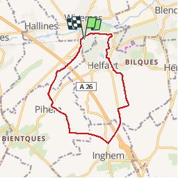
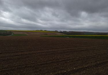
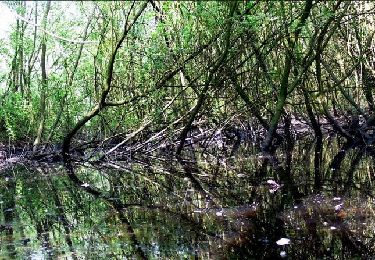
Ruta Senderismo de 11,7 km a descubrir en Alta Francia, Paso de Calais, Wizernes. Esta ruta ha sido propuesta por Yonal62.
Descripción
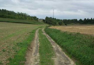
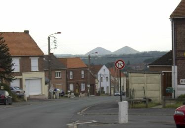
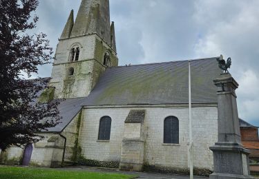
Des ravins de Pihem aux étangs d'Helfaut en passant par Inghem et retour à Wizernes par La Coupole
Localización
País:
France
Región :
Alta Francia
Departamento/provincia :
Paso de Calais
Municipio :
Wizernes
Localidad:
Unknown
Salida:(Dec)
Salida:(UTM)
445727 ; 5617267 (31U) N.
Comentarios
Excursiones cerca
![Excursión Senderismo Bellinghem - Inghem - Le sentier des Bosquets - Photo](https://media.geolcdn.com/t/375/260/ext.jpg?maxdim=2&url=https%3A%2F%2Fservices.sitytrail.com%2FGeolivesWS%2FDownloadMedia.ashx%3FTrailID%3D109703%26Media%3D4404_4.jpg)
![Senderismo Senderismo](https://static1.geolcdn.com/sitytour/trail-icons/101.png)
Inghem - Le sentier des Bosquets
Senderismo
Medio
Bellinghem,
Alta Francia,
Paso de Calais,
France
![](/images/other/stat-length.png)
8,2 km | 9,4 km-effort
1h 45min
![](https://static1.geolcdn.com/siteimages/upload/files/16400158638029165_repeat_loop_refresh_sync_direction_icon.png)
Sí
![Excursión Bicicleta Ecques - SF 2009 Circuit d'Aire sur la Lys - Photo](https://media.geolcdn.com/t/375/260/ext.jpg?maxdim=2&url=https%3A%2F%2Fservices.sitytrail.com%2FGeolivesWS%2FDownloadMedia.ashx%3FTrailID%3D104298%26Media%3D7524_5.jpg)
![Bicicleta Bicicleta](https://static1.geolcdn.com/sitytour/trail-icons/200.png)
SF 2009 Circuit d'Aire sur la Lys
Bicicleta
Medio
Ecques,
Alta Francia,
Paso de Calais,
France
![](/images/other/stat-length.png)
130 km | 144 km-effort
5h 57min
![](https://static1.geolcdn.com/siteimages/upload/files/16400158638029165_repeat_loop_refresh_sync_direction_icon.png)
Sí
![Excursión Senderismo Esquerdes - esquerdes - Photo](https://media.geolcdn.com/t/375/260/f5006276-f835-4c04-a8c6-f46372f2fc0d.jpg&format=jpg&maxdim=2)
![Senderismo Senderismo](https://static1.geolcdn.com/sitytour/trail-icons/101.png)
esquerdes
Senderismo
Difícil
Esquerdes,
Alta Francia,
Paso de Calais,
France
![](/images/other/stat-length.png)
12,1 km | 15,4 km-effort
2h 38min
![](https://static1.geolcdn.com/siteimages/upload/files/16400158638029165_repeat_loop_refresh_sync_direction_icon.png)
No
![Excursión Senderismo Pihem - rando du Lion - Photo](https://media.geolcdn.com/t/375/260/17c8a61f-7a03-4a55-9981-7341855c5163.jpg&format=jpg&maxdim=2)
![Senderismo Senderismo](https://static1.geolcdn.com/sitytour/trail-icons/101.png)
rando du Lion
Senderismo
Difícil
Pihem,
Alta Francia,
Paso de Calais,
France
![](/images/other/stat-length.png)
16,3 km | 18,8 km-effort
2h 52min
![](https://static1.geolcdn.com/siteimages/upload/files/16400158638029165_repeat_loop_refresh_sync_direction_icon.png)
Sí
![Excursión Bici de montaña Saint-Omer - 2092012 - Photo](https://media.geolcdn.com/t/375/260/ext.jpg?maxdim=2&url=https%3A%2F%2Fservices.sitytrail.com%2FGeolivesWS%2FDownloadMedia.ashx%3FTrailID%3D151052%26Media%3D20120902095703.jpg)
![Bici de montaña Bici de montaña](https://static1.geolcdn.com/sitytour/trail-icons/202.png)
2092012
Bici de montaña
Medio
Saint-Omer,
Alta Francia,
Paso de Calais,
France
![](/images/other/stat-length.png)
41 km | 49 km-effort
2h 40min
![](https://static1.geolcdn.com/siteimages/upload/files/16400158638029165_repeat_loop_refresh_sync_direction_icon.png)
Sí
![Excursión Senderismo Heuringhem - Heuringhem - Le sentier Perdu - Photo](https://media.geolcdn.com/t/375/260/ext.jpg?maxdim=2&url=https%3A%2F%2Fservices.sitytrail.com%2FGeolivesWS%2FDownloadMedia.ashx%3FTrailID%3D109707%26Media%3D4408_1.jpg)
![Senderismo Senderismo](https://static1.geolcdn.com/sitytour/trail-icons/101.png)
Heuringhem - Le sentier Perdu
Senderismo
Medio
Heuringhem,
Alta Francia,
Paso de Calais,
France
![](/images/other/stat-length.png)
14,5 km | 15,8 km-effort
3h 45min
![](https://static1.geolcdn.com/siteimages/upload/files/16400158638029165_repeat_loop_refresh_sync_direction_icon.png)
Sí
![Excursión Senderismo Hallines - Le ravin de Pihen 9.8km et 120m déniv - Photo](https://media.geolcdn.com/t/375/260/ext.jpg?maxdim=2&url=https%3A%2F%2Fstatic1.geolcdn.com%2Fsiteimages%2Fupload%2Ffiles%2F1553511878bg_sport_marche.png)
![Senderismo Senderismo](https://static1.geolcdn.com/sitytour/trail-icons/101.png)
Le ravin de Pihen 9.8km et 120m déniv
Senderismo
Medio
Hallines,
Alta Francia,
Paso de Calais,
France
![](/images/other/stat-length.png)
9,8 km | 11,4 km-effort
2h 35min
![](https://static1.geolcdn.com/siteimages/upload/files/16400158638029165_repeat_loop_refresh_sync_direction_icon.png)
Sí
![Excursión Senderismo Saint-Martin-lez-Tatinghem - wisques - Photo](https://media.geolcdn.com/t/375/260/ext.jpg?maxdim=2&url=https%3A%2F%2Fstatic1.geolcdn.com%2Fsiteimages%2Fupload%2Ffiles%2F1553511878bg_sport_marche.png)
![Senderismo Senderismo](https://static1.geolcdn.com/sitytour/trail-icons/101.png)
wisques
Senderismo
Fácil
Saint-Martin-lez-Tatinghem,
Alta Francia,
Paso de Calais,
France
![](/images/other/stat-length.png)
6,3 km | 7,3 km-effort
1h 9min
![](https://static1.geolcdn.com/siteimages/upload/files/16400158638029165_repeat_loop_refresh_sync_direction_icon.png)
No
![Excursión Senderismo Helfaut - Rando CAPSO La Coupole - Photo](https://media.geolcdn.com/t/375/260/ext.jpg?maxdim=2&url=https%3A%2F%2Fstatic1.geolcdn.com%2Fsiteimages%2Fupload%2Ffiles%2F1553511878bg_sport_marche.png)
![Senderismo Senderismo](https://static1.geolcdn.com/sitytour/trail-icons/101.png)
Rando CAPSO La Coupole
Senderismo
Medio
Helfaut,
Alta Francia,
Paso de Calais,
France
![](/images/other/stat-length.png)
8,5 km | 10 km-effort
2h 16min
![](https://static1.geolcdn.com/siteimages/upload/files/16400158638029165_repeat_loop_refresh_sync_direction_icon.png)
Sí