


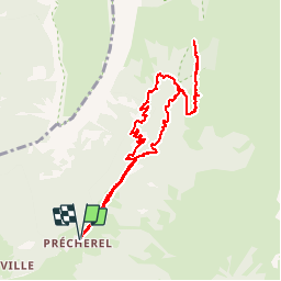

13,1 km | 24 km-effort

Usuario


Aplicación GPS de excursión GRATIS
 SityTrail
IGN / Institutos geográficos
SityTrail World
El mundo es suyo
Ruta Senderismo de 9,8 km a descubrir en Auvergne-Rhône-Alpes, Saboya, Jarsy. Esta ruta ha sido propuesta por Bogapuki.
15 janvier 2018
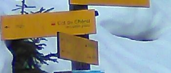
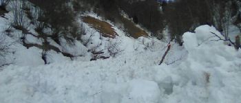
Rando-raquette assez douce. Attention quelques points avalancheux.
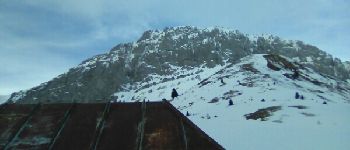
Éventuellement à faire dans l'autre sens ce qui permet une descente moins difficile (glissante) sur les feuilles mortes.


Senderismo

Senderismo

Senderismo

Senderismo

Senderismo

Senderismo
Senderismo
Senderismo

Senderismo