![](/images/other/stat-length.png)
![Excursión Senderismo Saint-Offenge - St Offenge ch. Trousset - Photo](https://media.geolcdn.com/t/1900/400/ext.pjpeg?maxdim=2&url=https%3A%2F%2Fservices.sitytrail.com%2FGeolivesWS%2FDownloadMedia.ashx%3FTrailID%3D871609%26Media%3Dfix__20171127111326.jpg)
St Offenge ch. Trousset
Bogapuki
Usuario
![Longitud](/images/other/stat-length.png)
Longitud
11,7 km
![Altitud máxima](https://static1.geolcdn.com/siteimages/upload/files/1508320355ic_sort_altitude_max_24dp.png)
Altitud máxima
1198 m
![Desnivel positivo](https://static1.geolcdn.com/siteimages/upload/files/1508320355ic_sort_den_pos_24dp.png)
Desnivel positivo
542 m
![Km-Effort](/images/other/stat-length.png)
Km-Effort
18,9 km
![Altitud mínima](https://static1.geolcdn.com/siteimages/upload/files/1508320355ic_sort_altitude_min_24dp.png)
Altitud mínima
692 m
![Desnivel negativo](https://static1.geolcdn.com/siteimages/upload/files/1508320355ic_sort_den_neg_24dp.png)
Desnivel negativo
540 m
![Boucle](https://static1.geolcdn.com/siteimages/upload/files/16400158638029165_repeat_loop_refresh_sync_direction_icon.png)
Boucle
Sí
Fecha de creación :
2018-11-25 09:18:52.469
Última modificación :
2018-11-25 09:18:52.469
![Senderismo](https://static1.geolcdn.com/sitytour/trail-icons/101.png)
4h14
Dificultad : Muy fácil
![Escanee este código QR para abrir la excursión en la aplicación SityTrail](https://capi.geolives.com/qq0zvz2zws4bq2lad0pu/sitytour/trails/871609/qr.png?size=200)
Aplicación GPS de excursión GRATIS
A propósito
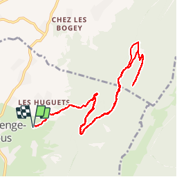
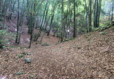
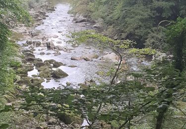
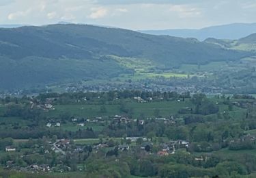
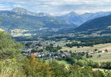
Ruta Senderismo de 11,7 km a descubrir en Auvergne-Rhône-Alpes, Saboya, Saint-Offenge. Esta ruta ha sido propuesta por Bogapuki.
Descripción
27 nov 2017
Aucune difficulté, pas de grand intérêt sauf pour une remise en jambes après un long arrêt d'activité. Possibilité de pique-nique dans le refuge.
Localización
País:
France
Región :
Auvergne-Rhône-Alpes
Departamento/provincia :
Saboya
Municipio :
Saint-Offenge
Localidad:
Saint-Offenge-Dessous
Salida:(Dec)
Salida:(UTM)
267644 ; 5068988 (32T) N.
Comentarios
Excursiones cerca
![Excursión Senderismo Arith - La Montagne de Bange 1434m, depuis Montagny - Photo](https://media.geolcdn.com/t/375/260/ext.jpg?maxdim=2&url=https%3A%2F%2Fservices.sitytrail.com%2FGeolivesWS%2FDownloadMedia.ashx%3FTrailID%3D317290%26Media%3D16482_1.jpg)
![Senderismo Senderismo](https://static1.geolcdn.com/sitytour/trail-icons/101.png)
La Montagne de Bange 1434m, depuis Montagny
Senderismo
Medio
(1)
Arith,
Auvergne-Rhône-Alpes,
Saboya,
France
![](/images/other/stat-length.png)
10,5 km | 18,5 km-effort
3h 45min
![](https://static1.geolcdn.com/siteimages/upload/files/16400158638029165_repeat_loop_refresh_sync_direction_icon.png)
Sí
![Excursión Senderismo Cusy - 13-09-2022 La Grand-Raie au Col de la Cochette - Photo](https://media.geolcdn.com/t/375/260/ext.jpg?maxdim=2&url=https%3A%2F%2Fmedia.geolcdn.com%2Ff%2F6cba586f-c088-48b0-8a7d-67e2ef29bd8a.jpg)
![Senderismo Senderismo](https://static1.geolcdn.com/sitytour/trail-icons/101.png)
13-09-2022 La Grand-Raie au Col de la Cochette
Senderismo
Muy difícil
Cusy,
Auvergne-Rhône-Alpes,
Alta Saboya,
France
![](/images/other/stat-length.png)
18,2 km | 35 km-effort
5h 24min
![](https://static1.geolcdn.com/siteimages/upload/files/16400158638029165_repeat_loop_refresh_sync_direction_icon.png)
Sí
![Excursión Senderismo Allèves - 06-09-2022 Tours Saint Jacques-Grottes de Bange - Photo](https://media.geolcdn.com/t/375/260/ext.jpg?maxdim=2&url=https%3A%2F%2Fmedia.geolcdn.com%2Ff%2F7a87734e-615b-4914-a2f6-8cd0e03da331.jpg)
![Senderismo Senderismo](https://static1.geolcdn.com/sitytour/trail-icons/101.png)
06-09-2022 Tours Saint Jacques-Grottes de Bange
Senderismo
Difícil
(1)
Allèves,
Auvergne-Rhône-Alpes,
Alta Saboya,
France
![](/images/other/stat-length.png)
13,5 km | 27 km-effort
4h 24min
![](https://static1.geolcdn.com/siteimages/upload/files/16400158638029165_repeat_loop_refresh_sync_direction_icon.png)
Sí
![Excursión Senderismo Cusy - Les chaos de Cheran - Photo](https://media.geolcdn.com/t/375/260/ext.jpg?maxdim=2&url=https%3A%2F%2Fmedia.geolcdn.com%2Ff%2F7e19bf6d-564b-481b-864d-0e6de1762649.jpg)
![Senderismo Senderismo](https://static1.geolcdn.com/sitytour/trail-icons/101.png)
Les chaos de Cheran
Senderismo
Medio
Cusy,
Auvergne-Rhône-Alpes,
Alta Saboya,
France
![](/images/other/stat-length.png)
17,1 km | 25 km-effort
4h 21min
![](https://static1.geolcdn.com/siteimages/upload/files/16400158638029165_repeat_loop_refresh_sync_direction_icon.png)
Sí
![Excursión Senderismo Cusy - Chaos. du Cheran - Photo](https://media.geolcdn.com/t/375/260/ext.jpg?maxdim=2&url=https%3A%2F%2Fstatic1.geolcdn.com%2Fsiteimages%2Fupload%2Ffiles%2F1553511878bg_sport_marche.png)
![Senderismo Senderismo](https://static1.geolcdn.com/sitytour/trail-icons/101.png)
Chaos. du Cheran
Senderismo
Muy fácil
(1)
Cusy,
Auvergne-Rhône-Alpes,
Alta Saboya,
France
![](/images/other/stat-length.png)
6,1 km | 9,7 km-effort
2h 34min
![](https://static1.geolcdn.com/siteimages/upload/files/16400158638029165_repeat_loop_refresh_sync_direction_icon.png)
Sí
![Excursión Senderismo Saint-Offenge - Saint-Offenge-Dessous Cusy - Photo](https://media.geolcdn.com/t/375/260/ext.jpg?maxdim=2&url=https%3A%2F%2Fmedia.geolcdn.com%2Ff%2F9922806d-4eb0-4835-85fc-26210664b335.jpg)
![Senderismo Senderismo](https://static1.geolcdn.com/sitytour/trail-icons/101.png)
Saint-Offenge-Dessous Cusy
Senderismo
Medio
Saint-Offenge,
Auvergne-Rhône-Alpes,
Saboya,
France
![](/images/other/stat-length.png)
7,4 km | 10,1 km-effort
2h 18min
![](https://static1.geolcdn.com/siteimages/upload/files/16400158638029165_repeat_loop_refresh_sync_direction_icon.png)
Sí
![Excursión Senderismo Arith - Col de la couchette en boucle avec passage au refuge - Photo](https://media.geolcdn.com/t/375/260/ext.jpg?maxdim=2&url=https%3A%2F%2Fmedia.geolcdn.com%2Ff%2F5494724c-8476-4b53-a696-21ced4d7d42a.jpg)
![Senderismo Senderismo](https://static1.geolcdn.com/sitytour/trail-icons/101.png)
Col de la couchette en boucle avec passage au refuge
Senderismo
Fácil
Arith,
Auvergne-Rhône-Alpes,
Saboya,
France
![](/images/other/stat-length.png)
12,9 km | 22 km-effort
4h 17min
![](https://static1.geolcdn.com/siteimages/upload/files/16400158638029165_repeat_loop_refresh_sync_direction_icon.png)
Sí
![Excursión Senderismo Cusy - 14-08-2022 Pont de Cusy - Pont de l'abîme - Photo](https://media.geolcdn.com/t/375/260/ext.jpg?maxdim=2&url=https%3A%2F%2Fmedia.geolcdn.com%2Ff%2Fafefb47b-f53a-4dff-bf88-24c102fec5de.jpg)
![Senderismo Senderismo](https://static1.geolcdn.com/sitytour/trail-icons/101.png)
14-08-2022 Pont de Cusy - Pont de l'abîme
Senderismo
Fácil
Cusy,
Auvergne-Rhône-Alpes,
Alta Saboya,
France
![](/images/other/stat-length.png)
5,9 km | 9,4 km-effort
1h 42min
![](https://static1.geolcdn.com/siteimages/upload/files/16400158638029165_repeat_loop_refresh_sync_direction_icon.png)
Sí
![Excursión Senderismo Arith - Chalet de la Plate, col de la Cochette... - Photo](https://media.geolcdn.com/t/375/260/ext.jpg?maxdim=2&url=https%3A%2F%2Fmedia.geolcdn.com%2Ff%2Fc233407c-b230-42c5-905d-b3bc22e6c05b.jpg)
![Senderismo Senderismo](https://static1.geolcdn.com/sitytour/trail-icons/101.png)
Chalet de la Plate, col de la Cochette...
Senderismo
Fácil
Arith,
Auvergne-Rhône-Alpes,
Saboya,
France
![](/images/other/stat-length.png)
13,6 km | 23 km-effort
5h 24min
![](https://static1.geolcdn.com/siteimages/upload/files/16400158638029165_repeat_loop_refresh_sync_direction_icon.png)
Sí