![](/images/other/stat-length.png)
![Excursión Senderismo Ledro - Along the traces of the Great War - Photo](https://media.geolcdn.com/t/1900/400/ext.pjpeg?maxdim=2&url=https%3A%2F%2Fstatic1.geolcdn.com%2Fsiteimages%2Fupload%2Ffiles%2F1553511878bg_sport_marche.png)
Along the traces of the Great War
Dhendrickx71
Usuario
![Longitud](/images/other/stat-length.png)
![Altitud máxima](https://static1.geolcdn.com/siteimages/upload/files/1508320355ic_sort_altitude_max_24dp.png)
![Desnivel positivo](https://static1.geolcdn.com/siteimages/upload/files/1508320355ic_sort_den_pos_24dp.png)
![Km-Effort](/images/other/stat-length.png)
![Altitud mínima](https://static1.geolcdn.com/siteimages/upload/files/1508320355ic_sort_altitude_min_24dp.png)
![Desnivel negativo](https://static1.geolcdn.com/siteimages/upload/files/1508320355ic_sort_den_neg_24dp.png)
![Boucle](https://static1.geolcdn.com/siteimages/upload/files/16400158638029165_repeat_loop_refresh_sync_direction_icon.png)
![Senderismo](https://static1.geolcdn.com/sitytour/trail-icons/101.png)
3h12
Dificultad : Difícil
![Escanee este código QR para abrir la excursión en la aplicación SityTrail](https://capi.geolives.com/qq0zvz2zws4bq2lad0pu/sitytour/trails/870601/qr.png?size=200)
Aplicación GPS de excursión GRATIS
A propósito
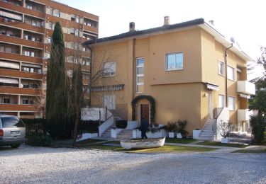
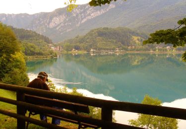
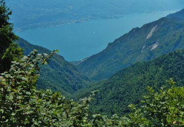
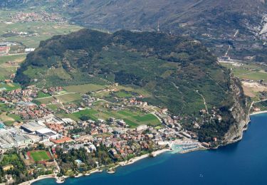
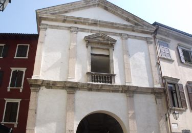
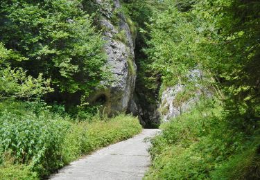
Ruta Senderismo de 6,6 km a descubrir en Trentino-Alto Adigio, Provincia di Trento, Ledro. Esta ruta ha sido propuesta por Dhendrickx71.
Descripción
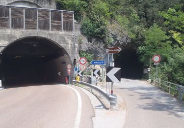
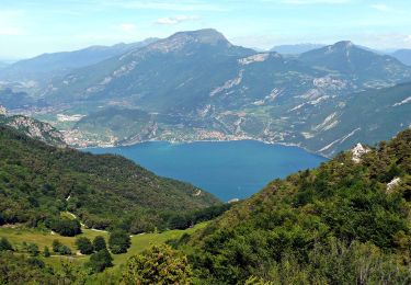
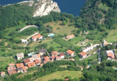
From BIacesa go up to theSan Giovanni Church through the 'Sentiero dei Bech' (Goat path) and the nr. 471. From there continue climbing to Cima Rocca (top of the walk). Go down till Boca Pasumer. Follow there the 405B for a while and a non marked path till Bocet dei Concoli. You'll find there the path 417. It will you bring down till the start. LOOK OUT. Parts of the walk are ± easy via ferrata (ladders). You also need a flashlight to pass through war tunnels.
Localización
Comentarios
Excursiones cerca
![Excursión A pie Riva del Garda - Sentiero delle Laste basse - Berghem](https://media.geolcdn.com/t/375/260/e00a9dfa-9e4b-4fb9-ac77-31d044744a99.jpeg&format=jpg&maxdim=2)
![A pie A pie](https://static1.geolcdn.com/sitytour/trail-icons/100.png)
A pie
![](/images/other/stat-length.png)
![](https://static1.geolcdn.com/siteimages/upload/files/16400158638029165_repeat_loop_refresh_sync_direction_icon.png)
![Excursión A pie Ledro - Sentiero Austroungarico 1915-1918 - Photo](https://media.geolcdn.com/t/375/260/3901eb4f-acb1-4ded-ab05-b22d3044cb19.jpeg&format=jpg&maxdim=2)
![A pie A pie](https://static1.geolcdn.com/sitytour/trail-icons/100.png)
A pie
![](/images/other/stat-length.png)
![](https://static1.geolcdn.com/siteimages/upload/files/16400158638029165_repeat_loop_refresh_sync_direction_icon.png)
![Excursión A pie Limone sul Garda - Agostino Tosi - Photo](https://media.geolcdn.com/t/375/260/424a7838-cda8-440e-9be6-adb0ec9f208f.jpeg&format=jpg&maxdim=2)
![A pie A pie](https://static1.geolcdn.com/sitytour/trail-icons/100.png)
A pie
![](/images/other/stat-length.png)
![](https://static1.geolcdn.com/siteimages/upload/files/16400158638029165_repeat_loop_refresh_sync_direction_icon.png)
![Excursión A pie Riva del Garda - Via ferrata](https://media.geolcdn.com/t/375/260/924836d8-b100-40e9-ab97-6e3c0247fb36.jpeg&format=jpg&maxdim=2)
![A pie A pie](https://static1.geolcdn.com/sitytour/trail-icons/100.png)
A pie
![](/images/other/stat-length.png)
![](https://static1.geolcdn.com/siteimages/upload/files/16400158638029165_repeat_loop_refresh_sync_direction_icon.png)
![Excursión A pie Ledro - Via ferrata del Bastione e della Rocchetta - Photo](https://media.geolcdn.com/t/375/260/a81e63e8-9f93-4a8e-a15c-f1a884a2b10c.jpeg&format=jpg&maxdim=2)
![A pie A pie](https://static1.geolcdn.com/sitytour/trail-icons/100.png)
A pie
![](/images/other/stat-length.png)
![](https://static1.geolcdn.com/siteimages/upload/files/16400158638029165_repeat_loop_refresh_sync_direction_icon.png)
![Excursión A pie Ledro - Via de Ari e sentiero Rino Zanotti - Photo](https://media.geolcdn.com/t/375/260/51a77690-51e7-48ea-989c-3e39c718514c.jpeg&format=jpg&maxdim=2)
![A pie A pie](https://static1.geolcdn.com/sitytour/trail-icons/100.png)
A pie
![](/images/other/stat-length.png)
![](https://static1.geolcdn.com/siteimages/upload/files/16400158638029165_repeat_loop_refresh_sync_direction_icon.png)
![Excursión A pie Riva del Garda - Sentér di Cima Nara - Photo](https://media.geolcdn.com/t/375/260/42befeb4-1be3-472e-b614-33994d4081d7.jpeg&format=jpg&maxdim=2)
![A pie A pie](https://static1.geolcdn.com/sitytour/trail-icons/100.png)
A pie
![](/images/other/stat-length.png)
![](https://static1.geolcdn.com/siteimages/upload/files/16400158638029165_repeat_loop_refresh_sync_direction_icon.png)
![Excursión A pie Riva del Garda - Sentér de Palaer - Photo](https://media.geolcdn.com/t/375/260/f333d570-7d61-46f8-b37b-a1ef19502aa9.jpeg&format=jpg&maxdim=2)
![A pie A pie](https://static1.geolcdn.com/sitytour/trail-icons/100.png)
A pie
![](/images/other/stat-length.png)
![](https://static1.geolcdn.com/siteimages/upload/files/16400158638029165_repeat_loop_refresh_sync_direction_icon.png)
![Excursión A pie Riva del Garda - IT-O422 - Photo](https://media.geolcdn.com/t/375/260/833639fd-6f4b-4cef-bb7e-2d9b7dcc2e07.jpeg&format=jpg&maxdim=2)
![A pie A pie](https://static1.geolcdn.com/sitytour/trail-icons/100.png)
A pie
![](/images/other/stat-length.png)
![](https://static1.geolcdn.com/siteimages/upload/files/16400158638029165_repeat_loop_refresh_sync_direction_icon.png)