![](/images/other/stat-length.png)
![Excursión Senderismo Rueil-Malmaison - 92-PR1 Sentier des parcs - Photo](https://media.geolcdn.com/t/1900/400/ext.pjpeg?maxdim=2&url=https%3A%2F%2Fstatic1.geolcdn.com%2Fsiteimages%2Fupload%2Ffiles%2F1553511878bg_sport_marche.png)
92-PR1 Sentier des parcs
lasvergn
Usuario
![Longitud](/images/other/stat-length.png)
![Altitud máxima](https://static1.geolcdn.com/siteimages/upload/files/1508320355ic_sort_altitude_max_24dp.png)
![Desnivel positivo](https://static1.geolcdn.com/siteimages/upload/files/1508320355ic_sort_den_pos_24dp.png)
![Km-Effort](/images/other/stat-length.png)
![Altitud mínima](https://static1.geolcdn.com/siteimages/upload/files/1508320355ic_sort_altitude_min_24dp.png)
![Desnivel negativo](https://static1.geolcdn.com/siteimages/upload/files/1508320355ic_sort_den_neg_24dp.png)
![Boucle](https://static1.geolcdn.com/siteimages/upload/files/16400158638029165_repeat_loop_refresh_sync_direction_icon.png)
![Senderismo](https://static1.geolcdn.com/sitytour/trail-icons/101.png)
9h46
Dificultad : Medio
![Escanee este código QR para abrir la excursión en la aplicación SityTrail](https://capi.geolives.com/qq0zvz2zws4bq2lad0pu/sitytour/trails/868748/qr.png?size=200)
Aplicación GPS de excursión GRATIS
A propósito
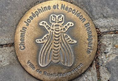
Ruta Senderismo de 41 km a descubrir en Isla de Francia, Altos del Sena, Rueil-Malmaison. Esta ruta ha sido propuesta por lasvergn.
Descripción
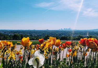
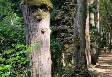
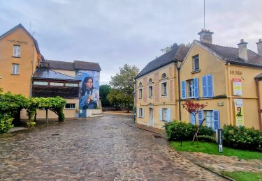
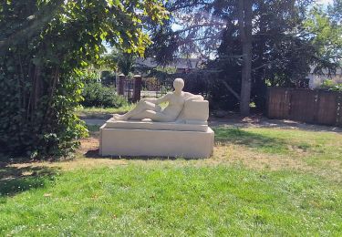
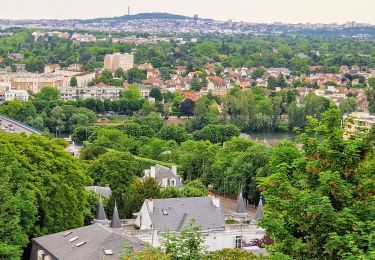
Le sentier des parcs commence à la gare RER A de Rueil Malmaison. Il traverse les communes de Rueil Malmaison, Nanterre, Courbevoie, La Garenne Colombes, Colombes, Bois Colombes, Asnières, Gennevilliers et le parc des chanteraines à Villeneuve la Garenne. Il se termine à la gare SNCF C1 d'Epinay sur Seine.
Localización
Comentarios
Excursiones cerca
![Excursión Senderismo Rueil-Malmaison - St Germain en Laye - Rueil Malmaison 28 km Inversee - Photo](https://media.geolcdn.com/t/375/260/b687f904-9338-4fa0-aef2-9bacff37d877.jpg&format=jpg&maxdim=2)
![Senderismo Senderismo](https://static1.geolcdn.com/sitytour/trail-icons/101.png)
Senderismo
![](/images/other/stat-length.png)
![](https://static1.geolcdn.com/siteimages/upload/files/16400158638029165_repeat_loop_refresh_sync_direction_icon.png)
![Excursión Senderismo Bougival - Bougival-Saint-cucufa reel - Photo](https://media.geolcdn.com/t/375/260/f8214235-f5e3-4ba5-8084-044ba7cbf132.jpeg&format=jpg&maxdim=2)
![Senderismo Senderismo](https://static1.geolcdn.com/sitytour/trail-icons/101.png)
Senderismo
![](/images/other/stat-length.png)
![](https://static1.geolcdn.com/siteimages/upload/files/16400158638029165_repeat_loop_refresh_sync_direction_icon.png)
![Excursión A pie Rueil-Malmaison - SityTrail - 3850997 - rando-chatou (1) - Photo](https://media.geolcdn.com/t/375/260/c514a42a-e126-47ef-85f0-d75f60d63c7a.jpg&format=jpg&maxdim=2)
![A pie A pie](https://static1.geolcdn.com/sitytour/trail-icons/100.png)
A pie
![](/images/other/stat-length.png)
![](https://static1.geolcdn.com/siteimages/upload/files/16400158638029165_repeat_loop_refresh_sync_direction_icon.png)
![Excursión Senderismo Saint-Germain-en-Laye - SityTrail - 202230519 RS 5km - Photo](https://media.geolcdn.com/t/375/260/ext.jpg?maxdim=2&url=https%3A%2F%2Fstatic1.geolcdn.com%2Fsiteimages%2Fupload%2Ffiles%2F1553511878bg_sport_marche.png)
![Senderismo Senderismo](https://static1.geolcdn.com/sitytour/trail-icons/101.png)
Senderismo
![](/images/other/stat-length.png)
![](https://static1.geolcdn.com/siteimages/upload/files/16400158638029165_repeat_loop_refresh_sync_direction_icon.png)
![Excursión Senderismo Rueil-Malmaison - De Rueil Malmaison aux Serres d'Auteuil via Suresnes - Photo](https://media.geolcdn.com/t/375/260/69c5aa69-7a4f-4e7d-be07-682d5ba1172b.jpg&format=jpg&maxdim=2)
![Senderismo Senderismo](https://static1.geolcdn.com/sitytour/trail-icons/101.png)
Senderismo
![](/images/other/stat-length.png)
![](https://static1.geolcdn.com/siteimages/upload/files/16400158638029165_repeat_loop_refresh_sync_direction_icon.png)
![Excursión Senderismo Rueil-Malmaison - Domaine Malmaison - Cité jardin Suresnes - Boulogne - Serres d'Auteuil - Photo](https://media.geolcdn.com/t/375/260/f35951a9-b213-4c85-9bfa-cc06ec3dd722.jpg&format=jpg&maxdim=2)
![Senderismo Senderismo](https://static1.geolcdn.com/sitytour/trail-icons/101.png)
Senderismo
![](/images/other/stat-length.png)
![](https://static1.geolcdn.com/siteimages/upload/files/16400158638029165_repeat_loop_refresh_sync_direction_icon.png)
![Excursión Senderismo Rueil-Malmaison - De rueil Malmaison à St Germain en Laye - Photo](https://media.geolcdn.com/t/375/260/2cfb8298-4a88-4640-a039-54786d423968.jpg&format=jpg&maxdim=2)
![Senderismo Senderismo](https://static1.geolcdn.com/sitytour/trail-icons/101.png)
Senderismo
![](/images/other/stat-length.png)
![](https://static1.geolcdn.com/siteimages/upload/files/16400158638029165_repeat_loop_refresh_sync_direction_icon.png)
![Excursión Senderismo Rueil-Malmaison - Rueil Ville, château, Cucufa-Seine - Photo](https://media.geolcdn.com/t/375/260/c2b90b8f-08d6-4c14-833f-306078b35459.jpg&format=jpg&maxdim=2)
![Senderismo Senderismo](https://static1.geolcdn.com/sitytour/trail-icons/101.png)
Senderismo
![](/images/other/stat-length.png)
![](https://static1.geolcdn.com/siteimages/upload/files/16400158638029165_repeat_loop_refresh_sync_direction_icon.png)
![Excursión Senderismo Le Pecq - 20230707 RS - Photo](https://media.geolcdn.com/t/375/260/ext.jpg?maxdim=2&url=https%3A%2F%2Fstatic1.geolcdn.com%2Fsiteimages%2Fupload%2Ffiles%2F1553511878bg_sport_marche.png)
![Senderismo Senderismo](https://static1.geolcdn.com/sitytour/trail-icons/101.png)
Senderismo
![](/images/other/stat-length.png)
![](https://static1.geolcdn.com/siteimages/upload/files/16400158638029165_repeat_loop_refresh_sync_direction_icon.png)