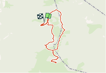
![](/images/other/stat-length.png)
![Excursión Senderismo Ledro - Malga Trat / Rifugio Pernici / Cima Pari - Photo](https://media.geolcdn.com/t/1900/400/ext.pjpeg?maxdim=2&url=https%3A%2F%2Fstatic1.geolcdn.com%2Fsiteimages%2Fupload%2Ffiles%2F1553511878bg_sport_marche.png)
Malga Trat / Rifugio Pernici / Cima Pari
Dhendrickx71
Usuario
![Longitud](/images/other/stat-length.png)
![Altitud máxima](https://static1.geolcdn.com/siteimages/upload/files/1508320355ic_sort_altitude_max_24dp.png)
![Desnivel positivo](https://static1.geolcdn.com/siteimages/upload/files/1508320355ic_sort_den_pos_24dp.png)
![Km-Effort](/images/other/stat-length.png)
![Altitud mínima](https://static1.geolcdn.com/siteimages/upload/files/1508320355ic_sort_altitude_min_24dp.png)
![Desnivel negativo](https://static1.geolcdn.com/siteimages/upload/files/1508320355ic_sort_den_neg_24dp.png)
![Boucle](https://static1.geolcdn.com/siteimages/upload/files/16400158638029165_repeat_loop_refresh_sync_direction_icon.png)
![Senderismo](https://static1.geolcdn.com/sitytour/trail-icons/101.png)
3h54
Dificultad : Medio
![Escanee este código QR para abrir la excursión en la aplicación SityTrail](https://capi.geolives.com/qq0zvz2zws4bq2lad0pu/sitytour/trails/868015/qr.png?size=200)
Aplicación GPS de excursión GRATIS
A propósito
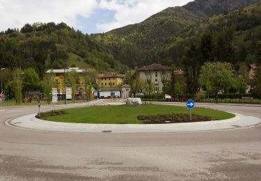
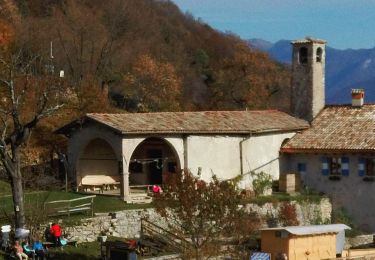
Ruta Senderismo de 9,4 km a descubrir en Trentino-Alto Adigio, Provincia di Trento, Ledro. Esta ruta ha sido propuesta por Dhendrickx71.
Descripción
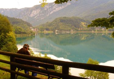
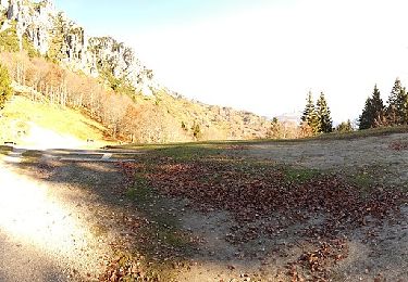
Take the forest path from the car park under the Malga Trat to the Malga. Then follow the path nr. 403 to the Nino Pernici refuge. From there follow the path nr. 413 (Trail of Peace) to Bocca Saval. Go up until you see the Malga below. Turn left on the cow trail to Cima Pari.After a breathtaking view of the Ledro valley and its lake from the top of Cima Pari (approx. 2000m above sea level) take the same path back down to Bocca Saval. Take a little visit to the Malga. Otherwise once at the Bocca Saval go up the path in front of you to Dos di Trat. Once you reach the top, go back up and follow the path of the cows towards Malga Trat and the car park.
Localización
Comentarios
Excursiones cerca
![Excursión A pie Ledro - Sentiero Austroungarico 1915-1918 - Photo](https://media.geolcdn.com/t/375/260/3901eb4f-acb1-4ded-ab05-b22d3044cb19.jpeg&format=jpg&maxdim=2)
![A pie A pie](https://static1.geolcdn.com/sitytour/trail-icons/100.png)
A pie
![](/images/other/stat-length.png)
![](https://static1.geolcdn.com/siteimages/upload/files/16400158638029165_repeat_loop_refresh_sync_direction_icon.png)
![Excursión A pie Ledro - Via ferrata del Bastione e della Rocchetta - Photo](https://media.geolcdn.com/t/375/260/a81e63e8-9f93-4a8e-a15c-f1a884a2b10c.jpeg&format=jpg&maxdim=2)
![A pie A pie](https://static1.geolcdn.com/sitytour/trail-icons/100.png)
A pie
![](/images/other/stat-length.png)
![](https://static1.geolcdn.com/siteimages/upload/files/16400158638029165_repeat_loop_refresh_sync_direction_icon.png)
![Excursión A pie Ledro - Via de Ari e sentiero Rino Zanotti - Photo](https://media.geolcdn.com/t/375/260/51a77690-51e7-48ea-989c-3e39c718514c.jpeg&format=jpg&maxdim=2)
![A pie A pie](https://static1.geolcdn.com/sitytour/trail-icons/100.png)
A pie
![](/images/other/stat-length.png)
![](https://static1.geolcdn.com/siteimages/upload/files/16400158638029165_repeat_loop_refresh_sync_direction_icon.png)
![Excursión A pie Ledro - Sentér de Giumela - Photo](https://media.geolcdn.com/t/375/260/004fe9cc-333c-4678-aabb-18391d4f658c.jpeg&format=jpg&maxdim=2)
![A pie A pie](https://static1.geolcdn.com/sitytour/trail-icons/100.png)
A pie
![](/images/other/stat-length.png)
![](https://static1.geolcdn.com/siteimages/upload/files/16400158638029165_repeat_loop_refresh_sync_direction_icon.png)
![Excursión A pie Tenno - Sentiero della Regina - Photo](https://media.geolcdn.com/t/375/260/2ab05804-e06c-4409-9276-0ed14f1ee005.jpeg&format=jpg&maxdim=2)
![A pie A pie](https://static1.geolcdn.com/sitytour/trail-icons/100.png)
A pie
![](/images/other/stat-length.png)
![](https://static1.geolcdn.com/siteimages/upload/files/16400158638029165_repeat_loop_refresh_sync_direction_icon.png)
![Excursión A pie Ledro - Sentér de Saval - Photo](https://media.geolcdn.com/t/375/260/6dd67a9d-cb86-4e91-a0a9-2a19b95f2d01.jpeg&format=jpg&maxdim=2)
![A pie A pie](https://static1.geolcdn.com/sitytour/trail-icons/100.png)
A pie
![](/images/other/stat-length.png)
![](https://static1.geolcdn.com/siteimages/upload/files/16400158638029165_repeat_loop_refresh_sync_direction_icon.png)
![Excursión A pie Ledro - Sentér de Dromaé - Photo](https://media.geolcdn.com/t/375/260/3901eb4f-acb1-4ded-ab05-b22d3044cb19.jpeg&format=jpg&maxdim=2)
![A pie A pie](https://static1.geolcdn.com/sitytour/trail-icons/100.png)
A pie
![](/images/other/stat-length.png)
![](https://static1.geolcdn.com/siteimages/upload/files/16400158638029165_repeat_loop_refresh_sync_direction_icon.png)
![Excursión A pie Fiavé - IT-O406 - Photo](https://media.geolcdn.com/t/375/260/09d96c99-5a90-43ce-9c2f-a9276d430601.jpeg&format=jpg&maxdim=2)
![A pie A pie](https://static1.geolcdn.com/sitytour/trail-icons/100.png)
A pie
![](/images/other/stat-length.png)
![](https://static1.geolcdn.com/siteimages/upload/files/16400158638029165_repeat_loop_refresh_sync_direction_icon.png)
![Excursión Bici de montaña Ledro - Lago di Ledro (Retour VTT à Arco) - Photo](https://media.geolcdn.com/t/375/260/ext.jpg?maxdim=2&url=https%3A%2F%2Fstatic1.geolcdn.com%2Fsiteimages%2Fupload%2Ffiles%2F1524743154velo.jpg)
![Bici de montaña Bici de montaña](https://static1.geolcdn.com/sitytour/trail-icons/202.png)
Bici de montaña
![](/images/other/stat-length.png)
![](https://static1.geolcdn.com/siteimages/upload/files/16400158638029165_repeat_loop_refresh_sync_direction_icon.png)