![](/images/other/stat-length.png)
![Excursión Senderismo Le Tablier - la vallée de l'Yon 9 - Photo](https://media.geolcdn.com/t/1900/400/ext.pjpeg?maxdim=2&url=https%3A%2F%2Fstatic1.geolcdn.com%2Fsiteimages%2Fupload%2Ffiles%2F1553511878bg_sport_marche.png)
la vallée de l'Yon 9
cath310
Usuario
![Longitud](/images/other/stat-length.png)
Longitud
16,2 km
![Altitud máxima](https://static1.geolcdn.com/siteimages/upload/files/1508320355ic_sort_altitude_max_24dp.png)
Altitud máxima
68 m
![Desnivel positivo](https://static1.geolcdn.com/siteimages/upload/files/1508320355ic_sort_den_pos_24dp.png)
Desnivel positivo
223 m
![Km-Effort](/images/other/stat-length.png)
Km-Effort
19,1 km
![Altitud mínima](https://static1.geolcdn.com/siteimages/upload/files/1508320355ic_sort_altitude_min_24dp.png)
Altitud mínima
8 m
![Desnivel negativo](https://static1.geolcdn.com/siteimages/upload/files/1508320355ic_sort_den_neg_24dp.png)
Desnivel negativo
223 m
![Boucle](https://static1.geolcdn.com/siteimages/upload/files/16400158638029165_repeat_loop_refresh_sync_direction_icon.png)
Boucle
Sí
Fecha de creación :
2018-04-17 12:14:21.692
Última modificación :
2018-04-17 12:14:21.692
![Senderismo](https://static1.geolcdn.com/sitytour/trail-icons/101.png)
4h09
Dificultad : Desconocido
![Escanee este código QR para abrir la excursión en la aplicación SityTrail](https://capi.geolives.com/qq0zvz2zws4bq2lad0pu/sitytour/trails/857358/qr.png?size=200)
Aplicación GPS de excursión GRATIS
A propósito
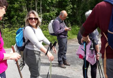
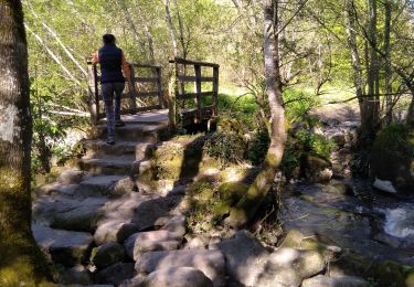
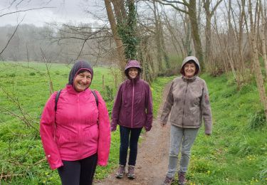
Ruta Senderismo de 16,2 km a descubrir en Países del Loira, Vandea, Le Tablier. Esta ruta ha sido propuesta por cath310.
Descripción
Départ place de l'église LE TABLIER
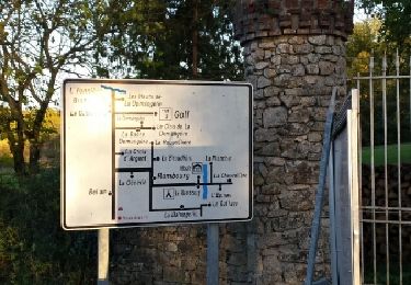
Balisage : jaune du départ à Grassonnière puis jaune-rouge jusqu'à la fin
Localización
País:
France
Región :
Países del Loira
Departamento/provincia :
Vandea
Municipio :
Le Tablier
Localidad:
Unknown
Salida:(Dec)
Salida:(UTM)
626964 ; 5159153 (30T) N.
Comentarios
Excursiones cerca
![Excursión Senderismo Rives-de-l'Yon - caille les orneaux - Photo](https://media.geolcdn.com/t/375/260/f4e8f30c-7059-4efc-827f-9cf894c1224d.jpg&format=jpg&maxdim=2)
![Senderismo Senderismo](https://static1.geolcdn.com/sitytour/trail-icons/101.png)
caille les orneaux
Senderismo
Muy fácil
(1)
Rives-de-l'Yon,
Países del Loira,
Vandea,
France
![](/images/other/stat-length.png)
10,3 km | 12,3 km-effort
4h 25min
![](https://static1.geolcdn.com/siteimages/upload/files/16400158638029165_repeat_loop_refresh_sync_direction_icon.png)
Sí
![Excursión Senderismo Rosnay - Les Vignes et la Vallée de l'Yon - N°15 - Photo](https://media.geolcdn.com/t/375/260/aa89ada1-4ce5-41ff-b125-e448f15654ec.jpg&format=jpg&maxdim=2)
![Senderismo Senderismo](https://static1.geolcdn.com/sitytour/trail-icons/101.png)
Les Vignes et la Vallée de l'Yon - N°15
Senderismo
Fácil
Rosnay,
Países del Loira,
Vandea,
France
![](/images/other/stat-length.png)
15,6 km | 18,3 km-effort
3h 47min
![](https://static1.geolcdn.com/siteimages/upload/files/16400158638029165_repeat_loop_refresh_sync_direction_icon.png)
Sí
![Excursión Senderismo Rosnay - R5 - Rosnay vignes - Photo](https://media.geolcdn.com/t/375/260/ext.jpg?maxdim=2&url=https%3A%2F%2Fstatic1.geolcdn.com%2Fsiteimages%2Fupload%2Ffiles%2F1553511878bg_sport_marche.png)
![Senderismo Senderismo](https://static1.geolcdn.com/sitytour/trail-icons/101.png)
R5 - Rosnay vignes
Senderismo
Muy fácil
(1)
Rosnay,
Países del Loira,
Vandea,
France
![](/images/other/stat-length.png)
11,7 km | 13,3 km-effort
2h 13min
![](https://static1.geolcdn.com/siteimages/upload/files/16400158638029165_repeat_loop_refresh_sync_direction_icon.png)
Sí
![Excursión Senderismo Nesmy - Pays de l'Yon & Vie N°9 - Photo](https://media.geolcdn.com/t/375/260/ext.jpg?maxdim=2&url=https%3A%2F%2Fservices.sitytrail.com%2FGeolivesWS%2FDownloadMedia.ashx%3FTrailID%3D861211%26Media%3Dfix__20171112165338.jpg)
![Senderismo Senderismo](https://static1.geolcdn.com/sitytour/trail-icons/101.png)
Pays de l'Yon & Vie N°9
Senderismo
Fácil
(1)
Nesmy,
Países del Loira,
Vandea,
France
![](/images/other/stat-length.png)
10,9 km | 12,1 km-effort
2h 39min
![](https://static1.geolcdn.com/siteimages/upload/files/16400158638029165_repeat_loop_refresh_sync_direction_icon.png)
Sí
![Excursión Senderismo Rives-de-l'Yon - Chaillé sous les Orrmeaux - Photo](https://media.geolcdn.com/t/375/260/ext.jpg?maxdim=2&url=https%3A%2F%2Fstatic1.geolcdn.com%2Fsiteimages%2Fupload%2Ffiles%2F1553511878bg_sport_marche.png)
![Senderismo Senderismo](https://static1.geolcdn.com/sitytour/trail-icons/101.png)
Chaillé sous les Orrmeaux
Senderismo
Fácil
(1)
Rives-de-l'Yon,
Países del Loira,
Vandea,
France
![](/images/other/stat-length.png)
16,6 km | 19,2 km-effort
4h 11min
![](https://static1.geolcdn.com/siteimages/upload/files/16400158638029165_repeat_loop_refresh_sync_direction_icon.png)
Sí
![Excursión Senderismo Le Tablier - le petit piquet - Photo](https://media.geolcdn.com/t/375/260/592ee705-dc08-4233-9012-e5c19068b97c.jpg&format=jpg&maxdim=2)
![Senderismo Senderismo](https://static1.geolcdn.com/sitytour/trail-icons/101.png)
le petit piquet
Senderismo
Muy fácil
Le Tablier,
Países del Loira,
Vandea,
France
![](/images/other/stat-length.png)
5,6 km | 6,9 km-effort
1h 40min
![](https://static1.geolcdn.com/siteimages/upload/files/16400158638029165_repeat_loop_refresh_sync_direction_icon.png)
Sí
![Excursión Senderismo Le Tablier - Piquet - Photo](https://media.geolcdn.com/t/375/260/49443e2b-45a2-406e-b980-3d6deb328159.jpg&format=jpg&maxdim=2)
![Senderismo Senderismo](https://static1.geolcdn.com/sitytour/trail-icons/101.png)
Piquet
Senderismo
Fácil
(1)
Le Tablier,
Países del Loira,
Vandea,
France
![](/images/other/stat-length.png)
5,3 km | 6,4 km-effort
1h 43min
![](https://static1.geolcdn.com/siteimages/upload/files/16400158638029165_repeat_loop_refresh_sync_direction_icon.png)
Sí
![Excursión A pie Nesmy - L'Aulne...au fil de l'eau NESMY (sentier n°45 vendée rando FFR) - Photo](https://media.geolcdn.com/t/375/260/ext.jpg?maxdim=2&url=https%3A%2F%2Fstatic1.geolcdn.com%2Fsiteimages%2Fupload%2Ffiles%2F1545311037marcheuse_200dpi.jpg)
![A pie A pie](https://static1.geolcdn.com/sitytour/trail-icons/100.png)
L'Aulne...au fil de l'eau NESMY (sentier n°45 vendée rando FFR)
A pie
Fácil
Nesmy,
Países del Loira,
Vandea,
France
![](/images/other/stat-length.png)
10,5 km | 11,7 km-effort
2h 39min
![](https://static1.geolcdn.com/siteimages/upload/files/16400158638029165_repeat_loop_refresh_sync_direction_icon.png)
Sí
![Excursión A pie Le Tablier - LA VALLEE DE L'YON n°9 sentiers Chamina - Photo](https://media.geolcdn.com/t/375/260/ext.jpg?maxdim=2&url=https%3A%2F%2Fstatic1.geolcdn.com%2Fsiteimages%2Fupload%2Ffiles%2F1545311037marcheuse_200dpi.jpg)
![A pie A pie](https://static1.geolcdn.com/sitytour/trail-icons/100.png)
LA VALLEE DE L'YON n°9 sentiers Chamina
A pie
Fácil
Le Tablier,
Países del Loira,
Vandea,
France
![](/images/other/stat-length.png)
16,7 km | 19,7 km-effort
4h 28min
![](https://static1.geolcdn.com/siteimages/upload/files/16400158638029165_repeat_loop_refresh_sync_direction_icon.png)
Sí
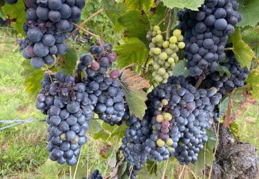
magnifique sauf après maisonneuve