![](/images/other/stat-length.png)
![Excursión Senderismo Ménières - Ménières Aumont Sassel et Verdière - Photo](https://media.geolcdn.com/t/1900/400/ext.pjpeg?maxdim=2&url=https%3A%2F%2Fservices.sitytrail.com%2FGeolivesWS%2FDownloadMedia.ashx%3FTrailID%3D842917%26Media%3D20171009165020.jpg)
Ménières Aumont Sassel et Verdière
henriclement
Usuario
![Longitud](/images/other/stat-length.png)
Longitud
11,6 km
![Altitud máxima](https://static1.geolcdn.com/siteimages/upload/files/1508320355ic_sort_altitude_max_24dp.png)
Altitud máxima
707 m
![Desnivel positivo](https://static1.geolcdn.com/siteimages/upload/files/1508320355ic_sort_den_pos_24dp.png)
Desnivel positivo
283 m
![Km-Effort](/images/other/stat-length.png)
Km-Effort
15,4 km
![Altitud mínima](https://static1.geolcdn.com/siteimages/upload/files/1508320355ic_sort_altitude_min_24dp.png)
Altitud mínima
496 m
![Desnivel negativo](https://static1.geolcdn.com/siteimages/upload/files/1508320355ic_sort_den_neg_24dp.png)
Desnivel negativo
280 m
![Boucle](https://static1.geolcdn.com/siteimages/upload/files/16400158638029165_repeat_loop_refresh_sync_direction_icon.png)
Boucle
No
Fecha de creación :
2018-04-17 10:18:46.324
Última modificación :
2018-04-17 10:18:46.324
![Senderismo](https://static1.geolcdn.com/sitytour/trail-icons/101.png)
2h52
Dificultad : Muy fácil
![Escanee este código QR para abrir la excursión en la aplicación SityTrail](https://capi.geolives.com/qq0zvz2zws4bq2lad0pu/sitytour/trails/842917/qr.png?size=200)
Aplicación GPS de excursión GRATIS
A propósito
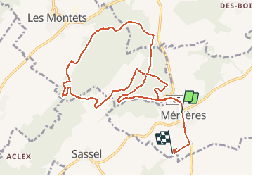
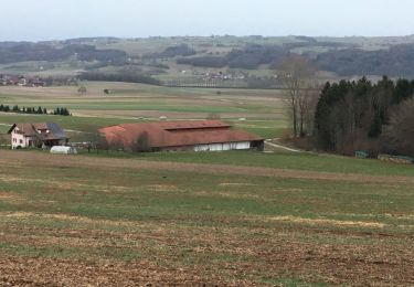
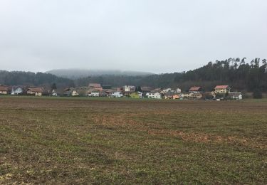
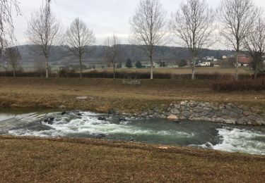
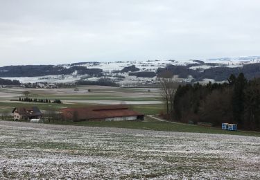
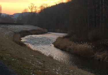
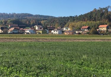
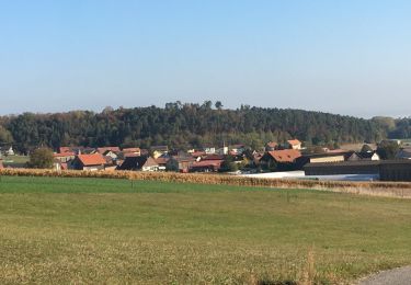
Ruta Senderismo de 11,6 km a descubrir en Friburgo, District de la Broye, Ménières. Esta ruta ha sido propuesta por henriclement.
Descripción
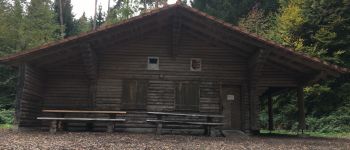
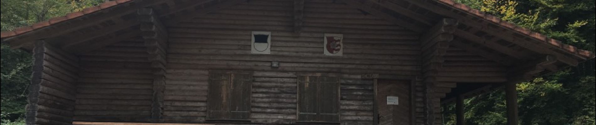
De Ménières à Aumont en passant par la cabane du Moto-club et visite du chemin des essences forestière
Localización
País:
Switzerland
Región :
Friburgo
Departamento/provincia :
District de la Broye
Municipio :
Ménières
Localidad:
Unknown
Salida:(Dec)
Salida:(UTM)
338216 ; 5183287 (32T) N.
Comentarios
Excursiones cerca
![Excursión Senderismo Ménières - Ménières Cousin Chapelle Sassel Ménières - Photo](https://media.geolcdn.com/t/375/260/ext.jpg?maxdim=2&url=https%3A%2F%2Fservices.sitytrail.com%2FGeolivesWS%2FDownloadMedia.ashx%3FTrailID%3D902170%26Media%3D20180209153058.jpg)
![Senderismo Senderismo](https://static1.geolcdn.com/sitytour/trail-icons/101.png)
Ménières Cousin Chapelle Sassel Ménières
Senderismo
Muy fácil
Ménières,
Friburgo,
District de la Broye,
Switzerland
![](/images/other/stat-length.png)
7,7 km | 10,5 km-effort
1h 58min
![](https://static1.geolcdn.com/siteimages/upload/files/16400158638029165_repeat_loop_refresh_sync_direction_icon.png)
Sí
![Excursión Senderismo Ménières - Malafin gravière à Bersier - Photo](https://media.geolcdn.com/t/375/260/ext.jpg?maxdim=2&url=https%3A%2F%2Fservices.sitytrail.com%2FGeolivesWS%2FDownloadMedia.ashx%3FTrailID%3D881679%26Media%3D20180101162015.jpg)
![Senderismo Senderismo](https://static1.geolcdn.com/sitytour/trail-icons/101.png)
Malafin gravière à Bersier
Senderismo
Muy fácil
Ménières,
Friburgo,
District de la Broye,
Switzerland
![](/images/other/stat-length.png)
4,9 km | 6,1 km-effort
1h 11min
![](https://static1.geolcdn.com/siteimages/upload/files/16400158638029165_repeat_loop_refresh_sync_direction_icon.png)
Sí
![Excursión Senderismo Ménières - Forêt de Verdière - Photo](https://media.geolcdn.com/t/375/260/ext.jpg?maxdim=2&url=https%3A%2F%2Fservices.sitytrail.com%2FGeolivesWS%2FDownloadMedia.ashx%3FTrailID%3D878827%26Media%3D20171224123839.jpg)
![Senderismo Senderismo](https://static1.geolcdn.com/sitytour/trail-icons/101.png)
Forêt de Verdière
Senderismo
Muy fácil
Ménières,
Friburgo,
District de la Broye,
Switzerland
![](/images/other/stat-length.png)
8,8 km | 11,2 km-effort
2h 48min
![](https://static1.geolcdn.com/siteimages/upload/files/16400158638029165_repeat_loop_refresh_sync_direction_icon.png)
Sí
![Excursión Senderismo Valbroye - Sirpierre - Photo](https://media.geolcdn.com/t/375/260/ext.jpg?maxdim=2&url=https%3A%2F%2Fservices.sitytrail.com%2FGeolivesWS%2FDownloadMedia.ashx%3FTrailID%3D877993%26Media%3D20171221154745.jpg)
![Senderismo Senderismo](https://static1.geolcdn.com/sitytour/trail-icons/101.png)
Sirpierre
Senderismo
Muy fácil
Valbroye,
Valdia,
District de la Broye-Vully,
Switzerland
![](/images/other/stat-length.png)
9,2 km | 12,5 km-effort
2h 36min
![](https://static1.geolcdn.com/siteimages/upload/files/16400158638029165_repeat_loop_refresh_sync_direction_icon.png)
Sí
![Excursión Senderismo Ménières - de chez moi et Sassel - Photo](https://media.geolcdn.com/t/375/260/ext.jpg?maxdim=2&url=https%3A%2F%2Fservices.sitytrail.com%2FGeolivesWS%2FDownloadMedia.ashx%3FTrailID%3D876538%26Media%3D20171217120921.jpg)
![Senderismo Senderismo](https://static1.geolcdn.com/sitytour/trail-icons/101.png)
de chez moi et Sassel
Senderismo
Muy fácil
Ménières,
Friburgo,
District de la Broye,
Switzerland
![](/images/other/stat-length.png)
5,5 km | 7 km-effort
1h 57min
![](https://static1.geolcdn.com/siteimages/upload/files/16400158638029165_repeat_loop_refresh_sync_direction_icon.png)
Sí
![Excursión Bicicleta Valbroye - passerelle Anne Marie Payerne et retour - Photo](https://media.geolcdn.com/t/375/260/ext.jpg?maxdim=2&url=https%3A%2F%2Fservices.sitytrail.com%2FGeolivesWS%2FDownloadMedia.ashx%3FTrailID%3D872974%26Media%3D20171203163923.jpg)
![Bicicleta Bicicleta](https://static1.geolcdn.com/sitytour/trail-icons/200.png)
passerelle Anne Marie Payerne et retour
Bicicleta
Muy fácil
Valbroye,
Valdia,
District de la Broye-Vully,
Switzerland
![](/images/other/stat-length.png)
9,3 km | 10,1 km-effort
2h 9min
![](https://static1.geolcdn.com/siteimages/upload/files/16400158638029165_repeat_loop_refresh_sync_direction_icon.png)
Sí
![Excursión Bicicleta Valbroye - passerelle Anne Marie Payerne et retour - Photo](https://media.geolcdn.com/t/375/260/ext.jpg?maxdim=2&url=https%3A%2F%2Fservices.sitytrail.com%2FGeolivesWS%2FDownloadMedia.ashx%3FTrailID%3D871073%26Media%3D20171203163923.jpg)
![Bicicleta Bicicleta](https://static1.geolcdn.com/sitytour/trail-icons/200.png)
passerelle Anne Marie Payerne et retour
Bicicleta
Muy fácil
Valbroye,
Valdia,
District de la Broye-Vully,
Switzerland
![](/images/other/stat-length.png)
9,3 km | 10,1 km-effort
2h 9min
![](https://static1.geolcdn.com/siteimages/upload/files/16400158638029165_repeat_loop_refresh_sync_direction_icon.png)
Sí
![Excursión Bicicleta Ménières - en vélo jusqu'à Fetigny - Photo](https://media.geolcdn.com/t/375/260/ext.jpg?maxdim=2&url=https%3A%2F%2Fservices.sitytrail.com%2FGeolivesWS%2FDownloadMedia.ashx%3FTrailID%3D846156%26Media%3D20171015154714.jpg)
![Bicicleta Bicicleta](https://static1.geolcdn.com/sitytour/trail-icons/200.png)
en vélo jusqu'à Fetigny
Bicicleta
Muy fácil
Ménières,
Friburgo,
District de la Broye,
Switzerland
![](/images/other/stat-length.png)
8,2 km | 9,1 km-effort
1h 7min
![](https://static1.geolcdn.com/siteimages/upload/files/16400158638029165_repeat_loop_refresh_sync_direction_icon.png)
Sí
![Excursión Bicicleta Ménières - forêt de Valbroye - Photo](https://media.geolcdn.com/t/375/260/ext.jpg?maxdim=2&url=https%3A%2F%2Fservices.sitytrail.com%2FGeolivesWS%2FDownloadMedia.ashx%3FTrailID%3D845258%26Media%3D20171014100314.jpg)
![Bicicleta Bicicleta](https://static1.geolcdn.com/sitytour/trail-icons/200.png)
forêt de Valbroye
Bicicleta
Muy fácil
Ménières,
Friburgo,
District de la Broye,
Switzerland
![](/images/other/stat-length.png)
3,2 km | 4,1 km-effort
54min
![](https://static1.geolcdn.com/siteimages/upload/files/16400158638029165_repeat_loop_refresh_sync_direction_icon.png)
Sí