![](/images/other/stat-length.png)
![Excursión Senderismo Pranles - volcan des chirouses - Photo](https://media.geolcdn.com/t/1900/400/ext.pjpeg?maxdim=2&url=https%3A%2F%2Fservices.sitytrail.com%2FGeolivesWS%2FDownloadMedia.ashx%3FTrailID%3D838598%26Media%3D20171001125955.jpg)
volcan des chirouses
ajd26
Usuario
![Longitud](/images/other/stat-length.png)
Longitud
12,1 km
![Altitud máxima](https://static1.geolcdn.com/siteimages/upload/files/1508320355ic_sort_altitude_max_24dp.png)
Altitud máxima
729 m
![Desnivel positivo](https://static1.geolcdn.com/siteimages/upload/files/1508320355ic_sort_den_pos_24dp.png)
Desnivel positivo
582 m
![Km-Effort](/images/other/stat-length.png)
Km-Effort
19,8 km
![Altitud mínima](https://static1.geolcdn.com/siteimages/upload/files/1508320355ic_sort_altitude_min_24dp.png)
Altitud mínima
372 m
![Desnivel negativo](https://static1.geolcdn.com/siteimages/upload/files/1508320355ic_sort_den_neg_24dp.png)
Desnivel negativo
581 m
![Boucle](https://static1.geolcdn.com/siteimages/upload/files/16400158638029165_repeat_loop_refresh_sync_direction_icon.png)
Boucle
Sí
Fecha de creación :
2019-05-19 18:03:41.85
Última modificación :
2019-05-19 18:03:42.651
![Senderismo](https://static1.geolcdn.com/sitytour/trail-icons/101.png)
3h36
Dificultad : Medio
![Escanee este código QR para abrir la excursión en la aplicación SityTrail](https://capi.geolives.com/qq0zvz2zws4bq2lad0pu/sitytour/trails/838598/qr.png?size=200)
Aplicación GPS de excursión GRATIS
A propósito
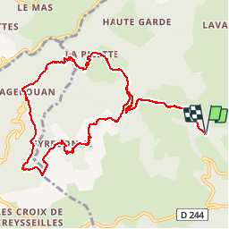
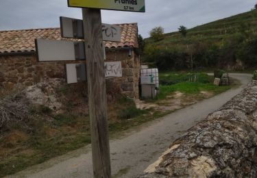
Ruta Senderismo de 12,1 km a descubrir en Auvergne-Rhône-Alpes, Ardecha, Pranles. Esta ruta ha sido propuesta por ajd26.
Descripción
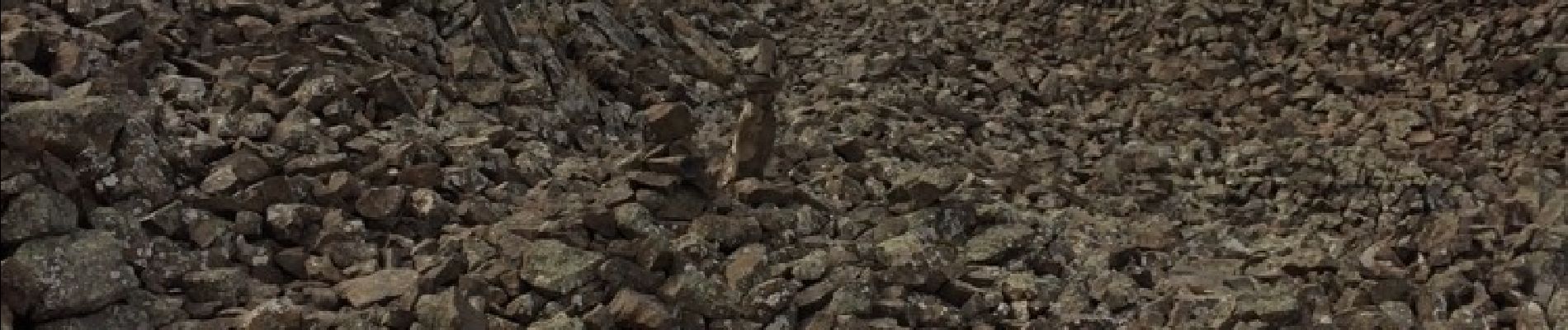
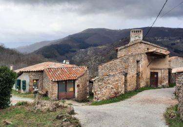
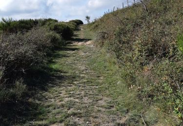
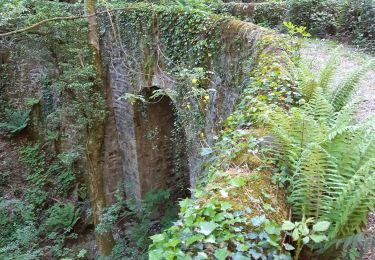
Au départ du Clap à 1km de Pranles 07 Un long pierrier à traverser (au pied du volcan) et ensuite belle balade dans les Châtaigneraies
Localización
País:
France
Región :
Auvergne-Rhône-Alpes
Departamento/provincia :
Ardecha
Municipio :
Pranles
Localidad:
Unknown
Salida:(Dec)
Salida:(UTM)
623738 ; 4959176 (31T) N.
Comentarios
Excursiones cerca
![Excursión Senderismo Coux - 2025-01-23_11h08m48_Coux Serre Gruas 19km - Photo](https://media.geolcdn.com/t/375/260/1192e010-d7d1-4f62-bb56-d159752d857e.jpg&format=jpg&maxdim=2)
![Senderismo Senderismo](https://static1.geolcdn.com/sitytour/trail-icons/101.png)
2025-01-23_11h08m48_Coux Serre Gruas 19km
Senderismo
Muy difícil
Coux,
Auvergne-Rhône-Alpes,
Ardecha,
France
![](/images/other/stat-length.png)
19,1 km | 29 km-effort
6h 33min
![](https://static1.geolcdn.com/siteimages/upload/files/16400158638029165_repeat_loop_refresh_sync_direction_icon.png)
Sí
![Excursión Senderismo Creysseilles - 07 mageroan pierre de boeuf ajoux zel - Photo](https://media.geolcdn.com/t/375/260/7bb0b48c-bed8-4199-9213-2d5bb1436604.jpg&format=jpg&maxdim=2)
![Senderismo Senderismo](https://static1.geolcdn.com/sitytour/trail-icons/101.png)
07 mageroan pierre de boeuf ajoux zel
Senderismo
Medio
Creysseilles,
Auvergne-Rhône-Alpes,
Ardecha,
France
![](/images/other/stat-length.png)
18,5 km | 29 km-effort
7h 21min
![](https://static1.geolcdn.com/siteimages/upload/files/16400158638029165_repeat_loop_refresh_sync_direction_icon.png)
No
![Excursión Senderismo Creysseilles - Magerouan Le Chier 14KM - Photo](https://media.geolcdn.com/t/375/260/85649a27-9268-4d71-b7cd-d2621e352912.jpg&format=jpg&maxdim=2)
![Senderismo Senderismo](https://static1.geolcdn.com/sitytour/trail-icons/101.png)
Magerouan Le Chier 14KM
Senderismo
Muy difícil
Creysseilles,
Auvergne-Rhône-Alpes,
Ardecha,
France
![](/images/other/stat-length.png)
14 km | 22 km-effort
4h 59min
![](https://static1.geolcdn.com/siteimages/upload/files/16400158638029165_repeat_loop_refresh_sync_direction_icon.png)
Sí
![Excursión Senderismo Lyas - 07 privas Livier zel - Photo](https://media.geolcdn.com/t/375/260/8d24354e-b88b-4db6-bb2a-e550ffe8d9ce.jpg&format=jpg&maxdim=2)
![Senderismo Senderismo](https://static1.geolcdn.com/sitytour/trail-icons/101.png)
07 privas Livier zel
Senderismo
Medio
Lyas,
Auvergne-Rhône-Alpes,
Ardecha,
France
![](/images/other/stat-length.png)
18,1 km | 28 km-effort
6h 46min
![](https://static1.geolcdn.com/siteimages/upload/files/16400158638029165_repeat_loop_refresh_sync_direction_icon.png)
Sí
![Excursión Senderismo Pranles - 07 chirouze prandes - Photo](https://media.geolcdn.com/t/375/260/410f3c87-d596-4d9a-9969-d749769d3ba9.jpg&format=jpg&maxdim=2)
![Senderismo Senderismo](https://static1.geolcdn.com/sitytour/trail-icons/101.png)
07 chirouze prandes
Senderismo
Fácil
Pranles,
Auvergne-Rhône-Alpes,
Ardecha,
France
![](/images/other/stat-length.png)
11,3 km | 17,6 km-effort
5h 12min
![](https://static1.geolcdn.com/siteimages/upload/files/16400158638029165_repeat_loop_refresh_sync_direction_icon.png)
No
![Excursión Senderismo Coux - Coux Serre Gruas 19km - Photo](https://media.geolcdn.com/t/375/260/ddf4cb94-3c0a-4ef3-961f-038a16207a44.jpg&format=jpg&maxdim=2)
![Senderismo Senderismo](https://static1.geolcdn.com/sitytour/trail-icons/101.png)
Coux Serre Gruas 19km
Senderismo
Medio
Coux,
Auvergne-Rhône-Alpes,
Ardecha,
France
![](/images/other/stat-length.png)
19,4 km | 29 km-effort
5h 25min
![](https://static1.geolcdn.com/siteimages/upload/files/16400158638029165_repeat_loop_refresh_sync_direction_icon.png)
Sí
![Excursión Senderismo Saint-Étienne-de-Serre - 07 chier magerouan - Photo](https://media.geolcdn.com/t/375/260/59fa1224-8f7b-47f4-adf5-40690e32d481.jpg&format=jpg&maxdim=2)
![Senderismo Senderismo](https://static1.geolcdn.com/sitytour/trail-icons/101.png)
07 chier magerouan
Senderismo
Medio
Saint-Étienne-de-Serre,
Auvergne-Rhône-Alpes,
Ardecha,
France
![](/images/other/stat-length.png)
15,6 km | 26 km-effort
6h 27min
![](https://static1.geolcdn.com/siteimages/upload/files/16400158638029165_repeat_loop_refresh_sync_direction_icon.png)
No
![Excursión Senderismo Les Ollières-sur-Eyrieux - 07 ollieres sur eyrieux Gruas - Photo](https://media.geolcdn.com/t/375/260/9ffda187-d312-43bf-86a6-ea773d0d4ffe.jpg&format=jpg&maxdim=2)
![Senderismo Senderismo](https://static1.geolcdn.com/sitytour/trail-icons/101.png)
07 ollieres sur eyrieux Gruas
Senderismo
Medio
Les Ollières-sur-Eyrieux,
Auvergne-Rhône-Alpes,
Ardecha,
France
![](/images/other/stat-length.png)
16,5 km | 27 km-effort
7h 0min
![](https://static1.geolcdn.com/siteimages/upload/files/16400158638029165_repeat_loop_refresh_sync_direction_icon.png)
Sí
![Excursión Senderismo Coux - w-frankrijk-wandelroute-coux-ardeche - Photo](https://media.geolcdn.com/t/375/260/ext.jpg?maxdim=2&url=https%3A%2F%2Fstatic1.geolcdn.com%2Fsiteimages%2Fupload%2Ffiles%2F1553511878bg_sport_marche.png)
![Senderismo Senderismo](https://static1.geolcdn.com/sitytour/trail-icons/101.png)
w-frankrijk-wandelroute-coux-ardeche
Senderismo
Muy fácil
(1)
Coux,
Auvergne-Rhône-Alpes,
Ardecha,
France
![](/images/other/stat-length.png)
5,8 km | 9,3 km-effort
Desconocido
![](https://static1.geolcdn.com/siteimages/upload/files/16400158638029165_repeat_loop_refresh_sync_direction_icon.png)
Sí