![](/images/other/stat-length.png)
![Excursión Senderismo Camaret-sur-Mer - Tour de Camaret - Centre de Vacances APAS BTP à Pointe de Pen Hir - Photo](https://media.geolcdn.com/t/1900/400/ext.pjpeg?maxdim=2&url=https%3A%2F%2Fstatic1.geolcdn.com%2Fsiteimages%2Fupload%2Ffiles%2F1553511878bg_sport_marche.png)
Tour de Camaret - Centre de Vacances APAS BTP à Pointe de Pen Hir
Marie-Claire-mcp
Usuario
![Longitud](/images/other/stat-length.png)
![Altitud máxima](https://static1.geolcdn.com/siteimages/upload/files/1508320355ic_sort_altitude_max_24dp.png)
![Desnivel positivo](https://static1.geolcdn.com/siteimages/upload/files/1508320355ic_sort_den_pos_24dp.png)
![Km-Effort](/images/other/stat-length.png)
![Altitud mínima](https://static1.geolcdn.com/siteimages/upload/files/1508320355ic_sort_altitude_min_24dp.png)
![Desnivel negativo](https://static1.geolcdn.com/siteimages/upload/files/1508320355ic_sort_den_neg_24dp.png)
![Boucle](https://static1.geolcdn.com/siteimages/upload/files/16400158638029165_repeat_loop_refresh_sync_direction_icon.png)
![Senderismo](https://static1.geolcdn.com/sitytour/trail-icons/101.png)
4h56
Dificultad : Difícil
![Escanee este código QR para abrir la excursión en la aplicación SityTrail](https://capi.geolives.com/qq0zvz2zws4bq2lad0pu/sitytour/trails/787364/qr.png?size=200)
Aplicación GPS de excursión GRATIS
A propósito
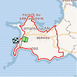
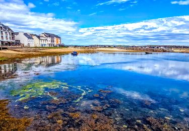
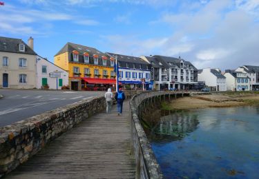
Ruta Senderismo de 18 km a descubrir en Bretaña, Finisterre, Camaret-sur-Mer. Esta ruta ha sido propuesta por Marie-Claire-mcp.
Descripción
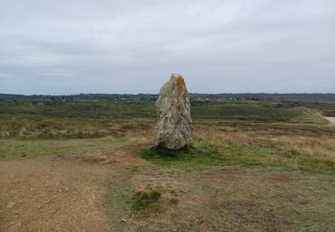
Départ du centre de vacances puis longer la falaise de la Tavelle, pointe de Portzen, hameau de Rigonou, trois Dolmen, puis sentier litoral jusqu'à Camaret puis Pointe du grand Goin, pointe du Tourlinguet et remonter vers la pointe de Pen Hir
Localización
Comentarios
Excursiones cerca
![Excursión Senderismo Camaret-sur-Mer - Camaret - Photo](https://media.geolcdn.com/t/375/260/da3799c5-a973-4bc5-ad07-ecea575496f6.jpg&format=jpg&maxdim=2)
![Senderismo Senderismo](https://static1.geolcdn.com/sitytour/trail-icons/101.png)
Senderismo
![](/images/other/stat-length.png)
![](https://static1.geolcdn.com/siteimages/upload/files/16400158638029165_repeat_loop_refresh_sync_direction_icon.png)
![Excursión Senderismo Camaret-sur-Mer - Autour de Camaret sur Mer - Photo](https://media.geolcdn.com/t/375/260/aeb5e75f-565d-4c3f-bdae-1cd067ca386f.jpg&format=jpg&maxdim=2)
![Senderismo Senderismo](https://static1.geolcdn.com/sitytour/trail-icons/101.png)
Senderismo
![](/images/other/stat-length.png)
![](https://static1.geolcdn.com/siteimages/upload/files/16400158638029165_repeat_loop_refresh_sync_direction_icon.png)
![Excursión Senderismo Camaret-sur-Mer - a les 3 pointes de camaret - Photo](https://media.geolcdn.com/t/375/260/ext.jpg?maxdim=2&url=https%3A%2F%2Fservices.sitytrail.com%2FGeolivesWS%2FDownloadMedia.ashx%3FTrailID%3D268935%26Media%3Dfix__20140421164842.jpg)
![Senderismo Senderismo](https://static1.geolcdn.com/sitytour/trail-icons/101.png)
Senderismo
![](/images/other/stat-length.png)
![](https://static1.geolcdn.com/siteimages/upload/files/16400158638029165_repeat_loop_refresh_sync_direction_icon.png)
![Excursión Senderismo Roscanvel - La pointe des Espagnols Boucle 18 km - Photo](https://media.geolcdn.com/t/375/260/93ad904e-720a-4417-9e64-50801db79033.jpg&format=jpg&maxdim=2)
![Senderismo Senderismo](https://static1.geolcdn.com/sitytour/trail-icons/101.png)
Senderismo
![](/images/other/stat-length.png)
![](https://static1.geolcdn.com/siteimages/upload/files/16400158638029165_repeat_loop_refresh_sync_direction_icon.png)
![Excursión Senderismo Camaret-sur-Mer - Boucle découverte Camaret village 6km - Photo](https://media.geolcdn.com/t/375/260/e9cd72b4-dd3f-43ce-987c-e3506f4b46d9.jpg&format=jpg&maxdim=2)
![Senderismo Senderismo](https://static1.geolcdn.com/sitytour/trail-icons/101.png)
Senderismo
![](/images/other/stat-length.png)
![](https://static1.geolcdn.com/siteimages/upload/files/16400158638029165_repeat_loop_refresh_sync_direction_icon.png)
![Excursión Senderismo Roscanvel - Quélern - Pointe des Espagnols Boucle GR34 - 20.2km 325m 5h15 (35mn) - 2019 09 10 - Photo](https://media.geolcdn.com/t/375/260/d3722b6e-34eb-4a9e-a2a0-ac45e343e6f5.jpg&format=jpg&maxdim=2)
![Senderismo Senderismo](https://static1.geolcdn.com/sitytour/trail-icons/101.png)
Senderismo
![](/images/other/stat-length.png)
![](https://static1.geolcdn.com/siteimages/upload/files/16400158638029165_repeat_loop_refresh_sync_direction_icon.png)
![Excursión Senderismo Camaret-sur-Mer - Camaret-sur-Mer - Boucle Pointes du Grand Gouin du Toulinguet de Pen Hir - 12.8km 250m 3h50 - 2019 09 09 - Photo](https://media.geolcdn.com/t/375/260/5859df70-afda-44bb-9b50-b74e5ed5b47c.jpg&format=jpg&maxdim=2)
![Senderismo Senderismo](https://static1.geolcdn.com/sitytour/trail-icons/101.png)
Senderismo
![](/images/other/stat-length.png)
![](https://static1.geolcdn.com/siteimages/upload/files/16400158638029165_repeat_loop_refresh_sync_direction_icon.png)
![Excursión Senderismo Camaret-sur-Mer - tour de camaret - Photo](https://media.geolcdn.com/t/375/260/ext.jpg?maxdim=2&url=https%3A%2F%2Fstatic1.geolcdn.com%2Fsiteimages%2Fupload%2Ffiles%2F1553511878bg_sport_marche.png)
![Senderismo Senderismo](https://static1.geolcdn.com/sitytour/trail-icons/101.png)
Senderismo
![](/images/other/stat-length.png)
![](https://static1.geolcdn.com/siteimages/upload/files/16400158638029165_repeat_loop_refresh_sync_direction_icon.png)
![Excursión Senderismo Camaret-sur-Mer - GR34 Camaret S/Mer --Morgat - Photo](https://media.geolcdn.com/t/375/260/c4d37962-542b-413c-9e95-2c6289ee6fc9.jpg&format=jpg&maxdim=2)
![Senderismo Senderismo](https://static1.geolcdn.com/sitytour/trail-icons/101.png)
Senderismo
![](/images/other/stat-length.png)
![](https://static1.geolcdn.com/siteimages/upload/files/16400158638029165_repeat_loop_refresh_sync_direction_icon.png)