![](/images/other/stat-length.png)
![Excursión Bicicleta Hénanbihen - F30 Touèches Plévenon Pléboule VTC - Photo](https://media.geolcdn.com/t/1900/400/ext.pjpeg?maxdim=2&url=https%3A%2F%2Fstatic1.geolcdn.com%2Fsiteimages%2Fupload%2Ffiles%2F1524743154velo.jpg)
F30 Touèches Plévenon Pléboule VTC
Vincent1960
Usuario
![Longitud](/images/other/stat-length.png)
Longitud
30 km
![Altitud máxima](https://static1.geolcdn.com/siteimages/upload/files/1508320355ic_sort_altitude_max_24dp.png)
Altitud máxima
96 m
![Desnivel positivo](https://static1.geolcdn.com/siteimages/upload/files/1508320355ic_sort_den_pos_24dp.png)
Desnivel positivo
335 m
![Km-Effort](/images/other/stat-length.png)
Km-Effort
35 km
![Altitud mínima](https://static1.geolcdn.com/siteimages/upload/files/1508320355ic_sort_altitude_min_24dp.png)
Altitud mínima
5 m
![Desnivel negativo](https://static1.geolcdn.com/siteimages/upload/files/1508320355ic_sort_den_neg_24dp.png)
Desnivel negativo
337 m
![Boucle](https://static1.geolcdn.com/siteimages/upload/files/16400158638029165_repeat_loop_refresh_sync_direction_icon.png)
Boucle
Sí
Fecha de creación :
2019-04-24 21:20:03.071
Última modificación :
2019-04-24 21:20:03.123
![Bicicleta](https://static1.geolcdn.com/sitytour/trail-icons/200.png)
1h56
Dificultad : Fácil
![Escanee este código QR para abrir la excursión en la aplicación SityTrail](https://capi.geolives.com/qq0zvz2zws4bq2lad0pu/sitytour/trails/781093/qr.png?size=200)
Aplicación GPS de excursión GRATIS
A propósito
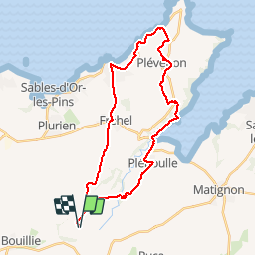
Ruta Bicicleta de 30 km a descubrir en Bretaña, Côtes-d'Armor, Hénanbihen. Esta ruta ha sido propuesta por Vincent1960.
Descripción
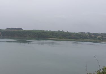
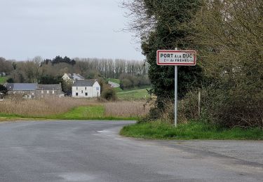
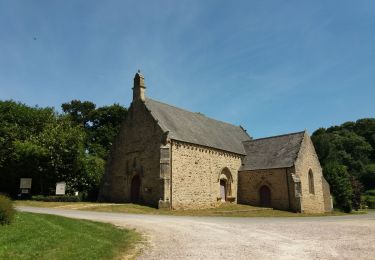
Très belle promenade alliant mer et campagne à travers de très beaux sentiers et voies vertes
Localización
País:
France
Región :
Bretaña
Departamento/provincia :
Côtes-d'Armor
Municipio :
Hénanbihen
Localidad:
Unknown
Salida:(Dec)
Salida:(UTM)
545153 ; 5380921 (30U) N.
Comentarios
Excursiones cerca
![Excursión Senderismo Fréhel - GR_34_BE_11_Frehel_Plevenon_20230508 - Photo](https://media.geolcdn.com/t/375/260/3e54842b-d65f-48b7-a2a7-3080a664fcb3.jpg&format=jpg&maxdim=2)
![Senderismo Senderismo](https://static1.geolcdn.com/sitytour/trail-icons/101.png)
GR_34_BE_11_Frehel_Plevenon_20230508
Senderismo
Medio
Fréhel,
Bretaña,
Côtes-d'Armor,
France
![](/images/other/stat-length.png)
19,1 km | 24 km-effort
6h 9min
![](https://static1.geolcdn.com/siteimages/upload/files/16400158638029165_repeat_loop_refresh_sync_direction_icon.png)
No
![Excursión Senderismo Fréhel - PORT à la DUC. ..... FORT LALATTE - Photo](https://media.geolcdn.com/t/375/260/3902333c-5fc1-4bec-a269-7c80c04af246.jpg&format=jpg&maxdim=2)
![Senderismo Senderismo](https://static1.geolcdn.com/sitytour/trail-icons/101.png)
PORT à la DUC. ..... FORT LALATTE
Senderismo
Medio
Fréhel,
Bretaña,
Côtes-d'Armor,
France
![](/images/other/stat-length.png)
16,8 km | 21 km-effort
5h 0min
![](https://static1.geolcdn.com/siteimages/upload/files/16400158638029165_repeat_loop_refresh_sync_direction_icon.png)
Sí
![Excursión Bici eléctrica Pléboulle - le Cap Frehel en boucle à partir de Pleboulle - Photo](https://media.geolcdn.com/t/375/260/10a542b6-397c-4da9-9694-5dfb679111e2.jpg&format=jpg&maxdim=2)
![Bici eléctrica Bici eléctrica](https://static1.geolcdn.com/sitytour/trail-icons/205.png)
le Cap Frehel en boucle à partir de Pleboulle
Bici eléctrica
Medio
Pléboulle,
Bretaña,
Côtes-d'Armor,
France
![](/images/other/stat-length.png)
33 km | 38 km-effort
2h 46min
![](https://static1.geolcdn.com/siteimages/upload/files/16400158638029165_repeat_loop_refresh_sync_direction_icon.png)
Sí
![Excursión Paseo ecuestre Pléboulle - rdv - Photo](https://media.geolcdn.com/t/375/260/ext.jpg?maxdim=2&url=https%3A%2F%2Fstatic1.geolcdn.com%2Fsiteimages%2Fupload%2Ffiles%2F1524743154cheval.jpg)
![Paseo ecuestre Paseo ecuestre](https://static1.geolcdn.com/sitytour/trail-icons/301.png)
rdv
Paseo ecuestre
Difícil
Pléboulle,
Bretaña,
Côtes-d'Armor,
France
![](/images/other/stat-length.png)
31 km | 36 km-effort
4h 30min
![](https://static1.geolcdn.com/siteimages/upload/files/16400158638029165_repeat_loop_refresh_sync_direction_icon.png)
No
![Excursión Senderismo Hénanbihen - Hénanbihen (boucle) - Photo](https://media.geolcdn.com/t/375/260/ext.jpg?maxdim=2&url=https%3A%2F%2Fstatic1.geolcdn.com%2Fsiteimages%2Fupload%2Ffiles%2F1553511878bg_sport_marche.png)
![Senderismo Senderismo](https://static1.geolcdn.com/sitytour/trail-icons/101.png)
Hénanbihen (boucle)
Senderismo
Medio
Hénanbihen,
Bretaña,
Côtes-d'Armor,
France
![](/images/other/stat-length.png)
12,2 km | 14 km-effort
3h 5min
![](https://static1.geolcdn.com/siteimages/upload/files/16400158638029165_repeat_loop_refresh_sync_direction_icon.png)
Sí
![Excursión Senderismo Pléboulle - pleboulle-cap frehel - Photo](https://media.geolcdn.com/t/375/260/ext.jpg?maxdim=2&url=https%3A%2F%2Fstatic1.geolcdn.com%2Fsiteimages%2Fupload%2Ffiles%2F1553511878bg_sport_marche.png)
![Senderismo Senderismo](https://static1.geolcdn.com/sitytour/trail-icons/101.png)
pleboulle-cap frehel
Senderismo
Medio
Pléboulle,
Bretaña,
Côtes-d'Armor,
France
![](/images/other/stat-length.png)
17,1 km | 22 km-effort
3h 34min
![](https://static1.geolcdn.com/siteimages/upload/files/16400158638029165_repeat_loop_refresh_sync_direction_icon.png)
No
![Excursión Marcha nórdica Pléboulle - GR34 (4) Pléboulle - Pléhérel (anse du croc) (camping du Pont de l'étang) - Photo](https://media.geolcdn.com/t/375/260/ext.jpg?maxdim=2&url=https%3A%2F%2Fstatic1.geolcdn.com%2Fsiteimages%2Fupload%2Ffiles%2F1545311037marcheuse_200dpi.jpg)
![Marcha nórdica Marcha nórdica](https://static1.geolcdn.com/sitytour/trail-icons/102.png)
GR34 (4) Pléboulle - Pléhérel (anse du croc) (camping du Pont de l'étang)
Marcha nórdica
Medio
Pléboulle,
Bretaña,
Côtes-d'Armor,
France
![](/images/other/stat-length.png)
24 km | 30 km-effort
4h 50min
![](https://static1.geolcdn.com/siteimages/upload/files/16400158638029165_repeat_loop_refresh_sync_direction_icon.png)
No
![Excursión Senderismo Fréhel - GR34-EtapeI-J04 - Photo](https://media.geolcdn.com/t/375/260/ext.jpg?maxdim=2&url=https%3A%2F%2Fstatic1.geolcdn.com%2Fsiteimages%2Fupload%2Ffiles%2F1553511878bg_sport_marche.png)
![Senderismo Senderismo](https://static1.geolcdn.com/sitytour/trail-icons/101.png)
GR34-EtapeI-J04
Senderismo
Medio
Fréhel,
Bretaña,
Côtes-d'Armor,
France
![](/images/other/stat-length.png)
21 km | 26 km-effort
6h 30min
![](https://static1.geolcdn.com/siteimages/upload/files/16400158638029165_repeat_loop_refresh_sync_direction_icon.png)
No
![Excursión Senderismo Fréhel - Port à la Duc 8k - Photo](https://media.geolcdn.com/t/375/260/ext.jpg?maxdim=2&url=https%3A%2F%2Fstatic1.geolcdn.com%2Fsiteimages%2Fupload%2Ffiles%2F1553511878bg_sport_marche.png)
![Senderismo Senderismo](https://static1.geolcdn.com/sitytour/trail-icons/101.png)
Port à la Duc 8k
Senderismo
Medio
Fréhel,
Bretaña,
Côtes-d'Armor,
France
![](/images/other/stat-length.png)
9,2 km | 11,1 km-effort
2h 31min
![](https://static1.geolcdn.com/siteimages/upload/files/16400158638029165_repeat_loop_refresh_sync_direction_icon.png)
No