![](/images/other/stat-length.png)
![Excursión Senderismo Büllingen - Manderfeld langs de Our - Photo](https://media.geolcdn.com/t/1900/400/ext.pjpeg?maxdim=2&url=https%3A%2F%2Fservices.sitytrail.com%2FGeolivesWS%2FDownloadMedia.ashx%3FTrailID%3D780303%26Media%3De747a43e-93c8-49c2-a2fd-b429011d2d85.jpg)
Manderfeld langs de Our
KoenV
Usuario
![Longitud](/images/other/stat-length.png)
![Altitud máxima](https://static1.geolcdn.com/siteimages/upload/files/1508320355ic_sort_altitude_max_24dp.png)
![Desnivel positivo](https://static1.geolcdn.com/siteimages/upload/files/1508320355ic_sort_den_pos_24dp.png)
![Km-Effort](/images/other/stat-length.png)
![Altitud mínima](https://static1.geolcdn.com/siteimages/upload/files/1508320355ic_sort_altitude_min_24dp.png)
![Desnivel negativo](https://static1.geolcdn.com/siteimages/upload/files/1508320355ic_sort_den_neg_24dp.png)
![Boucle](https://static1.geolcdn.com/siteimages/upload/files/16400158638029165_repeat_loop_refresh_sync_direction_icon.png)
![Senderismo](https://static1.geolcdn.com/sitytour/trail-icons/101.png)
3h31
Dificultad : Medio
![Escanee este código QR para abrir la excursión en la aplicación SityTrail](https://capi.geolives.com/qq0zvz2zws4bq2lad0pu/sitytour/trails/780303/qr.png?size=200)
Aplicación GPS de excursión GRATIS
A propósito
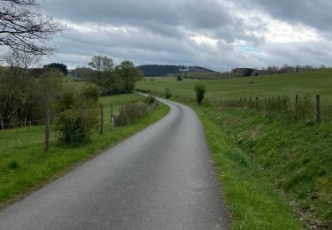
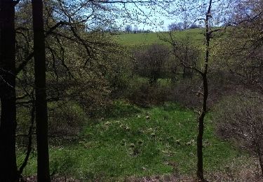
Ruta Senderismo de 12,3 km a descubrir en Valonia, Lieja, Büllingen. Esta ruta ha sido propuesta por KoenV.
Descripción
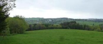
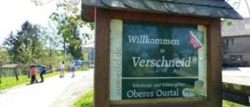
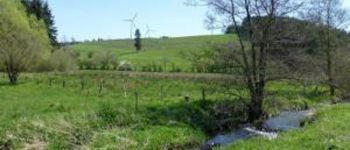
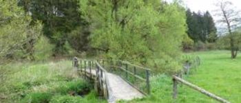
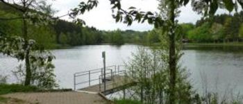
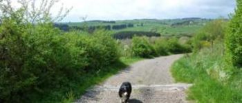
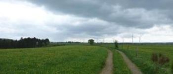
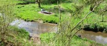
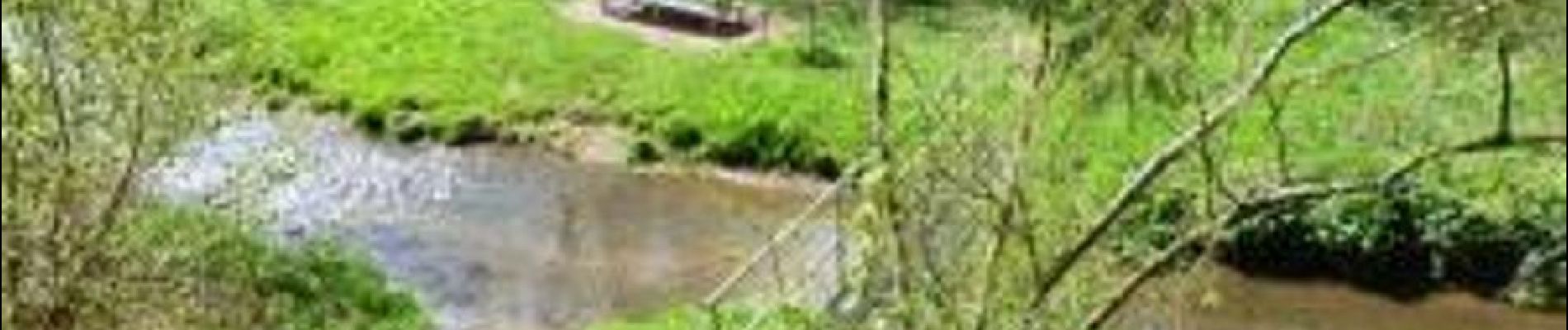
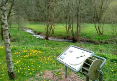
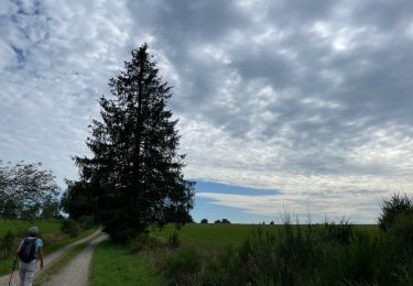
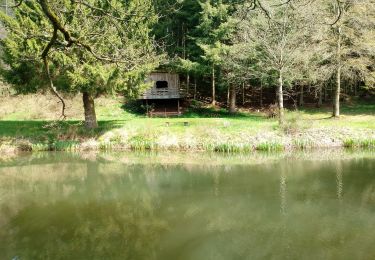
Vertrek aan de kerk van Manderfeld, parkeerplaatsen aanwezig. Wandeling doorheen het prachtige Belgisch- Duitse Eifellandschap, langsheen de oevers van de Our, met weidse uitzichten. Tijdens deze wandeling zijn er regelmatig zitbanken zodat af en toe rusten of picknicken mogelijk is. Eetmogelijkheid aan het vertrek- of aankomstpunt "Eifelerhof" in Manderfeld of in Auw
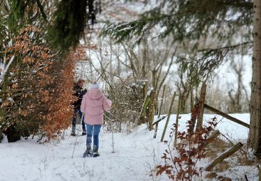
Localización
Comentarios
Excursiones cerca
![Excursión Raquetas de nieve Büllingen - Manderfeld (PVDB) - Photo](https://media.geolcdn.com/t/375/260/b5720bc8-7e16-46db-8525-f855b770a68c.jpg&format=jpg&maxdim=2)
![Raquetas de nieve Raquetas de nieve](https://static1.geolcdn.com/sitytour/trail-icons/504.png)
Raquetas de nieve
![](/images/other/stat-length.png)
![](https://static1.geolcdn.com/siteimages/upload/files/16400158638029165_repeat_loop_refresh_sync_direction_icon.png)
![Excursión A pie Büllingen - GrWandArd 15 Büchholz de pracht van het NP Eifel - Photo](https://media.geolcdn.com/t/375/260/0ae2ff0c-760f-408b-9aeb-c9e415472963.jpg&format=jpg&maxdim=2)
![A pie A pie](https://static1.geolcdn.com/sitytour/trail-icons/100.png)
A pie
![](/images/other/stat-length.png)
![](https://static1.geolcdn.com/siteimages/upload/files/16400158638029165_repeat_loop_refresh_sync_direction_icon.png)
![Excursión Senderismo Büllingen - wassererlebnispfad - Photo](https://media.geolcdn.com/t/375/260/f0c8da52-43c7-48ec-a405-ca86743d74c1.jpg&format=jpg&maxdim=2)
![Senderismo Senderismo](https://static1.geolcdn.com/sitytour/trail-icons/101.png)
Senderismo
![](/images/other/stat-length.png)
![](https://static1.geolcdn.com/siteimages/upload/files/16400158638029165_repeat_loop_refresh_sync_direction_icon.png)
![Excursión Senderismo Büllingen - Panorama Medendoef - Photo](https://media.geolcdn.com/t/375/260/15c7e70e-f172-4e7d-8119-2386986dbb50.jpg&format=jpg&maxdim=2)
![Senderismo Senderismo](https://static1.geolcdn.com/sitytour/trail-icons/101.png)
Senderismo
![](/images/other/stat-length.png)
![](https://static1.geolcdn.com/siteimages/upload/files/16400158638029165_repeat_loop_refresh_sync_direction_icon.png)
![Excursión Senderismo Amel - Herresbach - Photo](https://media.geolcdn.com/t/375/260/36e68325-3115-448f-9d2b-5df1ad3dc287.jpg&format=jpg&maxdim=2)
![Senderismo Senderismo](https://static1.geolcdn.com/sitytour/trail-icons/101.png)
![Excursión Carrera Büllingen - Haus der Stille - Photo](https://media.geolcdn.com/t/375/260/e9b2879b-5882-4613-a403-4a5fcb141089.jpg&format=jpg&maxdim=2)
![Carrera Carrera](https://static1.geolcdn.com/sitytour/trail-icons/103.png)
Carrera
![](/images/other/stat-length.png)
![](https://static1.geolcdn.com/siteimages/upload/files/16400158638029165_repeat_loop_refresh_sync_direction_icon.png)
![Excursión Senderismo Sankt Vith - Andler 7 Km - Photo](https://media.geolcdn.com/t/375/260/2e6fd033-933b-45db-9026-8d48e5a0b27c.jpg&format=jpg&maxdim=2)
![Senderismo Senderismo](https://static1.geolcdn.com/sitytour/trail-icons/101.png)
![Excursión Carrera Büllingen - Huis der stille - Photo](https://media.geolcdn.com/t/375/260/ext.jpg?maxdim=2&url=https%3A%2F%2Fstatic1.geolcdn.com%2Fsiteimages%2Fupload%2Ffiles%2F1524743154running.jpg)
![Carrera Carrera](https://static1.geolcdn.com/sitytour/trail-icons/103.png)
![Excursión Otra actividad Büllingen - Holzheim o - Photo](https://media.geolcdn.com/t/375/260/ext.jpg?maxdim=2&url=https%3A%2F%2Fservices.sitytrail.com%2FGeolivesWS%2FDownloadMedia.ashx%3FTrailID%3D564595%26Media%3Dfix__20160506134821.jpg)
![Otra actividad Otra actividad](https://static1.geolcdn.com/sitytour/trail-icons/900.png)
Otra actividad
![](/images/other/stat-length.png)
![](https://static1.geolcdn.com/siteimages/upload/files/16400158638029165_repeat_loop_refresh_sync_direction_icon.png)