


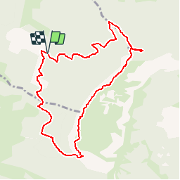


6,4 km | 11,2 km-effort


Usuario


Aplicación GPS de excursión GRATIS
 SityTrail
IGN / Institutos geográficos
SityTrail World
El mundo es suyo
Ruta Senderismo de 9,5 km a descubrir en Auvergne-Rhône-Alpes, Drôme, Saint-Vincent-la-Commanderie. Esta ruta ha sido propuesta por ageo.
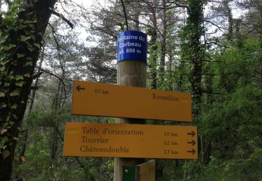
Du pas de Saint Vincent au pas du Touet, ne pas suivre la crête et prendre le chemin qui passe à Barraquand.
Senderismo

Senderismo

Senderismo

Senderismo

Senderismo
Senderismo
Senderismo

Senderismo

Senderismo