![](/images/other/stat-length.png)
![Excursión Senderismo Larchant - M&R-170303 - MtBlanc-DameJouanne - Photo](https://media.geolcdn.com/t/1900/400/ext.pjpeg?maxdim=2&url=https%3A%2F%2Fservices.sitytrail.com%2FGeolivesWS%2FDownloadMedia.ashx%3FTrailID%3D760635%26Media%3Dcb782408-ad0a-4cd7-b1ea-eae477cec3b7.jpg)
M&R-170303 - MtBlanc-DameJouanne
MarcheEtReve
Usuario
![Longitud](/images/other/stat-length.png)
![Altitud máxima](https://static1.geolcdn.com/siteimages/upload/files/1508320355ic_sort_altitude_max_24dp.png)
![Desnivel positivo](https://static1.geolcdn.com/siteimages/upload/files/1508320355ic_sort_den_pos_24dp.png)
![Km-Effort](/images/other/stat-length.png)
![Altitud mínima](https://static1.geolcdn.com/siteimages/upload/files/1508320355ic_sort_altitude_min_24dp.png)
![Desnivel negativo](https://static1.geolcdn.com/siteimages/upload/files/1508320355ic_sort_den_neg_24dp.png)
![Boucle](https://static1.geolcdn.com/siteimages/upload/files/16400158638029165_repeat_loop_refresh_sync_direction_icon.png)
![Senderismo](https://static1.geolcdn.com/sitytour/trail-icons/101.png)
5h00
Dificultad : Medio
![Escanee este código QR para abrir la excursión en la aplicación SityTrail](https://capi.geolives.com/qq0zvz2zws4bq2lad0pu/sitytour/trails/760635/qr.png?size=200)
Aplicación GPS de excursión GRATIS
A propósito
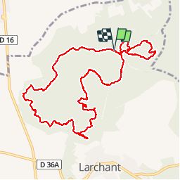
Ruta Senderismo de 11,8 km a descubrir en Isla de Francia, Sena y Marne, Larchant. Esta ruta ha sido propuesta por MarcheEtReve.
Descripción
=== Copie de randodan ===<br>
Rando Mont Blanc et Dame Jouanne avec Marche et Rêve<br>
- 3 mars 2017 -<br>
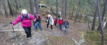
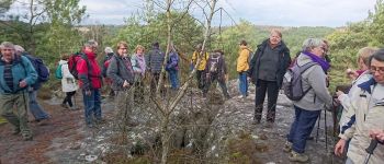
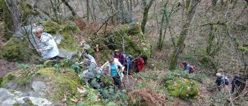
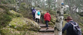
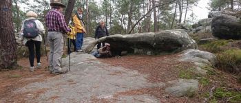
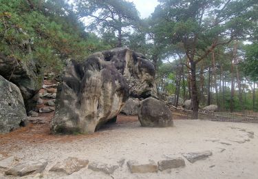
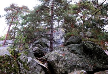
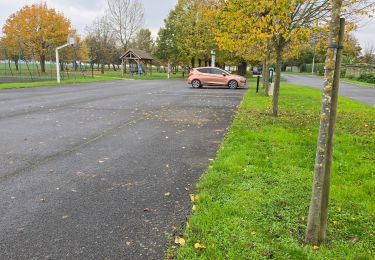
Départ 9h35 du parking de l'auberge et nous attaquons le Denecourt n°19, nommé aussi "Tour du Golfe de Larchant" . Quelques bonnes grimpettes sur le Mont Simonet et le Rocher de la Justice, ça nous fait apprécier, à 10h45, la pause biberon à l'Éléphant.<br>
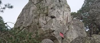
La Fontaine St-Mathurin, encore une grimpette au passage du Auvent, puis c'est l'ascension du Mont Blanc, 4810 m... heu non, seulement 112 m.<br>
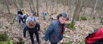
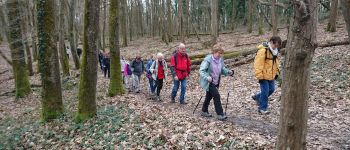
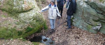
3/4h de marche dans cette belle Forêt Domaniale de la Commanderie, et tout d'un coup, Francine s'exclame : "Tiens, y a d'l'eau !" Et toc ! C'est la fameuse Fontaine St-Bernard qu'il était prévu rechercher . Bravo Francine.<br>
Une heure moins dix, arrivons à l'Auberge de la Dame Jouanne pour le saumon à la plancha.<br>
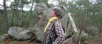
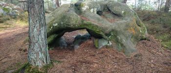
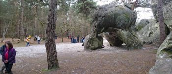
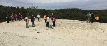
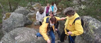
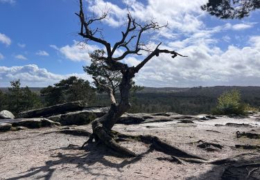
15h, nous repartons pour le tour de la Dame Jouanne . Vue de dessus de la Dame . Puis descendons par la diaclase et repassons au pied de la grande Dame par un petit hors piste.<br>
16h45, de retour aux voitures.<br>
Nous étions 27 grimpeurs sur le Mont Blanc.
Puntos de interés
Localización
Comentarios
Excursiones cerca
![Excursión Senderismo Recloses - Boucle recloses Nemours Grez/loing - Photo](https://media.geolcdn.com/t/375/260/191d15c7-1e16-40f7-89b9-dd7f9d0cddba.jpg&format=jpg&maxdim=2)
![Senderismo Senderismo](https://static1.geolcdn.com/sitytour/trail-icons/101.png)
Senderismo
![](/images/other/stat-length.png)
![](https://static1.geolcdn.com/siteimages/upload/files/16400158638029165_repeat_loop_refresh_sync_direction_icon.png)
![Excursión Senderismo Larchant - Larchant la Féérique - Photo](https://media.geolcdn.com/t/375/260/6d6c76e3-bdd9-40d1-a9ae-e6ab32ef1956.jpg&format=jpg&maxdim=2)
![Senderismo Senderismo](https://static1.geolcdn.com/sitytour/trail-icons/101.png)
Senderismo
![](/images/other/stat-length.png)
![](https://static1.geolcdn.com/siteimages/upload/files/16400158638029165_repeat_loop_refresh_sync_direction_icon.png)
![Excursión A pie Larchant - Sentier Denecourt-Colinet 19 - Photo](https://media.geolcdn.com/t/375/260/59338975-b7a3-4665-980b-9d3063da6c07.jpeg&format=jpg&maxdim=2)
![A pie A pie](https://static1.geolcdn.com/sitytour/trail-icons/100.png)
A pie
![](/images/other/stat-length.png)
![](https://static1.geolcdn.com/siteimages/upload/files/16400158638029165_repeat_loop_refresh_sync_direction_icon.png)
![Excursión Senderismo Amponville - Amponville - Dolmen dit la Pierre Larmoire - Photo](https://media.geolcdn.com/t/375/260/0d43a259-bccc-4e5b-a61d-e8068d2b0230.jpg&format=jpg&maxdim=2)
![Senderismo Senderismo](https://static1.geolcdn.com/sitytour/trail-icons/101.png)
Senderismo
![](/images/other/stat-length.png)
![](https://static1.geolcdn.com/siteimages/upload/files/16400158638029165_repeat_loop_refresh_sync_direction_icon.png)
![Excursión Senderismo Villiers-sous-Grez - Villiers sous grez / Larchant - Photo](https://media.geolcdn.com/t/375/260/2e824322-f7f9-4370-b291-7ab8bf6e7f9c.jpeg&format=jpg&maxdim=2)
![Senderismo Senderismo](https://static1.geolcdn.com/sitytour/trail-icons/101.png)
Senderismo
![](/images/other/stat-length.png)
![](https://static1.geolcdn.com/siteimages/upload/files/16400158638029165_repeat_loop_refresh_sync_direction_icon.png)
![Excursión Senderismo Recloses - Recloses Ve120124 pm - Photo](https://media.geolcdn.com/t/375/260/ext.jpg?maxdim=2&url=https%3A%2F%2Fstatic1.geolcdn.com%2Fsiteimages%2Fupload%2Ffiles%2F1553511878bg_sport_marche.png)
![Senderismo Senderismo](https://static1.geolcdn.com/sitytour/trail-icons/101.png)
Senderismo
![](/images/other/stat-length.png)
![](https://static1.geolcdn.com/siteimages/upload/files/16400158638029165_repeat_loop_refresh_sync_direction_icon.png)
![Excursión Senderismo Recloses - Recloses ve 120124 am - Photo](https://media.geolcdn.com/t/375/260/ext.jpg?maxdim=2&url=https%3A%2F%2Fstatic1.geolcdn.com%2Fsiteimages%2Fupload%2Ffiles%2F1553511878bg_sport_marche.png)
![Senderismo Senderismo](https://static1.geolcdn.com/sitytour/trail-icons/101.png)
Senderismo
![](/images/other/stat-length.png)
![](https://static1.geolcdn.com/siteimages/upload/files/16400158638029165_repeat_loop_refresh_sync_direction_icon.png)
![Excursión Senderismo Recloses - Recloses Ve 280423 SR30042323 PM10km - Photo](https://media.geolcdn.com/t/375/260/ext.jpg?maxdim=2&url=https%3A%2F%2Fstatic1.geolcdn.com%2Fsiteimages%2Fupload%2Ffiles%2F1553511878bg_sport_marche.png)
![Senderismo Senderismo](https://static1.geolcdn.com/sitytour/trail-icons/101.png)
Senderismo
![](/images/other/stat-length.png)
![](https://static1.geolcdn.com/siteimages/upload/files/16400158638029165_repeat_loop_refresh_sync_direction_icon.png)
![Excursión Marcha nórdica Larchant - Dame Juane - Photo](https://media.geolcdn.com/t/375/260/bdae311e-408b-4eeb-853e-c7a245eb80a6.jpg&format=jpg&maxdim=2)
![Marcha nórdica Marcha nórdica](https://static1.geolcdn.com/sitytour/trail-icons/102.png)
Marcha nórdica
![](/images/other/stat-length.png)
![](https://static1.geolcdn.com/siteimages/upload/files/16400158638029165_repeat_loop_refresh_sync_direction_icon.png)