![](/images/other/stat-length.png)
![Excursión Senderismo Méthamis - ISLE-sur-la-Sorgue (METHAMIS - Gorges de la Nesque) - Photo](https://media.geolcdn.com/t/1900/400/ext.pjpeg?maxdim=2&url=https%3A%2F%2Fservices.sitytrail.com%2FGeolivesWS%2FDownloadMedia.ashx%3FTrailID%3D754493%26Media%3Dfix__20170517143127.jpg)
ISLE-sur-la-Sorgue (METHAMIS - Gorges de la Nesque)
GerardBouche
Usuario
![Longitud](/images/other/stat-length.png)
![Altitud máxima](https://static1.geolcdn.com/siteimages/upload/files/1508320355ic_sort_altitude_max_24dp.png)
![Desnivel positivo](https://static1.geolcdn.com/siteimages/upload/files/1508320355ic_sort_den_pos_24dp.png)
![Km-Effort](/images/other/stat-length.png)
![Altitud mínima](https://static1.geolcdn.com/siteimages/upload/files/1508320355ic_sort_altitude_min_24dp.png)
![Desnivel negativo](https://static1.geolcdn.com/siteimages/upload/files/1508320355ic_sort_den_neg_24dp.png)
![Boucle](https://static1.geolcdn.com/siteimages/upload/files/16400158638029165_repeat_loop_refresh_sync_direction_icon.png)
![Senderismo](https://static1.geolcdn.com/sitytour/trail-icons/101.png)
3h33
Dificultad : Medio
![Escanee este código QR para abrir la excursión en la aplicación SityTrail](https://capi.geolives.com/qq0zvz2zws4bq2lad0pu/sitytour/trails/754493/qr.png?size=200)
Aplicación GPS de excursión GRATIS
A propósito
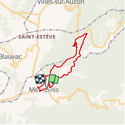
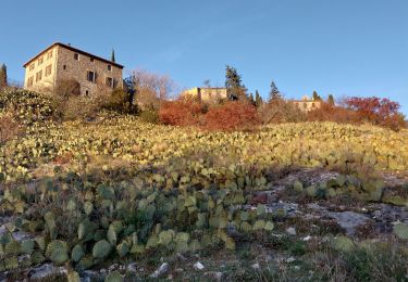
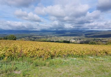
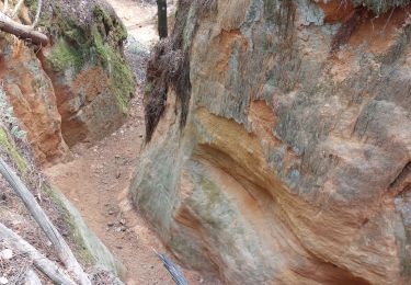
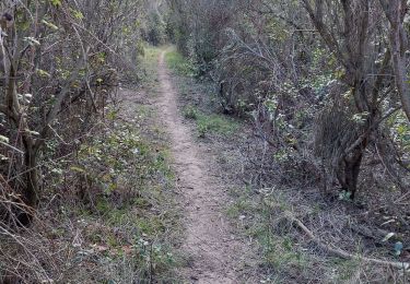
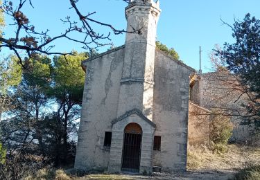
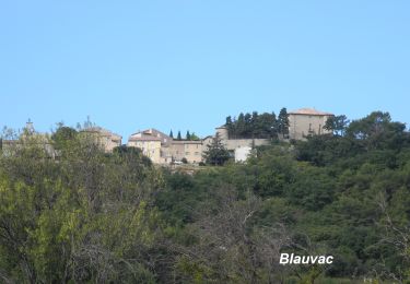
Ruta Senderismo de 12,5 km a descubrir en Provenza-Alpes-Costa Azul, Vaucluse, Méthamis. Esta ruta ha sido propuesta por GerardBouche.
Descripción
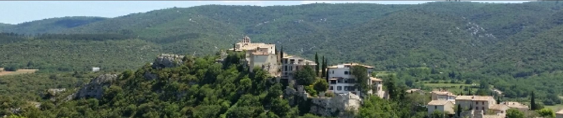
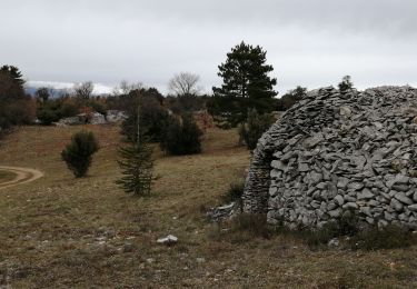
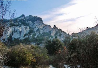
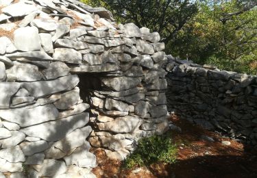
Au départ de Méthamis, un Très beau parcours ... d'abord caillouteux pendant 3,5 km dans le lit asséché de la Nesque. Par le "Ravin de Malaval" rejoindre les hauteurs et le retour par de petits sentiers dans la garrigue de buis-chênes "kermès/vert"romarin et senteurs provençales... un itinéraire agréable avec vue sur le Ventoux et au lieu dit "La Togne"un ancien four à chaux.
Localización
Comentarios
Excursiones cerca
![Excursión Senderismo Villes-sur-Auzon - villes sur auzon - Photo](https://media.geolcdn.com/t/375/260/0e280ec1-76df-4cda-81c1-92933dd2eb5d.jpg&format=jpg&maxdim=2)
![Senderismo Senderismo](https://static1.geolcdn.com/sitytour/trail-icons/101.png)
Senderismo
![](/images/other/stat-length.png)
![](https://static1.geolcdn.com/siteimages/upload/files/16400158638029165_repeat_loop_refresh_sync_direction_icon.png)
![Excursión Senderismo Méthamis - De Méthamis au four à chaux par la Gorge de la Nesque - Photo](https://media.geolcdn.com/t/375/260/ext.jpg?maxdim=2&url=https%3A%2F%2Fservices.sitytrail.com%2FGeolivesWS%2FDownloadMedia.ashx%3FTrailID%3D103445%26Media%3D5566_1.jpg)
![Senderismo Senderismo](https://static1.geolcdn.com/sitytour/trail-icons/101.png)
Senderismo
![](/images/other/stat-length.png)
![](https://static1.geolcdn.com/siteimages/upload/files/16400158638029165_repeat_loop_refresh_sync_direction_icon.png)
![Excursión Senderismo Méthamis - Sentiers sauvage de Méthamis - Photo](https://media.geolcdn.com/t/375/260/e268b0c0-fd60-4bfd-99f0-644b7c3d5e6d.jpg&format=jpg&maxdim=2)
![Senderismo Senderismo](https://static1.geolcdn.com/sitytour/trail-icons/101.png)
Senderismo
![](/images/other/stat-length.png)
![](https://static1.geolcdn.com/siteimages/upload/files/16400158638029165_repeat_loop_refresh_sync_direction_icon.png)
![Excursión Senderismo Blauvac - Un automne à Blauvac - Photo](https://media.geolcdn.com/t/375/260/c48d342f-3f81-4d97-866a-e8feb5b6e068.jpg&format=jpg&maxdim=2)
![Senderismo Senderismo](https://static1.geolcdn.com/sitytour/trail-icons/101.png)
Senderismo
![](/images/other/stat-length.png)
![](https://static1.geolcdn.com/siteimages/upload/files/16400158638029165_repeat_loop_refresh_sync_direction_icon.png)
![Excursión Senderismo Mormoiron - Ocres et forêt - Photo](https://media.geolcdn.com/t/375/260/35d12fb1-6bc6-4830-93b7-60e66fd303e1.jpg&format=jpg&maxdim=2)
![Senderismo Senderismo](https://static1.geolcdn.com/sitytour/trail-icons/101.png)
Senderismo
![](/images/other/stat-length.png)
![](https://static1.geolcdn.com/siteimages/upload/files/16400158638029165_repeat_loop_refresh_sync_direction_icon.png)
![Excursión Senderismo Mazan - Boucle NdA - Photo](https://media.geolcdn.com/t/375/260/161268ed-640e-4568-9c07-c4e064f489f3.jpg&format=jpg&maxdim=2)
![Senderismo Senderismo](https://static1.geolcdn.com/sitytour/trail-icons/101.png)
Senderismo
![](/images/other/stat-length.png)
![](https://static1.geolcdn.com/siteimages/upload/files/16400158638029165_repeat_loop_refresh_sync_direction_icon.png)
![Excursión Senderismo Blauvac - Passichaud Bergerie Pas du loup - Photo](https://media.geolcdn.com/t/375/260/61b46099-d063-4c59-b83e-1f9759560630.jpg&format=jpg&maxdim=2)
![Senderismo Senderismo](https://static1.geolcdn.com/sitytour/trail-icons/101.png)
Senderismo
![](/images/other/stat-length.png)
![](https://static1.geolcdn.com/siteimages/upload/files/16400158638029165_repeat_loop_refresh_sync_direction_icon.png)
![Excursión Senderismo Mazan - Mazan vers Blauvac, Notre Dame des Anges - Photo](https://media.geolcdn.com/t/375/260/653a59fb-5ee8-44e0-a576-e43e7ca3fd4c.jpg&format=jpg&maxdim=2)
![Senderismo Senderismo](https://static1.geolcdn.com/sitytour/trail-icons/101.png)
Senderismo
![](/images/other/stat-length.png)
![](https://static1.geolcdn.com/siteimages/upload/files/16400158638029165_repeat_loop_refresh_sync_direction_icon.png)
![Senderismo Senderismo](https://static1.geolcdn.com/sitytour/trail-icons/101.png)
Senderismo
![](/images/other/stat-length.png)
![](https://static1.geolcdn.com/siteimages/upload/files/16400158638029165_repeat_loop_refresh_sync_direction_icon.png)