![](/images/other/stat-length.png)
![Excursión Senderismo Contrexéville - Circuit entre forêts, thermes, et sentier des lacs au parc - Photo](https://media.geolcdn.com/t/1900/400/ext.pjpeg?maxdim=2&url=https%3A%2F%2Fservices.sitytrail.com%2FGeolivesWS%2FDownloadMedia.ashx%3FTrailID%3D743882%26Media%3D20170501125537.jpg)
Circuit entre forêts, thermes, et sentier des lacs au parc
Samuel88300
Usuario
![Longitud](/images/other/stat-length.png)
![Altitud máxima](https://static1.geolcdn.com/siteimages/upload/files/1508320355ic_sort_altitude_max_24dp.png)
![Desnivel positivo](https://static1.geolcdn.com/siteimages/upload/files/1508320355ic_sort_den_pos_24dp.png)
![Km-Effort](/images/other/stat-length.png)
![Altitud mínima](https://static1.geolcdn.com/siteimages/upload/files/1508320355ic_sort_altitude_min_24dp.png)
![Desnivel negativo](https://static1.geolcdn.com/siteimages/upload/files/1508320355ic_sort_den_neg_24dp.png)
![Boucle](https://static1.geolcdn.com/siteimages/upload/files/16400158638029165_repeat_loop_refresh_sync_direction_icon.png)
![Senderismo](https://static1.geolcdn.com/sitytour/trail-icons/101.png)
5h04
Dificultad : Fácil
![Escanee este código QR para abrir la excursión en la aplicación SityTrail](https://capi.geolives.com/qq0zvz2zws4bq2lad0pu/sitytour/trails/743882/qr.png?size=200)
Aplicación GPS de excursión GRATIS
A propósito
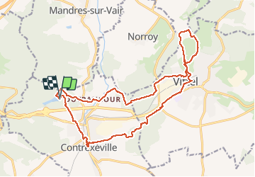
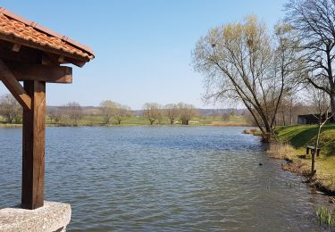
Ruta Senderismo de 19,9 km a descubrir en Gran Este, Vosgos, Contrexéville. Esta ruta ha sido propuesta por Samuel88300.
Descripción
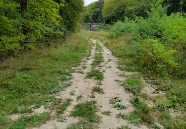
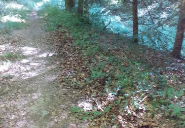
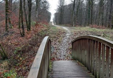
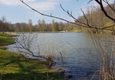
Au départ des lacs de la Folie, promenade agréable sur de larges sentiers forestiers qui vous guideront vers le parc thermal de Vittel, l'hippodrome et le golf. Retour par les chemins du forêt parc de Vittel et par le parc thermal de Contrexeville.
Localización
Comentarios
Excursiones cerca
![Excursión A pie Vittel - Les Crêtes du Montfort - Photo](https://media.geolcdn.com/t/375/260/6d097a10-be74-4800-b8ac-24a92984abd9.jpeg&format=jpg&maxdim=2)
![A pie A pie](https://static1.geolcdn.com/sitytour/trail-icons/100.png)
A pie
![](/images/other/stat-length.png)
![](https://static1.geolcdn.com/siteimages/upload/files/16400158638029165_repeat_loop_refresh_sync_direction_icon.png)
![Excursión Senderismo Vittel - circuit 23 raccourci à 9km sans lac - Photo](https://media.geolcdn.com/t/375/260/1f37caeb-0819-40b6-8fe4-eba891e1b712.jpg&format=jpg&maxdim=2)
![Senderismo Senderismo](https://static1.geolcdn.com/sitytour/trail-icons/101.png)
Senderismo
![](/images/other/stat-length.png)
![](https://static1.geolcdn.com/siteimages/upload/files/16400158638029165_repeat_loop_refresh_sync_direction_icon.png)
![Excursión Senderismo Vittel - circuit Sainte Anne n15 - Photo](https://media.geolcdn.com/t/375/260/9fbdca64-4020-4f2b-b037-25f217db66c8.jpg&format=jpg&maxdim=2)
![Senderismo Senderismo](https://static1.geolcdn.com/sitytour/trail-icons/101.png)
Senderismo
![](/images/other/stat-length.png)
![](https://static1.geolcdn.com/siteimages/upload/files/16400158638029165_repeat_loop_refresh_sync_direction_icon.png)
![Excursión Senderismo Contrexéville - Ccontrex-Bulgnéville-Contrex - Photo](https://media.geolcdn.com/t/375/260/e1e67144-6bc5-475f-bf05-cfe79ce148f4.jpg&format=jpg&maxdim=2)
![Senderismo Senderismo](https://static1.geolcdn.com/sitytour/trail-icons/101.png)
Senderismo
![](/images/other/stat-length.png)
![](https://static1.geolcdn.com/siteimages/upload/files/16400158638029165_repeat_loop_refresh_sync_direction_icon.png)
![Excursión Senderismo Bulgnéville - PR3 Bigneville étang des récollets . Contrexeville lac de conge - Photo](https://media.geolcdn.com/t/375/260/46712255-8914-4568-9eb5-dd676ac6ab0a.jpg&format=jpg&maxdim=2)
![Senderismo Senderismo](https://static1.geolcdn.com/sitytour/trail-icons/101.png)
Senderismo
![](/images/other/stat-length.png)
![](https://static1.geolcdn.com/siteimages/upload/files/16400158638029165_repeat_loop_refresh_sync_direction_icon.png)
![Excursión Senderismo Vittel - petite balade nocturne dans le parc de Vittel - Photo](https://media.geolcdn.com/t/375/260/29a4be39-ba90-486d-a3b4-a441893d3c71.jpg&format=jpg&maxdim=2)
![Senderismo Senderismo](https://static1.geolcdn.com/sitytour/trail-icons/101.png)
Senderismo
![](/images/other/stat-length.png)
![](https://static1.geolcdn.com/siteimages/upload/files/16400158638029165_repeat_loop_refresh_sync_direction_icon.png)
![Excursión Senderismo Bulgnéville - Bulgneville : Sur les traces du passé - Photo](https://media.geolcdn.com/t/375/260/b612b644-5533-4607-b345-26fd9a09b180.jpg&format=jpg&maxdim=2)
![Senderismo Senderismo](https://static1.geolcdn.com/sitytour/trail-icons/101.png)
Senderismo
![](/images/other/stat-length.png)
![](https://static1.geolcdn.com/siteimages/upload/files/16400158638029165_repeat_loop_refresh_sync_direction_icon.png)
![Excursión Senderismo Bulgnéville - Bulgnéville : Circuit court des 2 lacs - Photo](https://media.geolcdn.com/t/375/260/eaa05683-e3dd-4bde-97d3-c916129f3f3b.jpg&format=jpg&maxdim=2)
![Senderismo Senderismo](https://static1.geolcdn.com/sitytour/trail-icons/101.png)
Senderismo
![](/images/other/stat-length.png)
![](https://static1.geolcdn.com/siteimages/upload/files/16400158638029165_repeat_loop_refresh_sync_direction_icon.png)
![Excursión Senderismo Contrexéville - Contrexéville : Vair et voie romaine - Photo](https://media.geolcdn.com/t/375/260/06031a5a-9d1a-4baa-8277-d44122b4a79b.jpg&format=jpg&maxdim=2)
![Senderismo Senderismo](https://static1.geolcdn.com/sitytour/trail-icons/101.png)
Senderismo
![](/images/other/stat-length.png)
![](https://static1.geolcdn.com/siteimages/upload/files/16400158638029165_repeat_loop_refresh_sync_direction_icon.png)