![](/images/other/stat-length.png)
![Excursión Bici de montaña Sainte-Maxime - La nartelle - les saquedes - Photo](https://media.geolcdn.com/t/1900/400/ext.pjpeg?maxdim=2&url=https%3A%2F%2Fstatic1.geolcdn.com%2Fsiteimages%2Fupload%2Ffiles%2F1524743154velo.jpg)
La nartelle - les saquedes
jm.lemore
Usuario
![Longitud](/images/other/stat-length.png)
Longitud
27 km
![Altitud máxima](https://static1.geolcdn.com/siteimages/upload/files/1508320355ic_sort_altitude_max_24dp.png)
Altitud máxima
321 m
![Desnivel positivo](https://static1.geolcdn.com/siteimages/upload/files/1508320355ic_sort_den_pos_24dp.png)
Desnivel positivo
538 m
![Km-Effort](/images/other/stat-length.png)
Km-Effort
35 km
![Altitud mínima](https://static1.geolcdn.com/siteimages/upload/files/1508320355ic_sort_altitude_min_24dp.png)
Altitud mínima
2 m
![Desnivel negativo](https://static1.geolcdn.com/siteimages/upload/files/1508320355ic_sort_den_neg_24dp.png)
Desnivel negativo
533 m
![Boucle](https://static1.geolcdn.com/siteimages/upload/files/16400158638029165_repeat_loop_refresh_sync_direction_icon.png)
Boucle
No
Fecha de creación :
2017-04-16 00:00:00.0
Última modificación :
2017-04-16 00:00:00.0
![Bici de montaña](https://static1.geolcdn.com/sitytour/trail-icons/202.png)
2h35
Dificultad : Medio
![Escanee este código QR para abrir la excursión en la aplicación SityTrail](https://capi.geolives.com/qq0zvz2zws4bq2lad0pu/sitytour/trails/733617/qr.png?size=200)
Aplicación GPS de excursión GRATIS
A propósito
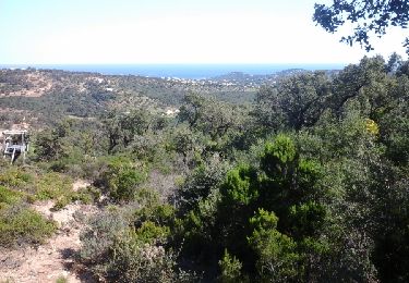
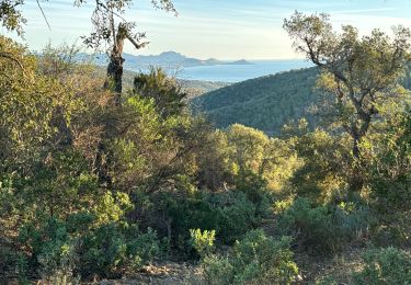
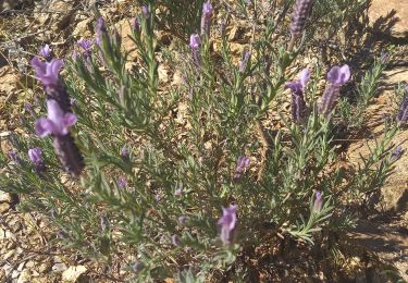
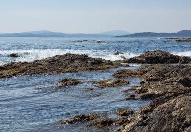
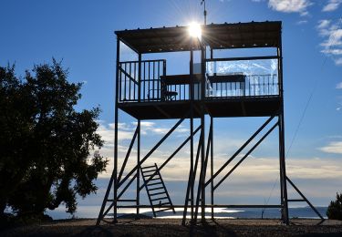
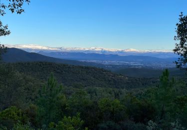
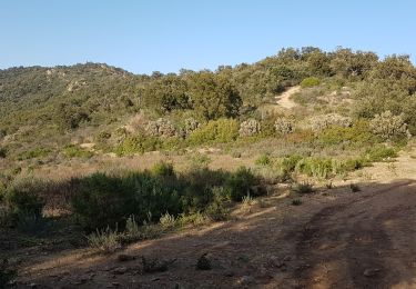
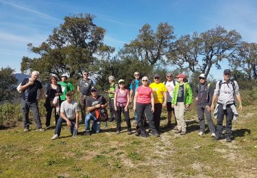
Ruta Bici de montaña de 27 km a descubrir en Provenza-Alpes-Costa Azul, Var, Sainte-Maxime. Esta ruta ha sido propuesta por jm.lemore.
Descripción
niveau moyen. très jolie balade et variée. Les débutants peuvent poser le pied à terre 2 ou 3 fois, mais ça passe.
Localización
País:
France
Región :
Provenza-Alpes-Costa Azul
Departamento/provincia :
Var
Municipio :
Sainte-Maxime
Localidad:
Unknown
Salida:(Dec)
Salida:(UTM)
310647 ; 4799002 (32T) N.
Comentarios
Excursiones cerca
![Excursión Senderismo Sainte-Maxime - la baumette - Photo](https://media.geolcdn.com/t/375/260/ext.jpg?maxdim=2&url=https%3A%2F%2Fservices.sitytrail.com%2FGeolivesWS%2FDownloadMedia.ashx%3FTrailID%3D415513%26Media%3Dfix__20150406153617.jpg)
![Senderismo Senderismo](https://static1.geolcdn.com/sitytour/trail-icons/101.png)
la baumette
Senderismo
Fácil
(1)
Sainte-Maxime,
Provenza-Alpes-Costa Azul,
Var,
France
![](/images/other/stat-length.png)
8,1 km | 10,6 km-effort
2h 25min
![](https://static1.geolcdn.com/siteimages/upload/files/16400158638029165_repeat_loop_refresh_sync_direction_icon.png)
Sí
![Excursión Senderismo Roquebrune-sur-Argens - Col du Bougnon : la Garonnette - Photo](https://media.geolcdn.com/t/375/260/0d614b7a-381f-42c2-94c2-191c569a24dd.jpg&format=jpg&maxdim=2)
![Senderismo Senderismo](https://static1.geolcdn.com/sitytour/trail-icons/101.png)
Col du Bougnon : la Garonnette
Senderismo
Medio
Roquebrune-sur-Argens,
Provenza-Alpes-Costa Azul,
Var,
France
![](/images/other/stat-length.png)
17,6 km | 28 km-effort
6h 16min
![](https://static1.geolcdn.com/siteimages/upload/files/16400158638029165_repeat_loop_refresh_sync_direction_icon.png)
Sí
![Excursión Senderismo Sainte-Maxime - Circuit du Deffend 12.3.23 - Photo](https://media.geolcdn.com/t/375/260/fbd7677e-0d08-4567-88d3-18eb53eac474.jpg&format=jpg&maxdim=2)
![Senderismo Senderismo](https://static1.geolcdn.com/sitytour/trail-icons/101.png)
Circuit du Deffend 12.3.23
Senderismo
Fácil
Sainte-Maxime,
Provenza-Alpes-Costa Azul,
Var,
France
![](/images/other/stat-length.png)
8,4 km | 12,4 km-effort
2h 15min
![](https://static1.geolcdn.com/siteimages/upload/files/16400158638029165_repeat_loop_refresh_sync_direction_icon.png)
Sí
![Excursión Senderismo Roquebrune-sur-Argens - LES ISSAMBRES - BOUCLE PAR SAN PEIRE - Photo](https://media.geolcdn.com/t/375/260/5f778908-4959-4901-8cb5-a585b8ad3339.jpg&format=jpg&maxdim=2)
![Senderismo Senderismo](https://static1.geolcdn.com/sitytour/trail-icons/101.png)
LES ISSAMBRES - BOUCLE PAR SAN PEIRE
Senderismo
Fácil
Roquebrune-sur-Argens,
Provenza-Alpes-Costa Azul,
Var,
France
![](/images/other/stat-length.png)
8,8 km | 11,5 km-effort
5h 6min
![](https://static1.geolcdn.com/siteimages/upload/files/16400158638029165_repeat_loop_refresh_sync_direction_icon.png)
Sí
![Excursión Senderismo Roquebrune-sur-Argens - les petites maures Roquebrume s Argens - Photo](https://media.geolcdn.com/t/375/260/16ebddb9-d7cc-45a5-a3e2-2746f9fa175c.jpg&format=jpg&maxdim=2)
![Senderismo Senderismo](https://static1.geolcdn.com/sitytour/trail-icons/101.png)
les petites maures Roquebrume s Argens
Senderismo
Medio
Roquebrune-sur-Argens,
Provenza-Alpes-Costa Azul,
Var,
France
![](/images/other/stat-length.png)
7,6 km | 11,1 km-effort
2h 7min
![](https://static1.geolcdn.com/siteimages/upload/files/16400158638029165_repeat_loop_refresh_sync_direction_icon.png)
Sí
![Senderismo Senderismo](https://static1.geolcdn.com/sitytour/trail-icons/101.png)
Col du Bougnon - Peigros
Senderismo
Muy difícil
(2)
Roquebrune-sur-Argens,
Provenza-Alpes-Costa Azul,
Var,
France
![](/images/other/stat-length.png)
15,9 km | 24 km-effort
4h 4min
![](https://static1.geolcdn.com/siteimages/upload/files/16400158638029165_repeat_loop_refresh_sync_direction_icon.png)
No
![Excursión Senderismo Roquebrune-sur-Argens - Le Peigros depuis le Bougnon - Photo](https://media.geolcdn.com/t/375/260/c1a2f2b7-0d5f-4ce9-89af-be2b73b8855d.jpg&format=jpg&maxdim=2)
![Senderismo Senderismo](https://static1.geolcdn.com/sitytour/trail-icons/101.png)
Le Peigros depuis le Bougnon
Senderismo
Medio
Roquebrune-sur-Argens,
Provenza-Alpes-Costa Azul,
Var,
France
![](/images/other/stat-length.png)
16,2 km | 25 km-effort
3h 58min
![](https://static1.geolcdn.com/siteimages/upload/files/16400158638029165_repeat_loop_refresh_sync_direction_icon.png)
Sí
![Excursión Senderismo Sainte-Maxime - SAINTE-MAXIME - LE DEFFEND - Photo](https://media.geolcdn.com/t/375/260/80c9a7a1-680a-464d-bf77-c071b4380968.jpg&format=jpg&maxdim=2)
![Senderismo Senderismo](https://static1.geolcdn.com/sitytour/trail-icons/101.png)
SAINTE-MAXIME - LE DEFFEND
Senderismo
Fácil
Sainte-Maxime,
Provenza-Alpes-Costa Azul,
Var,
France
![](/images/other/stat-length.png)
7,5 km | 11,2 km-effort
3h 5min
![](https://static1.geolcdn.com/siteimages/upload/files/16400158638029165_repeat_loop_refresh_sync_direction_icon.png)
Sí
![Excursión Senderismo Roquebrune-sur-Argens - Issambres - Photo](https://media.geolcdn.com/t/375/260/56a050b3-3c6c-4cea-9584-57fced5510e0.jpg&format=jpg&maxdim=2)
![Senderismo Senderismo](https://static1.geolcdn.com/sitytour/trail-icons/101.png)
Issambres
Senderismo
Muy fácil
Roquebrune-sur-Argens,
Provenza-Alpes-Costa Azul,
Var,
France
![](/images/other/stat-length.png)
3,4 km | 5,2 km-effort
2h 12min
![](https://static1.geolcdn.com/siteimages/upload/files/16400158638029165_repeat_loop_refresh_sync_direction_icon.png)
Sí