![](/images/other/stat-length.png)
![Excursión Bici de montaña Hanviller - Decouverte des vosges du nord a Roppeviler - Photo](https://media.geolcdn.com/t/1900/400/ext.pjpeg?maxdim=2&url=https%3A%2F%2Fservices.sitytrail.com%2FGeolivesWS%2FDownloadMedia.ashx%3FTrailID%3D705518%26Media%3Dfix__20170226160555.jpg)
Decouverte des vosges du nord a Roppeviler
JPMEGEL
Usuario
![Longitud](/images/other/stat-length.png)
![Altitud máxima](https://static1.geolcdn.com/siteimages/upload/files/1508320355ic_sort_altitude_max_24dp.png)
![Desnivel positivo](https://static1.geolcdn.com/siteimages/upload/files/1508320355ic_sort_den_pos_24dp.png)
![Km-Effort](/images/other/stat-length.png)
![Altitud mínima](https://static1.geolcdn.com/siteimages/upload/files/1508320355ic_sort_altitude_min_24dp.png)
![Desnivel negativo](https://static1.geolcdn.com/siteimages/upload/files/1508320355ic_sort_den_neg_24dp.png)
![Boucle](https://static1.geolcdn.com/siteimages/upload/files/16400158638029165_repeat_loop_refresh_sync_direction_icon.png)
![Bici de montaña](https://static1.geolcdn.com/sitytour/trail-icons/202.png)
2h47
Dificultad : Difícil
![Escanee este código QR para abrir la excursión en la aplicación SityTrail](https://capi.geolives.com/qq0zvz2zws4bq2lad0pu/sitytour/trails/705518/qr.png?size=200)
Aplicación GPS de excursión GRATIS
A propósito
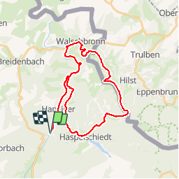
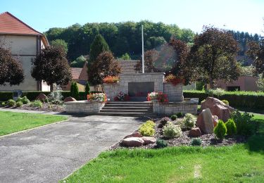
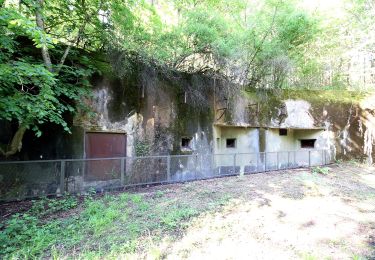
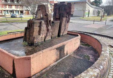
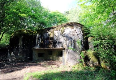
Ruta Bici de montaña de 33 km a descubrir en Gran Este, Mosela, Hanviller. Esta ruta ha sido propuesta por JPMEGEL.
Descripción
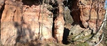
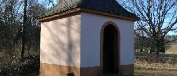
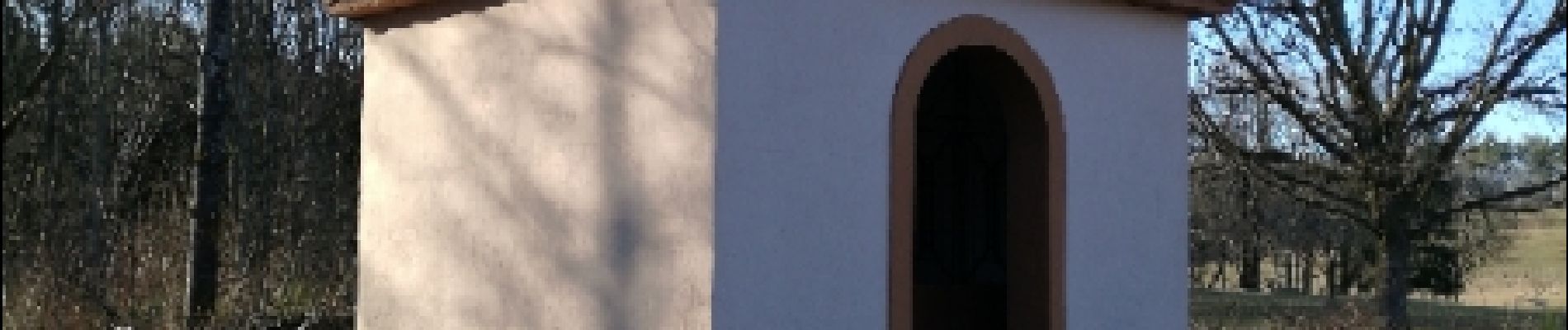
Depart de la Schwingmuehle, piste cyclable vers Walshbronn, Montée vers Schweix (Allemagne)puis Liederschied et Roppeviller par le rocher de Diane. Ensuite Haspelschiedt en passant par la chapelle Saint Wendelin, et retour au point de depart par les hauteur vers Bousseviller. Attention certains passages sont techniques mais les paysages sont beaux
Localización
Comentarios
Excursiones cerca
![Excursión Senderismo Roppeviller - Le rocher de l'Altschlossfelsen - Photo](https://media.geolcdn.com/t/375/260/ext.jpg?maxdim=2&url=https%3A%2F%2Fservices.sitytrail.com%2FGeolivesWS%2FDownloadMedia.ashx%3FTrailID%3D507904%26Media%3Dfix__20151230144825.jpg)
![Senderismo Senderismo](https://static1.geolcdn.com/sitytour/trail-icons/101.png)
Senderismo
![](/images/other/stat-length.png)
![](https://static1.geolcdn.com/siteimages/upload/files/16400158638029165_repeat_loop_refresh_sync_direction_icon.png)
![Excursión Senderismo Bitche - Circuit panoramique de Bitche - Photo](https://media.geolcdn.com/t/375/260/ext.jpg?maxdim=2&url=https%3A%2F%2Fservices.sitytrail.com%2FGeolivesWS%2FDownloadMedia.ashx%3FTrailID%3D118677%26Media%3D12842_6.jpg)
![Senderismo Senderismo](https://static1.geolcdn.com/sitytour/trail-icons/101.png)
Senderismo
![](/images/other/stat-length.png)
![](https://static1.geolcdn.com/siteimages/upload/files/16400158638029165_repeat_loop_refresh_sync_direction_icon.png)
![Excursión A pie Hanviller - Chevalet jaune - Photo](https://media.geolcdn.com/t/375/260/5ef45392-b749-445c-a602-485042878f58.jpeg&format=jpg&maxdim=2)
![A pie A pie](https://static1.geolcdn.com/sitytour/trail-icons/100.png)
![Excursión A pie Schorbach - Anneau bleu - Photo](https://media.geolcdn.com/t/375/260/9ec12433-595b-4107-889c-8d147508992c.jpeg&format=jpg&maxdim=2)
![A pie A pie](https://static1.geolcdn.com/sitytour/trail-icons/100.png)
![Excursión A pie Bitche - Yellow-white-yellow rectangle - Photo](https://media.geolcdn.com/t/375/260/b25926db-54e4-49bd-b984-8cab29c1cfec.jpeg&format=jpg&maxdim=2)
![A pie A pie](https://static1.geolcdn.com/sitytour/trail-icons/100.png)
A pie
![](/images/other/stat-length.png)
![](https://static1.geolcdn.com/siteimages/upload/files/16400158638029165_repeat_loop_refresh_sync_direction_icon.png)
![Excursión A pie Bitche - Yellow X - Photo](https://media.geolcdn.com/t/375/260/b25926db-54e4-49bd-b984-8cab29c1cfec.jpeg&format=jpg&maxdim=2)
![A pie A pie](https://static1.geolcdn.com/sitytour/trail-icons/100.png)
![Excursión A pie Schorbach - Circuit panoramique autour de Bitche - Photo](https://media.geolcdn.com/t/375/260/362356f4-bb8e-4b08-a677-d061df0886ee.jpeg&format=jpg&maxdim=2)
![A pie A pie](https://static1.geolcdn.com/sitytour/trail-icons/100.png)
A pie
![](/images/other/stat-length.png)
![](https://static1.geolcdn.com/siteimages/upload/files/16400158638029165_repeat_loop_refresh_sync_direction_icon.png)
![Excursión A pie Roppeviller - Circuit du rocher de l'Altschlossfelsen - Photo](https://media.geolcdn.com/t/375/260/e479e6c8-b176-4dba-ba62-ac01003618c1.jpeg&format=jpg&maxdim=2)
![A pie A pie](https://static1.geolcdn.com/sitytour/trail-icons/100.png)
A pie
![](/images/other/stat-length.png)
![](https://static1.geolcdn.com/siteimages/upload/files/16400158638029165_repeat_loop_refresh_sync_direction_icon.png)
![Excursión A pie Schweix - Anneau rouge - Photo](https://media.geolcdn.com/t/375/260/5ef45392-b749-445c-a602-485042878f58.jpeg&format=jpg&maxdim=2)
![A pie A pie](https://static1.geolcdn.com/sitytour/trail-icons/100.png)
A pie
![](/images/other/stat-length.png)
![](https://static1.geolcdn.com/siteimages/upload/files/16400158638029165_repeat_loop_refresh_sync_direction_icon.png)