![](/images/other/stat-length.png)
![Excursión Senderismo Bretoncelles - La marche de l'écrevisse 10 Km + Variante 9 km - Photo](https://media.geolcdn.com/t/1900/400/f3078d56-ce4a-48c0-b460-9f8033ffdb4f.jpg&format=pjpeg&maxdim=2)
La marche de l'écrevisse 10 Km + Variante 9 km
ODDAD78
Usuario
![Longitud](/images/other/stat-length.png)
![Altitud máxima](https://static1.geolcdn.com/siteimages/upload/files/1508320355ic_sort_altitude_max_24dp.png)
![Desnivel positivo](https://static1.geolcdn.com/siteimages/upload/files/1508320355ic_sort_den_pos_24dp.png)
![Km-Effort](/images/other/stat-length.png)
![Altitud mínima](https://static1.geolcdn.com/siteimages/upload/files/1508320355ic_sort_altitude_min_24dp.png)
![Desnivel negativo](https://static1.geolcdn.com/siteimages/upload/files/1508320355ic_sort_den_neg_24dp.png)
![Boucle](https://static1.geolcdn.com/siteimages/upload/files/16400158638029165_repeat_loop_refresh_sync_direction_icon.png)
![Senderismo](https://static1.geolcdn.com/sitytour/trail-icons/101.png)
2h52
Dificultad : Difícil
![Escanee este código QR para abrir la excursión en la aplicación SityTrail](https://capi.geolives.com/qq0zvz2zws4bq2lad0pu/sitytour/trails/656953/qr.png?size=200)
Aplicación GPS de excursión GRATIS
A propósito
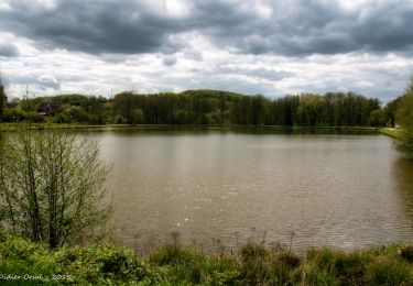
Ruta Senderismo de 10,1 km a descubrir en Normandía, Orne, Bretoncelles. Esta ruta ha sido propuesta por ODDAD78.
Descripción
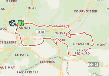
Quitter le parking et gagner le pont sur la Donnette ; la franchir. Continuer tout droit et longer la résidence des Grands Prés jusqu'à la maison de retraite.
Traverser la D918. Prendre en face le chemin goudronné de la Pezassière. Continuer tout droit. Haute Planche. La Voie.
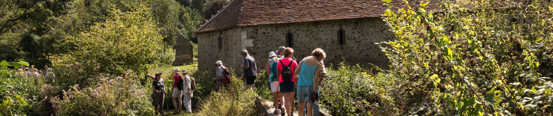
Traverser la D38, descendre vers la rivière et le moulin de Thivaux. Longer la Donnette en empruntant un sentier qui monte et débouche sur un chemin en « T ». Le prendre sur la droite, passer sous la voie ferrée ; traverser à gué ou sur la passerelle le ruisseau de la Fortune en suivant le balisage. Longer le petit cours d'eau sur 200m.
Tourner à gauche et prendre un chemin montant et sinueux qui, bientôt, rejoint une allée du taillis de Thivaux. A la première fourche, prendre le layon de droite ; après deux carrefours, tourner à droite pour déboucher en lisière de bois. Entre les prés, le chemin aboutit à la route du haras de Gravard.
Tourner à droite. Après le terrain du saut d'obstacles, descendre à gauche le chemin du Val Richard. Continuer tout droit vers la Grande Fosse.
Arrivé au hameau du Colombier, prendre à droite la voie goudronnée. Passer la Maintelonnière. Arrivé à Bel Air, tourner à gauche sur la voie communale en laissant le pont du chemin de fer sur la droite. Continuer sur 250m pour rejoindre la D924.
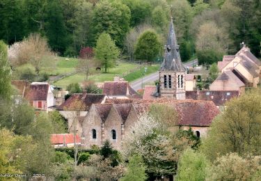
A la fourche, tourner à droite ; suivre la départementale. Passer Barboisseau. Quitter laD924 pour prendre, à gauche, en direction d'Ardelain. A l'entrée du hameau, bifurquer à droite ; suivre un chemin, empierré au départ. Après un bosquet, joli point de vue sur le bourg de Bretoncelles. Déboucher sur la D620, route de Coulonges les Sablons, près du calvaire des Maupinières, restauré en 2012 par l'association de sauvegarde du patrimoine.
Prendre à droite la rue de la Passerelle, puis la rue Sophie Girard. Aux feux tricolores, continuer en face par la rue Henri Levier.
Retour au parking, à droite par les écoles.
Une variante permet de réduire le circuit à 8,5 km
Localización
Comentarios
Excursiones cerca
![Excursión Senderismo La Madeleine-Bouvet - Les belles vues de Saint-Laumer et de la Madeleine Variante 10 Km - Photo](https://media.geolcdn.com/t/375/260/87362449-0ee3-40df-8df0-c17fd7220994.jpg&format=jpg&maxdim=2)
![Senderismo Senderismo](https://static1.geolcdn.com/sitytour/trail-icons/101.png)
Senderismo
![](/images/other/stat-length.png)
![](https://static1.geolcdn.com/siteimages/upload/files/16400158638029165_repeat_loop_refresh_sync_direction_icon.png)
![Excursión Senderismo La Madeleine-Bouvet - Les belles vues de Saint-Laumer et de la Madeleine 11 Km - Photo](https://media.geolcdn.com/t/375/260/3ee85883-b7ae-45a3-90c4-8bb6a4479600.jpg&format=jpg&maxdim=2)
![Senderismo Senderismo](https://static1.geolcdn.com/sitytour/trail-icons/101.png)
Senderismo
![](/images/other/stat-length.png)
![](https://static1.geolcdn.com/siteimages/upload/files/16400158638029165_repeat_loop_refresh_sync_direction_icon.png)
![Excursión Senderismo Bretoncelles - BRETONCELLES ET SES HAMEAUX - Photo](https://media.geolcdn.com/t/375/260/1ac05758-9066-478d-9efc-58a133a29698.jpg&format=jpg&maxdim=2)
![Senderismo Senderismo](https://static1.geolcdn.com/sitytour/trail-icons/101.png)
Senderismo
![](/images/other/stat-length.png)
![](https://static1.geolcdn.com/siteimages/upload/files/16400158638029165_repeat_loop_refresh_sync_direction_icon.png)
![Excursión Senderismo Moutiers-au-Perche - 2023-05-20_10h18m41_Moutiers-au-Perche Rando de Samedi - Photo](https://media.geolcdn.com/t/375/260/dd304cf5-1fa7-4625-9960-289d50411375.jpg&format=jpg&maxdim=2)
![Senderismo Senderismo](https://static1.geolcdn.com/sitytour/trail-icons/101.png)
Senderismo
![](/images/other/stat-length.png)
![](https://static1.geolcdn.com/siteimages/upload/files/16400158638029165_repeat_loop_refresh_sync_direction_icon.png)
![Excursión A pie Moutiers-au-Perche - Perche authentique - Photo](https://media.geolcdn.com/t/375/260/1c5fa599-8a3f-4902-99d5-149fc7bd1ba4.jpeg&format=jpg&maxdim=2)
![A pie A pie](https://static1.geolcdn.com/sitytour/trail-icons/100.png)
A pie
![](/images/other/stat-length.png)
![](https://static1.geolcdn.com/siteimages/upload/files/16400158638029165_repeat_loop_refresh_sync_direction_icon.png)
![Excursión Senderismo La Madeleine-Bouvet - Bretoncelles - La Madeleine-Bouvet 5,3 km - Photo](https://media.geolcdn.com/t/375/260/573e294c-51f9-41fe-8907-e8f30e9f4bad.jpg&format=jpg&maxdim=2)
![Senderismo Senderismo](https://static1.geolcdn.com/sitytour/trail-icons/101.png)
Senderismo
![](/images/other/stat-length.png)
![](https://static1.geolcdn.com/siteimages/upload/files/16400158638029165_repeat_loop_refresh_sync_direction_icon.png)
![Excursión Senderismo Bretoncelles - SityTrail - Les Douves du Grand Cumont Bretoncelles V2 15 Km - Photo](https://media.geolcdn.com/t/375/260/d3f7aac7-ac8c-46dc-96d3-852253cb1421.jpg&format=jpg&maxdim=2)
![Senderismo Senderismo](https://static1.geolcdn.com/sitytour/trail-icons/101.png)
Senderismo
![](/images/other/stat-length.png)
![](https://static1.geolcdn.com/siteimages/upload/files/16400158638029165_repeat_loop_refresh_sync_direction_icon.png)
![Excursión Senderismo Bretoncelles - SityTrail - Le Petit Houx du Parc - Bretoncelles 5,1 Km - Photo](https://media.geolcdn.com/t/375/260/7bdb7e04-5754-4fe7-8144-30a332f42ad5.jpg&format=jpg&maxdim=2)
![Senderismo Senderismo](https://static1.geolcdn.com/sitytour/trail-icons/101.png)
Senderismo
![](/images/other/stat-length.png)
![](https://static1.geolcdn.com/siteimages/upload/files/16400158638029165_repeat_loop_refresh_sync_direction_icon.png)
![Excursión Senderismo Bretoncelles - SityTrail - La boucle des Trois Moulins Bretoncelles 27,0 Km - Photo](https://media.geolcdn.com/t/375/260/5529bff9-ebf0-4b36-a1dd-763157d3177d.jpg&format=jpg&maxdim=2)
![Senderismo Senderismo](https://static1.geolcdn.com/sitytour/trail-icons/101.png)
Senderismo
![](/images/other/stat-length.png)
![](https://static1.geolcdn.com/siteimages/upload/files/16400158638029165_repeat_loop_refresh_sync_direction_icon.png)