![](/images/other/stat-length.png)
![Excursión Senderismo Arlempdes - Le Château d'Arlempdes et l'ancien Vivarais - Photo](https://media.geolcdn.com/t/1900/400/ext.pjpeg?maxdim=2&url=https%3A%2F%2Fservices.sitytrail.com%2FGeolivesWS%2FDownloadMedia.ashx%3FTrailID%3D653301%26Media%3Dfix__20161030172715.jpg)
Le Château d'Arlempdes et l'ancien Vivarais
yew
Usuario
![Longitud](/images/other/stat-length.png)
![Altitud máxima](https://static1.geolcdn.com/siteimages/upload/files/1508320355ic_sort_altitude_max_24dp.png)
![Desnivel positivo](https://static1.geolcdn.com/siteimages/upload/files/1508320355ic_sort_den_pos_24dp.png)
![Km-Effort](/images/other/stat-length.png)
![Altitud mínima](https://static1.geolcdn.com/siteimages/upload/files/1508320355ic_sort_altitude_min_24dp.png)
![Desnivel negativo](https://static1.geolcdn.com/siteimages/upload/files/1508320355ic_sort_den_neg_24dp.png)
![Boucle](https://static1.geolcdn.com/siteimages/upload/files/16400158638029165_repeat_loop_refresh_sync_direction_icon.png)
![Senderismo](https://static1.geolcdn.com/sitytour/trail-icons/101.png)
1h39
Dificultad : Fácil
![Escanee este código QR para abrir la excursión en la aplicación SityTrail](https://capi.geolives.com/qq0zvz2zws4bq2lad0pu/sitytour/trails/653301/qr.png?size=200)
Aplicación GPS de excursión GRATIS
A propósito
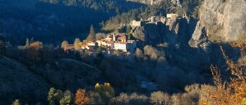
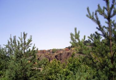
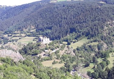
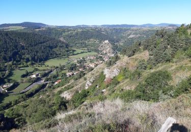
Ruta Senderismo de 5,3 km a descubrir en Auvergne-Rhône-Alpes, Alto Loira, Arlempdes. Esta ruta ha sido propuesta por yew.
Descripción
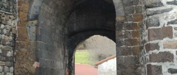
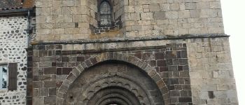
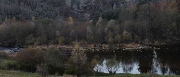
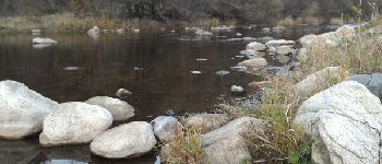
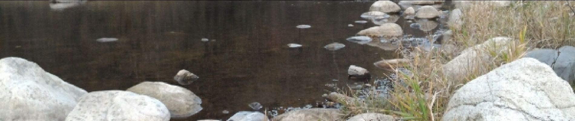
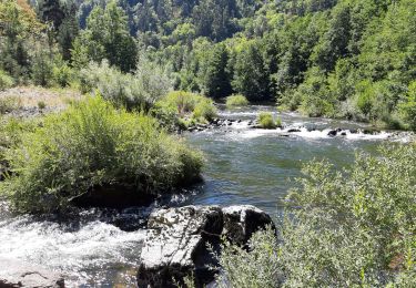
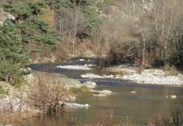
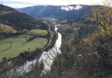
Une petite ballade qui permet de voir le château sous divers angles. Ce château est le premier sur la Loire. Il est du XIIe et XVe siècle et peut se visiter de juillet à aout, puis sur rendez-vous d'octobre à mars (timing non compris dans ce guide). Quelques passages sur des chemins aux pierres qui roulent sous les pieds. Un passage près d'une ferme nécessitant la tenue de votre chien si nécessaire. Toilettes à l'entrée du village.
Localización
Comentarios
Excursiones cerca
![Excursión Senderismo Saint-Arcons-de-Barges - Boucle de la forêt d'Arlempdes - Saint Arcon de Barges - Photo](https://media.geolcdn.com/t/375/260/ext.jpg?maxdim=2&url=https%3A%2F%2Fservices.sitytrail.com%2FGeolivesWS%2FDownloadMedia.ashx%3FTrailID%3D107372%26Media%3D12272_2.jpg)
![Senderismo Senderismo](https://static1.geolcdn.com/sitytour/trail-icons/101.png)
Senderismo
![](/images/other/stat-length.png)
![](https://static1.geolcdn.com/siteimages/upload/files/16400158638029165_repeat_loop_refresh_sync_direction_icon.png)
![Excursión Senderismo Goudet - Randonnée en boucle au dessus de Boudet - Photo](https://media.geolcdn.com/t/375/260/1575635e-33a7-4d46-b6c6-fa86079cce35.jpg&format=jpg&maxdim=2)
![Senderismo Senderismo](https://static1.geolcdn.com/sitytour/trail-icons/101.png)
Senderismo
![](/images/other/stat-length.png)
![](https://static1.geolcdn.com/siteimages/upload/files/16400158638029165_repeat_loop_refresh_sync_direction_icon.png)
![Excursión Senderismo Goudet - Au fil de la Loire sauvage - Photo](https://media.geolcdn.com/t/375/260/922cf54d-d405-42a0-bdac-6154828a6566.jpg&format=jpg&maxdim=2)
![Senderismo Senderismo](https://static1.geolcdn.com/sitytour/trail-icons/101.png)
Senderismo
![](/images/other/stat-length.png)
![](https://static1.geolcdn.com/siteimages/upload/files/16400158638029165_repeat_loop_refresh_sync_direction_icon.png)
![Excursión Senderismo Salettes - Camp D’Anthoune, Salettes (Haute-Loire) - Photo](https://media.geolcdn.com/t/375/260/cc87e0ec-268a-4d12-8da8-5e2775afe0e1.jpg&format=jpg&maxdim=2)
![Senderismo Senderismo](https://static1.geolcdn.com/sitytour/trail-icons/101.png)
Senderismo
![](/images/other/stat-length.png)
![](https://static1.geolcdn.com/siteimages/upload/files/16400158638029165_repeat_loop_refresh_sync_direction_icon.png)
![Excursión Senderismo Alleyrac - PR581 : le moulin du Rocher - Photo](https://media.geolcdn.com/t/375/260/505a08a3-6e3e-4814-8259-03cbd45df012.jpg&format=jpg&maxdim=2)
![Senderismo Senderismo](https://static1.geolcdn.com/sitytour/trail-icons/101.png)
Senderismo
![](/images/other/stat-length.png)
![](https://static1.geolcdn.com/siteimages/upload/files/16400158638029165_repeat_loop_refresh_sync_direction_icon.png)
![Excursión Senderismo Goudet - la Draille des muletiers Goudet 43 - Photo](https://media.geolcdn.com/t/375/260/77cca626-77c7-49f8-be15-3ec13728150e.jpg&format=jpg&maxdim=2)
![Senderismo Senderismo](https://static1.geolcdn.com/sitytour/trail-icons/101.png)
Senderismo
![](/images/other/stat-length.png)
![](https://static1.geolcdn.com/siteimages/upload/files/16400158638029165_repeat_loop_refresh_sync_direction_icon.png)
![Excursión Senderismo Goudet - Goudet - Photo](https://media.geolcdn.com/t/375/260/79faa700-3bf2-4d20-9e09-988ce3c27357.jpg&format=jpg&maxdim=2)
![Senderismo Senderismo](https://static1.geolcdn.com/sitytour/trail-icons/101.png)
Senderismo
![](/images/other/stat-length.png)
![](https://static1.geolcdn.com/siteimages/upload/files/16400158638029165_repeat_loop_refresh_sync_direction_icon.png)
![Excursión Senderismo Goudet - Les gorges de la Loire - Goudet - Photo](https://media.geolcdn.com/t/375/260/ext.jpg?maxdim=2&url=https%3A%2F%2Fservices.sitytrail.com%2FGeolivesWS%2FDownloadMedia.ashx%3FTrailID%3D173053%26Media%3D14575_6.jpg)
![Senderismo Senderismo](https://static1.geolcdn.com/sitytour/trail-icons/101.png)
Senderismo
![](/images/other/stat-length.png)
![](https://static1.geolcdn.com/siteimages/upload/files/16400158638029165_repeat_loop_refresh_sync_direction_icon.png)
![Excursión Senderismo Arlempdes - 2018-11-02 08:58:25 Jour - Photo](https://media.geolcdn.com/t/375/260/9b51640b-5e3d-4585-9ba4-1d73ef8d9e45.jpg&format=jpg&maxdim=2)
![Senderismo Senderismo](https://static1.geolcdn.com/sitytour/trail-icons/101.png)
Senderismo
![](/images/other/stat-length.png)
![](https://static1.geolcdn.com/siteimages/upload/files/16400158638029165_repeat_loop_refresh_sync_direction_icon.png)
Très belle promenade...