![](/images/other/stat-length.png)
![Excursión Senderismo Bourg-Saint-Maurice - Les cinq Lacs - La Combe - Photo](https://media.geolcdn.com/t/1900/400/ext.pjpeg?maxdim=2&url=https%3A%2F%2Fstatic1.geolcdn.com%2Fsiteimages%2Fupload%2Ffiles%2F1553511878bg_sport_marche.png)
Les cinq Lacs - La Combe
patrando49
Usuario
![Longitud](/images/other/stat-length.png)
Longitud
15 km
![Altitud máxima](https://static1.geolcdn.com/siteimages/upload/files/1508320355ic_sort_altitude_max_24dp.png)
Altitud máxima
2549 m
![Desnivel positivo](https://static1.geolcdn.com/siteimages/upload/files/1508320355ic_sort_den_pos_24dp.png)
Desnivel positivo
618 m
![Km-Effort](/images/other/stat-length.png)
Km-Effort
25 km
![Altitud mínima](https://static1.geolcdn.com/siteimages/upload/files/1508320355ic_sort_altitude_min_24dp.png)
Altitud mínima
1340 m
![Desnivel negativo](https://static1.geolcdn.com/siteimages/upload/files/1508320355ic_sort_den_neg_24dp.png)
Desnivel negativo
1248 m
![Boucle](https://static1.geolcdn.com/siteimages/upload/files/16400158638029165_repeat_loop_refresh_sync_direction_icon.png)
Boucle
No
Fecha de creación :
2016-10-28 00:00:00.0
Última modificación :
2016-10-28 00:00:00.0
![Senderismo](https://static1.geolcdn.com/sitytour/trail-icons/101.png)
5h00
Dificultad : Medio
![Escanee este código QR para abrir la excursión en la aplicación SityTrail](https://capi.geolives.com/qq0zvz2zws4bq2lad0pu/sitytour/trails/651989/qr.png?size=200)
Aplicación GPS de excursión GRATIS
A propósito
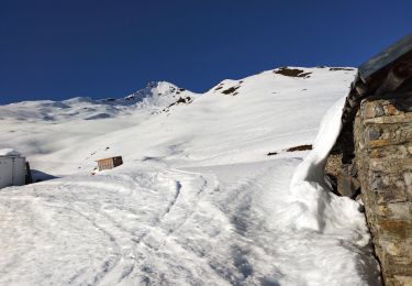
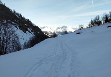
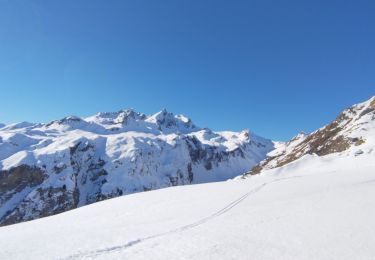
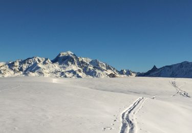
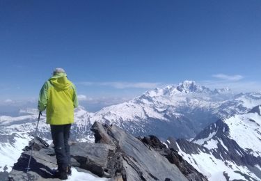
Ruta Senderismo de 15 km a descubrir en Auvergne-Rhône-Alpes, Saboya, Bourg-Saint-Maurice. Esta ruta ha sido propuesta por patrando49.
Descripción
Départ du fort de la Platte et retour par le chalet de la Combe jusqu'au parking d'Echine Dessus.
Localización
País:
France
Región :
Auvergne-Rhône-Alpes
Departamento/provincia :
Saboya
Municipio :
Bourg-Saint-Maurice
Localidad:
Unknown
Salida:(Dec)
Salida:(UTM)
323991 ; 5056362 (32T) N.
Comentarios
Excursiones cerca
![Excursión Senderismo Bourg-Saint-Maurice - Le sentier balcon des sources de l'Arbonne - Photo](https://media.geolcdn.com/t/375/260/ext.jpg?maxdim=2&url=https%3A%2F%2Fstatic1.geolcdn.com%2Fsiteimages%2Fupload%2Ffiles%2F1553511878bg_sport_marche.png)
![Senderismo Senderismo](https://static1.geolcdn.com/sitytour/trail-icons/101.png)
Le sentier balcon des sources de l'Arbonne
Senderismo
Difícil
(1)
Bourg-Saint-Maurice,
Auvergne-Rhône-Alpes,
Saboya,
France
![](/images/other/stat-length.png)
14,1 km | 24 km-effort
5h 26min
![](https://static1.geolcdn.com/siteimages/upload/files/16400158638029165_repeat_loop_refresh_sync_direction_icon.png)
Sí
![Excursión Esquí de fondo Bourg-Saint-Maurice - petite Aiguille de Praina - Photo](https://media.geolcdn.com/t/375/260/e105a7db-c885-44d0-a320-0f42ca59ba71.jpg&format=jpg&maxdim=2)
![Esquí de fondo Esquí de fondo](https://static1.geolcdn.com/sitytour/trail-icons/503.png)
petite Aiguille de Praina
Esquí de fondo
Fácil
Bourg-Saint-Maurice,
Auvergne-Rhône-Alpes,
Saboya,
France
![](/images/other/stat-length.png)
11,2 km | 26 km-effort
4h 25min
![](https://static1.geolcdn.com/siteimages/upload/files/16400158638029165_repeat_loop_refresh_sync_direction_icon.png)
Sí
![Excursión Esquí de fondo Bourg-Saint-Maurice - La Torche en boucle - Photo](https://media.geolcdn.com/t/375/260/18108b5f-6eb9-4481-a712-c62c16cbdb0d.jpg&format=jpg&maxdim=2)
![Esquí de fondo Esquí de fondo](https://static1.geolcdn.com/sitytour/trail-icons/503.png)
La Torche en boucle
Esquí de fondo
Medio
Bourg-Saint-Maurice,
Auvergne-Rhône-Alpes,
Saboya,
France
![](/images/other/stat-length.png)
17,6 km | 35 km-effort
5h 45min
![](https://static1.geolcdn.com/siteimages/upload/files/16400158638029165_repeat_loop_refresh_sync_direction_icon.png)
Sí
![Excursión Esquí de fondo Bourg-Saint-Maurice - Aiguille de Praina - Photo](https://media.geolcdn.com/t/375/260/8f6edc41-81d2-4218-97fb-5820c73f8bc2.jpg&format=jpg&maxdim=2)
![Esquí de fondo Esquí de fondo](https://static1.geolcdn.com/sitytour/trail-icons/503.png)
Aiguille de Praina
Esquí de fondo
Fácil
Bourg-Saint-Maurice,
Auvergne-Rhône-Alpes,
Saboya,
France
![](/images/other/stat-length.png)
12,3 km | 29 km-effort
4h 40min
![](https://static1.geolcdn.com/siteimages/upload/files/16400158638029165_repeat_loop_refresh_sync_direction_icon.png)
Sí
![Excursión Esquí de fondo Bourg-Saint-Maurice - Le grand Châtelet Est en boucle - Photo](https://media.geolcdn.com/t/375/260/6b25a155-1df9-4a43-bfdb-3a7483c7ae4a.jpg&format=jpg&maxdim=2)
![Esquí de fondo Esquí de fondo](https://static1.geolcdn.com/sitytour/trail-icons/503.png)
Le grand Châtelet Est en boucle
Esquí de fondo
Medio
Bourg-Saint-Maurice,
Auvergne-Rhône-Alpes,
Saboya,
France
![](/images/other/stat-length.png)
14,9 km | 32 km-effort
6h 0min
![](https://static1.geolcdn.com/siteimages/upload/files/16400158638029165_repeat_loop_refresh_sync_direction_icon.png)
Sí
![Excursión Esquí de fondo Bourg-Saint-Maurice - pointe de la combe neuve et Roc de l'enfer - Photo](https://media.geolcdn.com/t/375/260/c5014259-c6d5-4d86-8bfd-ce07a14ec173.jpg&format=jpg&maxdim=2)
![Esquí de fondo Esquí de fondo](https://static1.geolcdn.com/sitytour/trail-icons/503.png)
pointe de la combe neuve et Roc de l'enfer
Esquí de fondo
Medio
Bourg-Saint-Maurice,
Auvergne-Rhône-Alpes,
Saboya,
France
![](/images/other/stat-length.png)
13,3 km | 30 km-effort
7h 16min
![](https://static1.geolcdn.com/siteimages/upload/files/16400158638029165_repeat_loop_refresh_sync_direction_icon.png)
Sí
![Excursión Senderismo Séez - L’ouïe blanche - lac retour - chatelard - Photo](https://media.geolcdn.com/t/375/260/33c2f29d-a707-4cb3-a198-610db569a6dc.jpg&format=jpg&maxdim=2)
![Senderismo Senderismo](https://static1.geolcdn.com/sitytour/trail-icons/101.png)
L’ouïe blanche - lac retour - chatelard
Senderismo
Muy difícil
Séez,
Auvergne-Rhône-Alpes,
Saboya,
France
![](/images/other/stat-length.png)
22 km | 47 km-effort
7h 8min
![](https://static1.geolcdn.com/siteimages/upload/files/16400158638029165_repeat_loop_refresh_sync_direction_icon.png)
No
![Excursión Moto Bourg-Saint-Maurice - GTA 2018 - ETAPE 3 - Photo](https://media.geolcdn.com/t/375/260/9ebc9071-7b17-4ac0-80f3-e298458ddd76.jpg&format=jpg&maxdim=2)
![Moto Moto](https://static1.geolcdn.com/sitytour/trail-icons/402.png)
GTA 2018 - ETAPE 3
Moto
Fácil
Bourg-Saint-Maurice,
Auvergne-Rhône-Alpes,
Saboya,
France
![](/images/other/stat-length.png)
184 km | 0 m-effort
7h 15min
![](https://static1.geolcdn.com/siteimages/upload/files/16400158638029165_repeat_loop_refresh_sync_direction_icon.png)
No
![Excursión Senderismo Bourg-Saint-Maurice - Les cinq lacs, lacs de la Forclaz - Photo](https://media.geolcdn.com/t/375/260/ext.jpg?maxdim=2&url=https%3A%2F%2Fservices.sitytrail.com%2FGeolivesWS%2FDownloadMedia.ashx%3FTrailID%3D798947%26Media%3Dfix__20170730111436.jpg)
![Senderismo Senderismo](https://static1.geolcdn.com/sitytour/trail-icons/101.png)
Les cinq lacs, lacs de la Forclaz
Senderismo
Medio
Bourg-Saint-Maurice,
Auvergne-Rhône-Alpes,
Saboya,
France
![](/images/other/stat-length.png)
12 km | 22 km-effort
4h 4min
![](https://static1.geolcdn.com/siteimages/upload/files/16400158638029165_repeat_loop_refresh_sync_direction_icon.png)
Sí