![](/images/other/stat-length.png)
![Excursión Senderismo Froidchapelle - La balade du Grand Cerf - Photo](https://media.geolcdn.com/t/1900/400/ext.pjpeg?maxdim=2&url=https%3A%2F%2Fservices.sitytrail.com%2FGeolivesWS%2FDownloadMedia.ashx%3FTrailID%3D649009%26Media%3D59038bc9-7e40-40d0-a1f3-646685e2cdf1.jpg)
La balade du Grand Cerf
Desrumaux
Usuario GUIDE
![Longitud](/images/other/stat-length.png)
Longitud
8,4 km
![Altitud máxima](https://static1.geolcdn.com/siteimages/upload/files/1508320355ic_sort_altitude_max_24dp.png)
Altitud máxima
260 m
![Desnivel positivo](https://static1.geolcdn.com/siteimages/upload/files/1508320355ic_sort_den_pos_24dp.png)
Desnivel positivo
112 m
![Km-Effort](/images/other/stat-length.png)
Km-Effort
9,9 km
![Altitud mínima](https://static1.geolcdn.com/siteimages/upload/files/1508320355ic_sort_altitude_min_24dp.png)
Altitud mínima
204 m
![Desnivel negativo](https://static1.geolcdn.com/siteimages/upload/files/1508320355ic_sort_den_neg_24dp.png)
Desnivel negativo
109 m
![Boucle](https://static1.geolcdn.com/siteimages/upload/files/16400158638029165_repeat_loop_refresh_sync_direction_icon.png)
Boucle
Sí
Fecha de creación :
2016-10-21 00:00:00.0
Última modificación :
2016-10-21 00:00:00.0
![Senderismo](https://static1.geolcdn.com/sitytour/trail-icons/101.png)
2h30
Dificultad : Muy fácil
![Escanee este código QR para abrir la excursión en la aplicación SityTrail](https://capi.geolives.com/qq0zvz2zws4bq2lad0pu/sitytour/trails/649009/qr.png?size=200)
Aplicación GPS de excursión GRATIS
A propósito
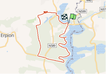
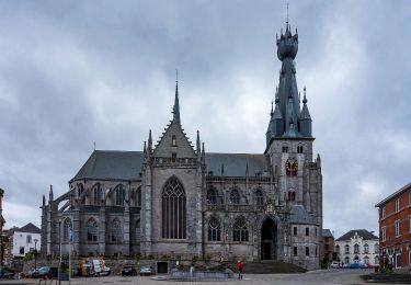
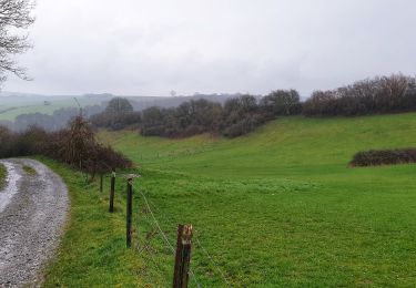
Ruta Senderismo de 8,4 km a descubrir en Valonia, Henao, Froidchapelle. Esta ruta ha sido propuesta por Desrumaux.
Descripción
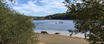
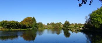
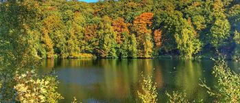
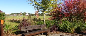
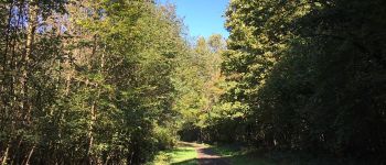
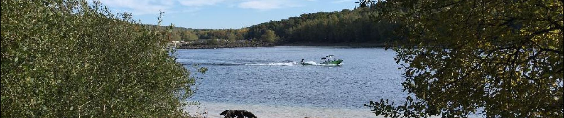
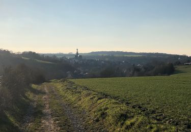
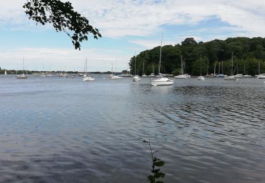
Jolie balade proposée par les Lacs de l'Eau d'Heure . Les magnifiques points de vue, la traversée des forêts et les courbes des rives raviront vos yeux.
Localización
País:
Belgium
Región :
Valonia
Departamento/provincia :
Henao
Municipio :
Froidchapelle
Localidad:
Boussu-lez-Walcourt
Salida:(Dec)
Salida:(UTM)
599199 ; 5563544 (31U) N.
Comentarios
Excursiones cerca
![Excursión Senderismo Walcourt - GG-Na-17_Walcourt - Philippeville - Photo](https://media.geolcdn.com/t/375/260/0ead20f8-4d85-41da-a61f-64e7e946f31c.jpg&format=jpg&maxdim=2)
![Senderismo Senderismo](https://static1.geolcdn.com/sitytour/trail-icons/101.png)
GG-Na-17_Walcourt - Philippeville
Senderismo
Muy difícil
(2)
Walcourt,
Valonia,
Namur,
Belgium
![](/images/other/stat-length.png)
21 km | 26 km-effort
5h 9min
![](https://static1.geolcdn.com/siteimages/upload/files/16400158638029165_repeat_loop_refresh_sync_direction_icon.png)
No
![Excursión Senderismo Cerfontaine - La balade du Ballonnet - Photo](https://media.geolcdn.com/t/375/260/ext.jpg?maxdim=2&url=https%3A%2F%2Fservices.sitytrail.com%2FGeolivesWS%2FDownloadMedia.ashx%3FTrailID%3D661211%26Media%3Df8ef018a-8a4e-43e9-8982-4175f97a626c.jpg)
![Senderismo Senderismo](https://static1.geolcdn.com/sitytour/trail-icons/101.png)
La balade du Ballonnet
Senderismo
Muy fácil
(6)
Cerfontaine,
Valonia,
Namur,
Belgium
![](/images/other/stat-length.png)
4,2 km | 5,2 km-effort
1h 12min
![](https://static1.geolcdn.com/siteimages/upload/files/16400158638029165_repeat_loop_refresh_sync_direction_icon.png)
Sí
![Excursión Senderismo Froidchapelle - Du Lac de l'Eau d'Heure au Lac du Ry Jaune - Photo](https://media.geolcdn.com/t/375/260/ext.jpg?maxdim=2&url=https%3A%2F%2Fservices.sitytrail.com%2FGeolivesWS%2FDownloadMedia.ashx%3FTrailID%3D379812%26Media%3Dd36c7a2e-70fd-44ad-a77a-7190af56fd8b.JPG)
![Senderismo Senderismo](https://static1.geolcdn.com/sitytour/trail-icons/101.png)
Du Lac de l'Eau d'Heure au Lac du Ry Jaune
Senderismo
Muy fácil
(3)
Froidchapelle,
Valonia,
Henao,
Belgium
![](/images/other/stat-length.png)
7,5 km | 9,4 km-effort
2h 6min
![](https://static1.geolcdn.com/siteimages/upload/files/16400158638029165_repeat_loop_refresh_sync_direction_icon.png)
Sí
![Excursión Senderismo Froidchapelle - Marche ADEPS à Boussu-lez-Walcourt - Photo](https://media.geolcdn.com/t/375/260/ext.jpg?maxdim=2&url=https%3A%2F%2Fservices.sitytrail.com%2FGeolivesWS%2FDownloadMedia.ashx%3FTrailID%3D251033%26Media%3D06de1a7a-a6bd-4c9d-b2ff-1e6fcd4fa4cd.JPG)
![Senderismo Senderismo](https://static1.geolcdn.com/sitytour/trail-icons/101.png)
Marche ADEPS à Boussu-lez-Walcourt
Senderismo
Fácil
(1)
Froidchapelle,
Valonia,
Henao,
Belgium
![](/images/other/stat-length.png)
10,4 km | 12,8 km-effort
2h 47min
![](https://static1.geolcdn.com/siteimages/upload/files/16400158638029165_repeat_loop_refresh_sync_direction_icon.png)
Sí
![Excursión Senderismo Walcourt - Randonnée autour de Walcourt - Photo](https://media.geolcdn.com/t/375/260/a37238d0-f00c-4fff-8a56-6d6b6e8a9220.jpg&format=jpg&maxdim=2)
![Senderismo Senderismo](https://static1.geolcdn.com/sitytour/trail-icons/101.png)
Randonnée autour de Walcourt
Senderismo
Medio
(2)
Walcourt,
Valonia,
Namur,
Belgium
![](/images/other/stat-length.png)
16 km | 20 km-effort
3h 43min
![](https://static1.geolcdn.com/siteimages/upload/files/16400158638029165_repeat_loop_refresh_sync_direction_icon.png)
Sí
![Excursión Senderismo Cerfontaine - cerfontaine - Photo](https://media.geolcdn.com/t/375/260/0818d68f-0878-4b89-a84e-8d165ea60a59.jpg&format=jpg&maxdim=2)
![Senderismo Senderismo](https://static1.geolcdn.com/sitytour/trail-icons/101.png)
cerfontaine
Senderismo
Muy fácil
(1)
Cerfontaine,
Valonia,
Namur,
Belgium
![](/images/other/stat-length.png)
6,5 km | 7,9 km-effort
1h 42min
![](https://static1.geolcdn.com/siteimages/upload/files/16400158638029165_repeat_loop_refresh_sync_direction_icon.png)
Sí
![Excursión Senderismo Froidchapelle - Le Tour du lac de la Plate Taille - Photo](https://media.geolcdn.com/t/375/260/ext.jpg?maxdim=2&url=https%3A%2F%2Fstatic1.geolcdn.com%2Fsiteimages%2Fupload%2Ffiles%2F1553511878bg_sport_marche.png)
![Senderismo Senderismo](https://static1.geolcdn.com/sitytour/trail-icons/101.png)
Le Tour du lac de la Plate Taille
Senderismo
Fácil
(3)
Froidchapelle,
Valonia,
Henao,
Belgium
![](/images/other/stat-length.png)
15,8 km | 18 km-effort
4h 0min
![](https://static1.geolcdn.com/siteimages/upload/files/16400158638029165_repeat_loop_refresh_sync_direction_icon.png)
Sí
![Excursión Senderismo Froidchapelle - Du lac de l'Eau d'Heure vers la Plate Taille - Photo](https://media.geolcdn.com/t/375/260/ext.jpg?maxdim=2&url=https%3A%2F%2Fstatic1.geolcdn.com%2Fsiteimages%2Fupload%2Ffiles%2F1553511878bg_sport_marche.png)
![Senderismo Senderismo](https://static1.geolcdn.com/sitytour/trail-icons/101.png)
Du lac de l'Eau d'Heure vers la Plate Taille
Senderismo
Fácil
(4)
Froidchapelle,
Valonia,
Henao,
Belgium
![](/images/other/stat-length.png)
13,7 km | 16,2 km-effort
3h 20min
![](https://static1.geolcdn.com/siteimages/upload/files/16400158638029165_repeat_loop_refresh_sync_direction_icon.png)
Sí
![Excursión Senderismo Walcourt - Balade à Walcourt - Photo](https://media.geolcdn.com/t/375/260/cc15b3fa-e158-4d51-b096-71bef2cb45f1.jpeg&format=jpg&maxdim=2)
![Senderismo Senderismo](https://static1.geolcdn.com/sitytour/trail-icons/101.png)
Balade à Walcourt
Senderismo
Medio
Walcourt,
Valonia,
Namur,
Belgium
![](/images/other/stat-length.png)
5,9 km | 7,3 km-effort
1h 39min
![](https://static1.geolcdn.com/siteimages/upload/files/16400158638029165_repeat_loop_refresh_sync_direction_icon.png)
Sí