![](/images/other/stat-length.png)
![Excursión Senderismo Chavanod - CHAVANOD - Photo](https://media.geolcdn.com/t/1900/400/ext.pjpeg?maxdim=2&url=https%3A%2F%2Fservices.sitytrail.com%2FGeolivesWS%2FDownloadMedia.ashx%3FTrailID%3D642834%26Media%3Dcf99f68d-cd6d-4093-a6f9-aa7a1c09564a.png)
CHAVANOD
HERRY
Usuario GUIDE
![Longitud](/images/other/stat-length.png)
![Altitud máxima](https://static1.geolcdn.com/siteimages/upload/files/1508320355ic_sort_altitude_max_24dp.png)
![Desnivel positivo](https://static1.geolcdn.com/siteimages/upload/files/1508320355ic_sort_den_pos_24dp.png)
![Km-Effort](/images/other/stat-length.png)
![Altitud mínima](https://static1.geolcdn.com/siteimages/upload/files/1508320355ic_sort_altitude_min_24dp.png)
![Desnivel negativo](https://static1.geolcdn.com/siteimages/upload/files/1508320355ic_sort_den_neg_24dp.png)
![Boucle](https://static1.geolcdn.com/siteimages/upload/files/16400158638029165_repeat_loop_refresh_sync_direction_icon.png)
![Senderismo](https://static1.geolcdn.com/sitytour/trail-icons/101.png)
2h34
Dificultad : Fácil
![Escanee este código QR para abrir la excursión en la aplicación SityTrail](https://capi.geolives.com/qq0zvz2zws4bq2lad0pu/sitytour/trails/642834/qr.png?size=200)
Aplicación GPS de excursión GRATIS
A propósito
Ruta Senderismo de 8,9 km a descubrir en Auvergne-Rhône-Alpes, Alta Saboya, Chavanod. Esta ruta ha sido propuesta por HERRY.
Descripción
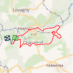
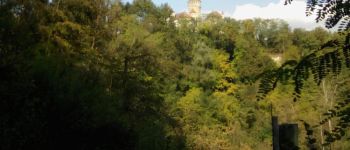
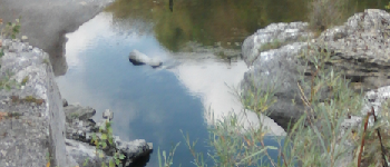
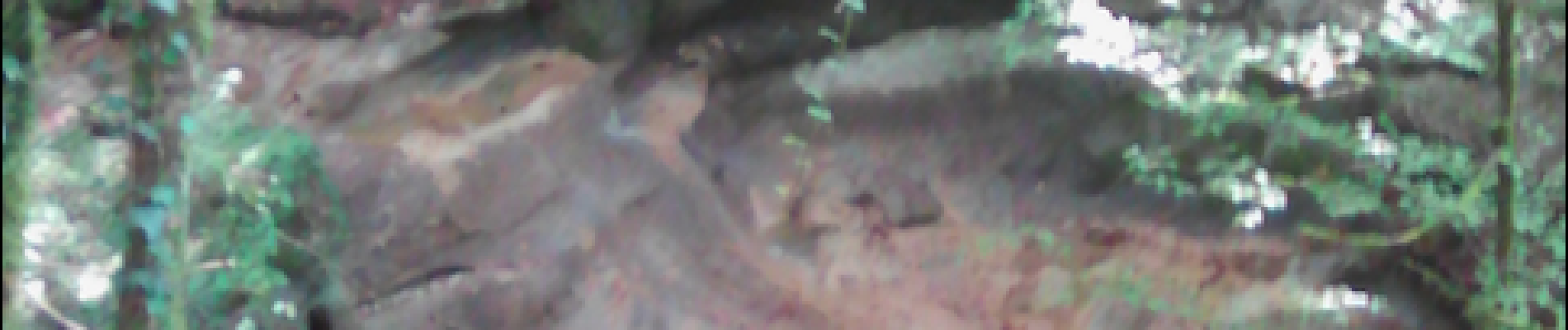
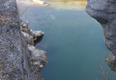
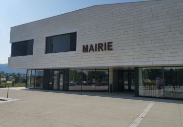
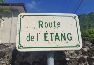
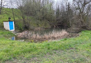
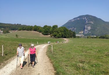
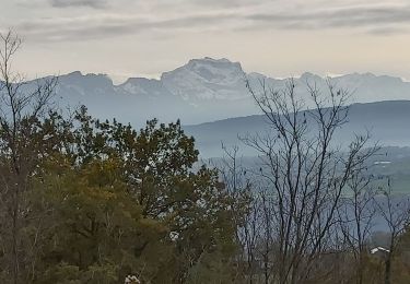
Circuit de 2H30 réalisable avec des enfants de de 6 ans. Le Circuit démarre en principe au Parking ( Point 6). Pour notre part,Nous sommes partis de Belleville et avons rejoint le chemin balisé (flèches jaunes sur fond vert) au point 1. Suivre ensuite le long du Fier et traverser la route Chavanod-Lovagny.Attention peu de visibilité à cet endroit et les voitures roulent vite. Il faut ensuite passer le long du site des « gorges du Fier » (point 2) puis tourner sur votre droite pour traverser la voie ferrée et continuer un moment le long du Fier. Le sentier va ensuite monter progressivement à travers la forêt pour arriver au point 3 où vous avez une jolie vue sur une cuve naturelle creusée dans la molasse. suivre ensuite le long du ruisseau.Après la traversée d’un petit pont en bois ne pas louper la bifurcation sur votre droite(point4). Suivre le balisage pour rejoindre un point de vue (point 5) sur la roche creusée par le ruisseau.Remonter ensuite vers la côte madame et rejoindre le parking par la route normale puis ensuite Belleville.
Localización
Comentarios
Excursiones cerca
![Excursión Bici de montaña Marcellaz-Albanais - Site VTT FFC de l'Albanais - Circuit N°4 Bois aux Loups - Marcellaz-Albanais - Photo](https://media.geolcdn.com/t/375/260/ext.jpg?maxdim=2&url=https%3A%2F%2Fservices.sitytrail.com%2FGeolivesWS%2FDownloadMedia.ashx%3FTrailID%3D191600%26Media%3D15236_1.jpg)
![Bici de montaña Bici de montaña](https://static1.geolcdn.com/sitytour/trail-icons/202.png)
Bici de montaña
![](/images/other/stat-length.png)
![](https://static1.geolcdn.com/siteimages/upload/files/16400158638029165_repeat_loop_refresh_sync_direction_icon.png)
![Excursión Senderismo Lovagny - 28/02/2022 - Gorges du Fier - Nonglard - Lovagny - Chavanod - Photo](https://media.geolcdn.com/t/375/260/03500606-e21f-4d38-a3f6-549dc5117f26.jpg&format=jpg&maxdim=2)
![Senderismo Senderismo](https://static1.geolcdn.com/sitytour/trail-icons/101.png)
Senderismo
![](/images/other/stat-length.png)
![](https://static1.geolcdn.com/siteimages/upload/files/16400158638029165_repeat_loop_refresh_sync_direction_icon.png)
![Excursión Bicicleta Annecy - semnoz par quintal - Photo](https://media.geolcdn.com/t/375/260/ext.jpg?maxdim=2&url=https%3A%2F%2Fstatic1.geolcdn.com%2Fsiteimages%2Fupload%2Ffiles%2F1524743154velo.jpg)
![Bicicleta Bicicleta](https://static1.geolcdn.com/sitytour/trail-icons/200.png)
Bicicleta
![](/images/other/stat-length.png)
![](https://static1.geolcdn.com/siteimages/upload/files/16400158638029165_repeat_loop_refresh_sync_direction_icon.png)
![Excursión Senderismo Vaulx - Autour de la commune de Vaulx 74150 - Photo](https://media.geolcdn.com/t/375/260/35bef058-8551-405b-b358-defe586c3f49.jpg&format=jpg&maxdim=2)
![Senderismo Senderismo](https://static1.geolcdn.com/sitytour/trail-icons/101.png)
Senderismo
![](/images/other/stat-length.png)
![](https://static1.geolcdn.com/siteimages/upload/files/16400158638029165_repeat_loop_refresh_sync_direction_icon.png)
![Excursión Senderismo Chavanod - CHAVANOD ... vers Montagny-les-Lanches. - Photo](https://media.geolcdn.com/t/375/260/9cf02be8-0d43-4c97-a143-e34f6de46c37.jpg&format=jpg&maxdim=2)
![Senderismo Senderismo](https://static1.geolcdn.com/sitytour/trail-icons/101.png)
Senderismo
![](/images/other/stat-length.png)
![](https://static1.geolcdn.com/siteimages/upload/files/16400158638029165_repeat_loop_refresh_sync_direction_icon.png)
![Excursión Senderismo Chavanod - CHAVANOD ... les Gorges du Fier. - Photo](https://media.geolcdn.com/t/375/260/b76880dc-3a6b-4b5d-9dee-7a400ed01ca2.jpg&format=jpg&maxdim=2)
![Senderismo Senderismo](https://static1.geolcdn.com/sitytour/trail-icons/101.png)
Senderismo
![](/images/other/stat-length.png)
![](https://static1.geolcdn.com/siteimages/upload/files/16400158638029165_repeat_loop_refresh_sync_direction_icon.png)
![Excursión sport Lovagny - 20230411 RANDONNÉE LOVAGNY - Photo](https://media.geolcdn.com/t/375/260/db936043-ccfb-4d87-a656-a3bf3f515ba1.jpg&format=jpg&maxdim=2)
sport
![](/images/other/stat-length.png)
![](https://static1.geolcdn.com/siteimages/upload/files/16400158638029165_repeat_loop_refresh_sync_direction_icon.png)
![Excursión Senderismo Poisy - Marais de poisy, chemin de Poësy et vergers de Macully - Photo](https://media.geolcdn.com/t/375/260/a99db235-e5a5-4581-aa0a-754977e54cbf.jpg&format=jpg&maxdim=2)
![Senderismo Senderismo](https://static1.geolcdn.com/sitytour/trail-icons/101.png)
Senderismo
![](/images/other/stat-length.png)
![](https://static1.geolcdn.com/siteimages/upload/files/16400158638029165_repeat_loop_refresh_sync_direction_icon.png)
![Excursión Senderismo Nonglard - Nonglard - Photo](https://media.geolcdn.com/t/375/260/1114e87f-940a-474b-8007-57d0b40aba43.jpg&format=jpg&maxdim=2)
![Senderismo Senderismo](https://static1.geolcdn.com/sitytour/trail-icons/101.png)
Senderismo
![](/images/other/stat-length.png)
![](https://static1.geolcdn.com/siteimages/upload/files/16400158638029165_repeat_loop_refresh_sync_direction_icon.png)
Belle balade