![](/images/other/stat-length.png)
![Excursión Senderismo Saint-Cast-le-Guildo - randonnée St Cast Le Guildo - Photo](https://media.geolcdn.com/t/1900/400/ext.pjpeg?maxdim=2&url=https%3A%2F%2Fservices.sitytrail.com%2FGeolivesWS%2FDownloadMedia.ashx%3FTrailID%3D636231%26Media%3Dfix__20160925162227.jpg)
randonnée St Cast Le Guildo
Axelloceane
Usuario
![Longitud](/images/other/stat-length.png)
![Altitud máxima](https://static1.geolcdn.com/siteimages/upload/files/1508320355ic_sort_altitude_max_24dp.png)
![Desnivel positivo](https://static1.geolcdn.com/siteimages/upload/files/1508320355ic_sort_den_pos_24dp.png)
![Km-Effort](/images/other/stat-length.png)
![Altitud mínima](https://static1.geolcdn.com/siteimages/upload/files/1508320355ic_sort_altitude_min_24dp.png)
![Desnivel negativo](https://static1.geolcdn.com/siteimages/upload/files/1508320355ic_sort_den_neg_24dp.png)
![Boucle](https://static1.geolcdn.com/siteimages/upload/files/16400158638029165_repeat_loop_refresh_sync_direction_icon.png)
![Senderismo](https://static1.geolcdn.com/sitytour/trail-icons/101.png)
4h38
Dificultad : Fácil
![Escanee este código QR para abrir la excursión en la aplicación SityTrail](https://capi.geolives.com/qq0zvz2zws4bq2lad0pu/sitytour/trails/636231/qr.png?size=200)
Aplicación GPS de excursión GRATIS
A propósito
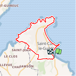
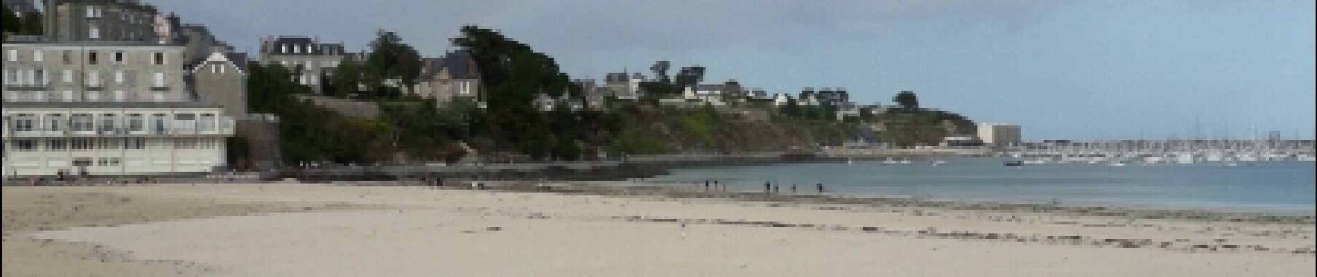
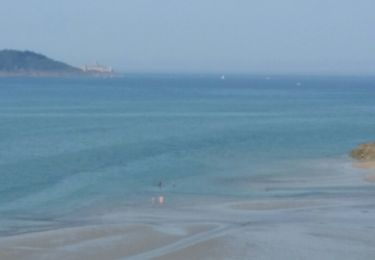
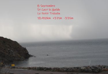
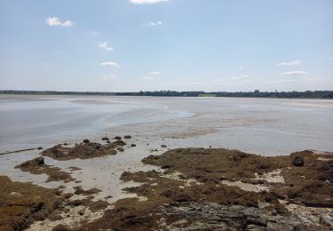
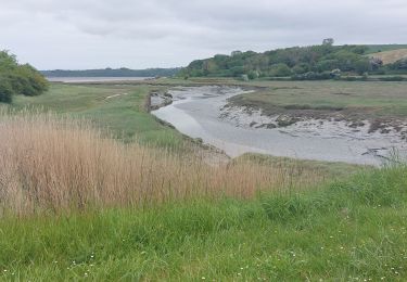
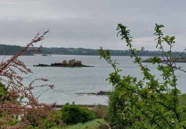
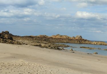
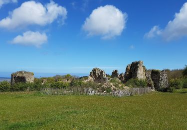
Ruta Senderismo de 17,6 km a descubrir en Bretaña, Côtes-d'Armor, Saint-Cast-le-Guildo. Esta ruta ha sido propuesta por Axelloceane.
Descripción
Départ du parking de la plage de Pen Guen.traverser la route en direction du camping les blés d'Or passer devant et continuer sur le chemin de terre.Au croisement tourner à droite et ensuite à gauche pour rejoindre le sentier longeant le ruisseau de Kermiton.Au Port St Jean suivre Le GR 34 en direction de St Cast Le Guildo et retour au parking.
Localización
Comentarios
Excursiones cerca
![Excursión Senderismo Saint-Cast-le-Guildo - 2017-08 St Cast-le Guildo - Photo](https://media.geolcdn.com/t/375/260/ext.jpg?maxdim=2&url=https%3A%2F%2Fservices.sitytrail.com%2FGeolivesWS%2FDownloadMedia.ashx%3FTrailID%3D820107%26Media%3Dfix__20170828153848.jpg)
![Senderismo Senderismo](https://static1.geolcdn.com/sitytour/trail-icons/101.png)
Senderismo
![](/images/other/stat-length.png)
![](https://static1.geolcdn.com/siteimages/upload/files/16400158638029165_repeat_loop_refresh_sync_direction_icon.png)
![Excursión Senderismo Matignon - Circuit de Matignon (itinéraire rose) - Photo](https://media.geolcdn.com/t/375/260/ext.jpg?maxdim=2&url=https%3A%2F%2Fservices.sitytrail.com%2FGeolivesWS%2FDownloadMedia.ashx%3FTrailID%3D111757%26Media%3D8211_6.jpg)
![Senderismo Senderismo](https://static1.geolcdn.com/sitytour/trail-icons/101.png)
Senderismo
![](/images/other/stat-length.png)
![](https://static1.geolcdn.com/siteimages/upload/files/16400158638029165_repeat_loop_refresh_sync_direction_icon.png)
![Senderismo Senderismo](https://static1.geolcdn.com/sitytour/trail-icons/101.png)
Senderismo
![](/images/other/stat-length.png)
![](https://static1.geolcdn.com/siteimages/upload/files/16400158638029165_repeat_loop_refresh_sync_direction_icon.png)
![Excursión Senderismo Saint-Jacut-de-la-Mer - St Jacut de la Mer 7.7.23 - Photo](https://media.geolcdn.com/t/375/260/7c37f328-93e1-4d4a-83bf-ec0b125bb7cd.jpg&format=jpg&maxdim=2)
![Senderismo Senderismo](https://static1.geolcdn.com/sitytour/trail-icons/101.png)
Senderismo
![](/images/other/stat-length.png)
![](https://static1.geolcdn.com/siteimages/upload/files/16400158638029165_repeat_loop_refresh_sync_direction_icon.png)
![Excursión Senderismo Saint-Cast-le-Guildo - GR_34_BD_10_St-Cast-Le-Guildo_Frehel_20230507 - Photo](https://media.geolcdn.com/t/375/260/068f3db5-6257-4ba4-9962-6c14136b62c6.jpg&format=jpg&maxdim=2)
![Senderismo Senderismo](https://static1.geolcdn.com/sitytour/trail-icons/101.png)
Senderismo
![](/images/other/stat-length.png)
![](https://static1.geolcdn.com/siteimages/upload/files/16400158638029165_repeat_loop_refresh_sync_direction_icon.png)
![Excursión Senderismo Saint-Jacut-de-la-Mer - GR_34_BC_09_St-Jacut-De-La-Mer_St-Cast-Le-Guildo_20230506 - Photo](https://media.geolcdn.com/t/375/260/a6421446-397c-40f2-8ef8-6251eb55e355.jpg&format=jpg&maxdim=2)
![Senderismo Senderismo](https://static1.geolcdn.com/sitytour/trail-icons/101.png)
Senderismo
![](/images/other/stat-length.png)
![](https://static1.geolcdn.com/siteimages/upload/files/16400158638029165_repeat_loop_refresh_sync_direction_icon.png)
![Excursión Senderismo Saint-Cast-le-Guildo - les 4 Vaux. Pen Guen - Photo](https://media.geolcdn.com/t/375/260/9c051867-9892-4ee3-a39c-78d231c8b844.jpg&format=jpg&maxdim=2)
![Senderismo Senderismo](https://static1.geolcdn.com/sitytour/trail-icons/101.png)
Senderismo
![](/images/other/stat-length.png)
![](https://static1.geolcdn.com/siteimages/upload/files/16400158638029165_repeat_loop_refresh_sync_direction_icon.png)
![Excursión Senderismo Saint-Jacut-de-la-Mer - îles des hebihens - Photo](https://media.geolcdn.com/t/375/260/62e1a056-179a-4626-b808-38cbde70ac24.jpg&format=jpg&maxdim=2)
![Senderismo Senderismo](https://static1.geolcdn.com/sitytour/trail-icons/101.png)
Senderismo
![](/images/other/stat-length.png)
![](https://static1.geolcdn.com/siteimages/upload/files/16400158638029165_repeat_loop_refresh_sync_direction_icon.png)
![Excursión A pie Beaussais-sur-Mer - Chemin des Dolmens - Photo](https://media.geolcdn.com/t/375/260/5f97a76e-17db-4c60-a005-1a71e6a46136.jpeg&format=jpg&maxdim=2)
![A pie A pie](https://static1.geolcdn.com/sitytour/trail-icons/100.png)
A pie
![](/images/other/stat-length.png)
![](https://static1.geolcdn.com/siteimages/upload/files/16400158638029165_repeat_loop_refresh_sync_direction_icon.png)