![](/images/other/stat-length.png)
![Excursión Senderismo Caden - Le grand val, caden - Photo](https://media.geolcdn.com/t/1900/400/ext.pjpeg?maxdim=2&url=https%3A%2F%2Fservices.sitytrail.com%2FGeolivesWS%2FDownloadMedia.ashx%3FTrailID%3D601953%26Media%3D0abf02b0-773e-415a-8a15-6135a09fd368.jpg)
Le grand val, caden
lfallek
Usuario
![Longitud](/images/other/stat-length.png)
![Altitud máxima](https://static1.geolcdn.com/siteimages/upload/files/1508320355ic_sort_altitude_max_24dp.png)
![Desnivel positivo](https://static1.geolcdn.com/siteimages/upload/files/1508320355ic_sort_den_pos_24dp.png)
![Km-Effort](/images/other/stat-length.png)
![Altitud mínima](https://static1.geolcdn.com/siteimages/upload/files/1508320355ic_sort_altitude_min_24dp.png)
![Desnivel negativo](https://static1.geolcdn.com/siteimages/upload/files/1508320355ic_sort_den_neg_24dp.png)
![Boucle](https://static1.geolcdn.com/siteimages/upload/files/16400158638029165_repeat_loop_refresh_sync_direction_icon.png)
![Senderismo](https://static1.geolcdn.com/sitytour/trail-icons/101.png)
2h00
Dificultad : Medio
![Escanee este código QR para abrir la excursión en la aplicación SityTrail](https://capi.geolives.com/qq0zvz2zws4bq2lad0pu/sitytour/trails/601953/qr.png?size=200)
Aplicación GPS de excursión GRATIS
A propósito
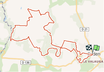
Ruta Senderismo de 15 km a descubrir en Bretaña, Morbihan, Caden. Esta ruta ha sido propuesta por lfallek.
Descripción
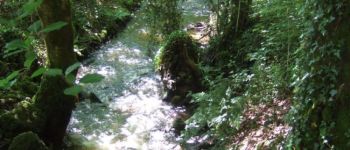
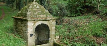
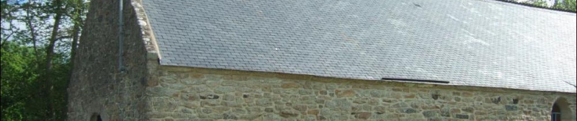
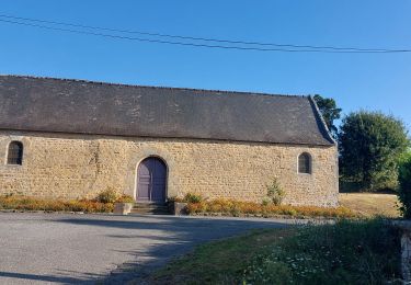
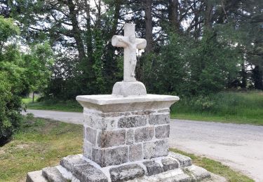
Cette longue boucle traverse de grands espaces boisés de chênes et de châtaigniers, notamment le Grand Val, au fond duquel coule le ruisseau du Matz. Elle conduit jusqu’à la vallée du ruisseau du Trévelo qui sépare les communes de Caden et Limerzel.
Balisage VTT et jaune- circuit PR sens inverse
Plus d’info : www.rochefortenterre-tourisme.com
Retrouvez tous les circuits de randonnée sur le site www.rando-paysdevannes.com
Localización
Comentarios
Excursiones cerca
![Excursión Senderismo Limerzel - PR_56_Limerzel_AA_01_Circuit1b_Vallee-Du-Trevelo_20231215 - Photo](https://media.geolcdn.com/t/375/260/b434d388-f2cf-4273-a9c9-f910c9f7a88a.jpg&format=jpg&maxdim=2)
![Senderismo Senderismo](https://static1.geolcdn.com/sitytour/trail-icons/101.png)
Senderismo
![](/images/other/stat-length.png)
![](https://static1.geolcdn.com/siteimages/upload/files/16400158638029165_repeat_loop_refresh_sync_direction_icon.png)
![Excursión Senderismo Péaule - PR_56_Peaule_BA_02_Circuit3b_De-L-Etier_20230914 - Photo](https://media.geolcdn.com/t/375/260/f17b2106-29c9-443c-b455-5d085c7b6379.jpg&format=jpg&maxdim=2)
![Senderismo Senderismo](https://static1.geolcdn.com/sitytour/trail-icons/101.png)
Senderismo
![](/images/other/stat-length.png)
![](https://static1.geolcdn.com/siteimages/upload/files/16400158638029165_repeat_loop_refresh_sync_direction_icon.png)
![Excursión Senderismo Limerzel - GRP_Lanvaux_AI_09_Limerzel_Berric_20210528 - Photo](https://media.geolcdn.com/t/375/260/c931dd36-7661-451d-be62-fb02e50c34f3.jpg&format=jpg&maxdim=2)
![Senderismo Senderismo](https://static1.geolcdn.com/sitytour/trail-icons/101.png)
Senderismo
![](/images/other/stat-length.png)
![](https://static1.geolcdn.com/siteimages/upload/files/16400158638029165_repeat_loop_refresh_sync_direction_icon.png)
![Excursión Senderismo Caden - PR_56_Caden_AA_01_Circuit1b_Le-Grand-Val_20200524 - Photo](https://media.geolcdn.com/t/375/260/422278ab-db23-4bf4-a06f-32394ef99a0f.jpg&format=jpg&maxdim=2)
![Senderismo Senderismo](https://static1.geolcdn.com/sitytour/trail-icons/101.png)
Senderismo
![](/images/other/stat-length.png)
![](https://static1.geolcdn.com/siteimages/upload/files/16400158638029165_repeat_loop_refresh_sync_direction_icon.png)
![Excursión Senderismo Béganne - Circuit des 2 vallées - Béganne - Photo](https://media.geolcdn.com/t/375/260/ext.jpg?maxdim=2&url=https%3A%2F%2Fservices.sitytrail.com%2FGeolivesWS%2FDownloadMedia.ashx%3FTrailID%3D111433%26Media%3D7246_4.jpg)
![Senderismo Senderismo](https://static1.geolcdn.com/sitytour/trail-icons/101.png)
Senderismo
![](/images/other/stat-length.png)
![](https://static1.geolcdn.com/siteimages/upload/files/16400158638029165_repeat_loop_refresh_sync_direction_icon.png)
![Excursión Senderismo Béganne - 216- circuit de la Bouloterie par Bignac. - Photo](https://media.geolcdn.com/t/375/260/d24d91d3-711f-48f3-b413-d07ef7e05936.jpg&format=jpg&maxdim=2)
![Senderismo Senderismo](https://static1.geolcdn.com/sitytour/trail-icons/101.png)
Senderismo
![](/images/other/stat-length.png)
![](https://static1.geolcdn.com/siteimages/upload/files/16400158638029165_repeat_loop_refresh_sync_direction_icon.png)
![Excursión Senderismo Limerzel - 192- la vallée du Trévelo - Photo](https://media.geolcdn.com/t/375/260/118c7e85-b6b5-4111-bf8d-236391bf9068.jpg&format=jpg&maxdim=2)
![Senderismo Senderismo](https://static1.geolcdn.com/sitytour/trail-icons/101.png)
Senderismo
![](/images/other/stat-length.png)
![](https://static1.geolcdn.com/siteimages/upload/files/16400158638029165_repeat_loop_refresh_sync_direction_icon.png)
![Excursión Senderismo Limerzel - 196 - rando du sillon Limerzel - Photo](https://media.geolcdn.com/t/375/260/ff8b2d16-fa07-4205-863f-1f2750659492.jpg&format=jpg&maxdim=2)
![Senderismo Senderismo](https://static1.geolcdn.com/sitytour/trail-icons/101.png)
Senderismo
![](/images/other/stat-length.png)
![](https://static1.geolcdn.com/siteimages/upload/files/16400158638029165_repeat_loop_refresh_sync_direction_icon.png)
![Excursión Bici de montaña Béganne - Beganne 2022 - Photo](https://media.geolcdn.com/t/375/260/ext.jpg?maxdim=2&url=https%3A%2F%2Fstatic1.geolcdn.com%2Fsiteimages%2Fupload%2Ffiles%2F1524743154velo.jpg)
![Bici de montaña Bici de montaña](https://static1.geolcdn.com/sitytour/trail-icons/202.png)
Bici de montaña
![](/images/other/stat-length.png)
![](https://static1.geolcdn.com/siteimages/upload/files/16400158638029165_repeat_loop_refresh_sync_direction_icon.png)