![](/images/other/stat-length.png)
![Excursión Senderismo Tours - Rochecorbon - Photo](https://media.geolcdn.com/t/1900/400/ext.pjpeg?maxdim=2&url=https%3A%2F%2Fservices.sitytrail.com%2FGeolivesWS%2FDownloadMedia.ashx%3FTrailID%3D545831%26Media%3Dfix__20160329151456.jpg)
Rochecorbon
Daguier
Usuario
![Longitud](/images/other/stat-length.png)
Longitud
12,1 km
![Altitud máxima](https://static1.geolcdn.com/siteimages/upload/files/1508320355ic_sort_altitude_max_24dp.png)
Altitud máxima
105 m
![Desnivel positivo](https://static1.geolcdn.com/siteimages/upload/files/1508320355ic_sort_den_pos_24dp.png)
Desnivel positivo
141 m
![Km-Effort](/images/other/stat-length.png)
Km-Effort
14 km
![Altitud mínima](https://static1.geolcdn.com/siteimages/upload/files/1508320355ic_sort_altitude_min_24dp.png)
Altitud mínima
44 m
![Desnivel negativo](https://static1.geolcdn.com/siteimages/upload/files/1508320355ic_sort_den_neg_24dp.png)
Desnivel negativo
141 m
![Boucle](https://static1.geolcdn.com/siteimages/upload/files/16400158638029165_repeat_loop_refresh_sync_direction_icon.png)
Boucle
Sí
Fecha de creación :
2016-03-29 00:00:00.0
Última modificación :
2016-03-29 00:00:00.0
![Senderismo](https://static1.geolcdn.com/sitytour/trail-icons/101.png)
2h26
Dificultad : Desconocido
![Escanee este código QR para abrir la excursión en la aplicación SityTrail](https://capi.geolives.com/qq0zvz2zws4bq2lad0pu/sitytour/trails/545831/qr.png?size=200)
Aplicación GPS de excursión GRATIS
A propósito
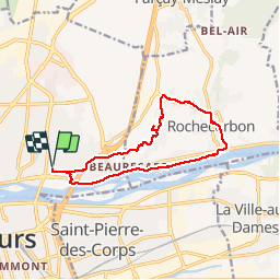
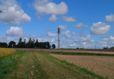
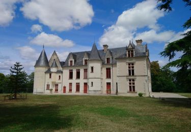
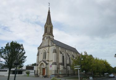
Ruta Senderismo de 12,1 km a descubrir en Centro, Indre y Loira, Tours. Esta ruta ha sido propuesta por Daguier.
Descripción
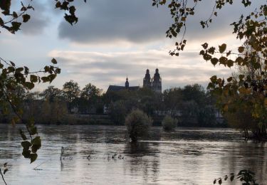
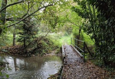
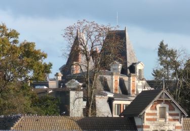
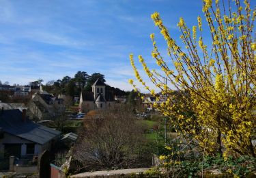
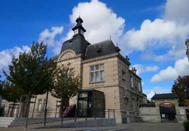
De ste Radegonde montée sur le plateau et traversée des vignes de Vouvray. Descente vers la Loire et retour en bord de Loire.
Localización
País:
France
Región :
Centro
Departamento/provincia :
Indre y Loira
Municipio :
Tours
Localidad:
Unknown
Salida:(Dec)
Salida:(UTM)
326871 ; 5252740 (31T) N.
Comentarios
Excursiones cerca
![Excursión Senderismo Tours - Tours - Marmoutier GR3 GR655 Rochecorbon - 8.2km 105m 1h50 - 2021 10 09 - Photo](https://media.geolcdn.com/t/375/260/8eec29df-bf69-4696-8607-c35bff826c99.jpg&format=jpg&maxdim=2)
![Senderismo Senderismo](https://static1.geolcdn.com/sitytour/trail-icons/101.png)
Tours - Marmoutier GR3 GR655 Rochecorbon - 8.2km 105m 1h50 - 2021 10 09
Senderismo
Muy fácil
(1)
Tours,
Centro,
Indre y Loira,
France
![](/images/other/stat-length.png)
8,2 km | 9,6 km-effort
1h 50min
![](https://static1.geolcdn.com/siteimages/upload/files/16400158638029165_repeat_loop_refresh_sync_direction_icon.png)
Sí
![Excursión Senderismo Fondettes - Fondettes Gare - Saint-Cyr-sur-Loire Tours - 23.4km 345m 5h10 (40mn) - 2024 10 27 - Photo](https://media.geolcdn.com/t/375/260/8177205d-60d4-4a9b-baf6-cca40bb2f1c5.jpg&format=jpg&maxdim=2)
![Senderismo Senderismo](https://static1.geolcdn.com/sitytour/trail-icons/101.png)
Fondettes Gare - Saint-Cyr-sur-Loire Tours - 23.4km 345m 5h10 (40mn) - 2024 1...
Senderismo
Fácil
Fondettes,
Centro,
Indre y Loira,
France
![](/images/other/stat-length.png)
23 km | 28 km-effort
5h 10min
![](https://static1.geolcdn.com/siteimages/upload/files/16400158638029165_repeat_loop_refresh_sync_direction_icon.png)
Sí
![Excursión Senderismo Saint-Cyr-sur-Loire - Saint-Cyr-sur-Loire la Gagnerie - la Membrolle-sur-Choisille Mettray - 24km 405m 5h15 (50mn) - 2024 10 20 - Photo](https://media.geolcdn.com/t/375/260/21cd2b46-14f0-4eaa-a3c8-0e5f8e58cc4a.jpg&format=jpg&maxdim=2)
![Senderismo Senderismo](https://static1.geolcdn.com/sitytour/trail-icons/101.png)
Saint-Cyr-sur-Loire la Gagnerie - la Membrolle-sur-Choisille Mettray - 24km 4...
Senderismo
Medio
Saint-Cyr-sur-Loire,
Centro,
Indre y Loira,
France
![](/images/other/stat-length.png)
24 km | 29 km-effort
5h 15min
![](https://static1.geolcdn.com/siteimages/upload/files/16400158638029165_repeat_loop_refresh_sync_direction_icon.png)
Sí
![Excursión Senderismo Fondettes - Fondettes Charcenay - Sentier Val de Choisille avec variantes - 23.5km 335m 5h10 (55mn) - 2024 10 13 - Photo](https://media.geolcdn.com/t/375/260/da5cdfb1-5871-4878-b704-e11c5bcbf000.jpg&format=jpg&maxdim=2)
![Senderismo Senderismo](https://static1.geolcdn.com/sitytour/trail-icons/101.png)
Fondettes Charcenay - Sentier Val de Choisille avec variantes - 23.5km 335m 5...
Senderismo
Fácil
Fondettes,
Centro,
Indre y Loira,
France
![](/images/other/stat-length.png)
23 km | 28 km-effort
5h 10min
![](https://static1.geolcdn.com/siteimages/upload/files/16400158638029165_repeat_loop_refresh_sync_direction_icon.png)
Sí
![Excursión Senderismo Rochecorbon - Rochecorbon - Zig zag autour de Rochecorbon - 17km 295m 3h50 - 2024 03 13 - Photo](https://media.geolcdn.com/t/375/260/c0145acf-b15a-4f41-833a-811e7495297d.jpg&format=jpg&maxdim=2)
![Senderismo Senderismo](https://static1.geolcdn.com/sitytour/trail-icons/101.png)
Rochecorbon - Zig zag autour de Rochecorbon - 17km 295m 3h50 - 2024 03 13
Senderismo
Medio
Rochecorbon,
Centro,
Indre y Loira,
France
![](/images/other/stat-length.png)
17,1 km | 21 km-effort
3h 50min
![](https://static1.geolcdn.com/siteimages/upload/files/16400158638029165_repeat_loop_refresh_sync_direction_icon.png)
Sí
![Excursión Senderismo Saint-Pierre-des-Corps - Saint-Pierre-des-Corps - PR Sentier du bord de Loire avec variantes - 13.6km 75m 2h55 (30mn) - 2023 10 22 - Photo](https://media.geolcdn.com/t/375/260/6a165834-3cba-4860-930a-9c6f29b052c7.jpg&format=jpg&maxdim=2)
![Senderismo Senderismo](https://static1.geolcdn.com/sitytour/trail-icons/101.png)
Saint-Pierre-des-Corps - PR Sentier du bord de Loire avec variantes - 13.6km ...
Senderismo
Fácil
Saint-Pierre-des-Corps,
Centro,
Indre y Loira,
France
![](/images/other/stat-length.png)
13,6 km | 14,7 km-effort
2h 55min
![](https://static1.geolcdn.com/siteimages/upload/files/16400158638029165_repeat_loop_refresh_sync_direction_icon.png)
Sí
![Excursión Senderismo Parçay-Meslay - Parcay-Meslay - lieu-dit le Houdeau de Monnaie - 21.3km 190m 4h50 (50mn) - 2023 08 27 - Photo](https://media.geolcdn.com/t/375/260/12319d71-2676-4fa6-b6d8-bd3dc55c96dc.jpg&format=jpg&maxdim=2)
![Senderismo Senderismo](https://static1.geolcdn.com/sitytour/trail-icons/101.png)
Parcay-Meslay - lieu-dit le Houdeau de Monnaie - 21.3km 190m 4h50 (50mn) - 20...
Senderismo
Fácil
Parçay-Meslay,
Centro,
Indre y Loira,
France
![](/images/other/stat-length.png)
21 km | 24 km-effort
4h 50min
![](https://static1.geolcdn.com/siteimages/upload/files/16400158638029165_repeat_loop_refresh_sync_direction_icon.png)
Sí
![Excursión Senderismo Saint-Avertin - Saint-Avertin - PR Sentier du vieux Cher, Cangé - 9.3km 95m 2h05 (20mn) - 2023 07 12 - Photo](https://media.geolcdn.com/t/375/260/1c5742ed-1795-4a54-ac46-a850f2d399d9.jpg&format=jpg&maxdim=2)
![Senderismo Senderismo](https://static1.geolcdn.com/sitytour/trail-icons/101.png)
Saint-Avertin - PR Sentier du vieux Cher, Cangé - 9.3km 95m 2h05 (20mn) - 202...
Senderismo
Fácil
Saint-Avertin,
Centro,
Indre y Loira,
France
![](/images/other/stat-length.png)
9,3 km | 10,5 km-effort
2h 5min
![](https://static1.geolcdn.com/siteimages/upload/files/16400158638029165_repeat_loop_refresh_sync_direction_icon.png)
Sí
![Excursión Senderismo Tours - Tours - Bd Béranger La Riche - 8.8km 45m 2h00 - 2022 09 12 - Photo](https://media.geolcdn.com/t/375/260/42e96b35-6e0b-4b51-82b8-ef6cff621515.jpg&format=jpg&maxdim=2)
![Senderismo Senderismo](https://static1.geolcdn.com/sitytour/trail-icons/101.png)
Tours - Bd Béranger La Riche - 8.8km 45m 2h00 - 2022 09 12
Senderismo
Muy fácil
Tours,
Centro,
Indre y Loira,
France
![](/images/other/stat-length.png)
8,8 km | 9,4 km-effort
2h 0min
![](https://static1.geolcdn.com/siteimages/upload/files/16400158638029165_repeat_loop_refresh_sync_direction_icon.png)
Sí