![](/images/other/stat-length.png)
![Excursión Senderismo Estrasburgo - Strasbourg médiéval - Photo](https://media.geolcdn.com/t/1900/400/ext.pjpeg?maxdim=2&url=https%3A%2F%2Fservices.sitytrail.com%2FGeolivesWS%2FDownloadMedia.ashx%3FTrailID%3D539176%26Media%3Dfix__20160317154118.jpg)
Strasbourg médiéval
phil88
Usuario
![Longitud](/images/other/stat-length.png)
Longitud
7,2 km
![Altitud máxima](https://static1.geolcdn.com/siteimages/upload/files/1508320355ic_sort_altitude_max_24dp.png)
Altitud máxima
159 m
![Desnivel positivo](https://static1.geolcdn.com/siteimages/upload/files/1508320355ic_sort_den_pos_24dp.png)
Desnivel positivo
73 m
![Km-Effort](/images/other/stat-length.png)
Km-Effort
8,2 km
![Altitud mínima](https://static1.geolcdn.com/siteimages/upload/files/1508320355ic_sort_altitude_min_24dp.png)
Altitud mínima
136 m
![Desnivel negativo](https://static1.geolcdn.com/siteimages/upload/files/1508320355ic_sort_den_neg_24dp.png)
Desnivel negativo
75 m
![Boucle](https://static1.geolcdn.com/siteimages/upload/files/16400158638029165_repeat_loop_refresh_sync_direction_icon.png)
Boucle
Sí
Fecha de creación :
2016-03-17 00:00:00.0
Última modificación :
2016-03-17 00:00:00.0
![Senderismo](https://static1.geolcdn.com/sitytour/trail-icons/101.png)
1h56
Dificultad : Fácil
![Escanee este código QR para abrir la excursión en la aplicación SityTrail](https://capi.geolives.com/qq0zvz2zws4bq2lad0pu/sitytour/trails/539176/qr.png?size=200)
Aplicación GPS de excursión GRATIS
A propósito
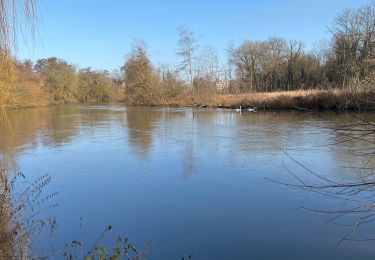
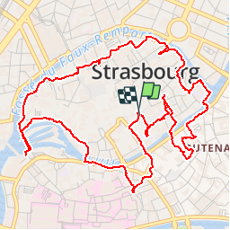
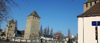
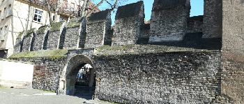
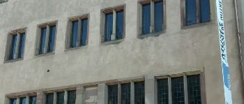
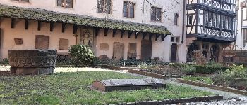
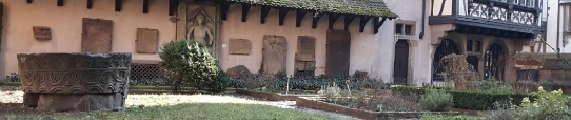
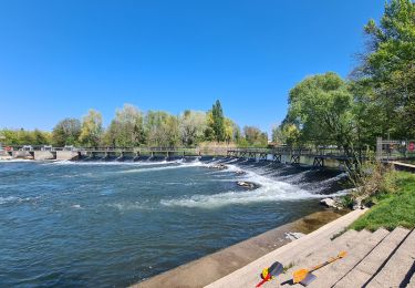
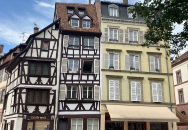
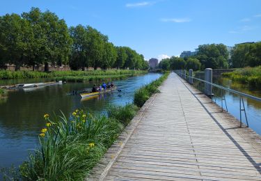
Ruta Senderismo de 7,2 km a descubrir en Gran Este, Bajo-Rin, Estrasburgo. Esta ruta ha sido propuesta por phil88.
Descripción
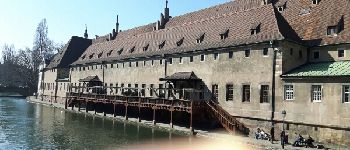
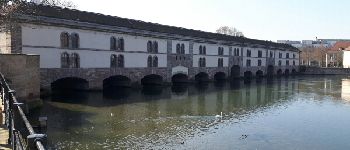
balade au moyen âge dans Strasbourg
Puntos de interés
Localización
País:
France
Región :
Gran Este
Departamento/provincia :
Bajo-Rin
Municipio :
Estrasburgo
Localidad:
Unknown
Salida:(Dec)
Salida:(UTM)
407816 ; 5381747 (32U) N.
Comentarios
Excursiones cerca
![Excursión Senderismo Estrasburgo - Strasbourg - Centre historique - Photo](https://media.geolcdn.com/t/375/260/ext.jpg?maxdim=2&url=https%3A%2F%2Fservices.sitytrail.com%2FGeolivesWS%2FDownloadMedia.ashx%3FTrailID%3D714530%26Media%3Dfix__20170315162311.jpg)
![Senderismo Senderismo](https://static1.geolcdn.com/sitytour/trail-icons/101.png)
Strasbourg - Centre historique
Senderismo
Fácil
(3)
Estrasburgo,
Gran Este,
Bajo-Rin,
France
![](/images/other/stat-length.png)
8 km | 9,2 km-effort
2h 11min
![](https://static1.geolcdn.com/siteimages/upload/files/16400158638029165_repeat_loop_refresh_sync_direction_icon.png)
No
![Excursión Senderismo Estrasburgo - Histoires d'eaux.... et de forêts au nord de Strasbourg - Photo](https://media.geolcdn.com/t/375/260/c1f2f71a-0902-4caa-a16a-ea63d24aef1b.jpg&format=jpg&maxdim=2)
![Senderismo Senderismo](https://static1.geolcdn.com/sitytour/trail-icons/101.png)
Histoires d'eaux.... et de forêts au nord de Strasbourg
Senderismo
Difícil
(1)
Estrasburgo,
Gran Este,
Bajo-Rin,
France
![](/images/other/stat-length.png)
26 km | 28 km-effort
5h 57min
![](https://static1.geolcdn.com/siteimages/upload/files/16400158638029165_repeat_loop_refresh_sync_direction_icon.png)
Sí
![Excursión Senderismo Estrasburgo - Untitled - Photo](https://media.geolcdn.com/t/375/260/ext.jpg?maxdim=2&url=https%3A%2F%2Fservices.sitytrail.com%2FGeolivesWS%2FDownloadMedia.ashx%3FTrailID%3D378325%26Media%3D20150118104613.jpg)
![Senderismo Senderismo](https://static1.geolcdn.com/sitytour/trail-icons/101.png)
Untitled
Senderismo
Muy fácil
(1)
Estrasburgo,
Gran Este,
Bajo-Rin,
France
![](/images/other/stat-length.png)
6,1 km | 7 km-effort
1h 42min
![](https://static1.geolcdn.com/siteimages/upload/files/16400158638029165_repeat_loop_refresh_sync_direction_icon.png)
Sí
![Excursión Senderismo Estrasburgo - Strasbourg Krutenau Université - Photo](https://media.geolcdn.com/t/375/260/8cbb56df-c20b-4a21-8b38-d84143e8ba5e.jpg&format=jpg&maxdim=2)
![Senderismo Senderismo](https://static1.geolcdn.com/sitytour/trail-icons/101.png)
Strasbourg Krutenau Université
Senderismo
Medio
(1)
Estrasburgo,
Gran Este,
Bajo-Rin,
France
![](/images/other/stat-length.png)
5,3 km | 6,1 km-effort
1h 23min
![](https://static1.geolcdn.com/siteimages/upload/files/16400158638029165_repeat_loop_refresh_sync_direction_icon.png)
Sí
![Excursión Senderismo Bischheim - marchepop bischheim 10km 2021 - Photo](https://media.geolcdn.com/t/375/260/ext.jpg?maxdim=2&url=https%3A%2F%2Fstatic1.geolcdn.com%2Fsiteimages%2Fupload%2Ffiles%2F1553511878bg_sport_marche.png)
![Senderismo Senderismo](https://static1.geolcdn.com/sitytour/trail-icons/101.png)
marchepop bischheim 10km 2021
Senderismo
Muy fácil
(1)
Bischheim,
Gran Este,
Bajo-Rin,
France
![](/images/other/stat-length.png)
10,7 km | 11,8 km-effort
2h 31min
![](https://static1.geolcdn.com/siteimages/upload/files/16400158638029165_repeat_loop_refresh_sync_direction_icon.png)
Sí
![Excursión Senderismo Estrasburgo - La ceinture verte de Strasbourg - Photo](https://media.geolcdn.com/t/375/260/1715a3d9-d8b0-4c65-a7b0-4d6433b491ed.jpg&format=jpg&maxdim=2)
![Senderismo Senderismo](https://static1.geolcdn.com/sitytour/trail-icons/101.png)
La ceinture verte de Strasbourg
Senderismo
Medio
Estrasburgo,
Gran Este,
Bajo-Rin,
France
![](/images/other/stat-length.png)
19,8 km | 22 km-effort
4h 6min
![](https://static1.geolcdn.com/siteimages/upload/files/16400158638029165_repeat_loop_refresh_sync_direction_icon.png)
Sí
![Excursión Senderismo Estrasburgo - 2022-08-25_07h47m05_Streckenplan Präsidentenwanderung über 15 km - Photo](https://media.geolcdn.com/t/375/260/ext.jpg?maxdim=2&url=https%3A%2F%2Fstatic1.geolcdn.com%2Fsiteimages%2Fupload%2Ffiles%2F1553511878bg_sport_marche.png)
![Senderismo Senderismo](https://static1.geolcdn.com/sitytour/trail-icons/101.png)
2022-08-25_07h47m05_Streckenplan Präsidentenwanderung über 15 km
Senderismo
Medio
(2)
Estrasburgo,
Gran Este,
Bajo-Rin,
France
![](/images/other/stat-length.png)
7 km | 8,4 km-effort
1h 53min
![](https://static1.geolcdn.com/siteimages/upload/files/16400158638029165_repeat_loop_refresh_sync_direction_icon.png)
No
![Excursión Senderismo Ostwald - Tayla - Photo](https://media.geolcdn.com/t/375/260/236e4d72-747b-45d2-ae4f-84e3c8bc8c57.jpg&format=jpg&maxdim=2)
![Senderismo Senderismo](https://static1.geolcdn.com/sitytour/trail-icons/101.png)
![Excursión Senderismo Ostwald - Lundi - Photo](https://media.geolcdn.com/t/375/260/7f259d80-50fa-422a-96ef-cd2ae8fbda1c.jpg&format=jpg&maxdim=2)
![Senderismo Senderismo](https://static1.geolcdn.com/sitytour/trail-icons/101.png)