![](/images/other/stat-length.png)
![Excursión Senderismo Roquebrune-sur-Argens - Roquebrune L'Escaillon rando - Photo](https://media.geolcdn.com/t/1900/400/ext.pjpeg?maxdim=2&url=https%3A%2F%2Fservices.sitytrail.com%2FGeolivesWS%2FDownloadMedia.ashx%3FTrailID%3D529992%26Media%3Dffbf80e6-f9ce-4c88-aca7-8d67343e410c.jpg)
Roquebrune L'Escaillon rando
Sugg
Usuario
![Longitud](/images/other/stat-length.png)
Longitud
18,3 km
![Altitud máxima](https://static1.geolcdn.com/siteimages/upload/files/1508320355ic_sort_altitude_max_24dp.png)
Altitud máxima
259 m
![Desnivel positivo](https://static1.geolcdn.com/siteimages/upload/files/1508320355ic_sort_den_pos_24dp.png)
Desnivel positivo
490 m
![Km-Effort](/images/other/stat-length.png)
Km-Effort
25 km
![Altitud mínima](https://static1.geolcdn.com/siteimages/upload/files/1508320355ic_sort_altitude_min_24dp.png)
Altitud mínima
15 m
![Desnivel negativo](https://static1.geolcdn.com/siteimages/upload/files/1508320355ic_sort_den_neg_24dp.png)
Desnivel negativo
488 m
![Boucle](https://static1.geolcdn.com/siteimages/upload/files/16400158638029165_repeat_loop_refresh_sync_direction_icon.png)
Boucle
Sí
Fecha de creación :
2019-03-22 16:59:21.212
Última modificación :
2019-03-22 16:59:21.389
![Senderismo](https://static1.geolcdn.com/sitytour/trail-icons/101.png)
5h23
Dificultad : Medio
![Escanee este código QR para abrir la excursión en la aplicación SityTrail](https://capi.geolives.com/qq0zvz2zws4bq2lad0pu/sitytour/trails/529992/qr.png?size=200)
Aplicación GPS de excursión GRATIS
A propósito
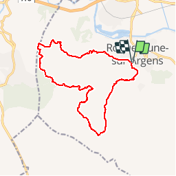
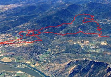
Ruta Senderismo de 18,3 km a descubrir en Provenza-Alpes-Costa Azul, Var, Roquebrune-sur-Argens. Esta ruta ha sido propuesta por Sugg.
Descripción
24-02-16
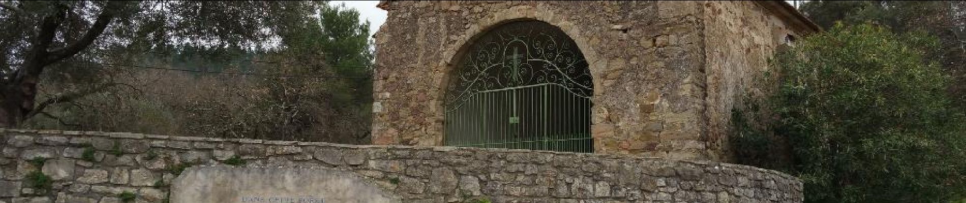
Rando de Restons en Forme Draguignan.
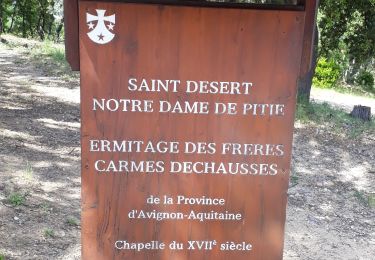
Beau temps, pique nique au niveau du petit lac des campons en bas du vallon du même nom, voir photo.
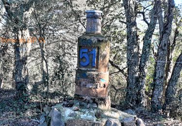
Attention, terrain privé quartier Les Sausses au NO.
Localización
País:
France
Región :
Provenza-Alpes-Costa Azul
Departamento/provincia :
Var
Municipio :
Roquebrune-sur-Argens
Localidad:
Unknown
Salida:(Dec)
Salida:(UTM)
308540 ; 4812396 (32T) N.
Comentarios
Excursiones cerca
![Excursión Senderismo Roquebrune-sur-Argens - SityTrail - Les 25 ponts-Roquebrune sur Argens-28-01-22 - Photo](https://media.geolcdn.com/t/375/260/605c9bb1-f90a-4cd2-a653-fe52e6d3d081.jpg&format=jpg&maxdim=2)
![Senderismo Senderismo](https://static1.geolcdn.com/sitytour/trail-icons/101.png)
SityTrail - Les 25 ponts-Roquebrune sur Argens-28-01-22
Senderismo
Medio
(1)
Roquebrune-sur-Argens,
Provenza-Alpes-Costa Azul,
Var,
France
![](/images/other/stat-length.png)
14,4 km | 20 km-effort
6h 0min
![](https://static1.geolcdn.com/siteimages/upload/files/16400158638029165_repeat_loop_refresh_sync_direction_icon.png)
Sí
![Excursión Senderismo Roquebrune-sur-Argens - Rocher de Roquebrune, les Trois Croix - Photo](https://media.geolcdn.com/t/375/260/ext.jpg?maxdim=2&url=https%3A%2F%2Fservices.sitytrail.com%2FGeolivesWS%2FDownloadMedia.ashx%3FTrailID%3D173163%26Media%3D14736_1.jpg)
![Senderismo Senderismo](https://static1.geolcdn.com/sitytour/trail-icons/101.png)
Rocher de Roquebrune, les Trois Croix
Senderismo
Difícil
(4)
Roquebrune-sur-Argens,
Provenza-Alpes-Costa Azul,
Var,
France
![](/images/other/stat-length.png)
7 km | 11,4 km-effort
4h 15min
![](https://static1.geolcdn.com/siteimages/upload/files/16400158638029165_repeat_loop_refresh_sync_direction_icon.png)
Sí
![Excursión A pie Puget-sur-Argens - PUGET SUR ARGENS- gazoduc-Terres Gastes DRI - Photo](https://media.geolcdn.com/t/375/260/ext.jpg?maxdim=2&url=https%3A%2F%2Fstatic1.geolcdn.com%2Fsiteimages%2Fupload%2Ffiles%2F1545311037marcheuse_200dpi.jpg)
![A pie A pie](https://static1.geolcdn.com/sitytour/trail-icons/100.png)
PUGET SUR ARGENS- gazoduc-Terres Gastes DRI
A pie
Fácil
(1)
Puget-sur-Argens,
Provenza-Alpes-Costa Azul,
Var,
France
![](/images/other/stat-length.png)
7,7 km | 8,9 km-effort
2h 1min
![](https://static1.geolcdn.com/siteimages/upload/files/16400158638029165_repeat_loop_refresh_sync_direction_icon.png)
Sí
![Excursión Senderismo Roquebrune-sur-Argens - les merles 2 - Photo](https://media.geolcdn.com/t/375/260/ext.jpg?maxdim=2&url=https%3A%2F%2Fstatic1.geolcdn.com%2Fsiteimages%2Fupload%2Ffiles%2F1553511878bg_sport_marche.png)
![Senderismo Senderismo](https://static1.geolcdn.com/sitytour/trail-icons/101.png)
les merles 2
Senderismo
Medio
(1)
Roquebrune-sur-Argens,
Provenza-Alpes-Costa Azul,
Var,
France
![](/images/other/stat-length.png)
6,6 km | 7,9 km-effort
1h 47min
![](https://static1.geolcdn.com/siteimages/upload/files/16400158638029165_repeat_loop_refresh_sync_direction_icon.png)
Sí
![Excursión Senderismo Roquebrune-sur-Argens - 2023-10-25_17h14m36_Randonn_e-27 - Photo](https://media.geolcdn.com/t/375/260/ext.jpg?maxdim=2&url=https%3A%2F%2Fstatic1.geolcdn.com%2Fsiteimages%2Fupload%2Ffiles%2F1553511878bg_sport_marche.png)
![Senderismo Senderismo](https://static1.geolcdn.com/sitytour/trail-icons/101.png)
2023-10-25_17h14m36_Randonn_e-27
Senderismo
Difícil
(1)
Roquebrune-sur-Argens,
Provenza-Alpes-Costa Azul,
Var,
France
![](/images/other/stat-length.png)
9,2 km | 12,6 km-effort
2h 52min
![](https://static1.geolcdn.com/siteimages/upload/files/16400158638029165_repeat_loop_refresh_sync_direction_icon.png)
Sí
![Excursión Senderismo Roquebrune-sur-Argens - Autour de la Maurette (variante) - Photo](https://media.geolcdn.com/t/375/260/9e327cd4-b701-4d2e-839f-23509b76ff37.jpg&format=jpg&maxdim=2)
![Senderismo Senderismo](https://static1.geolcdn.com/sitytour/trail-icons/101.png)
Autour de la Maurette (variante)
Senderismo
Muy difícil
Roquebrune-sur-Argens,
Provenza-Alpes-Costa Azul,
Var,
France
![](/images/other/stat-length.png)
16,5 km | 23 km-effort
4h 10min
![](https://static1.geolcdn.com/siteimages/upload/files/16400158638029165_repeat_loop_refresh_sync_direction_icon.png)
Sí
![Excursión A pie Roquebrune-sur-Argens - Roquebrune sur argens-Les 25 Ponds-ND de la pitié- Lac des clos - Photo](https://media.geolcdn.com/t/375/260/ext.jpg?maxdim=2&url=https%3A%2F%2Fstatic1.geolcdn.com%2Fsiteimages%2Fupload%2Ffiles%2F1545311037marcheuse_200dpi.jpg)
![A pie A pie](https://static1.geolcdn.com/sitytour/trail-icons/100.png)
Roquebrune sur argens-Les 25 Ponds-ND de la pitié- Lac des clos
A pie
Fácil
(1)
Roquebrune-sur-Argens,
Provenza-Alpes-Costa Azul,
Var,
France
![](/images/other/stat-length.png)
11,9 km | 17 km-effort
3h 51min
![](https://static1.geolcdn.com/siteimages/upload/files/16400158638029165_repeat_loop_refresh_sync_direction_icon.png)
Sí
![Excursión Senderismo Roquebrune-sur-Argens - les hauts de Roquebrune sur Argens - Photo](https://media.geolcdn.com/t/375/260/fb3b5c94-db8e-400d-a9b2-b3a4bc6a654b.jpg&format=jpg&maxdim=2)
![Senderismo Senderismo](https://static1.geolcdn.com/sitytour/trail-icons/101.png)
les hauts de Roquebrune sur Argens
Senderismo
Fácil
(1)
Roquebrune-sur-Argens,
Provenza-Alpes-Costa Azul,
Var,
France
![](/images/other/stat-length.png)
6,2 km | 8,9 km-effort
2h 9min
![](https://static1.geolcdn.com/siteimages/upload/files/16400158638029165_repeat_loop_refresh_sync_direction_icon.png)
Sí
![Excursión Senderismo Roquebrune-sur-Argens - Le sentier découverte des 25 ponts - Photo](https://media.geolcdn.com/t/375/260/ext.jpg?maxdim=2&url=https%3A%2F%2Fstatic1.geolcdn.com%2Fsiteimages%2Fupload%2Ffiles%2F1553511878bg_sport_marche.png)
![Senderismo Senderismo](https://static1.geolcdn.com/sitytour/trail-icons/101.png)
Le sentier découverte des 25 ponts
Senderismo
Muy fácil
(1)
Roquebrune-sur-Argens,
Provenza-Alpes-Costa Azul,
Var,
France
![](/images/other/stat-length.png)
4,5 km | 6 km-effort
Desconocido
![](https://static1.geolcdn.com/siteimages/upload/files/16400158638029165_repeat_loop_refresh_sync_direction_icon.png)
Sí