


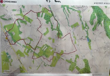
12,7 km | 25 km-effort


Usuario


Aplicación GPS de excursión GRATIS
 SityTrail
IGN / Institutos geográficos
SityTrail World
El mundo es suyo
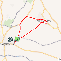
Ruta Senderismo de 5,9 km a descubrir en Auvergne-Rhône-Alpes, Drôme, Bésayes. Esta ruta ha sido propuesta por potan12.
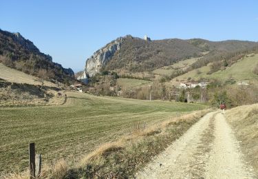
Petite balade sympa pour passer une heure trente c'est presque tout plat, hormis le village de Marches qui est perché

Senderismo

Senderismo

Senderismo

Senderismo
Senderismo
Senderismo
Senderismo

sport
Senderismo