![](/images/other/stat-length.png)
![Excursión Senderismo Longroy - longroy - Photo](https://media.geolcdn.com/t/1900/400/ext.pjpeg?maxdim=2&url=https%3A%2F%2Fservices.sitytrail.com%2FGeolivesWS%2FDownloadMedia.ashx%3FTrailID%3D473480%26Media%3Dfix__20150919181325.jpg)
longroy
Brindille
Usuario
![Longitud](/images/other/stat-length.png)
Longitud
10,3 km
![Altitud máxima](https://static1.geolcdn.com/siteimages/upload/files/1508320355ic_sort_altitude_max_24dp.png)
Altitud máxima
167 m
![Desnivel positivo](https://static1.geolcdn.com/siteimages/upload/files/1508320355ic_sort_den_pos_24dp.png)
Desnivel positivo
177 m
![Km-Effort](/images/other/stat-length.png)
Km-Effort
12,7 km
![Altitud mínima](https://static1.geolcdn.com/siteimages/upload/files/1508320355ic_sort_altitude_min_24dp.png)
Altitud mínima
23 m
![Desnivel negativo](https://static1.geolcdn.com/siteimages/upload/files/1508320355ic_sort_den_neg_24dp.png)
Desnivel negativo
198 m
![Boucle](https://static1.geolcdn.com/siteimages/upload/files/16400158638029165_repeat_loop_refresh_sync_direction_icon.png)
Boucle
No
Fecha de creación :
2016-03-09 00:00:00.0
Última modificación :
2016-03-09 00:00:00.0
![Senderismo](https://static1.geolcdn.com/sitytour/trail-icons/101.png)
2h38
Dificultad : Fácil
![Escanee este código QR para abrir la excursión en la aplicación SityTrail](https://capi.geolives.com/qq0zvz2zws4bq2lad0pu/sitytour/trails/473480/qr.png?size=200)
Aplicación GPS de excursión GRATIS
A propósito
Ruta Senderismo de 10,3 km a descubrir en Normandía, Sena-Marítimo, Longroy. Esta ruta ha sido propuesta por Brindille.
Descripción
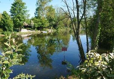
départ du parking à côté du restaurant " au rendez-vous des pêcheurs "
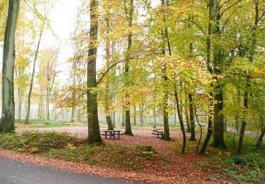
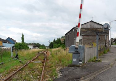
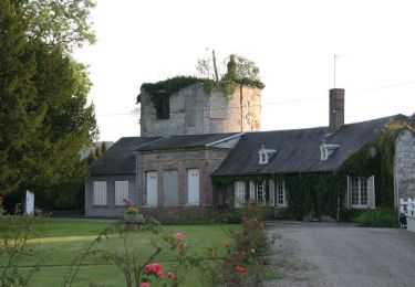
Localización
País:
France
Región :
Normandía
Departamento/provincia :
Sena-Marítimo
Municipio :
Longroy
Localidad:
Unknown
Salida:(Dec)
Salida:(UTM)
395018 ; 5538405 (31U) N.
Comentarios
Excursiones cerca
![Excursión Senderismo Incheville - Balade dans le Massif du Triage - Forêt d'Eu - Photo](https://media.geolcdn.com/t/375/260/ext.jpg?maxdim=2&url=https%3A%2F%2Fservices.sitytrail.com%2FGeolivesWS%2FDownloadMedia.ashx%3FTrailID%3D172311%26Media%3D13631_5.jpg)
![Senderismo Senderismo](https://static1.geolcdn.com/sitytour/trail-icons/101.png)
Balade dans le Massif du Triage - Forêt d'Eu
Senderismo
Medio
(3)
Incheville,
Normandía,
Sena-Marítimo,
France
![](/images/other/stat-length.png)
13,2 km | 16,8 km-effort
2h 45min
![](https://static1.geolcdn.com/siteimages/upload/files/16400158638029165_repeat_loop_refresh_sync_direction_icon.png)
Sí
![Excursión A pie Gamaches - L'eau vive - Photo](https://media.geolcdn.com/t/375/260/3c4fa46f-9dc2-4d1a-9161-49027c2a541e.jpeg&format=jpg&maxdim=2)
![A pie A pie](https://static1.geolcdn.com/sitytour/trail-icons/100.png)
![Excursión A pie Gamaches - Au fil des Étangs - Photo](https://media.geolcdn.com/t/375/260/fbb955a0-b551-4370-8c7b-e1b57583333e.jpeg&format=jpg&maxdim=2)
![A pie A pie](https://static1.geolcdn.com/sitytour/trail-icons/100.png)
![Excursión Senderismo Incheville - incheville 20190513 les étangs - Photo](https://media.geolcdn.com/t/375/260/cceeab57-358f-4452-b8ac-b5c31f54eba5.jpg&format=jpg&maxdim=2)
![Senderismo Senderismo](https://static1.geolcdn.com/sitytour/trail-icons/101.png)
incheville 20190513 les étangs
Senderismo
Muy fácil
(1)
Incheville,
Normandía,
Sena-Marítimo,
France
![](/images/other/stat-length.png)
8,1 km | 9,3 km-effort
2h 6min
![](https://static1.geolcdn.com/siteimages/upload/files/16400158638029165_repeat_loop_refresh_sync_direction_icon.png)
Sí
![Excursión Senderismo Bazinval - Circuit du Mont Madame (n° 4) - Bazinval - Photo](https://media.geolcdn.com/t/375/260/ext.jpg?maxdim=2&url=https%3A%2F%2Fservices.sitytrail.com%2FGeolivesWS%2FDownloadMedia.ashx%3FTrailID%3D515192%26Media%3Ddd8d8fe8-7d2c-473f-b996-842072fc4ffd.jpg)
![Senderismo Senderismo](https://static1.geolcdn.com/sitytour/trail-icons/101.png)
Circuit du Mont Madame (n° 4) - Bazinval
Senderismo
Medio
Bazinval,
Normandía,
Sena-Marítimo,
France
![](/images/other/stat-length.png)
12,4 km | 15,8 km-effort
3h 10min
![](https://static1.geolcdn.com/siteimages/upload/files/16400158638029165_repeat_loop_refresh_sync_direction_icon.png)
Sí
![Excursión Senderismo Monchy-sur-Eu - hêtre des princes II - Photo](https://media.geolcdn.com/t/375/260/ext.jpg?maxdim=2&url=https%3A%2F%2Fservices.sitytrail.com%2FGeolivesWS%2FDownloadMedia.ashx%3FTrailID%3D488083%26Media%3Dfix__20151031170306.jpg)
![Senderismo Senderismo](https://static1.geolcdn.com/sitytour/trail-icons/101.png)
hêtre des princes II
Senderismo
Fácil
Monchy-sur-Eu,
Normandía,
Sena-Marítimo,
France
![](/images/other/stat-length.png)
9,3 km | 12,1 km-effort
2h 34min
![](https://static1.geolcdn.com/siteimages/upload/files/16400158638029165_repeat_loop_refresh_sync_direction_icon.png)
Sí
![Excursión Senderismo Monchy-sur-Eu - poteau hêtre des princes 2 - Photo](https://media.geolcdn.com/t/375/260/ext.jpg?maxdim=2&url=https%3A%2F%2Fservices.sitytrail.com%2FGeolivesWS%2FDownloadMedia.ashx%3FTrailID%3D468401%26Media%3Dfix__20150905162721.jpg)
![Senderismo Senderismo](https://static1.geolcdn.com/sitytour/trail-icons/101.png)
poteau hêtre des princes 2
Senderismo
Fácil
Monchy-sur-Eu,
Normandía,
Sena-Marítimo,
France
![](/images/other/stat-length.png)
6,8 km | 8,3 km-effort
2h 2min
![](https://static1.geolcdn.com/siteimages/upload/files/16400158638029165_repeat_loop_refresh_sync_direction_icon.png)
Sí
![Excursión Senderismo Monchy-sur-Eu - poteau hêtre des princes 2 - Photo](https://media.geolcdn.com/t/375/260/ext.jpg?maxdim=2&url=https%3A%2F%2Fservices.sitytrail.com%2FGeolivesWS%2FDownloadMedia.ashx%3FTrailID%3D468389%26Media%3Dfix__20150905162721.jpg)
![Senderismo Senderismo](https://static1.geolcdn.com/sitytour/trail-icons/101.png)
poteau hêtre des princes 2
Senderismo
Fácil
Monchy-sur-Eu,
Normandía,
Sena-Marítimo,
France
![](/images/other/stat-length.png)
6,8 km | 8,3 km-effort
2h 2min
![](https://static1.geolcdn.com/siteimages/upload/files/16400158638029165_repeat_loop_refresh_sync_direction_icon.png)
Sí
![Excursión Senderismo Melleville - Melleville, Gomare - Photo](https://media.geolcdn.com/t/375/260/ext.jpg?maxdim=2&url=https%3A%2F%2Fservices.sitytrail.com%2FGeolivesWS%2FDownloadMedia.ashx%3FTrailID%3D452425%26Media%3Dfix__20150731182734.jpg)
![Senderismo Senderismo](https://static1.geolcdn.com/sitytour/trail-icons/101.png)
Melleville, Gomare
Senderismo
Muy fácil
Melleville,
Normandía,
Sena-Marítimo,
France
![](/images/other/stat-length.png)
12,6 km | 15,3 km-effort
3h 17min
![](https://static1.geolcdn.com/siteimages/upload/files/16400158638029165_repeat_loop_refresh_sync_direction_icon.png)
Sí