![](/images/other/stat-length.png)
![Excursión Senderismo Saint-Géry-Vers - QUERCY (Causse) - Photo](https://media.geolcdn.com/t/1900/400/ext.pjpeg?maxdim=2&url=https%3A%2F%2Fservices.sitytrail.com%2FGeolivesWS%2FDownloadMedia.ashx%3FTrailID%3D472076%26Media%3Dfix__20150915174553.jpg)
QUERCY (Causse)
GerardBouche
Usuario
![Longitud](/images/other/stat-length.png)
Longitud
6,2 km
![Altitud máxima](https://static1.geolcdn.com/siteimages/upload/files/1508320355ic_sort_altitude_max_24dp.png)
Altitud máxima
296 m
![Desnivel positivo](https://static1.geolcdn.com/siteimages/upload/files/1508320355ic_sort_den_pos_24dp.png)
Desnivel positivo
174 m
![Km-Effort](/images/other/stat-length.png)
Km-Effort
8,5 km
![Altitud mínima](https://static1.geolcdn.com/siteimages/upload/files/1508320355ic_sort_altitude_min_24dp.png)
Altitud mínima
142 m
![Desnivel negativo](https://static1.geolcdn.com/siteimages/upload/files/1508320355ic_sort_den_neg_24dp.png)
Desnivel negativo
171 m
![Boucle](https://static1.geolcdn.com/siteimages/upload/files/16400158638029165_repeat_loop_refresh_sync_direction_icon.png)
Boucle
Sí
Fecha de creación :
2017-06-28 00:00:00.0
Última modificación :
2017-06-28 00:00:00.0
![Senderismo](https://static1.geolcdn.com/sitytour/trail-icons/101.png)
1h48
Dificultad : Fácil
![Escanee este código QR para abrir la excursión en la aplicación SityTrail](https://capi.geolives.com/qq0zvz2zws4bq2lad0pu/sitytour/trails/472076/qr.png?size=200)
Aplicación GPS de excursión GRATIS
A propósito
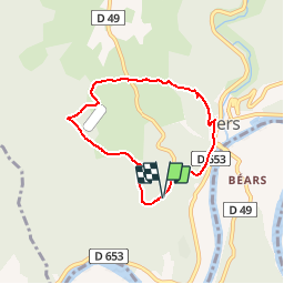
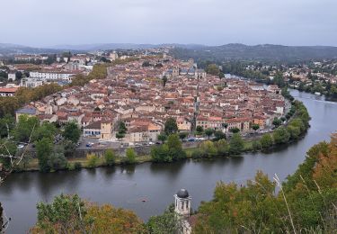
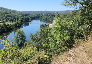
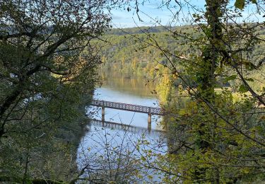
Ruta Senderismo de 6,2 km a descubrir en Occitania, Lot, Saint-Géry-Vers. Esta ruta ha sido propuesta por GerardBouche.
Descripción
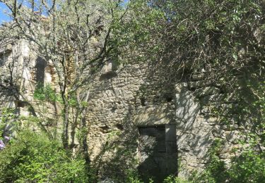
Au départ du parking visiteurs "Mas de Saboth" belle balade avec pt de vue sur le Lot et petits sentiers ombragés par le chêne pubescent.
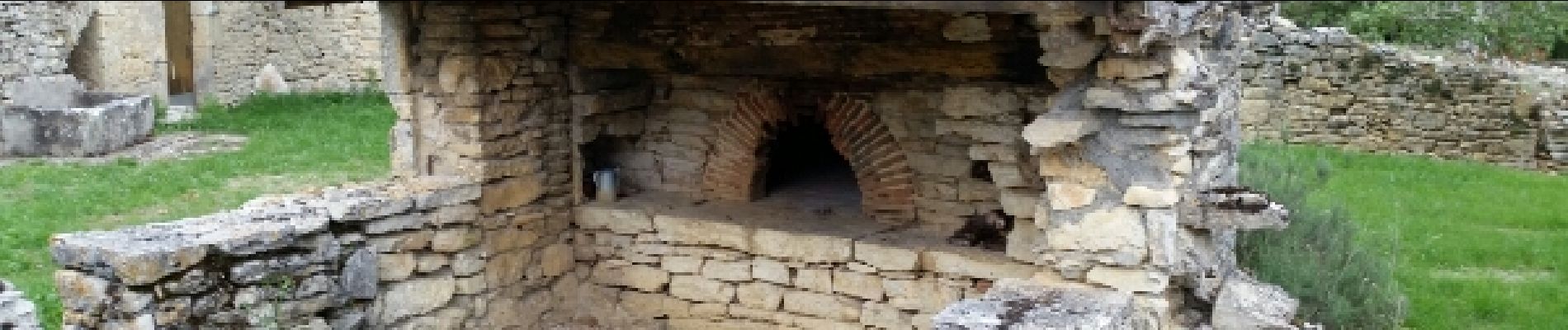
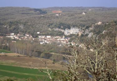
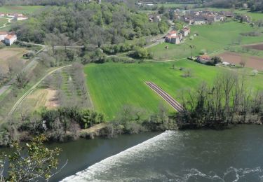
Localización
País:
France
Región :
Occitania
Departamento/provincia :
Lot
Municipio :
Saint-Géry-Vers
Localidad:
Vers
Salida:(Dec)
Salida:(UTM)
384156 ; 4925927 (31T) N.
Comentarios
Excursiones cerca
![Excursión Senderismo Saint-Géry-Vers - Vers, St Gery Vallée du Lot - Photo](https://media.geolcdn.com/t/375/260/ext.jpg?maxdim=2&url=https%3A%2F%2Fservices.sitytrail.com%2FGeolivesWS%2FDownloadMedia.ashx%3FTrailID%3D103241%26Media%3D5146_6.jpg)
![Senderismo Senderismo](https://static1.geolcdn.com/sitytour/trail-icons/101.png)
Vers, St Gery Vallée du Lot
Senderismo
Difícil
(3)
Saint-Géry-Vers,
Occitania,
Lot,
France
![](/images/other/stat-length.png)
14,1 km | 19,8 km-effort
4h 0min
![](https://static1.geolcdn.com/siteimages/upload/files/16400158638029165_repeat_loop_refresh_sync_direction_icon.png)
Sí
![Senderismo Senderismo](https://static1.geolcdn.com/sitytour/trail-icons/101.png)
Causse de Vers-7539719
Senderismo
Difícil
(1)
Saint-Géry-Vers,
Occitania,
Lot,
France
![](/images/other/stat-length.png)
11,6 km | 15,9 km-effort
3h 36min
![](https://static1.geolcdn.com/siteimages/upload/files/16400158638029165_repeat_loop_refresh_sync_direction_icon.png)
Sí
![Senderismo Senderismo](https://static1.geolcdn.com/sitytour/trail-icons/101.png)
randogps46-388
Senderismo
Difícil
(1)
Aujols,
Occitania,
Lot,
France
![](/images/other/stat-length.png)
11,9 km | 16,8 km-effort
3h 49min
![](https://static1.geolcdn.com/siteimages/upload/files/16400158638029165_repeat_loop_refresh_sync_direction_icon.png)
Sí
![Excursión Senderismo Arcambal - Étape 5 Les Mazuts Cahen - Photo](https://media.geolcdn.com/t/375/260/2b1b58ea-d9da-4d3c-9ded-fdbc44ee415e.jpg&format=jpg&maxdim=2)
![Senderismo Senderismo](https://static1.geolcdn.com/sitytour/trail-icons/101.png)
Étape 5 Les Mazuts Cahen
Senderismo
Medio
Arcambal,
Occitania,
Lot,
France
![](/images/other/stat-length.png)
16,9 km | 21 km-effort
4h 40min
![](https://static1.geolcdn.com/siteimages/upload/files/16400158638029165_repeat_loop_refresh_sync_direction_icon.png)
No
![Excursión Bici de montaña Lamagdelaine - lamagdelaine, vers - Photo](https://media.geolcdn.com/t/375/260/283c2e24-a254-41e5-9434-72402b6820e6.jpg&format=jpg&maxdim=2)
![Bici de montaña Bici de montaña](https://static1.geolcdn.com/sitytour/trail-icons/202.png)
lamagdelaine, vers
Bici de montaña
Muy difícil
Lamagdelaine,
Occitania,
Lot,
France
![](/images/other/stat-length.png)
33 km | 41 km-effort
2h 19min
![](https://static1.geolcdn.com/siteimages/upload/files/16400158638029165_repeat_loop_refresh_sync_direction_icon.png)
Sí
![Excursión Senderismo Saint-Géry-Vers - Boucle Vers - Merlan gr46 - Photo](https://media.geolcdn.com/t/375/260/2b826dd5-3670-4ee5-a059-34afa2c2d67d.jpg&format=jpg&maxdim=2)
![Senderismo Senderismo](https://static1.geolcdn.com/sitytour/trail-icons/101.png)
Boucle Vers - Merlan gr46
Senderismo
Fácil
Saint-Géry-Vers,
Occitania,
Lot,
France
![](/images/other/stat-length.png)
14,7 km | 19,3 km-effort
4h 21min
![](https://static1.geolcdn.com/siteimages/upload/files/16400158638029165_repeat_loop_refresh_sync_direction_icon.png)
Sí
![Excursión Senderismo Arcambal - Galessie les Mazuts Barouillet - Photo](https://media.geolcdn.com/t/375/260/16327faa-cf00-4004-ade5-741b674ecd90.jpg&format=jpg&maxdim=2)
![Senderismo Senderismo](https://static1.geolcdn.com/sitytour/trail-icons/101.png)
Galessie les Mazuts Barouillet
Senderismo
Muy fácil
Arcambal,
Occitania,
Lot,
France
![](/images/other/stat-length.png)
10,7 km | 13,9 km-effort
2h 30min
![](https://static1.geolcdn.com/siteimages/upload/files/16400158638029165_repeat_loop_refresh_sync_direction_icon.png)
Sí
![Excursión Senderismo Saint-Géry-Vers - Vers merlan pech picou - Photo](https://media.geolcdn.com/t/375/260/012b6a5e-2859-438e-93b8-84dfecc2d09a.jpg&format=jpg&maxdim=2)
![Senderismo Senderismo](https://static1.geolcdn.com/sitytour/trail-icons/101.png)
Vers merlan pech picou
Senderismo
Muy fácil
Saint-Géry-Vers,
Occitania,
Lot,
France
![](/images/other/stat-length.png)
10,2 km | 13,5 km-effort
2h 13min
![](https://static1.geolcdn.com/siteimages/upload/files/16400158638029165_repeat_loop_refresh_sync_direction_icon.png)
No
![Excursión Bici eléctrica Saint-Géry-Vers - St gery St cirq Cabreret - Photo](https://media.geolcdn.com/t/375/260/d519f58f-2190-4a19-bfda-7ad5dc0cd01a.jpg&format=jpg&maxdim=2)
![Bici eléctrica Bici eléctrica](https://static1.geolcdn.com/sitytour/trail-icons/205.png)
St gery St cirq Cabreret
Bici eléctrica
Muy fácil
Saint-Géry-Vers,
Occitania,
Lot,
France
![](/images/other/stat-length.png)
39 km | 51 km-effort
3h 24min
![](https://static1.geolcdn.com/siteimages/upload/files/16400158638029165_repeat_loop_refresh_sync_direction_icon.png)
Sí
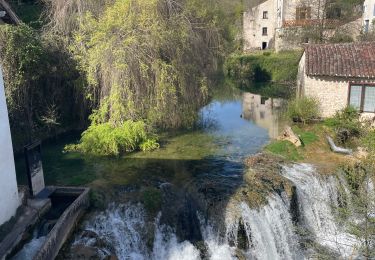
Fait le 11/11 avec Bene joli sentier