![](/images/other/stat-length.png)
![Excursión Senderismo Beauregard - QUERCY (Beauregard) - Photo](https://media.geolcdn.com/t/1900/400/ext.pjpeg?maxdim=2&url=https%3A%2F%2Fservices.sitytrail.com%2FGeolivesWS%2FDownloadMedia.ashx%3FTrailID%3D470747%26Media%3Dfix__20150911135716.jpg)
QUERCY (Beauregard)
GerardBouche
Usuario
![Longitud](/images/other/stat-length.png)
Longitud
10,6 km
![Altitud máxima](https://static1.geolcdn.com/siteimages/upload/files/1508320355ic_sort_altitude_max_24dp.png)
Altitud máxima
397 m
![Desnivel positivo](https://static1.geolcdn.com/siteimages/upload/files/1508320355ic_sort_den_pos_24dp.png)
Desnivel positivo
116 m
![Km-Effort](/images/other/stat-length.png)
Km-Effort
12,1 km
![Altitud mínima](https://static1.geolcdn.com/siteimages/upload/files/1508320355ic_sort_altitude_min_24dp.png)
Altitud mínima
351 m
![Desnivel negativo](https://static1.geolcdn.com/siteimages/upload/files/1508320355ic_sort_den_neg_24dp.png)
Desnivel negativo
116 m
![Boucle](https://static1.geolcdn.com/siteimages/upload/files/16400158638029165_repeat_loop_refresh_sync_direction_icon.png)
Boucle
Sí
Fecha de creación :
2017-06-27 00:00:00.0
Última modificación :
2017-06-27 00:00:00.0
![Senderismo](https://static1.geolcdn.com/sitytour/trail-icons/101.png)
2h39
Dificultad : Muy fácil
![Escanee este código QR para abrir la excursión en la aplicación SityTrail](https://capi.geolives.com/qq0zvz2zws4bq2lad0pu/sitytour/trails/470747/qr.png?size=200)
Aplicación GPS de excursión GRATIS
A propósito
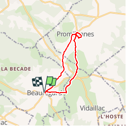
Ruta Senderismo de 10,6 km a descubrir en Occitania, Lot, Beauregard. Esta ruta ha sido propuesta por GerardBouche.
Descripción
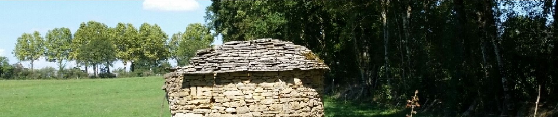
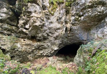
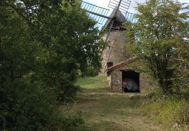
Très belle balade au départ des halles de Beauregard vers Promilhanes à la découverte d'anciens pigeonniers - gariottes et moulin à vent.
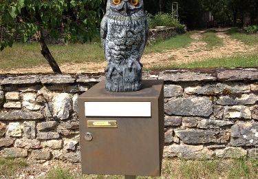
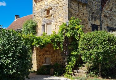
Localización
País:
France
Región :
Occitania
Departamento/provincia :
Lot
Municipio :
Beauregard
Localidad:
Unknown
Salida:(Dec)
Salida:(UTM)
403792 ; 4910999 (31T) N.
Comentarios
Excursiones cerca
![Excursión sport Saint-Projet - St projet beauregard - Photo](https://media.geolcdn.com/t/375/260/9a3f4d55-4de4-4115-9cbf-5e977c443564.jpg&format=jpg&maxdim=2)
St projet beauregard
sport
Muy fácil
Saint-Projet,
Occitania,
Tarn y Garona,
France
![](/images/other/stat-length.png)
15,7 km | 18,8 km-effort
Desconocido
![](https://static1.geolcdn.com/siteimages/upload/files/16400158638029165_repeat_loop_refresh_sync_direction_icon.png)
Sí
![Excursión Senderismo Beauregard - Beauregard - Mas de Poussau - Photo](https://media.geolcdn.com/t/375/260/ext.jpg?maxdim=2&url=https%3A%2F%2Fservices.sitytrail.com%2FGeolivesWS%2FDownloadMedia.ashx%3FTrailID%3D343451%26Media%3D20140908151751.jpg)
![Senderismo Senderismo](https://static1.geolcdn.com/sitytour/trail-icons/101.png)
Beauregard - Mas de Poussau
Senderismo
Muy fácil
Beauregard,
Occitania,
Lot,
France
![](/images/other/stat-length.png)
4,4 km | 5,3 km-effort
56min
![](https://static1.geolcdn.com/siteimages/upload/files/16400158638029165_repeat_loop_refresh_sync_direction_icon.png)
Sí
![Excursión Senderismo Saillac - Saillac - Chemin de la perte du Cros - Photo](https://media.geolcdn.com/t/375/260/ext.jpg?maxdim=2&url=https%3A%2F%2Fservices.sitytrail.com%2FGeolivesWS%2FDownloadMedia.ashx%3FTrailID%3D334954%26Media%3D20140811164615.jpg)
![Senderismo Senderismo](https://static1.geolcdn.com/sitytour/trail-icons/101.png)
Saillac - Chemin de la perte du Cros
Senderismo
Muy fácil
Saillac,
Occitania,
Lot,
France
![](/images/other/stat-length.png)
7,9 km | 9,2 km-effort
2h 0min
![](https://static1.geolcdn.com/siteimages/upload/files/16400158638029165_repeat_loop_refresh_sync_direction_icon.png)
Sí
![Excursión Senderismo Beauregard - Beauregard - Château de Marsa - Photo](https://media.geolcdn.com/t/375/260/ext.jpg?maxdim=2&url=https%3A%2F%2Fservices.sitytrail.com%2FGeolivesWS%2FDownloadMedia.ashx%3FTrailID%3D330553%26Media%3D20140803161452.jpg)
![Senderismo Senderismo](https://static1.geolcdn.com/sitytour/trail-icons/101.png)
Beauregard - Château de Marsa
Senderismo
Muy fácil
(1)
Beauregard,
Occitania,
Lot,
France
![](/images/other/stat-length.png)
4,8 km | 5,5 km-effort
1h 13min
![](https://static1.geolcdn.com/siteimages/upload/files/16400158638029165_repeat_loop_refresh_sync_direction_icon.png)
Sí
![Excursión Senderismo Saillac - Saillac - Photo](https://media.geolcdn.com/t/375/260/ff4c1845-7c51-499d-9e73-1fb8e25ed8b0.jpg&format=jpg&maxdim=2)
![Senderismo Senderismo](https://static1.geolcdn.com/sitytour/trail-icons/101.png)
![Excursión Senderismo Puylagarde - vidaillac_29 - Photo](https://media.geolcdn.com/t/375/260/ext.jpg?maxdim=2&url=https%3A%2F%2Fstatic1.geolcdn.com%2Fsiteimages%2Fupload%2Ffiles%2F1553511878bg_sport_marche.png)
![Senderismo Senderismo](https://static1.geolcdn.com/sitytour/trail-icons/101.png)
vidaillac_29
Senderismo
Muy difícil
Puylagarde,
Occitania,
Tarn y Garona,
France
![](/images/other/stat-length.png)
17,6 km | 21 km-effort
4h 7min
![](https://static1.geolcdn.com/siteimages/upload/files/16400158638029165_repeat_loop_refresh_sync_direction_icon.png)
No
![Excursión Senderismo Promilhanes - 46_Promilhanes - Photo](https://media.geolcdn.com/t/375/260/ext.jpg?maxdim=2&url=https%3A%2F%2Fstatic1.geolcdn.com%2Fsiteimages%2Fupload%2Ffiles%2F1553511878bg_sport_marche.png)
![Senderismo Senderismo](https://static1.geolcdn.com/sitytour/trail-icons/101.png)
46_Promilhanes
Senderismo
Medio
Promilhanes,
Occitania,
Lot,
France
![](/images/other/stat-length.png)
18,8 km | 22 km-effort
4h 49min
![](https://static1.geolcdn.com/siteimages/upload/files/16400158638029165_repeat_loop_refresh_sync_direction_icon.png)
Sí
![Excursión Senderismo Saint-Projet - boucle saillagol - Photo](https://media.geolcdn.com/t/375/260/ext.jpg?maxdim=2&url=https%3A%2F%2Fstatic1.geolcdn.com%2Fsiteimages%2Fupload%2Ffiles%2F1553511878bg_sport_marche.png)
![Senderismo Senderismo](https://static1.geolcdn.com/sitytour/trail-icons/101.png)
boucle saillagol
Senderismo
Medio
Saint-Projet,
Occitania,
Tarn y Garona,
France
![](/images/other/stat-length.png)
19,1 km | 23 km-effort
5h 47min
![](https://static1.geolcdn.com/siteimages/upload/files/16400158638029165_repeat_loop_refresh_sync_direction_icon.png)
Sí
![Excursión Bici de carretera Vidaillac - Vidaillac - Photo](https://media.geolcdn.com/t/375/260/ext.jpg?maxdim=2&url=https%3A%2F%2Fstatic1.geolcdn.com%2Fsiteimages%2Fupload%2Ffiles%2F1524743154velo.jpg)
![Bici de carretera Bici de carretera](https://static1.geolcdn.com/sitytour/trail-icons/201.png)